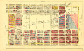
Sheet 16 : Maple Street to Oak Street and False Creek to Sixteenth Avenue
- AM1594-MAP 682-: MAP 682.18
- Item
- [ca. 1925], with revisions to June 27, 1952
Part of City of Vancouver Archives technical and cartographic drawing collection
Item is a section showing Maple Street to Oak Street and False Creek to Sixteenth Avenue. Includes streets and roads, blocks, lots, legal descriptions, railways, schools and parks. Indicates crown land leased to the C.P.R. and other bodies.
Vancouver (B.C.). Office of the City Engineer