
- COV-S639-1-F59-: CVA 790-1873
- Item
- [1985?]
Part of City of Vancouver fonds
6250 results with digital objects Show results with digital objects
Part of City of Vancouver fonds

Part of City of Vancouver fonds

Part of City of Vancouver fonds

Part of City of Vancouver fonds
Item is a photograph of the Hotel Vancouver.

Part of City of Vancouver fonds

Part of City of Vancouver fonds
Item is a photograph in which a sign for British Columbia and Yukon Chamber of Mines is visible.
Part of City of Vancouver fonds
Item is a photograph in which a sign for Mr. Big and Tall is visible.

Part of City of Vancouver fonds

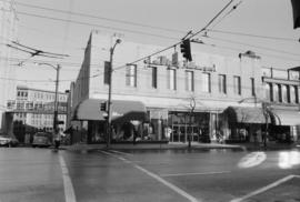
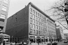
301-307, 315-319 West Hastings Street
Part of City of Vancouver fonds
Item is a photograph in which signs for Moler School of Hairdressing and Leather Land are visible.

Part of City of Vancouver fonds

Part of City of Vancouver fonds
Item is a photograph in which a sign for Save On Surplus is visible.
Part of City of Vancouver fonds
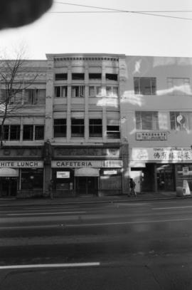
Item is a photograph in which a sign for White Lunch is visible.

Part of City of Vancouver fonds
Item is a photograph in which a sign for Rainbow Restaurant is visible.
Part of City of Vancouver fonds

166 East Hastings Street (Roosevelt)
Part of City of Vancouver fonds

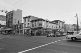
161-159 East Hastings Street (Balmoral)
Part of City of Vancouver fonds
Item is a photograph of the Hotel Balmoral.

Part of City of Vancouver fonds
Item is a photograph in which a sign for Sears is visible.

Part of City of Vancouver fonds

Part of City of Vancouver fonds
Item is a photograph in which a sign for Calico Cat is visible.

Part of City of Vancouver fonds
Item is a photograph in which a sign for Cost Plus is visible.

Part of City of Vancouver fonds
Item is a photograph in which a sign for Shoe Factory Discount Warehouse is visible.
Part of City of Vancouver fonds
Part of City of Vancouver fonds
Item is a photograph in which a sign for Import Bazaar is visible.
Part of City of Vancouver fonds
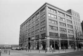
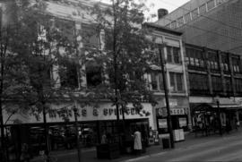
Item is a photograph of the Marks and Spencer store.

Part of City of Vancouver fonds
Item is a photograph in which the James Inglis Reid sign reading "The Larder of the Wise" is visible.

Part of City of Vancouver fonds
Item is a photograph in which a sign for The Cookie Jar is visible.
Part of City of Vancouver fonds
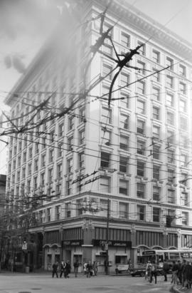
Item is a photograph in which a sign for O.B. Allan Jewellers is visible.

Part of City of Vancouver fonds
![C.B.D. [Central Business District] trip trace density chart](/uploads/r/null/6/b/4/6b4dfcd5710a8add68045b374b1df6e0649e8577a53d23070c9494276c76c3fd/0e0776f3-ca72-4c99-8121-6e7293b90cee-LEG26_142.jpg)
C.B.D. [Central Business District] trip trace density chart
Part of City of Vancouver fonds
Item is a chart produced as part of the Metropolitan Highway Planning Study, containing five maps of the downtown Vancouver area showing trip traces per square mile for 1955, projected trip traces for 1976, and projected trip traces for three test freeway networks.

Possible civic square development for downtown Vancouver
Part of City of Vancouver fonds
Item is a drawing showing existing civic structures, possible new structures, and a proposed civic square.

Households and population by enumeration areas : 1966 census
Part of City of Vancouver fonds
Item is a map annotated to show households and population for the West End and downtown core east to Main Street. Base map shows streets.

Building permit values for offices, 1945-1954
Part of City of Vancouver fonds
Item is a map showing building permit values for offices in dollars per square foot for the downtown area bounded by Burrard Street, Robson Street, and Nicola Street in the west and Main Street in the east.

Proposed customer parking areas
Part of City of Vancouver fonds
Item is a map showing proposed parking areas and the high density core area in downtown Vancouver from Burrard Street, Robson Street, and Nicola Street in the west to Main Street in the east.

Part of City of Vancouver fonds
Item is a map showing building density by floor space ratio for the downtown area bounded by Burrard Street, Robson Street, and Nicola Street in the west and Main Street in the east.
![[Firefighters and motorized equipment in front of Firehall No. 2, 754 Seymour Street]](/uploads/r/null/1/a/2/1a2f1373f1d648856294c4009aca38f93d121927679c379a3ab4dd4db0fd8128/e7169b57-02b8-4cc5-a5d8-122e1c212954-CVA354-043_142.jpg)
[Firefighters and motorized equipment in front of Firehall No. 2, 754 Seymour Street]
Part of City of Vancouver fonds
![[Gathering of fire engines to show "Fully Motorized" occasion at C.P.R. freight yards]](/uploads/r/null/4/6/4/464e3333148bebd4439aa317794f2892018b4cdc4c4f2c3e8cfed544422a76d1/ac7aecd4-f952-4786-9697-0f24efacfc7c-CVA354-049_142.jpg)
[Gathering of fire engines to show "Fully Motorized" occasion at C.P.R. freight yards]
Part of City of Vancouver fonds
Item is a photograph showing firefighters and fire equipment with a view of the 700 block of Main Street and a rail car in the background.
Part of City of Vancouver fonds
Part of City of Vancouver fonds
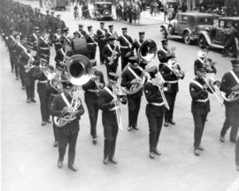
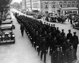
![[Group portrait of Firemen's Band on steps of Vancouver Court House]](/uploads/r/null/6/7/1/671ad823231c96cc5d64acf1461780da510a44b5779df01a4f7d6f2afba9aee6/28cbea32-cd96-49d3-8b15-a1440201704f-CVA354-101_142.jpg)
[Group portrait of Firemen's Band on steps of Vancouver Court House]
Part of City of Vancouver fonds
![8:06 pm Monday Dec. 26/55 1131 Beach Ave [view of firefighters putting out house fire]](/uploads/r/null/6/a/1/6a12647ac0f56355d27068df38766b24072ec21727a47cb1720c0a4776f47b18/e674c369-21ab-43ea-b482-8ebef2f0b301-CVA354-164_142.jpg)
8:06 pm Monday Dec. 26/55 1131 Beach Ave [view of firefighters putting out house fire]
Part of City of Vancouver fonds
![8:06 pm Monday Dec. 26/55 1131 Beach Ave [view of firefighters putting out house fire]](/uploads/r/null/5/5/e/55e6e5ee078efef5b8db66756db934b5a8e587d96615b516795cef0686bee29f/c1d72d91-cf49-4366-baf1-ce1807a52e46-CVA354-165_142.jpg)
8:06 pm Monday Dec. 26/55 1131 Beach Ave [view of firefighters putting out house fire]
Part of City of Vancouver fonds
![[Chief C.W. Thompson seated in Vancouver Fire Department automobile by Court House]](/uploads/r/null/9/5/7/957086fef640611a76ba82f9d85c3c033e0817a97acff07df0202d93930b6df9/d8263eca-24ec-48ab-bd53-3871f1b75d1d-CVA354-389_142.jpg)
[Chief C.W. Thompson seated in Vancouver Fire Department automobile by Court House]
Part of City of Vancouver fonds
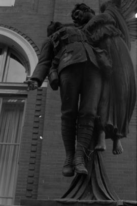
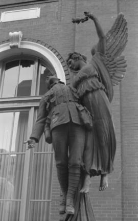
Angel of Victory, statue, 601 West Cordova Street
Part of City of Vancouver fonds

Royal General Insurance Co. - right lion
Part of City of Vancouver fonds

Royal General Insurance Co. - both lions
Part of City of Vancouver fonds
![Birk's Clock [Granville Street at West Georgia]](/uploads/r/null/a/9/6/a9697d6cc40854505b0b4a9a14831053be80ab68faa24a88551272cc2a71f88a/c19b38e7-1228-4e0e-9147-8f3e7408be73-CVA792-379_142.jpg)
Birk's Clock [Granville Street at West Georgia]
Part of City of Vancouver fonds
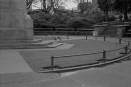
Victory Square Cenotaph, detail
Part of City of Vancouver fonds

Part of City of Vancouver fonds
Part of City of Vancouver fonds

Part of City of Vancouver fonds
Item is a photograph showing the Orpheum Theatre.