Portrait of unidentified man
![[Osborne J. Pierce]](/uploads/r/null/2/3/237c61c9ad88467482f99b90469506e254687c51197d822d142c82dc52cf1b1e/a71e515c-3934-431f-9ca2-abcc0ddea5dc-CVA1477-435_142.jpg)
[Osborne J. Pierce]

[Portrait of Sir James Douglas, presented to Mr. & Mrs. E.M. McVicker "with best wishes from Martha Douglas Harris"]

Portrait of Alexander Godfrey (left) and Chris Godfrey
Marine Camp, San Juan Inlet, August 1860 : Copied at the Dominion Archives, Ottawa, Nov. 30, 1921
Marine Camp, San Juan Inlet, August 1860 : Copied at the Dominion Archives, Ottawa, Nov. 30, 1921
Yale, B.C., 15th June, 1860 : Copied at the Dominion Archives, Ottawa, June 14, 1921
Yale, B.C., 15th June, 1860 : Copied at the Dominion Archives, Ottawa, June 14, 1921

Portrait of unidentified woman
![[Portrait of young woman]](/uploads/r/null/0/7/0718aea0d074adceb65a1fe8eb9a83e90636cb10ea9fa30cba9a02ad58b961c1/cfa0469e-a1ea-4866-acf5-55ba21813e80-A01843_142.jpg)
[Portrait of young woman]

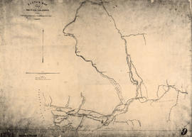
Map showing the line of boundary between the United States & British possessions
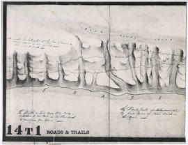
Four cross sections, mainland to Vancouver Island
Four cross sections, mainland to Vancouver Island
![[Mrs. Benjamin Springer (nee Frances Nias)]](/uploads/r/null/c/a/ca224d65615780f4d8db5b187e45a1ca4c1fe491e81acf2c4b841e6883315c99/7464c91c-c001-4588-bfc5-f425b0f080dc-A34654_142.jpg)
[Mrs. Benjamin Springer (nee Frances Nias)]
![Family home about 1860: Samuel Rogers, father of B.T. [Benjamin Tingley]](/uploads/r/null/b/d/9/bd9b3292c97579705ac4901524e8a4c8f9f68f09b5bf73906a4e53ad7331be1f/53a63c82-c73d-4d8f-a8f4-f594b5fb981a-2011-092_142.jpg)
Family home about 1860: Samuel Rogers, father of B.T. [Benjamin Tingley]
The site of Vancouver, B.C., 1861 : Copied at the Dominion Archives, Ottawa, June 27, 1921
The site of Vancouver, B.C., 1861 : Copied at the Dominion Archives, Ottawa, June 27, 1921
New Westminster, British Columbia
New Westminster, British Columbia
![[Studio portrait of] Queen Victoria and Prince Albert](/uploads/r/null/5/3/53c221c69324f41995a43bf139f40583e568effd9407e2e6d2a68976583552e7/5643ee3f-2936-4a96-8d0c-d4ad3314286a-A02238_142.jpg)
[Studio portrait of] Queen Victoria and Prince Albert
![Sketch of part of proposed line of waggon [sic] road from "Boston Bar" to "Yale&qu...](/uploads/r/null/c/e/2/ce2401c4feac301ae2c09b558486e5d36c42075bdbdb34d93491fb38bf94199b/a0d055f2-d790-4fc6-b0aa-1572524f65c8-LEG1800_142.jpg)
Sketch of part of proposed line of waggon [sic] road from "Boston Bar" to "Yale" on left bank of "Fraser River"
![Sketch of part of line of waggon [sic] road from "Boston Bar" to "Yale"](/uploads/r/null/6/8/5/685aeba6eb70cf489e3dc55456603ed30b0d42c00326cb69f8eb8fa758e030aa/714b3ee8-af5a-4786-85f4-230287a8d5fa-LEG1800_142.jpg)
Sketch of part of line of waggon [sic] road from "Boston Bar" to "Yale"

Sketch of part of line of road along right bank of "Fraser River" from "Boston Bar" to "Yale"

Haro Strait and middle channel

Map of Esquimalt, showing location of Royal Hospital

Mary McCleery and brother Samuel McCleery
Sketch map of part of British Columbia showing trails and routes of communication

British Columbia
![[Full length studio portrait of] John Woolsey](/uploads/r/null/a/f/af5720e477d9072c3383876a2c8b977e2f9335444842deecbb4de8240deea9a8/1fa39eda-b6aa-479e-97af-172a0b94e8aa-A02517_142.jpg)
[Full length studio portrait of] John Woolsey
Unidentified portion of Fraser River shoreline
![Country lands, New Westminster District [D.L. 185]](/uploads/r/null/2/f/f/2ff00fcb19a3dd23ff02f3355264a2fef808da9c2362a01bc084c87c334bbb27/0143c5f1-96bf-4733-b1d3-2386ba496659-LEG1801_142.jpg)
Country lands, New Westminster District [D.L. 185]

Esther McCleery and brother Fitzgerald McCleery
British Columbia
British Columbia

Sketch map of part of British Columbia showing trails and routes of communication
Hugh McRoberts, genealogy, McRobert's Island, written by Miss M.E. Bunting, granddaughter of Hugh McRoberts
Hugh McRoberts, genealogy, McRobert's Island, written by Miss M.E. Bunting, granddaughter of Hugh McRoberts
![D.L. 184 westward to [D.L. 181?]](/uploads/r/null/d/6/6/d66e699892f5f3573732fab74345928c93375400f48a564db38b4128d7809aa6/10ea8d79-243c-45ea-99f9-60f17d329c2c-LEG1801_142.jpg)
D.L. 184 westward to [D.L. 181?]

Foreshore D.L. 181 westward

Foreshore survey D.L. 185
Marriage certificate of Samuel B. Rogers and Clara A. Dupuy
Marriage certificate of Samuel B. Rogers and Clara A. Dupuy

North America. West Coast. Fraser River and Burrard Inlet
![[View of the Thompson River east of Lytton]](/uploads/r/null/b/5/b57bdc9554f4c089b187d1c5f5b233acbf931272e64dad2a0b54dd28040149cf/21978601-2e31-4d42-983f-3d601c619e55-A33843_142.jpg)
[View of the Thompson River east of Lytton]
![[View of Yale from across the river]](/uploads/r/null/d/8/d88bb63c674fa01155005f050b7f8d2ee6d5c424265116251dcf4dda08e4b73c/32c5ed3b-5b71-4c9d-8738-671a1fb58eef-A33844_142.jpg)
[View of Yale from across the river]
Khahatshlano, A.J. Baptismal Certificate, 1877-1879
Khahatshlano, A.J. Baptismal Certificate, 1877-1879

British Columbia
![[A part of the Cariboo Road between Hell's Gate and Chapmans]](/uploads/r/null/0/9/09f564a5e10bf8b5b528d6cef608078781396fb613caaf73894b7adb3890e28a/20f81bdb-6c16-431f-a020-ec7dbd161749-A33841_142.jpg)
[A part of the Cariboo Road between Hell's Gate and Chapmans]
![[A part of the Cariboo Road]](/uploads/r/null/3/2/325b5ab94be7474ca99a4c6172efdaacbc096e5e7d14797a940ba9f1978735da/e943c3c1-170d-4b5c-a086-104eb24bb724-A33836_142.jpg)
[A part of the Cariboo Road]
![[View of Spences Bridge]](/uploads/r/null/f/d/fde21c3df95bc8ea353a096dfa36a64257e960c089734510aecbf780ba673c38/905a7d1e-4b81-48f2-a730-cf093778e339-A33845_142.jpg)
[View of Spences Bridge]
![The Cameron C[ompanies?] claim "Camerouton" Williams Creek, B.C.](/uploads/r/null/5/8/586bbd218cda2979c8a18a35132229376962b6000903d6a90345763e5f4917c4/cc30a9b4-062f-43eb-b1e8-aaebd3631afd-A26627_142.jpg)
The Cameron C[ompanies?] claim "Camerouton" Williams Creek, B.C.
Capilano Creek, 1863 survey, showing position of Homulcheson Indian Village
Capilano Creek, 1863 survey, showing position of Homulcheson Indian Village
Royal Engineers, in B.C.
Royal Engineers, in B.C.
![[A part of the Cariboo Road]](/uploads/r/null/0/4/0451742b8f917ab9edd6b6e459fc385a9414ee9989dcb46d1e7183d293552284/cd8f24b9-f274-4655-bd36-999be6a1c680-A33839_142.jpg)
[A part of the Cariboo Road]
![[Nicaragua Bluff on the Cariboo Road]](/uploads/r/null/2/1/212ee267c1018cf936840d29525145920f13592d01c4166f02011afb7960667e/dfe8ff21-00f5-46e8-af64-5e05462e6164-A33842_142.jpg)
[Nicaragua Bluff on the Cariboo Road]
![[Hill 19 on the Cariboo Road]](/uploads/r/null/a/7/a7b7a913e1e5325c312ae63d254ada4c643f0714061a8c4eae87d2593375f76d/c51b19f1-c3f8-4602-ab31-e440fec83226-A33838_142.jpg)
[Hill 19 on the Cariboo Road]
Five dollar note No. 1698 issued by MacDonald and Company, Bankers, at 5 Yates Street, Victoria, Vancouver Island.
Five dollar note No. 1698 issued by MacDonald and Company, Bankers, at 5 Yates Street, Victoria, Vancouver Island.
Historic sketch map of Lower Mainland by Col. R.C. Moody, Feb. 10, [18--?] initialled RCM
Historic sketch map of Lower Mainland by Col. R.C. Moody, Feb. 10, [18--?] initialled RCM