Showing 1505 results

Archival description
City of Vancouver Archives technical and cartographic drawing collection Item
Print preview View:

1194 results with digital objects Show results with digital objects

Sheet 32 : Main Street to Clark Drive and Sixteenth Avenue to Great Northern Way

Item is a section showing the area from Main Street to Clark Drive and Sixteenth Avenue to Great Northern Way. Includes streets, blocks, lots and legal descriptions, and the locations of parks, schools and railways.

Vancouver (B.C.). Engineering Services

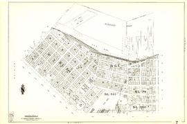
Sheet 7 : Burrard Street to Main Street and Georgia Viaduct to Burrard Inlet

Item is a section showing the area from Burrard Street to Main Street and Georgia Viaduct to Burrard Inlet. Includes streets, blocks, lots and legal descriptions, and the locations of parks, beaches, schools, theatres, post office and Canadian Pacific Railway yards and piers.

Vancouver (B.C.). Engineering Services

Sheet 22 : Maple Street to Drake Street and Fourth Avenue to Thurlow Street

Item is a section showing the area from Maple Street to Drake Street and Fourth Avenue to Thurlow Street. Includes streets, blocks, lots and legal descriptions, and the locations of First Nations reserves, parks, railways and railway yards.

Vancouver (B.C.). Engineering Services

Sheet 28 : Camosun Street to Balaclava Street and Fourteenth Avenue to Fourth Avenue

Item is a section showing the area from Camosun Street to Balaclava Street and Fourteenth Avenue to Fourth Avenue. Includes streets, blocks, lots and legal descriptions, and the locations of parks and schools.

Vancouver (B.C.). Engineering Services

Sheet 30 : Maple Street to Oak Street and Fourteenth Avenue to Third Avenue and False Creek

Item is a section showing the area from Maple Street to Oak Street and Fourteenth Avenue to Third Avenue and False Creek. Includes streets, blocks, lots and legal descriptions, and the locations of parks, schools and railways.

Vancouver (B.C.). Engineering Services

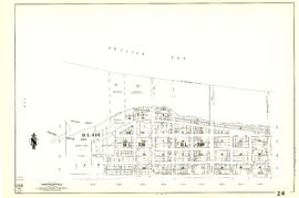
Sheet 20 : Main Street to Clark Drive and Great Northern Way to Prior Street

Item is a section showing the area from Main Street to Clark Drive and Great Northern Way to Prior Street. Includes streets, blocks, lots and legal descriptions, and the locations of parks, railways and railway yards.

Vancouver (B.C.). Engineering Services

Sheet 38 : Nanaimo Street to Rupert Street and Twenty-second Avenue to Grandview Highway

Item is a section showing the area from Nanaimo Street to Rupert Street and Twenty-second Avenue to Grandview Highway. Includes streets, blocks, lots and legal descriptions, and the locations of parks, schools and a preventorium (TB hospital).

Vancouver (B.C.). Engineering Services

Sheet 42 : Oak Street to Ontario Street and Twenty-eighth Avenue to Sixteenth Avenue

Item is a section showing the area from Oak Street to Ontario Street and wenty-eighth Avenue to Sixteenth Avenue. Includes streets, blocks, lots and legal descriptions, and the locations of parks and schools.

Vancouver (B.C.). Engineering Services

British Columbia : an historical illustrated map commemorating two centenaries, 1867-1967, 1866-1966

Item is an illustrated map is of the province of British Columbia, created to commemorate the Canadian Centennial.

The central component of the sheet is a reproduction of part of a map from the Department of Lands; surrounding the map are illustrations depicting prominent historical figures and accompanying information. The map has been annotated with the routes of Captain Cook's voyage (1778-1779), Captain Vancouver's voyage (1792-1794), and the overland routes of Sir Alexander MacKenzie (1793), David Thompson (1806-1811) and Simon Fraser (1808).

Portraits, accompanied by short biographies, are included for Cook, Vancouver, MacKenzie, Fraser and Sir James Douglas. Six other portraits are of the early governors of the colony of Vancouver Island and of British Columbia between 1849 and 1876. An illustration of the Great Seal of the Realm attached to the royal commission appointing Richard Blanshard the first governor of the colony of Vancouver Island is shown. A short textual description of the birth and expansion of British Columbia is included with an accompanying illustration of the expansion of the province over time.

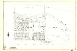
Sheet 5 : Stanley Park to Nicola Street and English Bay Beach to Robson Street

Item is a section showing the area from Stanley Park to Nicola Street and English Bay Beach to Robson Street. Includes streets, blocks, lots and legal descriptions, and the locations of parks, beaches, schools and golf courses.

Vancouver (B.C.). Engineering Services

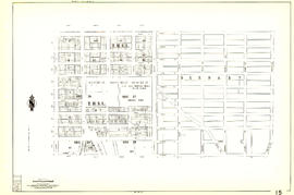
Sheet 15 : Rupert Street to Boundary Road and Kitchener Street to Pender Street

Item is a section showing the area from Rupert Street to Boundary Road and Kitchener Street to Pender Street. Includes streets, blocks, lots and legal descriptions. Also shown are streets and blocks in the area from Boundary Road to Carleton Avenue in Burnaby.

Vancouver (B.C.). Engineering Services

Sheet 17 : Nanaimo Street to Rupert Street and Charles Street to Pender Street

Item is a section showing the area from Nanaimo Street to Rupert Street and Charles Street to Pender Street. Includes streets, blocks, lots and legal descriptions. Includes streets, blocks, lots and legal descriptions, and the locations of parks and schools.

Vancouver (B.C.). Engineering Services

Sheet 9 : Main Street to Clark Drive and Prior Street to Burrard Inlet

Item is a section showing the area from Main Street to Clark Drive and Prior Street to Burrard Inlet. Includes streets, blocks, lots and legal descriptions, and the locations of parks, schools, railways and piers along the waterfront.

Vancouver (B.C.). Engineering Services

Sheet 31 : Oak Street to Main Street and Sixteenth Avenue to Fourth Avenue and False Creek

Item is a section showing the area from Oak Street to Main Street and Sixteenth Avenue to Fourth Avenue and False Creek. Includes streets, blocks, lots and legal descriptions, and the locations of parks, schools and railways.

Vancouver (B.C.). Engineering Services

Plan of a 9.783 acre portion of Kitsilano Indian Reserve, District Lot 3610, Group one, New Westminster District [annotated]

Item is a map depicting the area of the former Department of National Defence site at Kitsilano Point (now part of Vanier Park). The map shows the locations of the various Defence buildings on the site. Annotations show a grid layout imposed on the site.

Vancouver (B.C.). Office of the City Engineer

Plan of a 9.783 acre portion of Kitsilano Indian Reserve, District Lot 3610, Group one, New Westminster District [annotated]

Item is a map depicting the area of the former Department of National Defence site at Kitsilano Point (now part of Vanier Park). The map shows the locations of the various Defence buildings on the site. Annotations show measurements on the north-west boundary of the site.

Vancouver (B.C.). Office of the City Engineer

Plan of a 9.783 acre portion of Kitsilano Indian Reserve, District Lot 3610, Group one, New Westminster District [annotated]

Item is a map depicting the area of the former Department of National Defence site at Kitsilano Point (now part of Vanier Park). The map shows the locations of the various Defence buildings on the site. Annotations depict what appears to be draft layout of the Museum of Vancouver and Planetarium buildings superimposed on the site.

Vancouver (B.C.). Office of the City Engineer

Vancouver, British Columbia : [urban analysis maps]

Maps show land use, land slope and elevation, density of buildings, structural material of buildings, height of buildings, water supply systems, sewage systems, electric power systems, gas trunk systems, population distribution, daytime population distribution, dwelling units, schools, hospitals and doctors, land transportation, port facilities, food manufacturing, textile manufacturing, wood product manufacturing, metal product manufacturing, transportation equipment manufacturing, non-metallic mineral and chemical products manufacturing, retail and wholesale food enterprises, retail and wholesale building materials enterprises, retail and wholesale drugs, general merchandise, apparel and accessories enterprises, retail and wholesale clothing and shoes enterprises, retail and wholesale furnishing enterprises and hotels and eating places in the Greater Vancouver area (including West Vancouver, North Vancouver, Vancouver, Burnaby, New Westminster, the northern portion of Richmond and the western portion of Coquitlam). Much of the data for these maps was derived from the 1961 census of Canada.

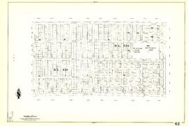
Sheet 62 : Cypress Street to Oak Street and Forty-ninth Avenue to Forty-first Avenue

Item is a section showing the area from Cypress Street to Oak Street and Forty-ninth Avenue to Forty-first Avenue. Includes streets, blocks, lots and legal descriptions, and the locations of parks and schools.

Vancouver (B.C.). Engineering Services

Sheet 69 : Musqueam Indian Reserve to Macdonald Street and North Arm of the Fraser River to Forty-ninth Avenue

Item is a section showing the area from Musqueam Indian Reserve to Macdonald Street and North Arm of the Fraser River to Forty-ninth Avenue. Includes streets, blocks, lots and legal descriptions, and golf courses.

Vancouver (B.C.). Engineering Services

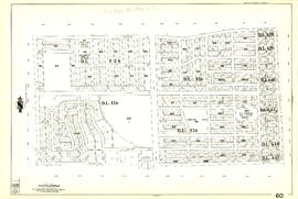
Sheet 60 : Oak Street to Quebec Street and Forty-sixth Avenue to Thirty-seventh Avenue

Item is a section showing the area from Oak Street to Quebec Street and Forty-sixth Avenue to Thirty-seventh Avenue. Includes streets, blocks, lots and legal descriptions, and the locations of parks and schools.

Vancouver (B.C.). Engineering Services

Sheet 44 : Blenheim Street to Arbutus Street and King Edward Avenue to Fourteenth Avenue

Item is a section showing the area from Blenheim Street to Arbutus Street and King Edward Avenue to Fourteenth Avenue. Includes streets, blocks, lots and legal descriptions, and the locations of parks, schools and railways.

Vancouver (B.C.). Engineering Services

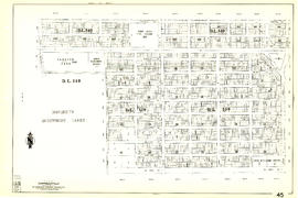
Sheet 45 : Discovery Street to Blenheim Street and King Edward Avenue to Fourteenth Avenue

Item is a section showing the area from Discovery Street to Blenheim Street and King Edward Avenue to Fourteenth Avenue. Includes streets, blocks, lots and legal descriptions, and the locations of parks and schools.

Vancouver (B.C.). Engineering Services

Sheet 87 : Barnard Street to Heather Street and Beckwith Road to Seventy-fifth Avenue

Item is a section showing the area from Barnard Street to Heather Street and the North Arm of the Fraser River to Seventy-fifth Avenue. Includes streets, blocks, lots and legal descriptions, and the locations of schools and parks. Also Includes streets and blocks in Richmond from Beckwith Road to River Drive.

Vancouver (B.C.). Engineering Services

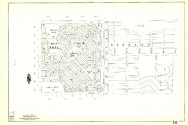
Sheet 36 : Rupert Street to Carlton Avenue and Twenty-second Avenue to Grandview Highway

Item is a section showing the area from Rupert Street to Boundary Road and Twenty-second Avenue to Grandview Highway. Includes streets, blocks, lots and legal descriptions, and the locations of parks and schools. Also included are streets and blocks in the area from Boundary Road to Carleton Avenue in Burnaby.

Vancouver (B.C.). Engineering Services

Plan of Kitsilano Indian Reserve, No. 6 (contours)

Item is a topographical map used as a base for showing surveying information such as lot numbers, boundaries, contours, bearings, pipelines, bridge and rail rights-of-way and other landmarks on the Kitsilano Indian Reserve. The map was likely used in planning the development of Vanier Park and/or the Vancouver Museum in the mid-late 1960s. Annotations show "most likely entrance" at McNicoll Avenue.

Vancouver (B.C.). Engineer's Office

Results 251 to 300 of 1505