Add to clipboard
Location of ferry pedestrian subway, Vancouver, B.C.
Add to clipboard
Hotels
Add to clipboard
Street index (Royal Oak Avenue, Vancouver to Frederick Road, North Vancouver)
Add to clipboard
Street index (Campbell Street to Rosser Avenue)
Add to clipboard
District lot index and street index (1st Avenue to Campbell Avenue)
Add to clipboard
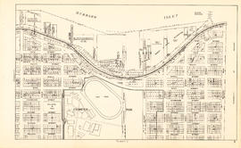
Plate 28 [Rogers Street to Burrard Inlet to Raymur Avenue to Powell Street]
Indexed guide map of the City of Vancouver and suburbs
Add to clipboard
Indexed guide map of the City of Vancouver and suburbs
A souvenir and correct map of the location of all the fair buildings of the Vancouver Exhibition
Add to clipboard
A souvenir and correct map of the location of all the fair buildings of the Vancouver Exhibition
Add to clipboard
Plan of Cambie St. grounds
Add to clipboard
Plan of the Vancouver Exhibition grounds
Add to clipboard
A souvenir and correct map of the location of all the fair buildings of the Vancouver Exhibition
Add to clipboard
The city of Vancouver, British Columbia
Vancouver B.C. waterfront map
Add to clipboard
Vancouver B.C. waterfront map
Add to clipboard
Section 2 [Jervis Street to Granville Street]
Add to clipboard
Section 3 [Granville Street to Abbott Street]
Add to clipboard
Section 4 [Abbott Street to Gore Avenue]
Add to clipboard
Section 6 [Heatley Avenue to Raymur Avenue]
Add to clipboard
Key plan
Add to clipboard
Section 9 [Salisbury Drive to McGill and Wall Streets]
Add to clipboard
Section 1 [Coal Harbour to Jervis Street]
Add to clipboard
Section 7 [Raymur Avenue to McLean Drive]
Add to clipboard
Section 5 [Gore Avenue to Heatley Avenue]
Add to clipboard
Section 8 [McLean Drive to Salisbury Drive]
Add to clipboard
Plate 3 [Seymour Street to Burrard Inlet to Hornby Street to Pender Street]
Add to clipboard
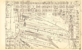
Plate 4 [Hamilton & Cambie Streets to CP Railway yards to Seymour Street to Pender Street]
Add to clipboard
Plate 16 [Seymour Street to Pender Street to Hornby Street to Georgia Street]
Add to clipboard
Plate 6 [Carrall Street to Water Street to Abbott Street to Pender Street]
Add to clipboard
Plate 17 [Hamilton Street to Pender Street to Seymour Street to Georgia Street]
Add to clipboard
Plate 19 [Hamilton Street to Georgia Stret to Seymour Street to Smithe Street]
Add to clipboard
Plan of Point Grey Municipality
Add to clipboard
Plate 2 [Hornby Street to Burrard Inlet to Thurlow Street to Pender Street]
Add to clipboard
Plate 5 [Abbott Street to CP Rail right-of-way to Cambie Street to Pender Street]
Add to clipboard
Plate 7 [Main Street to Powell Street to Columbia Street to Pender Street]
Add to clipboard
Plate 18 [Seymour Street to Georgia Street to Hornby Street to Smithe Street]
Granville Street
Add to clipboard
Granville Street
Add to clipboard
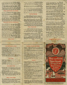
Map and Guide to Vancouver Street Car and Interurban Lines
British Columbia Electric Railway Company systems : Vancouver Island, Lower Mainland, Vancouver and New Westminster; Alouette-Stave development, present and projected
Add to clipboard
British Columbia Electric Railway Company systems : Vancouver Island, Lower Mainland, Vancouver and New Westminster; Alouette-Stave development, present and projected
Add to clipboard
British Columbia Electric Railway Company Limited : Vancouver and New Westminster city and suburban lines and Alouette-Stave development, present and projected
Add to clipboard
Plan of the City of Vancouver, B.C.
Add to clipboard
Vancouver city and suburban lines
Add to clipboard
Plan of the City of Vancouver, B.C.
Commercial Map of Greater Vancouver and District [BC]
Add to clipboard
Commercial Map of Greater Vancouver and District [BC]
Add to clipboard
Sheet S.V. 15 : Dawson Street to Boundary Road and Foster Avenue to Fiftieth Avenue
Add to clipboard
Sheet 1 : Slocan Street to Boundary Road and Triumph Street to Burrard Inlet
Add to clipboard
Sheet 11 : Carrall Street to Clark Drive and waterfront to Keefer Street
Add to clipboard
Sheet 12 : Ontario Street to Clark Drive and Keefer Street to Second Avenue
Add to clipboard
Sheet 20 : Granville Street to Ontario Street and Robson Street to Sixth Avenue
Add to clipboard
Sheet F : Wallace Street to Trafalgar Street and Sixteenth Avenue to Twenty-seventh Avenue
Add to clipboard
Sheet J : University Endowment Lands to Wallace Street and Twenty-seventh Avenue to Thirty-eighth Avenue
Add to clipboard
Sheet L : Trafalgar Street to Granville Street and Nanton Avenue to Thirty-eighth Avenue


![Plate 28 [Rogers Street to Burrard Inlet to Raymur Avenue to Powell Street]](/uploads/r/null/a/d/4/ad448e6434aca51e0c80d95d998867b723fddcca85b2c25a6ac6630b3eceff50/5bfa1e47-4599-430a-9aba-d4d40a02d674-1972-582_142.jpg)


![Section 2 [Jervis Street to Granville Street]](/uploads/r/null/c/f/5/cf5684518fb1cdac0f2d643c89acc078a47fe51a6a1896caf8fcfaf23999a562/c5097ebd-7d02-4ddb-be5e-d0f2658f2849-1972-581_142.jpg)
![Section 3 [Granville Street to Abbott Street]](/uploads/r/null/f/7/c/f7c18e536d617ec84d3c777f7d3bc02b98868d606842132c28166caaaa2dac3d/7e715850-e92f-48ba-bbc7-3678c5a832df-1972-581_142.jpg)
![Section 4 [Abbott Street to Gore Avenue]](/uploads/r/null/d/0/b/d0bdb5bfbb8ea9ebfe40ab12d3166035d9041c0874b44ccbcf0feaf7d343e90d/3d33023b-e416-4a39-b51c-f201b58c1e2c-1972-581_142.jpg)
![Section 6 [Heatley Avenue to Raymur Avenue]](/uploads/r/null/3/a/0/3a00a7d7ff2433b00b59b0d575006a89ff1e36eea4ecb961d585d3702308874e/61c58478-fbdc-4b03-b27d-4c69089913cd-1972-581_142.jpg)

![Section 9 [Salisbury Drive to McGill and Wall Streets]](/uploads/r/null/2/c/a/2ca00124652bd05f6e2ba7a38be0913c343f9df3ba7b70bb934ceb836de2fa89/dd14b8fd-0710-4ff6-9a02-2a79e289941f-1972-581_142.jpg)
![Section 1 [Coal Harbour to Jervis Street]](/uploads/r/null/9/e/9/9e9001a91f4548dd7acb5cf68e9748a8fa0f3d8a10ad9a1235983466dfcc5e1f/d062ae77-a147-4ff8-8a2f-805b659ba7b3-1972-581_142.jpg)
![Section 7 [Raymur Avenue to McLean Drive]](/uploads/r/null/6/6/9/669640404bae29e74b38e879b94454a054f0417ed40580a028e0db5b976a2e80/614de88a-1a33-4127-8bdf-f328f3cd4e22-1972-581_142.jpg)
![Section 5 [Gore Avenue to Heatley Avenue]](/uploads/r/null/c/a/9/ca9447df558507296e13d910ed22dcef00b730757d8104a6fdbd5d4e2955a8e1/f669a13d-c71c-4b3a-904d-555f84e054a3-1972-581_142.jpg)
![Section 8 [McLean Drive to Salisbury Drive]](/uploads/r/null/9/1/c/91cb699e74dcee955f380f79208650cd638e651fcce20dbaf91e0f6fd7309854/2dcab9c8-db56-41e3-934c-91dbdfccf6f8-1972-581_142.jpg)
![Plate 3 [Seymour Street to Burrard Inlet to Hornby Street to Pender Street]](/uploads/r/null/b/6/e/b6e52f14a0b98be97e608633aaf0e2cdd8d5a51d8772a2b1ef80d1b748c7ebdc/eecaa1fa-a58b-4079-bf99-7f62b81de43f-1972-582_142.jpg)
![Plate 4 [Hamilton & Cambie Streets to CP Railway yards to Seymour Street to Pender Street]](/uploads/r/null/7/e/9/7e931c45a666b558ca27b156ef8b243f5244a2820199fe50e04a7aaed21eeb20/06bd9672-ba7d-4013-aaac-2d7c9d8c5188-1972-582_142.jpg)
![Plate 16 [Seymour Street to Pender Street to Hornby Street to Georgia Street]](/uploads/r/null/5/b/3/5b3e6b9c6b363ebf8647de3c6cbd08be134849a51c2afb6ae2d8270992423224/1bbec413-4808-4972-ba42-96d87508f044-1972-582_142.jpg)
![Plate 6 [Carrall Street to Water Street to Abbott Street to Pender Street]](/uploads/r/null/2/9/d/29d9b87c8a0b2ec0ebe43b7a1b209cf540943a17fcdf02f7fbf229b97c9beb06/65cae868-4124-4b7f-bb47-c6364f18c039-1972-582_142.jpg)
![Plate 17 [Hamilton Street to Pender Street to Seymour Street to Georgia Street]](/uploads/r/null/d/b/0/db02a6582e4c80b48f4280307b3a1bf96e118648e3076fd16fe61c9a33d078a4/9e87cf0f-995c-4324-92af-170d1a2248d5-1972-582_142.jpg)
![Plate 19 [Hamilton Street to Georgia Stret to Seymour Street to Smithe Street]](/uploads/r/null/0/e/c/0ecea3ead6474f95320d3370c410bde1bef129fc8bcb8e54709f6f4aae7e3461/561bca07-f000-4835-ad8e-9e2bda093863-1972-582_142.jpg)

![Plate 2 [Hornby Street to Burrard Inlet to Thurlow Street to Pender Street]](/uploads/r/null/8/6/e/86edaec51670e0342c610b1530e723e6bb9890d9ef2f3b0db31ad30f0b559c61/adee6b6a-0b86-4884-b86a-cbcb2773c325-1972-582_142.jpg)
![Plate 5 [Abbott Street to CP Rail right-of-way to Cambie Street to Pender Street]](/uploads/r/null/6/b/0/6b0b7025ad796cf3c24bd82d3128128aeb9437211623e8b002f3aa257584f3d8/b2e8d0db-d7d6-463d-9eed-a04b68cd2033-1972-582_142.jpg)
![Plate 7 [Main Street to Powell Street to Columbia Street to Pender Street]](/uploads/r/null/d/f/b/dfb6afa705be957fb1edcc4db4eebed9e70de2f7da4428a558a100303c04c15c/49c15b71-8829-4feb-b5c6-1643c02b3907-1972-582_142.jpg)
![Plate 18 [Seymour Street to Georgia Street to Hornby Street to Smithe Street]](/uploads/r/null/1/a/4/1a4187cb3019a9f0a84f3d7a4ffed7e4cb88181cbd49481d7904d57b9dfd1cc6/bd298293-e0af-4e5a-b89c-faab9207fc67-1972-582_142.jpg)
