Print preview Close
Showing 269 results
Archival description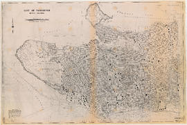
City of Vancouver, B.C.
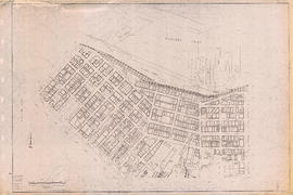
Sectional map of Vancouver showing streets, block and lot outlines, and building perimeters : Map 7 : Burrard Street to Main Street and Burrard Inlet to Georgia Street

Sectional map of Vancouver showing streets, block and lot outlines, and building perimeters : Map 10 : Clark Drive to Nanaimo Street and Burrard Inlet to Frances Street/Ferndale Street
Sectional map of Vancouver showing streets, block and lot outlines, and building perimeters : Map 16 : Rupert Street to Boundary Road and Kitchener Street to 5th Avenue
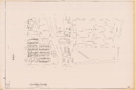
Sectional map of Vancouver showing streets, block and lot outlines, and building perimeters : Map 21 : False Creek waterfront and adjacent buildings from foot of Drake Street to Main Street
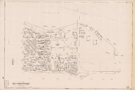
Sectional map of Vancouver showing streets, block and lot outlines, and building perimeters : Map 25 : Blanca Street to Jericho Beach Park and English Bay to 4th Avenue
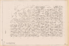
Sectional map of Vancouver showing streets, block and lot outlines, and building perimeters : Map 28 : Camosun Street to Balaclava Street and 4th Avenue to 14th Avenue

Sectional map of Vancouver showing streets, block and lot outlines, and building perimeters : Map 29 : Balaclava Street to Maple Street and 3rd Avenue to 14th Avenue

Sectional map of Vancouver showing streets, block and lot outlines, and building perimeters : Map 30 : Maple Street to Oak Street and 3rd Avenue/6th Avenue to 14th Avenue

Sectional map of Vancouver showing streets, block and lot outlines, and building perimeters : Map 31 : Oak Street to Main Street and 6th Avenue/4th Avenue to 16th Avenue
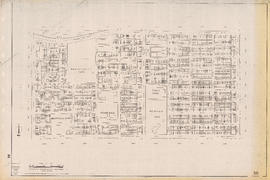
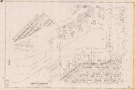
Sectional map of Vancouver showing streets, block and lot outlines, and building perimeters : Map 38 : Nanaimo Street to Rupert Street and Grandview Highway to 22nd Avenue

Sectional map of Vancouver showing streets, block and lot outlines, and building perimeters : Map 45 : Discovery Street/Camosun Street to Blenheim Street and 14th Avenue to King Edward Avenue

Sectional map of Vancouver showing streets, block and lot outlines, and building perimeters : Map 53 : Inverness Street to Nanaimo Street and 32nd Avenue to 41st Avenue

Sectional map of Vancouver showing streets, block and lot outlines, and building perimeters : Map 54 : Nanaimo Street to McHardy Street/Cecil Street/Joyce Street and Ward Street/Euclid Avenue/Vanness Avenue to 41st Avenue

Sectional map of Vancouver showing streets, block and lot outlines, and building perimeters : Map 59 : Quebec Street to Inverness Street and 37th Avenue to 47th Avenue

Sectional map of Vancouver showing streets, block and lot outlines, and building perimeters : Map 64 : Balaclava Street to Cypress Street and 41st Avenue to 49th Avenue

Sectional map of Vancouver showing streets, block and lot outlines, and building perimeters : Map 65 : Camosun Street to Carnarvon Street and 33rd Avenue to 41st Avenue

Sectional map of Vancouver showing streets, block and lot outlines, and building perimeters : Map 70 : Macdonald Street to Cypress Street and 49th Avenue to 57th Avenue
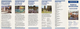
Vancouver Parks and Recreation : map and guide
Results 251 to 269 of 269