
Sheet 32 : Main Street to Clark Drive and Sixteenth Avenue to Great Northern Way

Sheet 25 : Blanca Street to Jericho Beach and Fourth Avenue to Locarno Beach

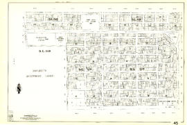
Sheet 26 : University Endowment Lands to Blanca Street and Fourth Avenue to Spanish Banks Beach

Sheet 29 : Balaclava Street to Maple Street and Fourteenth Avenue to Third Avenue

Sheet 7 : Burrard Street to Main Street and Georgia Viaduct to Burrard Inlet

Sheet 21 : Homer Street to Main Street and Fourth Avenue to Georgia Viaduct

Sheet 22 : Maple Street to Drake Street and Fourth Avenue to Thurlow Street

Sheet 28 : Camosun Street to Balaclava Street and Fourteenth Avenue to Fourth Avenue

Sheet 23 : Balaclava Street to Maple Street and Third Avenue to English Bay

Sheet 30 : Maple Street to Oak Street and Fourteenth Avenue to Third Avenue and False Creek

Sheet 61 : Cypress Street to Oak Street and Forty-first Avenue to Thirty-third Avenue

Sheet 20 : Main Street to Clark Drive and Great Northern Way to Prior Street

Sheet 38 : Nanaimo Street to Rupert Street and Twenty-second Avenue to Grandview Highway

Sheet 42 : Oak Street to Ontario Street and Twenty-eighth Avenue to Sixteenth Avenue
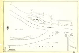
Sheet 90 : Carrington Street to Macdonald Street and Richmond to Celtic Avenue
Let's go see! Inside Vancouver
Let's go see! Inside Vancouver

British Columbia : an historical illustrated map commemorating two centenaries, 1867-1967, 1866-1966
[Map showing proposed electoral district boundaries within the Greater Vancouver area]
[Map showing proposed electoral district boundaries within the Greater Vancouver area]

Sheet 65 : Camosun Street to Carnarvon Street and Forty-first Avenue to Thirty-third Avenue
Provincial electoral districts
Provincial electoral districts
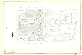
False Creek
False Creek
A composite plan showing Capilano Indian Reserve No. 5 and district lot 5521
A composite plan showing Capilano Indian Reserve No. 5 and district lot 5521
Map of Greater Vancouver and Lower Mainland area
Map of Greater Vancouver and Lower Mainland area

Sheet 5 : Stanley Park to Nicola Street and English Bay Beach to Robson Street
Sheet 15 : Rupert Street to Boundary Road and Kitchener Street to Pender Street

Sheet 17 : Nanaimo Street to Rupert Street and Charles Street to Pender Street

Sheet 9 : Main Street to Clark Drive and Prior Street to Burrard Inlet

Sheet 31 : Oak Street to Main Street and Sixteenth Avenue to Fourth Avenue and False Creek
Vancouver Centennial Museum : proposed new building services
Vancouver Centennial Museum : proposed new building services

Plan of a 9.783 acre portion of Kitsilano Indian Reserve, District Lot 3610, Group one, New Westminster District

Plan of a 9.783 acre portion of Kitsilano Indian Reserve, District Lot 3610, Group one, New Westminster District [annotated]

Plan of a 9.783 acre portion of Kitsilano Indian Reserve, District Lot 3610, Group one, New Westminster District [annotated]

Plan of a 9.783 acre portion of Kitsilano Indian Reserve, District Lot 3610, Group one, New Westminster District [annotated]
Vancouver, British Columbia : [urban analysis maps]
Vancouver, British Columbia : [urban analysis maps]

Sheet 62 : Cypress Street to Oak Street and Forty-ninth Avenue to Forty-first Avenue

Sheet 89 : North Arm of Fraser River to Southwest Marine Drive and Barnard Street

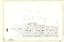
Sheet 69 : Musqueam Indian Reserve to Macdonald Street and North Arm of the Fraser River to Forty-ninth Avenue
Map of Greater Vancouver and Lower Mainland area
Map of Greater Vancouver and Lower Mainland area
![Plan to accompany by-law no. [Blank] being a by-law to amend by-law no. 4054 being the street nam...](/uploads/r/null/3/a/d/3ad2e1a740be487ac9cdd1a7e10ac6cbe15cda433b0937bde9a0837696e4148a/802101ef-808b-4353-a5fe-3100da56eeb7-MAP71c_142.jpg)
Plan to accompany by-law no. [Blank] being a by-law to amend by-law no. 4054 being the street naming by-law
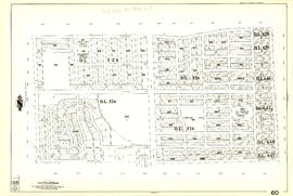
Sheet 60 : Oak Street to Quebec Street and Forty-sixth Avenue to Thirty-seventh Avenue

Sheet 44 : Blenheim Street to Arbutus Street and King Edward Avenue to Fourteenth Avenue
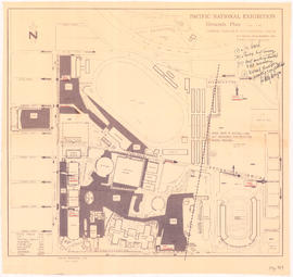
Pacific National Exhibition grounds plan : parking available for proposed arena
Sheet 45 : Discovery Street to Blenheim Street and King Edward Avenue to Fourteenth Avenue

Sheet 87 : Barnard Street to Heather Street and Beckwith Road to Seventy-fifth Avenue
Sheet 36 : Rupert Street to Carlton Avenue and Twenty-second Avenue to Grandview Highway
Sheet 24 : Jericho Beach to Balaclava Street and Fourth Avenue to Cameron Avenue

Sheet 11 : Wall Street to Rupert Street and McGill Street to Burrard Inlet
Plan of Kitsilano Indian Reserve, No. 6 (contours)
Plan of Kitsilano Indian Reserve, No. 6 (contours)

Sheet 13 : Rupert Street to Boundary Road and Eton Street to Burrard Inlet
![McRoberts Island [Sea Island]](/uploads/r/null/6/9/6981a571c6d3102ee36ac270cce0eca9727531a3a9b4dd09f46f6f61adbbadbe/b8c696f2-5181-4f84-9e76-6420f9b2e916-Map800_142.jpg)
McRoberts Island [Sea Island]