- AM1594-: MAP 854-: LEG1153.013
- Part
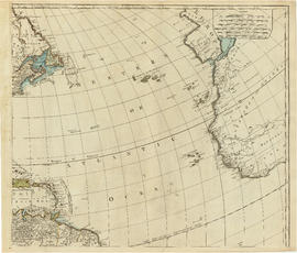
- June 1, 1781
Part of City of Vancouver Archives technical and cartographic drawing collection
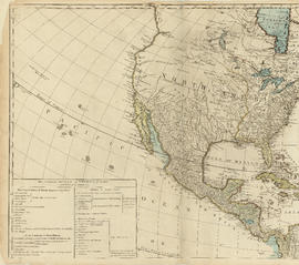
Part depicts text and accompanying diagram on "the art of dialing by a common globe", a chart of universal scale, a map of the world using Mercator's projection, a map of the southern half of the Americans, descriptions of the various maps and charts, and the left-hand side of a map of the lunar surface viewable from Earth.
Dunn, Samuel