
- COV-S639-1-F66-: CVA 790-2108
- Item
- [1985?]
Part of City of Vancouver fonds
6250 results with digital objects Show results with digital objects
Part of City of Vancouver fonds

Part of City of Vancouver fonds

Part of City of Vancouver fonds
Item is a photograph in which signs for Universal Handicrafts and Gastown Pawn Brokers are visible.
Part of City of Vancouver fonds

Part of City of Vancouver fonds

Part of City of Vancouver fonds
Item is a photograph in which signs for Dog's Ear Boutique and Golden Dragon are visible.

Part of City of Vancouver fonds

Part of City of Vancouver fonds
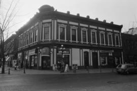
Item is a photograph in which a sign for Antiques is visible.

Part of City of Vancouver fonds
Part of City of Vancouver fonds
Item is a photograph in which a sign for Baskin-Robbins is visible.
Part of City of Vancouver fonds
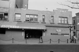
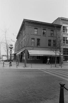
Item is a photograph in which a sign for Brothers Restaurant is visible.
Part of City of Vancouver fonds
Part of City of Vancouver fonds
Item is a photograph in which a sign for Import Bazaar is visible.

Part of City of Vancouver fonds
Part of City of Vancouver fonds

Part of City of Vancouver fonds
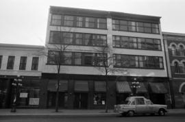
Item is a photograph in which a sign for Shoe Factory Discount Warehouse is visible.

Part of City of Vancouver fonds
Item is a photograph in which a sign for Cost Plus is visible.

Part of City of Vancouver fonds
Item is a photograph in which a sign for Thrifty's is visible.

Part of City of Vancouver fonds

Part of City of Vancouver fonds
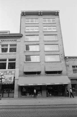
Item is a photograph in which a sign for Frances Hill Inc. is visible.
Part of City of Vancouver fonds
Item is a photograph in which a sign for The Games People is visible.

Part of City of Vancouver fonds
Item is a photograph in which a sign for Calico Cat is visible.
Part of City of Vancouver fonds
Item is a photograph in which a sign for Gingham Dog is visible.

Part of City of Vancouver fonds

Part of City of Vancouver fonds

Part of City of Vancouver fonds

Part of City of Vancouver fonds
Item is a photograph in which a sign for Dairy Queen is visible.

Part of City of Vancouver fonds
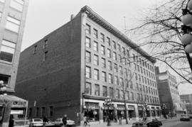
Item is a photograph in which a sign for Sears is visible.

Part of City of Vancouver fonds
Item is a photograph in which a sign for Willson is visible.

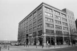
Buses and Vancouver Block outside the Eaton’s Building
Part of City of Vancouver fonds
Item part is a photograph of the bus stop with buses on Granville Street taken from the open area at the eastern corner of the Eaton’s Building. Scott’s Restaurant (and Cafe), Roselawn Florists, and Vancouver Block (736 Granville Street) are visible across Granville Street past the buses. The rounded eastern corner of the Eaton’s Building is visible on the right edge of the photograph.

Allscreen - Vancouver - reel #3
Part of Yaletown Productions Inc. fonds
Film consists of raw footage of scenes of Vancouver used in the video postcard "Vancouver - The World in a City." Including Vancouver street scenes, the downtown area around Burrard Street, and Georgia Street, the Trade and Convention Centre construction site in Coal Harbour, Coal Harbour, the B.C. Ferries seabus, the Gastown neighbourhood, tourists, the steam clock, First Nations artists carving a totem pole, the undeveloped Expo 86 site, and various views of the city of Vancouver. Silent film.

Part of Yaletown Productions Inc. fonds
This item consists of raw footage featuring B.C./Expo 86 aerials; shot in 35mm and transferred to one inch tape. Original negative no longer exists and only video footage survives. Some of this material was used in Yaletown Production's video postcard series. Includes nighttime footage of downtown Vancouver.

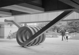
"Spring" sculpture by Chung Hung at Robson Square
Part of Paul Yee fonds

"Spring" sculpture by Chung Hung at Robson Square
Part of Paul Yee fonds
"Spring" sculpture by Chung Hung at Robson Square
Part of Paul Yee fonds

Downtown Peninsula; Vancouver, B.C. Canada; Lines at 100 Foot Intervals; Datum Line 100
Part of City of Vancouver Archives technical and cartographic drawing collection
Item consists of map of downtown Vancouver (possibly using a Planning Department map as a base map) depicting hand-drawn topographic countour lines, possibly created as part of a development application.
Part of City of Vancouver Archives technical and cartographic drawing collection
Item consists of a map similar to a planning map of the central downtown business district, showing the principal buildings and either their heights or total elevations. This may have been created as part of the development application for the Bank of British Columbia Building (now HBSC Bank Building) at 855 West Georgia Street, which was built at the site of the demolished Devonshire Hotel in 1987.
Site plan of central downtown waterfront
Part of City of Vancouver Archives technical and cartographic drawing collection
Item consists of a site plan that appears to depict a proposed redevelopment of Seabus terminal site for second cruise ship terminal and new helijet terminal to the east. The plan also includes a pencil sketch of the profile of the proposed building in the margins of the site plan.
Marathon Realty Company Limited Coal Harbour Redevelopment
Part of City of Vancouver Archives technical and cartographic drawing collection
Item consists of a site plan map delineating the outline of what appears to be a proposed redevelopment of the western portion of Coal Harbour. The site plan uses as a base map an aerial photo of the waterfront from Coal Harbour to the convention centre.
Marathon Realty Co. Ltd. Coal Harbour Shoreline
Part of City of Vancouver Archives technical and cartographic drawing collection
Item consists of a topographic map of the south shoreline of Burrard Inlet from Burrard to Cardero streets.
Harbour Green Neighborhood; Hastings Street Elevation North
Part of City of Vancouver Archives technical and cartographic drawing collection
Item consists of a street elevation of Hastings Street between Bute and Jervis streets, most likely depicting the proposed Evergreen Building at 1285 West Pender Street.
Topographic Base Map; Marathon Realty Co. Ltd Coal Harbour Development
Part of City of Vancouver Archives technical and cartographic drawing collection
Site plan of central downtown waterfront
Part of City of Vancouver Archives technical and cartographic drawing collection
Item is a map of the central downtown waterfront area, from the eastern end of Coal Harbour to east of Crab Park, depicting roads and buildings. The drawing may be related to 2014-002.04.

Part of Stuart Thomson fonds
Item is a photograph showing the rectory building of the Holy Rosary Cathedral Church on Richards Street (between Dunsmuir and West Georgia).
Woman standing on beach at English Bay
Item is a photograph showing beach goers and the bathhouse in the background.
Aerial view of Vancouver looking south east
Item is a photograph showing downtown Vancouver with BC Place Stadium and Science World in the foreground and the Burnaby skyline in the background.
Westcoast Transmission Building - Core in progress
Part of Tom Grant fonds
Item is a photograph showing the construction sequence of the Westcoast Transmission Building 1300 blk [block] West Georgia St [taken] from Pacific Palisades Apt and Georgian Towers Hotel.
Westcoast Transmission Building - Core is completed
Part of Tom Grant fonds
Item is a photograph showing the construction sequence of the Westcoast Transmission Building 1300 blk [block] West Georgia St [taken] from Pacific Palisades Apt and Georgian Towers Hotel.