
- COV-S371-: MAP 367-: LEG1336.08
- Part
- May 1, 1912
Part of City of Vancouver fonds
244 results with digital objects Show results with digital objects
Part of City of Vancouver fonds
Part of City of Vancouver fonds

Part of City of Vancouver fonds

Part of City of Vancouver fonds

Part of City of Vancouver fonds

Part of City of Vancouver fonds

Part of City of Vancouver fonds

Part of City of Vancouver fonds
Part of City of Vancouver fonds

Part of City of Vancouver fonds

Part of City of Vancouver fonds

Part of City of Vancouver fonds

Part of City of Vancouver fonds

Part of City of Vancouver fonds

Part of City of Vancouver fonds

Part of City of Vancouver fonds

Part of City of Vancouver fonds

Part of City of Vancouver fonds

Part of City of Vancouver fonds

Part of City of Vancouver fonds

Part of City of Vancouver fonds

Part of City of Vancouver fonds

Part of City of Vancouver fonds

Part of City of Vancouver fonds

Part of City of Vancouver fonds

Part of City of Vancouver fonds

Part of City of Vancouver fonds

Part of City of Vancouver fonds

Part of City of Vancouver fonds

Part of City of Vancouver fonds

Part of City of Vancouver fonds

Part of City of Vancouver fonds

Part of City of Vancouver fonds
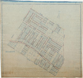
![[First section of] Shaughnessy Heights](/uploads/r/null/c/d/0/cd05f96b7e9f01fee4ba2afe83ac83cef9d70b3cf83d3ba8c4ebe5a0a20a429d/0d2ec941-063b-4722-8d84-aff283b273f6-MAP329_142.jpg)
[First section of] Shaughnessy Heights
Part of City of Vancouver Archives technical and cartographic drawing collection
Item is a cadastral map showing lot divisions and in some cases ownership, in Shaughnessy Heights up to January 1st, 1932.
Canadian Pacific Railway Company
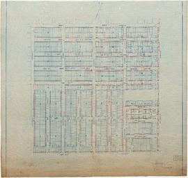
![[Second section of] Shaughnessy Heights](/uploads/r/null/9/4/d/94d42178bb60a8c60cdc002199430e863ae830696947ad73807b5fd11046c39a/72c651d3-6742-4c5c-a0bc-d83c3526a9ba-MAP330_142.jpg)
[Second section of] Shaughnessy Heights
Part of City of Vancouver Archives technical and cartographic drawing collection
Item is a map showing lot subdivision of the southern portion of Shaughnessy Heights (commonly referred to as "Second Shaughnessy") at January 1st, 1932.
Canadian Pacific Railway Company
![[Third section of] Shaughnessy Heights](/uploads/r/null/b/9/c/b9c97036cadac8b6ffc53f2380c1c158d767da3473d29ad1b04968cc742d132e/0301116d-9946-489d-a272-9d6453523103-MAP331_142.jpg)
[Third section of] Shaughnessy Heights
Part of City of Vancouver Archives technical and cartographic drawing collection
Item is a map showing lot subdivisions in the portion of Shaughnessy Heights south of Thirty-seventh Avenue as of January 1st, 1931.
Vancouver, B.C., Pacific terminus of the C.P.R.
Part of City of Vancouver Archives technical and cartographic drawing collection
Item is a brochure published by a real estate development company, promoting the city and its properties. The front side of the unfolded brochure contains information about the city, about Ross and Ceperley, and has information about prominent buildings, many with photographs or illustrations.

Map of part of the New Westminster District shewing the proposed new municipality of Burnaby
Part of City of Vancouver Archives technical and cartographic drawing collection
Item is a map showing boundaries of a proposed new municipality of Burnaby, which would include all land outside the "old" City of Vancouver between Burrard Inlet and the Fraser River and west of North Road. The map also shows the boundaries of District Lots in this area.
Garden, Hermon and Burwell, Provincial Land Surveyors

City of Vancouver : Canadian Pacific town site
Part of Major Matthews collection
Item is a map showing lot numbers and street names in Vancouver's West End from Boundary Avenue (now Glen Drive) in the east to Chilco Street in the west and Kitsilano (from First Avenue in the north to Fifth Avenue in the south and from Heather Street in the east to Vine Street in the west). The three inset maps are a map of "Canadian Pacific mail steamship lines" around the world, an "Index plan of Vancouver, B.C." and an "Index plan city limits".

Plan of the town of Newcastle, English Bay
Part of City of Vancouver Archives technical and cartographic drawing collection
Item is a map showing lot numbers and street names for the proposed town of Newcastle on the north shore of English Bay in what is now West Vancouver. An index map shows the location of Newcastle in relation to Vancouver and English Bay.
West section Richmond municipality
Part of City of Vancouver Archives technical and cartographic drawing collection
Item is a copy of part of a published map of Richmond, B.C. The map shows lot numbers, post offices, dikes, streets, roads, swinging bridges, churches, schools, municipal boundaries and geographical features in the area from Marpole in the north to Gunn Island in the south and from Jacombs Road in the east to Sturgeon Bank in the west. The portion has been annotated with a grid, but information is included which indicates what the lines mean.
![Map of the business portion of the City of Vancouver, British Columbia [early street paving]](/uploads/r/null/7/1/7187f671d2770050eb87f7f397a10ea92bf0bc593b0a186e3a4bf341b3d26e42/8770145a-b925-4eef-82ac-e397f61a65aa-Map1163_142.jpg)
Map of the business portion of the City of Vancouver, British Columbia [early street paving]
Part of City of Vancouver Archives technical and cartographic drawing collection
Item is a published map of the Vancouver central business district which has been annotated to show which paving type has been used on certain streets: wood block or bituminous.
Part of City of Vancouver Archives technical and cartographic drawing collection
Item is a pamphlet with a map of the Lower Mainland on one side and information about Delta, Chilliwhack [sic], Surrey, New Westminster, Maple Ridge, Langley, and British Columbia on the other.

Port Moody, the western terminus of the Canadian Pacific Railway
Part of Major Matthews collection
Item is a map showing lots surveys and made available for purchase in Port Moody.

Port Moody, the western terminus of the Canadian Pacific Railway
Part of City of Vancouver Archives technical and cartographic drawing collection
Item is a map showing lots surveys and made available for purchase in Port Moody.
Plan of Point Grey Municipality
Part of City of Vancouver Archives technical and cartographic drawing collection
Item is a map showing lot numbers, street names and boundaries of the municipality of Point Grey. The map also shows part of the city of Vancouver (from False Creek in the north to 16th Avenue in the south and from Ontario Street in the east to Alma in the west).

Plan of New Westminster City and suburban lots
Part of City of Vancouver Archives technical and cartographic drawing collection
Map shows land subdivisions and streets of New Westminster.

Map of the Lower Mainland showing municipal boundaries and lot numbers
Part of City of Vancouver Archives technical and cartographic drawing collection
Item is a portion of a map showing municipal boundaries, lot numbers, major roads, railways, bridges and reserves in the Lower Mainland area.
Glenayre Subdivision, Port Moody
Part of Major Matthews collection
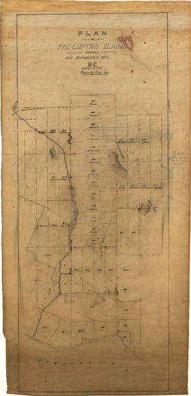
Plan of pre-emption claims, group 1, New Westminster District B.C., 1887-1888
Part of Major Matthews collection
Item is a map depicting pre-emption claims in Group 1, New Westminster District, a section of land extending north from Burrard Inlet and including Capilano Creek. The majority of claims are numbered and/or include the owner's last name. In addition to creeks, the map also shows the location of a waterworks dam, mountains, and high hills. Pencil annotations indicate the location of "Trythall's Clearing."