Add to clipboard
Plate 116 [Second Street to Tenth Avenue to Twelfth Street to Sixth Avenue]
Add to clipboard
Plate 115 [Twelfth Street to Tenth Avenue to Twentieth Street to Sixth Avenue]
Add to clipboard
Index to Streets and Index to Registered Plans
Add to clipboard
Plate 5: West End [Richards Street - Hastings Street - Thurlow Street - Georgia Street]
Add to clipboard
B.C. Electric plan showing bus stops in Vancouver
Add to clipboard
City of Vancouver
Add to clipboard
A preliminary proposal for development of Jericho Park
Add to clipboard
City of Vancouver, British Columbia
Add to clipboard
City of Vancouver, British Columbia
Add to clipboard
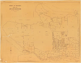
District lot boundaries within the City of Vancouver
Add to clipboard
City of Vancouver
Add to clipboard
City of Vancouver [park sites June/80]
Add to clipboard
City of Vancouver, British Columbia : co-ordinate street index map 12
Add to clipboard
Chinatown existing
[1971 Census of Canada]
Add to clipboard
[1971 Census of Canada]
Map of the city of Liverpool, Burrard Inlet, British Columbia
Add to clipboard
Map of the city of Liverpool, Burrard Inlet, British Columbia
Add to clipboard
City of Vancouver
Add to clipboard
Chinatown existing
Add to clipboard
It might have been Albert City, 1858, New Georgia 1792 : it was Granville, 1870, British Columbia, 1871 : it is Vancouver, 1886, British Columbia, 1871 : it is Vancouver, 1886, Canada, 1867
Add to clipboard
Commercial map of Greater Vancouver and district [assessment districts]
Add to clipboard
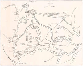
The Seechelt [Sechelt] Forest
Add to clipboard
Commercial map of Greater Vancouver and district
B.C. Electric guide to Greater Vancouver
Add to clipboard
B.C. Electric guide to Greater Vancouver
Add to clipboard
Schedule "A" : Polling districts : City of Vancouver
Add to clipboard
Schedule "A" : Polling districts : City of Vancouver
Add to clipboard
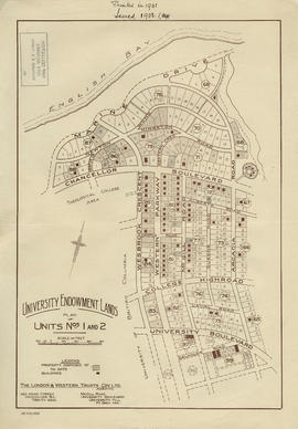
University Endowment Lands : plan of units nos. 1 and 2
Add to clipboard
University Endowment Lands : plan of units nos. 1 and 2
Add to clipboard
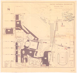
Pacific National Exhibition grounds plan : parking available for proposed arena
Add to clipboard
Vancouver sewers
Add to clipboard
Unemployment relief works under Department of National Defence, Canada : British Columbia and Alberta
Add to clipboard
British North America
Add to clipboard
Plan of Lot 6311, Vancouver, B.C. fronting on Kitsilano Indian Reserve No. 6
Add to clipboard
Town of Granville, Burrard Inlet, B.C.
Add to clipboard
Map of early Chilliwack district
Add to clipboard
A map of the whole continent of America divided into North and South and West Indies
Add to clipboard
Algemeene kaart : van de ontdekkingen van Kapit. J. Cook
Add to clipboard
Nova totius Americae descriptio
Add to clipboard
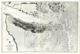
Strait of Juan de Fuca
Add to clipboard
Cape Caution to Port Simpson including Hecate Strait and part of Queen Charlotte Islands
Add to clipboard
Map of South Vancouver
Add to clipboard
Map of the Lower Mainland district of British Columbia
Add to clipboard
North Arm of the Fraser River : Ione Island sheet
Add to clipboard
Vancouver parks
Add to clipboard
Seaforth camp, Vancouver, B.C.
Add to clipboard
Map of Richmond municipality
Add to clipboard
Vancouver, British Columbia
Add to clipboard
Map of downtown Vancouver
Add to clipboard
Reference schedule AA - Floodplan map
Add to clipboard
Reference schedule AA - Floodplan map
Add to clipboard
Proposed location for St. Roch [Kitsilano Point]
![Plate 116 [Second Street to Tenth Avenue to Twelfth Street to Sixth Avenue]](/uploads/r/null/9/4/a/94a2eaaee6d845d8743ef8c81252057bc025656a77c773dd17e5aa37113b3116/fe7612b5-f7f4-4f6f-b985-a278440f8554-1972-472_142.jpg)
![Plate 115 [Twelfth Street to Tenth Avenue to Twentieth Street to Sixth Avenue]](/uploads/r/null/3/e/b/3eb1b1f2663b11b9151d3e22347f7b1fe922789a9a5866f3bf24b29d5b441606/74148ea4-ae2e-43f6-b969-bcdfff9ac71a-1972-472_142.jpg)

![Plate 5: West End [Richards Street - Hastings Street - Thurlow Street - Georgia Street]](/uploads/r/null/6/e/8/6e8029e15299600c6890f41cb1e769ea5f4c8a79c7923ef6e2075a19883197b7/ae297304-5960-4a77-930f-8a2926cc0ee0-MAP342a_142.jpg)


![City of Vancouver [park sites June/80]](/uploads/r/null/9/4/9484add7c4684ea3838e4d00ee8add3ecf85d78d5aa8fe2780cae273e59556a5/bd2464d8-2aa9-4501-aba6-8b3f7d130a42-MAP1032_142.jpg)


![Commercial map of Greater Vancouver and district [assessment districts]](/uploads/r/null/0/9/2/0928add1a06ab55bc236f8bebb87712b7e6ad4422db32cc3065efe7c9da96c04/b5b4129d-f9ba-49b9-a863-2ab6e954897e-MAP102_142.jpg)
![The Seechelt [Sechelt] Forest](/uploads/r/null/e/6/d/e6d1e8d1a7613c8e7ce050434f42ef80f8e00ca339edc6e23dc578f9a4154957/c9ad5fbf-94a8-4925-8b43-b0845d5bd699-MAP54_142.jpg)


![Proposed location for St. Roch [Kitsilano Point]](/uploads/r/null/c/5/2/c52369b1ff6c9f96ec6b6a4c790487d6d8b36681c79121e12eff5acb61f653fb/155e6ba4-333c-4f85-b00f-6acaa95fc98d-MAP711_142.jpg)