Item is a map showing boundaries of clearance areas for project 2 (areas 5 (part), 6 and 7) and project 1 (area 3). Maps also show sewers to remain, sewers to be abandoned, water lines to remain, water lines to be abandoned, gas lines to remain, gas lines to be abandoned, power lines existing underground, proposed diversions of power lines, power lines existing overhead, proposed overhead power lines and long distance telephone lines existing underground. Larger map shows area from Hastings Street in the north to Union Street in the south and from Heatley Avenue in the east to Gore Avenue in the west. Smaller map shows area from Powell Street in the north to Hastings Street in the south and from Clark Drive in the east to Glen Drive in the west. Item also shows estimates of costs for utility diversions and rearrangements for areas 5, 6 and 7.
Attached label indicates that the map was approved by Council Sept. 17, 1963.


![[Dick Burgess, driver, Nemo Layfield, tiller, on aerial truck at Firehall No. 1]](/uploads/r/null/5/3/7/53716591402a12ce891715e5a4a7d5f4434c640c1302912053ef25d630290b44/e508b1ef-39ee-49c9-a001-2e75ce893a4e-CVA354-013_142.jpg)
![[Firefighters standing on balcony of No. 4 Firehall at 10th Avenue and Granville Street]](/uploads/r/null/2/f/d/2fd4cf1cbacbf21ea2370397ed595de7e8ff2fb8fcf2b4387ef25efc8ace3d5a/394bd92d-3699-4aec-9f06-8d37b277a757-CVA354-022_142.jpg)
![[1912 American-La France Hose Chemical wagon and firefighters in front of Point Grey Firehall No. 1]](/uploads/r/null/5/9/0/590a2f772f6506d4206377625b9c2c493282a86428ee8591c5a88e52f5c593d8/0222654e-7112-41a6-8475-f12b5d48c0b4-CVA354-034_142.jpg)

![[Two firemen in Point Grey Fire Department Chief's automobile]](/uploads/r/null/e/b/c/ebc94a44006330a7417e906a39d686ad1bf925c9b3caeeec600f4fd9a3df3683/096cdfe2-9828-4c08-a730-5decdb017472-CVA354-039_142.jpg)
![[Members of South Vancouver Fire Department aboard Hose Chemical truck on street]](/uploads/r/null/2/0/f/20fece789651c38866327ed56433cbfb3f7460b0a11daef5a6e79a17deca8175/0e0b9130-c685-4586-b7e6-95e1411df687-CVA354-041_142.jpg)
![[Firefighters and motorized equipment in front of Firehall No. 2, 754 Seymour Street]](/uploads/r/null/1/a/2/1a2f1373f1d648856294c4009aca38f93d121927679c379a3ab4dd4db0fd8128/e7169b57-02b8-4cc5-a5d8-122e1c212954-CVA354-043_142.jpg)
![[Studio portrait of firefighter Alex Alexander]](/uploads/r/null/e/6/2/e62ae1b4640ad564410c78d02c930760fe38b3fcf766277e62c2f1b77937b1a6/701b8005-a725-451c-b50e-08cfb6f3971a-CVA354-045_142.jpg)
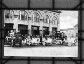
![[Point Grey Fire Department firefighters and motorized equipment in front of firehall]](/uploads/r/null/1/1/3/113fb9c321052a570412e3113c5ab221aa163dae5546d28d3496f4b0edef26df/e9cbb090-82c4-4973-a9ae-bb2ef6530c32-CVA354-046_142.jpg)
![[Gathering of fire engines to show "Fully Motorized" occasion at C.P.R. freight yards]](/uploads/r/null/4/6/4/464e3333148bebd4439aa317794f2892018b4cdc4c4f2c3e8cfed544422a76d1/ac7aecd4-f952-4786-9697-0f24efacfc7c-CVA354-049_142.jpg)
![[View of aftermath of fire at Coughlin Shipyards - Fmn. (fireman) Cameron killed]](/uploads/r/null/0/9/4/09432532898fda03f4d03a2915beec43a56c9ffe28f335bee8a3b5e1edfbfa8a/19792784-df36-4eeb-abce-7fa1ec269cb2-CVA354-052_142.jpg)
![[Group portrait for opening of South Vancouver Firehall No. 3 for opening]](/uploads/r/null/0/3/b/03be9559d102890d505b0bba59df610904391233bf03fde80beefb2ddddb1665/2d33bb93-0663-4c85-906e-0ca20d50fd56-CVA354-059_142.jpg)
![[Group portrait of Vancouver Firemen's Football Club in front of bleachers]](/uploads/r/null/1/f/f/1ff9b85dd289b443813c5f5dd83e945ed374bdb8b68debcd8086c9e0fef57bdf/d39b7556-2618-4ffa-9eb8-3f72aba7e16c-CVA354-060_142.jpg)
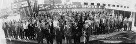
![[Group portrait of delegates and guests to Firemen's convention, Victoria, B.C.]](/uploads/r/null/f/d/f/fdf1e39e20db8386972359a7859ef1a8c73e9e03de56282c147955add0ef6d26/ec0cbe14-9e5b-4881-b498-cd723f13b279-CVA354-064_142.jpg)
![[Exterior portrait of South Vancouver Fire Department members assembled with equipment]](/uploads/r/null/1/2/2/1226f38dfc38509f585417a7ffa8046a6a72e1c419f007b8a4eebd7f139e2fd5/a169d84a-4713-46b6-9a6f-8596faab8b3a-CVA354-069_142.jpg)
![[Group portrait of Firehall No. 2 firefighters in uniform]](/uploads/r/null/e/5/1/e515eb838de5909dfd08c58c66b76957831eb9e0b34ad99b70480420033dbe08/4794eb5a-3e06-44e7-b7e9-d65f03972789-CVA354-074_142.jpg)
![Chief F. Raymur P.G.F.D. [Point Grey Fire Department]](/uploads/r/null/6/3/b/63ba6cef1c6f6d732c1c7426309d45302294f7987fbf02f0c5011020e4eaa265/50a1ac42-5d80-4e66-bf39-b17a3a6aaeb2-CVA354-081_142.jpg)
![[Firefighter "Red" Creelman cooking at stove at Firehall No. 2]](/uploads/r/null/9/c/e/9cefa2511de70b8c1030238767cf08d4c4d31db839bff5a55f9bb05dc70dd0a9/523038c3-ace5-4104-b096-999639d33bad-CVA354-100_142.jpg)
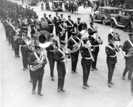
![[Group portrait of Firemen's Band on steps of Vancouver Court House]](/uploads/r/null/6/7/1/671ad823231c96cc5d64acf1461780da510a44b5779df01a4f7d6f2afba9aee6/28cbea32-cd96-49d3-8b15-a1440201704f-CVA354-101_142.jpg)
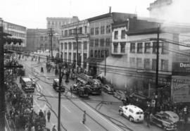
![[View of Canadian Pacific Railway Pier D on fire]](/uploads/r/null/9/4/7/947a23d02f7e0b571dc3ea2c42c87f331257cb8e07a77cd2fd080ee000a32c49/43728ece-6a42-442b-8400-3b359d07fb59-CVA354-104_142.jpg)
![[View of Canadian Pacific Railway Pier D on fire and two fireboats working on the water]](/uploads/r/null/1/a/5/1a5caaed72c26733bb244d7b7cef4dc70a5c4b6f8798bf06446c3833ce46a408/03274c80-6414-44a9-ba31-c04b2ddcfe2a-CVA354-105_142.jpg)

![[View of fire damage to the Canadian Pacific Railway Pier D]](/uploads/r/null/6/3/5/635d13e935d76330673b5019d208298a6ee6d3a5b8b171b52650a641e8c0c6a2/c79e795f-faab-453d-abbc-cf7a83cde71e-CVA354-116_142.jpg)
![[View of the S.S. Greenhill Park on fire]](/uploads/r/null/1/1/6/116eaefb8238080d4b37828698d9e4c7f7610416bdce7ad85459bbdf2ea1c072/348c8f77-2d8d-42d4-9d4c-63d8d3defe03-CVA354-123_142.jpg)
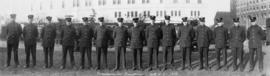
![[Group portrait of Fire Wardens in front of Firehall No. 1 on Cordova Street]](/uploads/r/null/2/3/7/2371193efa6c82565b6b2d73eb4d208e851b64450d7f8868c985f000e40897b4/fd87df4b-9305-4d95-b656-da6fc1f249bf-CVA354-125_142.jpg)
![[Firefighters seated at dinner tables at retirement party for Captain Crutchley, 1917-1950.]](/uploads/r/null/6/d/9/6d97e4636fc24dad363c957332a510a506ac4b4222f86d0f34553a3049949d4e/46e20790-3d49-4488-be6c-ddbdafad17c6-CVA354-129_142.jpg)
![[Chief Fire Warden Louis Mulligan examines map showing arson distribution in the city]](/uploads/r/null/4/1/c/41c5bef86fe91c1fcb1f5f6bf6d18829f0fe66a283b152ce563990195747f40e/eb621d9c-9271-4f54-9085-27fdf0529e3c-CVA354-131_142.jpg)
![[View of Squad Wagon car wreck at Broadway and Clark Drive]](/uploads/r/null/8/2/a/82ab696fadf8dde30e6d578856f855345436ca7aa6d9c320e1d3220e07da828c/2f3b92ed-11e0-4136-8f8b-72b3a516e0bf-CVA354-136_142.jpg)
