
- PUB-: PD 2134-: LEG1376.70
- Part
- [ca. 1980]
Part of City publications collection
504 results with digital objects Show results with digital objects
Part of City publications collection

Part of City publications collection
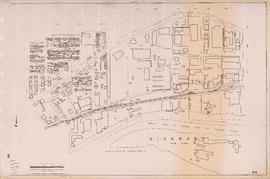
Building outlines not shown on this sheet.

Part of City publications collection
Building outlines not shown on this sheet.

Part of City publications collection
Building outlines not shown on this sheet.

Part of City publications collection
Building outlines not shown on this sheet.


Part of City publications collection
Building outlines not shown on this sheet.
Part of City publications collection


Part of City publications collection


Part of City publications collection
Building outlines not shown on this sheet.


Part of City of Vancouver Archives technical and cartographic drawing collection

Part of City of Vancouver Archives technical and cartographic drawing collection
Part contains a street map of Greater Vancouver showing highways, municipal boundaries, parks and golf courses.

Tourist map of Greater Vancouver
Part of City of Vancouver Archives technical and cartographic drawing collection
Part is a sheet with two maps. The main map shows a pictorial view of Greater Vancouver, including the location of major roads and tourist attractions. Drawings of "the most important single objects on totem poles of the Pacific Northwest Indians" form a decorative border. The inset map shows downtown Granville Street and the location of the Scenery Shop.

City of Vancouver. Fifth Sale. Lots and blocks in Lot 540
Part of City of Vancouver Archives technical and cartographic drawing collection
Part is the outer sheet of an unfolded brochure advertising the sale of lots owned by the provincial government. The map included in the sheet is an index map of greater Vancouver, showing the location of District Lot 540.

Part of City of Vancouver Archives technical and cartographic drawing collection
Part is the inner sheet of an unfolded brochure, showing lots offered for sale in the northern portion of District Lot 540.

Vancouver city and suburban lines
Part of City of Vancouver Archives technical and cartographic drawing collection
Part is the back side of an informational pamphlet published by the BC Electric Railway Co. showing street car lines, interurban lines, bus routes and parks.

Part of City of Vancouver Archives technical and cartographic drawing collection
Part is the front sheet of an unfolded tourism brochure showing Vancouver tourist attractions, The sheet includes a map of downtown Vancouver, with transportation information, a map of the roads in Stanley Park, photographs and information on various sites and attractions in the city, as well as general promotional information.

Part of City of Vancouver Archives technical and cartographic drawing collection
Part is the reverse side of a tourism brochure, containing a tourist map of Greater Vancouver, showing major roads, locations of tourist attractions and recreational sites, and routes into Vancouver.
![Sheet 1A [Northwest corner of Exhibition Park to Burrard Inlet to Slocan Street to Cambridge Street]](/uploads/r/null/4/a/9/4a95f2d331599fc1ed353ee49268f50fbc2f377d28b98788199ef496d1657e19/54d2e041-40b4-4c97-89e1-d44e9d73ba03-LEG1153_142.jpg)
Sheet 1A [Northwest corner of Exhibition Park to Burrard Inlet to Slocan Street to Cambridge Street]
Part of City publications collection
![Sheet 1B [Boundary Road to Burrard Inlet to Rupert Street to Cambridge Street]](/uploads/r/null/2/d/e/2de8a9356c43bdf5c2000524f0160e69ebb4155a087c48253380abd411347e98/c0871cff-d576-48da-93e7-50334a7f3bfe-LEG1153_142.jpg)
Sheet 1B [Boundary Road to Burrard Inlet to Rupert Street to Cambridge Street]
Part of City publications collection
![Sheet 1C [South portion of Exhibition Park to Cambridge Street to Slocan Street]](/uploads/r/null/0/9/8/098483f307187795ecf4e61450d06083a061d3907b0222ef0f03256008e2e58e/d7a0fcd1-8028-4946-a99a-8ba6da1b2e4a-LEG1153_142.jpg)
Sheet 1C [South portion of Exhibition Park to Cambridge Street to Slocan Street]
Part of City publications collection
![Sheet 2A [Windermere Street to Pender Street to Slocan Street to Charles Street]](/uploads/r/null/e/f/0/ef0145166907c36b80690dbaafd084071b8c82a23a84f931050a22101462f091/f7da3c3b-6025-445b-a5a6-5eb1608264e9-LEG1153_142.jpg)
Sheet 2A [Windermere Street to Pender Street to Slocan Street to Charles Street]
Part of City publications collection
![Sheet 1D [Boundary Road to Cambridge Street to Windermere Street to Pender Street]](/uploads/r/null/1/d/4/1d47034f04f443cd5d3bba2f8d2d21c3a21a2e6b801a5af04c074e2c3b6dd02e/7ad1a0c8-97c9-4e10-98c2-5017d74f4033-LEG1153_142.jpg)
Sheet 1D [Boundary Road to Cambridge Street to Windermere Street to Pender Street]
Part of City publications collection
![Sheet 2B [Boundary Road to Pender Street to Windermere Street to Charles Street]](/uploads/r/null/6/d/d/6dd321f1933530c0449917d5fdeb9ddeadff6b12ddc423a9f60d2633579ba2f1/e16c6545-d33e-4bf8-93d8-24f9847c06ac-LEG1153_142.jpg)
Sheet 2B [Boundary Road to Pender Street to Windermere Street to Charles Street]
Part of City publications collection
![Sheet 2C [Windermere Street to Charles Street to Slocan Street to 5th Avenue]](/uploads/r/null/5/c/3/5c31b68277d535d0bf8c13023079d05dfe1fb535497b50e8f264465db169ce22/3a1ef444-0d14-4f3d-aaa7-27bc65dc7224-LEG1153_142.jpg)
Sheet 2C [Windermere Street to Charles Street to Slocan Street to 5th Avenue]
Part of City publications collection
![Sheet 2D [Boundary Road to Chalres Stret to Windermere Street to 5th Avenue]](/uploads/r/null/9/7/0/9702a82a6010cf52eb7cf7e486466e91e67bc732d2586158ff4cf07d8f71fb7e/f364eebb-c9c0-4aba-8970-b9128de74769-LEG1153_142.jpg)
Sheet 2D [Boundary Road to Chalres Stret to Windermere Street to 5th Avenue]
Part of City publications collection
![Sheet 3C [Windermere Street to Grandview Highway to Slocan Street to 22nd Avenue]](/uploads/r/null/1/9/6/19695a354a40b66650d4a6b96b8fdd67ad76a3e8091ea936c2671a1e22e520da/e571973c-a7de-4828-9846-136aabb0b4e5-LEG1153_142.jpg)
Sheet 3C [Windermere Street to Grandview Highway to Slocan Street to 22nd Avenue]
Part of City publications collection
![Sheet 3A [Windermere Street to 5th Avenue to Slocan Street to Grandview Highway]](/uploads/r/null/c/0/8/c081ba1194af0da71e1f88ca1a7c4efd637e7ae3d846b4e9fd5d153faa656b0e/ce3a288b-01f7-491a-b5ee-59b744d23996-LEG1153_142.jpg)
Sheet 3A [Windermere Street to 5th Avenue to Slocan Street to Grandview Highway]
Part of City publications collection
![Sheet 3B [Boundary Road to 5th Avenue to Windermere Street to Grandview Highway]](/uploads/r/null/c/9/c/c9c099174510121f7347c0ed2dc3f4db8a646b3846d9fcf65747209bb83b81d2/51551449-0417-479e-8467-bddbe7b574b3-LEG1153_142.jpg)
Sheet 3B [Boundary Road to 5th Avenue to Windermere Street to Grandview Highway]
Part of City publications collection
![Sheet 4A [Windermere Street to 22nd Avenue to Slocan Street to 29th Avenue]](/uploads/r/null/a/d/f/adf64a2e43a5bbd7b7b6359d2dfbb3ff89b5ac7e2947a14033383119422d0069/643362ca-2df8-48bd-9f04-c5af1d6505f1-LEG1153_142.jpg)
Sheet 4A [Windermere Street to 22nd Avenue to Slocan Street to 29th Avenue]
Part of City publications collection
![Sheet 3D [Boundary Road to Grandview Highway to Windermere Street to 22nd Avenue]](/uploads/r/null/e/3/8/e38ad95268d472e5b09a59157e2655363d00d976611f9b5ce0783a0b268c9102/92a3bbb3-76f5-4077-ae8c-e541a3b6a3ae-LEG1153_142.jpg)
Sheet 3D [Boundary Road to Grandview Highway to Windermere Street to 22nd Avenue]
Part of City publications collection
![Sheet 4C [Spencer Street to 29th Avenue to Slocan Street to Kingsway Avenue]](/uploads/r/null/0/c/1/0c1c1eea769ffe690bcd89398f43463c8f8019dacc5ed2883d8a0f82728d4559/dc190b53-9756-4e8e-ac6f-ec929e1e7f01-LEG1153_142.jpg)
Sheet 4C [Spencer Street to 29th Avenue to Slocan Street to Kingsway Avenue]
Part of City publications collection
![Sheet 4B [Boundary Road to 22nd Avenue to Windermere Street to 29th Avenue]](/uploads/r/null/f/3/b/f3b17dcb0ca74267e166e0229fcb9ab99281c9b35b609d67f1110241073d6bd8/486b3ba1-dce8-4aaa-85fb-b164dc027e6a-LEG1153_142.jpg)
Sheet 4B [Boundary Road to 22nd Avenue to Windermere Street to 29th Avenue]
Part of City publications collection
![Sheet 5A [McKinnon Street to Kingsway Avenue to Wales Street to 45th Avenue]](/uploads/r/null/e/8/a/e8a898c0e8b3b2f26130948113540327f8be8bf9b6cc9f24dcf2a87dd8475188/e2ed686c-e99a-4a73-a462-257126de47b2-LEG1153_142.jpg)
Sheet 5A [McKinnon Street to Kingsway Avenue to Wales Street to 45th Avenue]
Part of City publications collection
![Sheet 4D [Bundary Road to 29th Avenue to Manor Street to Euclid Avenue]](/uploads/r/null/c/0/2/c02fc1e98486bf47bb5179c1d6b399831444222c7a54db8f5a58dda1cce6d070/eb4d8a12-929b-4b83-9998-97fd0b274ae9-LEG1153_142.jpg)
Sheet 4D [Bundary Road to 29th Avenue to Manor Street to Euclid Avenue]
Part of City publications collection
![Sheet 5C [Doman Street to 45th Avenue to Vivian Street to 52nd Avenue]](/uploads/r/null/0/f/4/0f44f7b43fd58c096ccc443d651cbc43d9aadeac3e13e7b6863a8914a79bd80d/1486eb87-cda0-4a49-b822-95368cce1f7a-LEG1153_142.jpg)
Sheet 5C [Doman Street to 45th Avenue to Vivian Street to 52nd Avenue]
Part of City publications collection
![Sheet 5B [Boundary Road to Euclid Avenue to Joyce Street to 45th Avenue]](/uploads/r/null/b/d/a/bdaaca7a1a5c9f9359248cc9d383c63ffcf8800e719c0cf177f45dd4bac3cb61/e97627da-8e6c-4ebc-87bd-d46130b9261d-LEG1153_142.jpg)
Sheet 5B [Boundary Road to Euclid Avenue to Joyce Street to 45th Avenue]
Part of City publications collection
![Sheet 5D [Boundary Road to 45th Avenue to Doman Street to 52nd Avenue]](/uploads/r/null/9/a/5/9a56c23cc8d5ad437bb7063cd9cf0f954bc1d67724ef20861270160771809b4c/d7777803-4376-423c-a5d5-8a44ed84aee7-LEG1153_142.jpg)
Sheet 5D [Boundary Road to 45th Avenue to Doman Street to 52nd Avenue]
Part of City publications collection
![Sheet 6A [Doman Street to 52nd Avenue to Vivian Street to 61st Avenue]](/uploads/r/null/6/8/b/68b456da543f104f4daefa87e7c0ddbd6dbb5db25e3239ded4652d327398b023/092d539d-4c5c-4406-b26f-1fa7e217b791-LEG1153_142.jpg)
Sheet 6A [Doman Street to 52nd Avenue to Vivian Street to 61st Avenue]
Part of City publications collection
![Sheet 6C [Doman Street to 61st Avenue to Jellicoe Street to railway right-of-way]](/uploads/r/null/0/1/2/012976cfb4b4852f4b51cf284a1af29b28e855331a360ce98aa998c853334763/da2a784f-bd89-4cf2-bb2e-44e0568ced3d-LEG1153_142.jpg)
Sheet 6C [Doman Street to 61st Avenue to Jellicoe Street to railway right-of-way]
Part of City publications collection
![Sheet 6B [Boundary Road to 52nd Avenue to Doman Street to 61st Avenue]](/uploads/r/null/2/3/2/2320f1235e898d9e510839eb4408e0746654e3df66acd70352f78e35c1f83fe4/a427c08e-09a5-4e9f-adbd-6f81d49fe16f-LEG1153_142.jpg)
Sheet 6B [Boundary Road to 52nd Avenue to Doman Street to 61st Avenue]
Part of City publications collection
![Sheet 6D [Boundary Road to 61st Avenue to Kinross Street to Ellis Avenue]](/uploads/r/null/c/a/1/ca18897f165b8c9fc64a0a090824a17dd124c7fd9eaa4b86b2ef3043e96ae6da/0f219d9c-5616-4b1e-8103-33d6770ccf02-LEG1153_142.jpg)
Sheet 6D [Boundary Road to 61st Avenue to Kinross Street to Ellis Avenue]
Part of City publications collection
![Sheet 7B [Slocan Street to Burrard Inlet to Wall Street to Cambridge Street]](/uploads/r/null/9/a/0/9a0201695d105ce35f3ebe2ff7e982467eb8a211258d83a9894bad340bc1219e/d391f25d-7a0e-4b8d-a3ed-529aed04004a-LEG1153_142.jpg)
Sheet 7B [Slocan Street to Burrard Inlet to Wall Street to Cambridge Street]
Part of City publications collection
![Sheet 7C [Semlin Drive to Burrard Inlet to Clark Drive to Hastings Street]](/uploads/r/null/e/8/7/e87f1b836e88849bba468bcf8aaacb8ad218aa467eb291cb406c557b30a44f53/e7b14ec1-7002-44ea-a4d9-a4a408d2f078-LEG1153_142.jpg)
Sheet 7C [Semlin Drive to Burrard Inlet to Clark Drive to Hastings Street]
Part of City publications collection
![Sheet 7D [Slocan Street to Cambridge Street to Semlin Drive to Pender Street]](/uploads/r/null/b/8/5/b85f2b7f19d9d3491a53e8b9ef51fee071ca3fc6774cda1d9d9550e2ecae1d37/516885bd-701c-4a0b-90ef-fb2768ed0084-LEG1153_142.jpg)
Sheet 7D [Slocan Street to Cambridge Street to Semlin Drive to Pender Street]
Part of City publications collection
![Sheet 8A [Semlin Drive to Hastings Street to Clark Drive to Charles Street]](/uploads/r/null/c/e/1/ce14d71e20eb294141c9dd954f1318d51d5f7a7cd55238a25a046162a7080d15/a477e80d-6d23-4d54-9c01-cb4ffe87796e-LEG1153_142.jpg)
Sheet 8A [Semlin Drive to Hastings Street to Clark Drive to Charles Street]
Part of City publications collection