
Greater Vancouver sewerage and drainage district : general and statistical information
- AM1594-: MAP 798-: LEG1327.2
- Part
- 1961
Part of City of Vancouver Archives technical and cartographic drawing collection
1440 results with digital objects Show results with digital objects
Greater Vancouver sewerage and drainage district : general and statistical information
Part of City of Vancouver Archives technical and cartographic drawing collection
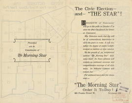
The civic election - and "The Star"!
Part of City of Vancouver Archives technical and cartographic drawing collection
Part contains text advertising The Morning Star newspaper and assuring readers of its political neutrality.

The civic election - and "The Star"!
Part of City of Vancouver Archives technical and cartographic drawing collection
Part contains text advertising The Morning Star newspaper and assuring readers of its political neutrality.

Advertisements for Vancouver real estate
Part of City of Vancouver Archives technical and cartographic drawing collection

Indexed map of Greater Vancouver : map cover and advertisements
Part of City of Vancouver Archives technical and cartographic drawing collection
Part contains information on the services and facilities of Bekins Moving and Storage Co.

Free map of Vancouver, New Westminster and surroundings
Part of City of Vancouver Archives technical and cartographic drawing collection
Part contains information about Vancouver parks, promotional text for British Columbia Electric Railway, and advertisements for other businesses.
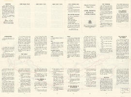
Target area civil defence survival instructions
Part of City of Vancouver Archives technical and cartographic drawing collection

Map and Guide to Vancouver Street Car and Interurban Lines
Part of City of Vancouver Archives technical and cartographic drawing collection
Part is the front side of an informational pamphlet published by the BC Electric Railway Co. regarding City streetcar routes and interurban lines, golf and country clubs, city trips, interurban trips, motor coach trips, stations, ferries and docks, bathing beaches, public parks, North Shore canyons and parks, athletic and amusement parks.

Greater Vancouver road map : map cover
Part of City of Vancouver Archives technical and cartographic drawing collection

Automobile road map of Greater Vancouver and environs : map cover
Part of City of Vancouver Archives technical and cartographic drawing collection
Map cover includes advertisements for Eng Chow Company and Happyland.

Automobile road map of Greater Vancouver and environs : inside map cover
Part of City of Vancouver Archives technical and cartographic drawing collection

City of Vancouver : residential lots, Area B, Champlain Heights : page 1
Part of City of Vancouver Archives technical and cartographic drawing collection
Part is the first of two sheets outlining details associated with the sale of lots in Champlain Heights as shown on the map "Champlain Heights : D.L. 334, group one, N.W.D." (LEG1315.1).

City of Vancouver : residential lots, Area B, Champlain Heights : page 2
Part of City of Vancouver Archives technical and cartographic drawing collection
Part is the second of two sheets outlining details associated with the sale of lots in Champlain Heights as shown on the map "Champlain Heights : D.L. 334, group one, N.W.D." (LEG1315.1).

Tidal current charts, Vancouver Harbour, British Columbia : front cover
Part of City of Vancouver Archives technical and cartographic drawing collection

Tidal current charts, Vancouver Harbour : inside front cover
Part of City of Vancouver Archives technical and cartographic drawing collection
Part contains explanatory text to be used in conjunction with the tidal current charts in the booklet.

Tidal current chart, Vancouver Harbour : inside back cover
Part of City of Vancouver Archives technical and cartographic drawing collection
Part contains information about the survey data upon which the charts are based, and contact information for the Canadian Hydrographic Service.

Part of City of Vancouver Archives technical and cartographic drawing collection
Item is the cover for the brochure of maps of the British Properties development.

Index to streets and block numbers
Part of City of Vancouver Archives technical and cartographic drawing collection
Part of City of Vancouver Archives technical and cartographic drawing collection

Part of City of Vancouver Archives technical and cartographic drawing collection
Part is the original attached cover for the map, which would have been stored folded in the cover.

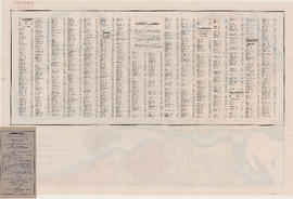
Street index of Vancouver and lower mainland
Part of City of Vancouver Archives technical and cartographic drawing collection
Part contains the street index for a map of Greater Vancouver and advertisements for Roy Wrigley Printing and Publishing Co. and A.E. Austin and Co. Limited.

Wrigley's offical arrow city map : Greater Vancouver and New Westminster : map cover
Part of City of Vancouver Archives technical and cartographic drawing collection

Direct mail as an advertising and marketing medium
Part of City of Vancouver Archives technical and cartographic drawing collection
Part is the inside cover for a street map of Greater Vancouver and contains text advertising Roy Wrigley's direct mail campaigns

Part of City of Vancouver Archives technical and cartographic drawing collection

Part of City of Vancouver Archives technical and cartographic drawing collection

Sheet 1 : Slocan Street to Boundary Road and Triumph Street to Burrard Inlet
Part of City of Vancouver Archives technical and cartographic drawing collection
Item is a section showing the area bound by Slocan Street, Boundary Road, Triumph Street and the waterfront. Includes streets, roads, railways, blocks, lots, legal descriptions, quit claims, leases, parks and businesses along the waterfront.
Vancouver (B.C.). Office of the City Engineer

Sheet 2 : Slocan Street to Boundary Road and Charles Street to Triumph Street
Part of City of Vancouver Archives technical and cartographic drawing collection
Item is a section showing the area from Slocan Street to Boundary Road and Charles Street to Triumph Street. Includes streets, roads, blocks, lots, legal descriptions, parks, schools, and retirement homes.
Vancouver (B.C.). Office of the City Engineer

Sheet 3 : Slocan Street to Boundary Road and Seventh Avenue to Charles Street
Part of City of Vancouver Archives technical and cartographic drawing collection
Item is a section showing the area from Slocan Street to Boundary Road and Seventh Avenue to Charles Street. Includes streets and roads, blocks, lots, legal descriptions, parks and schools.
Vancouver (B.C.). Office of the City Engineer

Sheet 4 : Slocan Street to Boundary Road and Broadway to Seventeenth Avenue
Part of City of Vancouver Archives technical and cartographic drawing collection
Item is a section showing the area from Slocan Street to Boundary Road and Broadway to Seventeenth Avenue. Includes streets and roads, blocks, lots, legal descriptions, railways, parks and schools.
Vancouver (B.C.). Office of the City Engineer

Sheet 5 : Slocan Street to Boundary Road and Seventeenth Avenue to Twenty-ninth Avenue
Part of City of Vancouver Archives technical and cartographic drawing collection
Item is a section showing the area from Slocan Street to Boundary Road and Seventeenth Avenue to Twenty-ninth Avenue. Includes streets and roads, blocks, lots, legal descriptions, railways, parks, schools and the Vancouver Preventorium (for tuberculosis patients). Some annotations have been made in pencil.
Vancouver (B.C.). Office of the City Engineer

Sheet 6 : Knight Street to Slocan Street and Eighteenth Avenue to Twenty-ninth Avenue
Part of City of Vancouver Archives technical and cartographic drawing collection
Item is a section showing the area from Knight Street to Slocan Street and Eighteenth Avenue to Twenty-ninth Avenue. Includes streets and roads, blocks, lots, legal descriptions, railways, parks and schools. Some annotations have been made in pencil.
Vancouver (B.C.). Office of the City Engineer

Sheet 7 : Clark Drive to Slocan Street and Seventh Avenue to Eighteenth Avenue
Part of City of Vancouver Archives technical and cartographic drawing collection
Item is a section showing the area from Clark Drive to Slocan Street and Seventh Avenue to Eighteenth Avenue. Includes streets and roads, blocks, lots, legal descriptions, railways, parks and schools. Some annotations have been made in green ink.
Vancouver (B.C.). Office of the City Engineer

Sheet 8 : McLean Drive to Slocan Street and William Street to Seventh Avenue
Part of City of Vancouver Archives technical and cartographic drawing collection
Item is a section showing the area from McLean Drive to Slocan Street and William Street to Seventh Avenue. Includes streets and roads, blocks, lots, legal descriptions, railways, parks, schools and some businesses.
Vancouver (B.C.). Office of the City Engineer

Sheet 9 : Clark Drive to Slocan Street and Triumph Street to Charles Street
Part of City of Vancouver Archives technical and cartographic drawing collection
Item is a section showing the area from Clark Drive to Slocan Street and Triumph Street to Charles Street. Includes streets and roads, blocks, lots, legal descriptions, railways, parks, schools and drill hall. The Town of Hastings is indicated on the map.
Vancouver (B.C.). Office of the City Engineer

Sheet 10 : Clark Drive to Slocan Street and waterfront to Triumph Street
Part of City of Vancouver Archives technical and cartographic drawing collection
Item is a section showing the area from Clark Drive to Slocan Street and aterfront to Triumph Street. Includes streets and roads, blocks, lots, legal descriptions, railways, parks, boys' detention home and businesses along the waterfront. The Town of Hastings is indicated on the map.
Vancouver (B.C.). Office of the City Engineer
![City of Vancouver, British Columbia [index map]](/uploads/r/null/d/4/d4fc7ef393680c6515927aa960de863e6fd9e846c3fac12499691549673dc4b7/eed36b0b-2e63-48f2-a7ee-02ed3de937b9-MAP682_142.jpg)
City of Vancouver, British Columbia [index map]
Part of City of Vancouver Archives technical and cartographic drawing collection
Item is an index map of Vancouver showing the boundaries of the sectional maps in this file. Map includes streets, roads and railways; blocks, lots and legal descriptions; First Nations reserves, government buildings, cemeteries, parks and businesses along the waterfront.
Vancouver (B.C.). Office of the City Engineer

Plan of district lot boundaries, City of Vancouver, B.C.
Part of City of Vancouver Archives technical and cartographic drawing collection
Item is an index map of Vancouver showing distict lot boundaries.
Vancouver (B.C.). Office of the City Engineer

Sheet 11 : Carrall Street to Clark Drive and waterfront to Keefer Street
Part of City of Vancouver Archives technical and cartographic drawing collection
Item is a section showing the area from Carrall Street to Clark Drive and waterfront to Keefer Street. Includes streets and roads, blocks, lots, legal descriptions, railways, parks, schools, freight sheds, warehouses, piers and businesses along the waterfront.
Vancouver (B.C.). Office of the City Engineer

Sheet 12 : Ontario Street to Clark Drive and Keefer Street to Second Avenue
Part of City of Vancouver Archives technical and cartographic drawing collection
Item is a section showing the area from Ontario Street to Clark Drive and Keefer Street to Second Avenue. Includes streets, roads, blocks, lots, legal descriptions, railways, parks and schools. Includes Terminal Avenue and land used by the Great Northern Railway and the Canadian National Railway. Annotations in pencil.
Vancouver (B.C.). Office of the City Engineer

Sheet 13 : Ontario Street to Clark Drive and First Avenue to Sixteenth Avenue
Part of City of Vancouver Archives technical and cartographic drawing collection
Item is a section showing the area from Ontario Street to Clark Drive and First Avenue to Sixteenth Avenue. Includes streets, roads, blocks, lots, legal descriptions, railways, parks and schools. Includes B.C. Electric Railway car barns. Annotations in pencil.
Vancouver (B.C.). Office of the City Engineer

Sheet 14 : Main Street to Knight Street and Fifteenth Avenue to King Edward Street
Part of City of Vancouver Archives technical and cartographic drawing collection
Item is a section showing the area from Main Street to Knight Street and Fifteenth Avenue to King Edward Street. Includes streets and roads, blocks, lots, legal descriptions, parks, schools and businesses.
Vancouver (B.C.). Office of the City Engineer

Sheet 15 : Oak Street to Main Street and False Creek to Sixteenth Avenue
Part of City of Vancouver Archives technical and cartographic drawing collection
Item is a section showing Oak Street to Main Street and False Creek to Sixteenth Avenue. Includes streets and roads, blocks, lots, legal descriptions, railways, schools, monastery, Vancouver General Hospital and City Hall. Indicates crown land leased to the C.P.R.
Vancouver (B.C.). Office of the City Engineer

Sheet 16 : Maple Street to Oak Street and False Creek to Sixteenth Avenue
Part of City of Vancouver Archives technical and cartographic drawing collection
Item is a section showing Maple Street to Oak Street and False Creek to Sixteenth Avenue. Includes streets and roads, blocks, lots, legal descriptions, railways, schools and parks. Indicates crown land leased to the C.P.R. and other bodies.
Vancouver (B.C.). Office of the City Engineer

Sheet 17 : Trutch Street to Maple Street and Fourth Avenue to Sixteenth Avenue
Part of City of Vancouver Archives technical and cartographic drawing collection
Item is a section showing Trutch Street to Maple Street and Fourth Avenue to Sixteenth Avenue. Includes streets, roads, blocks, lots, legal descriptions, parks and schools. Annotations in pencil.

Sheet 18 : Trutch Street to Maple Street and English Bay to Third Avenue
Part of City of Vancouver Archives technical and cartographic drawing collection
Item is a section showing Trutch Street to Maple Street and English Bay to Third Avenue. Includes streets, roads, blocks, lots, legal descriptions, parks and crown grants.

Sheet 19 : Maple Street to Richards Street and Drake Street to Third Avenue
Part of City of Vancouver Archives technical and cartographic drawing collection
Item is a section showing Maple Street to Richards Street and Drake Street to Third Avenue. Includes streets, roads, blocks, lots, legal descriptions, parks, schools, the Burrard and Granville Street Bridges, C.P.R. right-of-ways, the Squamish Band reserve, C.P.R. leases and property, and government reserve. Map includes Granville Island.

Sheet 20 : Granville Street to Ontario Street and Robson Street to Sixth Avenue
Part of City of Vancouver Archives technical and cartographic drawing collection
Item is a section showing Granville Street to Ontario Street and Robson Street to Sixth Avenue. Includes streets, roads, blocks, lots, legal descriptions, businesses, crown leases, city leases, the Granville Street and Connaught (Cambie) Bridges, and the False Creek yards.

Sheet 21 : Burrard Street to False Creek and waterfront to Robson Street
Part of City of Vancouver Archives technical and cartographic drawing collection
Item is a section showing Burrard Street to False Creek and waterfront to Robson Street. Includes streets and roads; blocks, lots and legal descriptions; the locations of hotels, court house, businesses, parks, and schools; crown leases; C.P.R. land and the company's Piers B and C, yards, sheds and depot; the B.C. Electric Railway Carrall Street Yard; and the Union Steamship Company.

Sheet 22 : Stanley Park to Burrard Street and waterfront to Robson Street
Part of City of Vancouver Archives technical and cartographic drawing collection
Item is a section showing Stanley Park to Burrard Street and waterfront to Robson Street. Includes streets and roads; blocks, lots and legal descriptions. Map shows the locations of Stanley Park, Deadmans Island, marine filling stations, the dredged channel, harbour headline, C.P.R .yards and Pier A, businesses along the waterfront, government buildings, land leases and quit claims.
Vancouver (B.C.). Office of the City Engineer

Sheet 23 : Stanley Park to Granville Street and Robson Street to False Creek
Part of City of Vancouver Archives technical and cartographic drawing collection
Item is a section showing the area from Stanley Park to Granville Street and Robson Street to False Creek. Includes streets, roads and railways; blocks, lots and legal descriptions; as well as parks, schools, hospitals and churches. Shows the Burrard Bridge and C.P.R. property. Annotations in ink and pencil.
Vancouver (B.C.). Office of the City Engineer