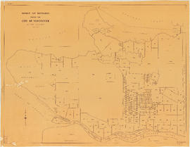
District lot boundaries within the City of Vancouver
City of Vancouver
City of Vancouver [park sites June/80]
City of Vancouver, British Columbia : co-ordinate street index map 12
Chinatown existing
City of Vancouver
Chinatown existing
It might have been Albert City, 1858, New Georgia 1792 : it was Granville, 1870, British Columbia, 1871 : it is Vancouver, 1886, British Columbia, 1871 : it is Vancouver, 1886, Canada, 1867
Commercial map of Greater Vancouver and district [assessment districts]
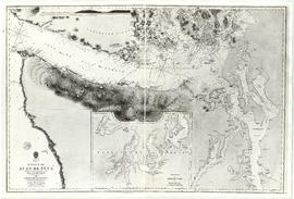
The Seechelt [Sechelt] Forest
Commercial map of Greater Vancouver and district
Schedule "A" : Polling districts : City of Vancouver
Schedule "A" : Polling districts : City of Vancouver
B.C. Electric Rly. Co. Ltd. plan showing transit services in Vancouver city as at end of 1951 : verso with annotations
B.C. Electric Rly. Co. Ltd. plan showing transit services in Vancouver city as at end of 1951
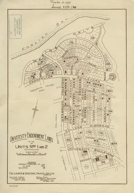
University Endowment Lands : plan of units nos. 1 and 2
University Endowment Lands : plan of units nos. 1 and 2
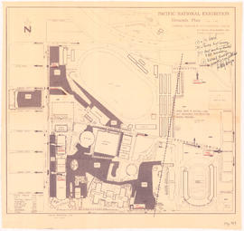
Pacific National Exhibition grounds plan : parking available for proposed arena
Vancouver sewers
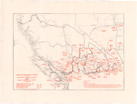
Unemployment relief works under Department of National Defence, Canada : British Columbia and Alberta
British North America
Plan of Lot 6311, Vancouver, B.C. fronting on Kitsilano Indian Reserve No. 6
Town of Granville, Burrard Inlet, B.C.
Map of early Chilliwack district
A map of the whole continent of America divided into North and South and West Indies
Algemeene kaart : van de ontdekkingen van Kapit. J. Cook
Nova totius Americae descriptio
Strait of Juan de Fuca
Cape Caution to Port Simpson including Hecate Strait and part of Queen Charlotte Islands
Map of South Vancouver
Map of the Lower Mainland district of British Columbia
North Arm of the Fraser River : Ione Island sheet
Vancouver parks
Seaforth camp, Vancouver, B.C.
Map of Richmond municipality
Vancouver, British Columbia
Map of downtown Vancouver
Reference schedule AA - Floodplan map
Reference schedule AA - Floodplan map
Proposed location for St. Roch [Kitsilano Point]
Vancouver, British Columbia
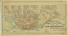
Plan of system of sewerage for the city of New Westminster, British Columbia
Vancouver and Northern Railway, 1908
Vancouver, B.C. 1890 : built-on area
Vancouver : urban growth, 1865-1970
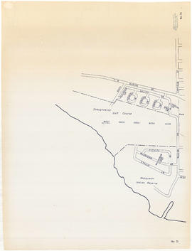
Sheet 31 : Camosun Street to Shaughnessy golf course to Fraser River to Salish Drive
Sheet 28 : Main Street to Twenty-ninth Avenue to Granville Street to Fiftieth Avenue
Sheet 26 : Highbury Street to English Bay to Tasmania Boulevard to Seventeenth Avenue
Sheet 25 : Balaclava Street to Fifteenth Avenue to Blanca Street to Thirty-fifth Avenue


![City of Vancouver [park sites June/80]](/uploads/r/null/9/4/9484add7c4684ea3838e4d00ee8add3ecf85d78d5aa8fe2780cae273e59556a5/bd2464d8-2aa9-4501-aba6-8b3f7d130a42-MAP1032_142.jpg)


![Commercial map of Greater Vancouver and district [assessment districts]](/uploads/r/null/0/9/2/0928add1a06ab55bc236f8bebb87712b7e6ad4422db32cc3065efe7c9da96c04/b5b4129d-f9ba-49b9-a863-2ab6e954897e-MAP102_142.jpg)
![The Seechelt [Sechelt] Forest](/uploads/r/null/e/6/d/e6d1e8d1a7613c8e7ce050434f42ef80f8e00ca339edc6e23dc578f9a4154957/c9ad5fbf-94a8-4925-8b43-b0845d5bd699-MAP54_142.jpg)


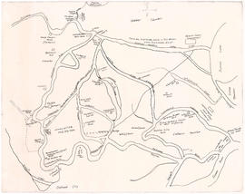


![Proposed location for St. Roch [Kitsilano Point]](/uploads/r/null/c/5/2/c52369b1ff6c9f96ec6b6a4c790487d6d8b36681c79121e12eff5acb61f653fb/155e6ba4-333c-4f85-b00f-6acaa95fc98d-MAP711_142.jpg)