![Sheet 62 [NW] : Brunette River to Tenth Avenue to Eighth Street to Fraser River](/uploads/r/null/8/c/0/8c00b096f6257381d8b28e6fe276a91bec30a8f112a0ac0c770cb6fc7550fb89/8a082b06-1a35-4b7d-a7d3-53c33798cd56-LEG1831_142.jpg)
Sheet 62 [NW] : Brunette River to Tenth Avenue to Eighth Street to Fraser River

Sheet 4 N.V. William Street to Twenty-eighth Street to Chesterfield Avenue to Seventeenth Street
![Sheet 9 N.V. : Seymour River to Lynn Canyon to Hoskins Road to [Keith Road?]](/uploads/r/null/3/7/5/375911fd91c57f28aaa91e483da08e145effcd26c69d693ebf72f1bf590e9442/c9afad59-d672-4c8e-96b7-0bdd968fb8fc-LEG1831_142.jpg)
Sheet 9 N.V. : Seymour River to Lynn Canyon to Hoskins Road to [Keith Road?]

Sheet 11 N.V. : Lower Seymour Creek

Distribution system of waterworks, City of New Westminster, British Columbia
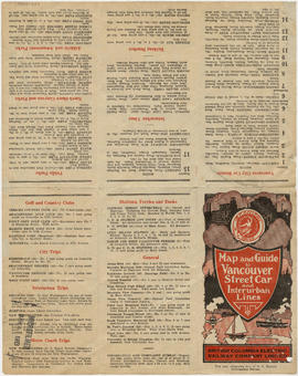
Map and guide to Vancouver street car and interurban lines

Vancouver city and suburban lines
![Hastings Townsite [Boundary Road to 5th Avenue to Kamloops Street (?) to 33rd Avenue]](/uploads/r/null/7/f/0/7f0fe2a27b9af4f20ad7837792af3bbb3aa93c3487024e69b14fa38144134f19/8e7a0e66-c6cc-40ca-bbac-4ea73db77437-LEG1800_142.jpg)
Hastings Townsite [Boundary Road to 5th Avenue to Kamloops Street (?) to 33rd Avenue]

Map and guide to Vancouver street car and interurban lines

Reference schedule AA - Floodplan map

Map of Lulu Island and Sea Island ; Municipality of Surrey ; Map of Maillardville ; University Endowment Lands

Map of downtown section of Vancouver ; Diagram of New Westminster, B.C., downtown section

Automobile road map of Greater Vancouver and environs : map cover

Through the Canadian Pacific Rockies : a large scale map of the mountains from Calgary to Sicamous : map cover

Through the Canadian Pacific Rockies : a large scale map of the mountains from Calgary to Sicamous : inside map cover

Schedule "A" : Polling districts : City of Vancouver

Greater Vancouver
![Vancouver, B.C., the Pacific coast terminus of the C.P.R. [Canadian Pacific Railway]](/uploads/r/null/8/3/f/83fcf65f0d66d64e6357d0d647e0ea6e2fa4aae4c3d1919f952d7725b4299cda/623e750c-fbab-43b7-a496-d20b384baeb6-LEG1321_142.jpg)
Vancouver, B.C., the Pacific coast terminus of the C.P.R. [Canadian Pacific Railway]

University Endowment Lands : plan of units nos. 1 and 2

Hastings Townsite : Renfrew Street to Rupert Street and 5th Avenue to 13th Avenue

Hastings Townsite : Rupert Street to Boundary Road and 5th Avenue to 13th Avenue

Hastings Townsite : Nanaimo Street to Renfrew Street and 13th Avenue to Strathcona Road (22nd Avenue)

Hastings Townsite : Renfrew Street to Rupert Street and Strathcona Road (22nd Avenue) to Government Road (29th Avenue)

New Westminster

Coquitlam

A preliminary proposal for development of Jericho Park

Map from the Pacific Ocean across the Rocky Mountain zone
![Chart of Nepigon [Nipigon] Bay. Lake Superior](/uploads/r/null/e/6/0/e6083525f33c7a6d0dd05f840915433768b0cfaed2c5b564153e3bfb5830f77e/8dd4e8d6-c36f-488f-a1bb-7aea7e098200-LEG1153_142.jpg)
Chart of Nepigon [Nipigon] Bay. Lake Superior
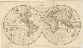
Map of the world

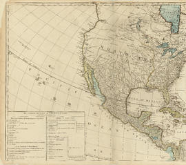
North America

Top left plate

Coal Harbour, Vancouver, B.C.

Plan of a 9.783 acre portion of Kitsilano Indian Reserve, District Lot 3610, Group one, New Westminster District

British Columbia

Plan of a 9.783 acre portion of Kitsilano Indian Reserve, District Lot 3610, Group one, New Westminster District [annotated]
![Plate 118 [Brunette River to Tenth Avenue to Langley/School/Keary Streets to Brunette Street]](/uploads/r/null/1/2/c/12c40d6d14f873e070ca2b0a5bfe05f2d1b13bcaf1775c8dc357e7ca81a55dda/1f12f0be-27cc-46e2-a722-0a8c209f762c-1972-472_142.jpg)
Plate 118 [Brunette River to Tenth Avenue to Langley/School/Keary Streets to Brunette Street]

Plate 125 Queensborough - south-west

Plate 128 Queensborough - north-east
![Section 2 [Jervis Street to Granville Street]](/uploads/r/null/c/f/5/cf5684518fb1cdac0f2d643c89acc078a47fe51a6a1896caf8fcfaf23999a562/c5097ebd-7d02-4ddb-be5e-d0f2658f2849-1972-581_142.jpg)
Section 2 [Jervis Street to Granville Street]
![Section 3 [Granville Street to Abbott Street]](/uploads/r/null/f/7/c/f7c18e536d617ec84d3c777f7d3bc02b98868d606842132c28166caaaa2dac3d/7e715850-e92f-48ba-bbc7-3678c5a832df-1972-581_142.jpg)
Section 3 [Granville Street to Abbott Street]
![Section 4 [Abbott Street to Gore Avenue]](/uploads/r/null/d/0/b/d0bdb5bfbb8ea9ebfe40ab12d3166035d9041c0874b44ccbcf0feaf7d343e90d/3d33023b-e416-4a39-b51c-f201b58c1e2c-1972-581_142.jpg)
Section 4 [Abbott Street to Gore Avenue]
![Section 6 [Heatley Avenue to Raymur Avenue]](/uploads/r/null/3/a/0/3a00a7d7ff2433b00b59b0d575006a89ff1e36eea4ecb961d585d3702308874e/61c58478-fbdc-4b03-b27d-4c69089913cd-1972-581_142.jpg)
Section 6 [Heatley Avenue to Raymur Avenue]

Fraser River - Deas Island sheet

Burrard Inlet - Vancouver sheet

Burrard Inlet - Dollarton sheet

Fraser River - triangulation control

Burrard Inlet - triangulation control
Top left plate
![Plate 3 [Seymour Street to Burrard Inlet to Hornby Street to Pender Street]](/uploads/r/null/b/6/e/b6e52f14a0b98be97e608633aaf0e2cdd8d5a51d8772a2b1ef80d1b748c7ebdc/eecaa1fa-a58b-4079-bf99-7f62b81de43f-1972-582_142.jpg)
Plate 3 [Seymour Street to Burrard Inlet to Hornby Street to Pender Street]
![Plate 4 [Hamilton & Cambie Streets to CP Railway yards to Seymour Street to Pender Street]](/uploads/r/null/7/e/9/7e931c45a666b558ca27b156ef8b243f5244a2820199fe50e04a7aaed21eeb20/06bd9672-ba7d-4013-aaac-2d7c9d8c5188-1972-582_142.jpg)
Plate 4 [Hamilton & Cambie Streets to CP Railway yards to Seymour Street to Pender Street]