Vancouver 1886-1986 : yesterday, gateway to the Pacific : today, crossroads of the world
Plan of Point Grey Municipality
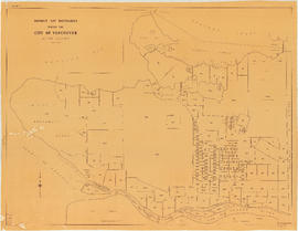
Map of portion New Westminster District
C.P.R. [Canadian Pacific Railway] Land Department : Shaughnessy Heights
Second section : Shaughnessy Heights
Stanley Park, Vancouver, B.C.
Cheakamus power survey for City of Vancouver, 1930-1931 : general plan & profile : sheet no. 1 [Garibaldi Lake to Cheakamus Lake] to accompany report of E.A. Cleveland dated November 30th 1931
Cheakamus power survey for City of Vancouver, 1930-1931 general plan and profile : sheet no. 1 [Garibaldi Lake to Cheakamus Lake] to accompany report of E.A. Cleveland dated November 30th 1931
Cheakamus power survey for City of Vancouver, 1930-1931 : mass curves showing Cheakamus River discharge : sheet no. 2 to accompany report of E.A. Cleveland dated November 30th 1931
Cheakamus power survey for City of Vancouver, 1930-1931 : plan showing proposed development at Cheakamus Lake : sheet no. 3 to accompany report of E.A. Cleveland dated November 30th 1931
Cheakamus power survey for City of Vancouver, 1930-1931 : plan showing proposed development near McGuire and Brandywine : sheet no. 4 to accompany report of E.A. Cleveland dated November 30th 1931
Cheakamus power survey for City of Vancouver, 1930-1931 : proposed storage reservoir at Daisy Lake : sheet no. 5 to accompany report of E.A. Cleveland dated November 30th 1931
Cheakamus power survey for City of Vancouver, 1930-1931 : plan showing proposed development near Mile 19 - P.G.E. Rly. : sheet no. 6 to accompany report of E.A. Cleveland dated November 30th 1931
Cheakamus power survey for City of Vancouver, 1930-1931 : plan showing proposed diversion works near Mile 19 - P.G.E. Rly., detail sheet : sheet no. 7 to accompany report of E.A. Cleveland dated November 30th 1931
![Sheet 10 N.V. : [Seymour Heights]](/uploads/r/null/1/d/1/1d15e4ca3f7c6aebec06e8dfaf73fbbf9fe54dacb8d193238f30210354947064/e84baddc-7eee-42d6-b61a-5fa09a2451d2-LEG1831_142.jpg)


![Sheet 16 N.V. : Capilano River to [ca. Queens Avenue] to [15th Street] to foreshore](/uploads/r/null/6/f/6/6f62b97a865379e80901e3a525e5496ab6750a5ca2d531bcad22a1e03bf80a38/85d7d67a-5d7d-42c9-b709-eedfe2c4429e-LEG1831_142.jpg)


![Sheet 19 N.V. : [West Vancouver?]](/uploads/r/null/c/3/1/c31b6c877bd8ee180b750559f16371bad467808c21b5ad79d3f339f15a42f2cc/440b4ffb-2c51-40d5-9dc0-5622630ac007-LEG1831_142.jpg)
![Sheet 20 N.V. : White Cliff City [sic] and Eagle Harbour](/uploads/r/null/f/b/2/fb2ca0eac09bd01ce584d6b73e53ddc6e831b650fca057844dd9f698bc1545fb/4ae39779-c57b-4436-bb50-b339df3289c1-LEG1831_142.jpg)

![Canadian Pacific map of Vancouver [west half]](/uploads/r/null/f/a/fa49266d21715d75ce93883012d471657dd058b90843927ec82b44d2bb42b007/f12ea9a5-4914-4db8-bda9-312aa2e2ccef-MAP10_142.jpg)


![Commercial map of Greater Vancouver and district [assessment districts]](/uploads/r/null/0/9/2/0928add1a06ab55bc236f8bebb87712b7e6ad4422db32cc3065efe7c9da96c04/b5b4129d-f9ba-49b9-a863-2ab6e954897e-MAP102_142.jpg)


![City of Vancouver [park sites June/80]](/uploads/r/null/9/4/9484add7c4684ea3838e4d00ee8add3ecf85d78d5aa8fe2780cae273e59556a5/bd2464d8-2aa9-4501-aba6-8b3f7d130a42-MAP1032_142.jpg)


![C.P.R. [Canadian Pacific Railway] Land Department : Shaughnessy Heights](/uploads/r/null/b/4/5/b45f6c8bb0c605bac487bce451fdb4aab1b7f1f6640b3522a7b08a1f7951b667/2a0cca04-e3e3-48b6-8bb4-30ea1fa948cf-MAP1057_142.jpg)


