Portions of New Westminster District and Vancouver Island
Plan of part of D.L. 540
Map of West Vancouver and vicinity
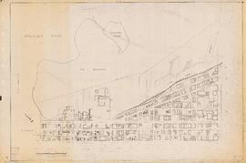
[First section of] Shaughnessy Heights
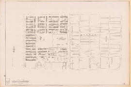
D.L. [District Lot] 526
Plan of government subdivision at Point Grey, B.C.
Map of New Westminster District, B.C.
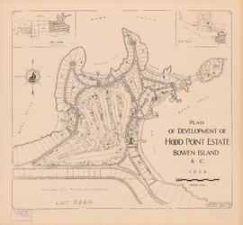
Plan of development of Hood Point Estate, Bowen Island, B.C., 1928
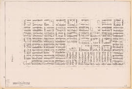
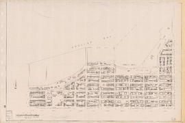
Municipality of North Vancouver [Burrard Inlet]
Map of the Fraser Valley showing railway lines and district lots
Plan of Greater Vancouver, British Columbia
Plan of the municipality of South Vancouver
Plan of provincial government property being a sub-division of a portion of expired timber lease situated in North Vancouver, New Westminster district, B.C., to be sold by public auction
Plan of sub-division of lot 2027, group 1, New Westminster District, B.C., to be sold by public auction at Vancouver, B.C.
City of Vancouver : Canadian Pacific town site
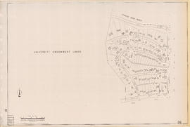
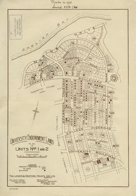
University Endowment Lands : plan of units nos. 1 and 2
Hastings Townsite : Rupert Street to Boundary Road and Strathcona Road (22nd Avenue) to Government Road (29th Avenue)
Vancouver City : plan of Subdivision of lot 301, Group 1, New Westminster District
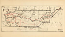
Lower Mainland Regional Plan : base map
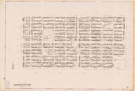
Part of D.L. [District Lot] 185
Sectional map : City of Vancouver, B.C. : sheet no. S.V. 29
Sectional map of Vancouver showing streets, block and lot outlines, and building perimeters : Map 4 : Chilco Street to Burrard Street and Coal Harbour to Robson Street
Sectional map of Vancouver showing streets, block and lot outlines, and building perimeters : Map 12 : Nanaimo Street to Cassiar Street and McGill Street/Wall Street to Pender Street
Sectional map of Vancouver showing streets, block and lot outlines, and building perimeters : Map 15 : Rupert Street to Boundary Road and Pender Street to Kitchener Street
Sectional map of Vancouver showing streets, block and lot outlines, and building perimeters : Map 17 : Nanaimo Street to Rupert Street and Pender Street to Charles Street
Sectional map of Vancouver showing streets, block and lot outlines, and building perimeters : Map 18 : Nanaimo Street to Rupert Street and Charles Street to 5th Avenue
Sectional map of Vancouver showing streets, block and lot outlines, and building perimeters : Map 23 : Balaclava Street to Maple Street and English Bay to 3rd Avenue
Sectional map of Vancouver showing streets, block and lot outlines, and building perimeters : Map 26 : University Endowment Lands to Blanca Street and N.W. Marine Drive to 4th Avenue
Sectional map of Vancouver showing streets, block and lot outlines, and building perimeters : Map 34 : Nanaimo Street to Rupert Street and 5th Avenue to Grandview Highway North
Sectional map of Vancouver showing streets, block and lot outlines, and building perimeters : Map 36 : Rupert Street to Boundary Road and Grandview Highway to 22nd Avenue
Sectional map of Vancouver showing streets, block and lot outlines, and building perimeters : Map 39 : Nanaimo Street to Rupert Street and 22nd Avenue to Kingsway/Vanness Avenue
Sectional map of Vancouver showing streets, block and lot outlines, and building perimeters : Map 47 : 29th Avenue at King Edward Avenue to Blenheim Street and King Edward Avenue to 33rd Avenue
Sectional map of Vancouver showing streets, block and lot outlines, and building perimeters : Map 56 : Joyce Street/Doman Street to Boundary Road and Kingsway to 49th Avenue
Sectional map of Vancouver showing streets, block and lot outlines, and building perimeters : Map 61 : Cypress Street to Oak Street and 33rd Avenue to 41st Avenue
Sectional map of Vancouver showing streets, block and lot outlines, and building perimeters : Map 63 : Carnarvon Street to Cypress Street and 33rd Avenue to 41st Avenue
Sectional map of Vancouver showing streets, block and lot outlines, and building perimeters : Map 72 : Oak Street to Quebec Street and 46th Avenue to 57th Avenue
Sectional map of Vancouver showing streets, block and lot outlines, and building perimeters : Map 74 : Inverness Street to Nanaimo Street and 49th Avenue to 61st Avenue
Sectional map of Vancouver showing streets, block and lot outlines, and building perimeters : Map 76 : Kerr Street to Boundary Road and 49th Avenue/48th Avenue to Rosemont Drive
Sectional map of Vancouver showing streets, block and lot outlines, and building perimeters : Map 85 : Laburnum Street to Fremlin Street and 57th Avenue to 68th Avenue/67th Avenue
Sectional map of Vancouver showing streets, block and lot outlines, and building perimeters : Map 87 : Barnard Street to Heather Street and 75th Avenue/Kent Avenue South to the North Arm of the Fraser River
Sectional map of Vancouver showing streets, block and lot outlines, and building perimeters : Map 88 : MacDonald Street to Laburnum Street/Angus Drive and 57th Avenue to the North Arm of the Fraser River
Plan showing parcels 'A', 'B' & 'C' : Kitsilano Indian Reserve, No. 6 of the Squamish band, Vancouver, B.C.
Water service map of South Vancouver : Bridge Street (Cambie Street) to Main Street and 16th Avenue to 26th Avenue
Water service map of South Vancouver : Fraser Street to Knight Street and 25th Avenue to 34th Avenue (33rd Avenue)
Water service map of South Vancouver : Churchill Street (Rupert Street) to Tyne Street and School Road (School Avenue) to 46th Avenue (45th Avenue)
Water service map of South Vancouver : Tyne Street to Park Street (Boundary Road) and Vanness Avenue to 46th Avenue (45th Avenue)
Water service map of South Vancouver : Ontario Street to Fraser Street and 33rd Avenue to 41st Avenue
Water service map of South Vancouver : Tyne Street to Park Street (Boundary Road) and 46th Avenue (45th Avenue) to 56th Avenue (54th Avenue)
Water service map of South Vancouver : Victoria Drive to Vivan Street and 67th Avenue (65th Avenue) to North Arm of Fraser River
Water service map of South Vancouver : Doman Street to Park Street (Boundary Road) and 67th Avenue (65th Avenue) to North Arm of Fraser River


![[First section of] Shaughnessy Heights](/uploads/r/null/c/d/0/cd05f96b7e9f01fee4ba2afe83ac83cef9d70b3cf83d3ba8c4ebe5a0a20a429d/0d2ec941-063b-4722-8d84-aff283b273f6-MAP329_142.jpg)
![D.L. [District Lot] 526](/uploads/r/null/c/b/4/cb45fc2541156cf0f1c89b637733e961198017ddd4aa199ba866f1150856a8ba/dfb19024-a115-4097-9258-559e228c275d-MAP332_142.jpg)


![Municipality of North Vancouver [Burrard Inlet]](/uploads/r/null/6/d/6d0d9a4b75b38672c56aa89a5984fe2d0e6d66be85f6f375cbe8e2fd7ac94a98/577914e1-3de2-478b-a629-5f391731387a-MAP588_142.jpg)


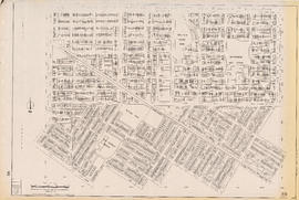
![Part of D.L. [District Lot] 185](/uploads/r/null/d/0/2/d020a729408b2c6caa3fc78d706b687230bf429554ef426ba4dc104ce23d48d6/dbf9611e-8fed-4827-b82a-7e29f4922fc3-MAP904_142.jpg)