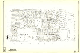
Sheet 42 : Oak Street to Ontario Street and Twenty-eighth Avenue to Sixteenth Avenue
- AM1594-MAP 341-: MAP 341.41
- Item
- [1962?], with revisions to July 1966
Part of City of Vancouver Archives technical and cartographic drawing collection
Item is a section showing the area from Oak Street to Ontario Street and wenty-eighth Avenue to Sixteenth Avenue. Includes streets, blocks, lots and legal descriptions, and the locations of parks and schools.
Vancouver (B.C.). Engineering Services


![[Sheet 7 : Burrard Street to Main Street and Georgia Viaduct to Burrard Inlet]](/uploads/r/null/c/d/cd235086cbaf81487b8784fb32b6ef913f4fe27305678cd1961adf506324c250/8f72f6bd-1013-48ad-a56c-e6269cb6f5a8-MAP339_142.jpg)
![[Sheet 9 : Main Street to Clark Drive and Prior Street to Burrard Inlet]](/uploads/r/null/c/a/ca4b4713bea0118fec812e6258afe5c1efa039db74073214703001a47b00f122/5e0d243a-99ae-42aa-8bb3-4a1abe9e1209-MAP339_142.jpg)
![[Sheet 24 : Jericho Beach to Balaclava Street and Fourth Avenue to Cameron Avenue]](/uploads/r/null/e/7/e737857a87702a8fbd029d7bdb109697279cac537d45931818415e380dd2867c/67258081-9a3b-44c0-9191-8a3719f6c999-MAP339_142.jpg)

![[Sheet 40 : Inverness Street to Nanaimo Street and Twenty-second Avenue to Thirteenth Avenue]](/uploads/r/null/9/3/9367a0c50f6fa513d717a1972b1bac72acde6d41b002fefcf48ddbd8c8122e8a/c7bfac0b-bf44-441b-b059-fd7bbc0bd4a0-MAP339_142.jpg)
![[Sheet 41 : Ontario Street to Inverness Street and Twenty-eighth Avenue to Sixteenth Avenue]](/uploads/r/null/c/2/c22ca2538905633f64373261ce970df6216075ce4de9e22d491c2e212ce17c1f/616ab944-e39a-4c66-abb4-918b17cc3252-MAP339_142.jpg)
![[Sheet 43 : East Boulevard to Oak Street and Laurier Avenue to Fourteenth Avenue]](/uploads/r/null/8/8/8846e3e6c19438103b656786c264d5dcccc37b59de3cf8fa85bb05f01b65d8f9/9fb3d6cb-93e9-48d0-be52-05cc55ad4ec4-MAP339_142.jpg)

![[Three boys at Kitsilano Beach park]](/uploads/r/null/4/7/471a58411b4995f9c9016ab2e90bfe1ed069af03907558667386f287b22f971c/c0a61429-ff75-4638-8d06-b4c703d73d19-A23641_142.jpg)

![[View of Pioneer Place, corner of Carrall Street and Hastings]](/uploads/r/null/8/3/83cee3d4801654884f4b86d80714ca8988e09f94cd6e8f33eb45e126261ef9c7/f0ce6d46-0eb0-4883-8521-0fe2e4197063-A10286_142.jpg)
![[Intersection of two paths next to lake]](/uploads/r/null/d/7/d760c01663f15e6f1af48e61a82c1af04d6197b8648a69bf35efaee558f51a4f/c4f37f4c-993b-4d6e-adda-72cfecbc7cac-A02393_142.jpg)
![Meditation Park [north foot of Nanaimo St.]](/uploads/r/null/8/f/8f126b069f5fd3c8ccae452480249216cb9b576ca04bc7272ae8ee8c51262a44/8cdb99c4-2af8-45be-8907-e6c2fc5e513e-A21786_142.jpg)


![Parks [3 of 7]](/uploads/r/null/9/8/989d26bb1590a543511311fe14dcac4046eca4838a8bd9497c7cf9117e4e9f60/8d3b695d-c692-47e9-bdba-7902700627c0-A64155_142.jpg)
![Parks [5 of 7]](/uploads/r/null/b/3/b30949c3fa12945ac5cf3c3640c1f3231dbf39a20fdee8ae60da8658f65948b0/4e58617f-3107-464e-a913-bb0fd653296f-A64159_142.jpg)
![Kensington Park [2 of 17]](/uploads/r/null/8/a/8a27d0b38354b6eea36c17bdd693b7a2b326a2b73b35517d1891a6366e4099b4/47cb06eb-034e-4af7-8dc4-bc3cf913a455-A66096_142.jpg)
![Kensington Park [4 of 17]](/uploads/r/null/9/5/95bf876922e1e2274e5af0fda6a7fb71c6e46af30becf823445f5aea277c69d2/bcae757c-b178-4640-8d80-e26c09f52093-A66098_142.jpg)
![Kensington Park [6 of 17]](/uploads/r/null/3/5/35e3d70795e87adf81d6bad05c01095ca54132f880fcb149ef948c3dc39ef82b/9065cb7e-2e39-43d4-98c3-8e3ef72ab3cd-A66100_142.jpg)
![Kensington Park [7 of 17]](/uploads/r/null/2/f/2fb7bd7b5002883f6b7c29c671b77f5b9003c1f1bfe16bbbbbae1129e9c69116/d7203282-df22-489e-b4e7-7ae6ff508ddd-A66101_142.jpg)
![Mini-park [1 of 2]](/uploads/r/null/e/8/e83191b331b23e1ae30897704a0dd24784f5ea093625bf50c8a8e501ef4e87ab/0582037d-e7bd-428c-8c54-d55c7035eb08-A66264_142.jpg)
![Kensington Park [9 of 17]](/uploads/r/null/1/c/1c2ea14f95158a045dda857ed240e919b2062663c3b2f49747798980152c3162/995ad5d0-cd4c-4757-939b-8b85fb230ff5-A66326_142.jpg)
![Kensington Park [10 of 17]](/uploads/r/null/0/2/021aa9f7e3deb1f0f15afde366960885ca7bbf5af6ddd80a893e5d6e70d58519/6d567c6c-dae5-4dce-957b-9609f7220e8c-A66327_142.jpg)
![Kensington Park [17 of 17]](/uploads/r/null/c/b/cb287ec5a45376b99a5d57a00bab20661c6e61f6b789c9034106647007f71fd6/816a82e2-aa83-43d2-845f-d89b898e21f6-A66334_142.jpg)
![[Park covered in snow]](/uploads/r/null/2/4/5/2452f623f1a8f13b316ec1c920ef648ef8e89cc430108f2a5591facd98fd9bf2/ca7e51f3-218d-4cf4-8c84-575ad56b582e-CVA1095-09242_142.jpg)