
- COV-S535-F4-: CVA 786-59.35
- Item
- 1978
Part of City of Vancouver fonds
Part of City of Vancouver fonds

Part of City of Vancouver fonds

Part of City of Vancouver fonds

Part of City of Vancouver fonds

Part of City of Vancouver fonds

Part of City of Vancouver fonds

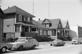
2130-2136 Prince Edward Street
Part of City of Vancouver fonds

Part of City of Vancouver fonds

Part of City of Vancouver fonds

Part of City of Vancouver fonds

Part of City of Vancouver fonds
![MacLean and Powell Iron Works [398 W. 2nd Avenue]](/uploads/r/null/d/e/1/de1bd2331d8f38729f62a271796726cfd094a2e754ddbd1ac5e7de6cc53a1314/a1f0c6aa-e324-41b1-a8c2-6288e3ce8e8d-CVA786-23_142.jpg)
MacLean and Powell Iron Works [398 W. 2nd Avenue]
Part of City of Vancouver fonds
![Opsal Steel Ltd. [97 E. 2nd Avenue]](/uploads/r/null/2/3/2/232ac779d96989d15d252741cab0695612ef729cc1e731fed9f739c897c3c296/73ecb72a-8d0f-48c3-802c-9e9b06d7b626-CVA786-23_142.jpg)
Opsal Steel Ltd. [97 E. 2nd Avenue]
Part of City of Vancouver fonds
Item is a photograph showing Opsal Steel Ltd. Logging Equipment.
![David L. Jones [wholesale florist], Wylie Street and W. 1st Avenue](/uploads/r/null/b/4/c/b4c819d9d656eb30d8a4f33dc80065703c7c90b95fce9c1880eddaba3fd82210/8634ab24-f2e2-4506-9f99-c4139d53fda6-CVA786-23_142.jpg)
David L. Jones [wholesale florist], Wylie Street and W. 1st Avenue
Part of City of Vancouver fonds

W. 4th Avenue & Manitoba Street
Part of City of Vancouver fonds

W. 4th Avenue & Ontario Street
Part of City of Vancouver fonds

Part of City of Vancouver fonds

Part of City of Vancouver fonds
Part of City of Vancouver fonds

Part of City of Vancouver fonds

Part of City of Vancouver fonds

Part of City of Vancouver fonds

Proposed convenience at Kingsway & Main St.
Part of City of Vancouver fonds
Item is an architectural drawing of an underground public toilet facility. Drawing includes pans and cross-sections.
Vancouver (B.C.). Engineer's Office
![Contour plan 220a [Mt. Pleasant]](/uploads/r/null/b/d/bd5c7afeea1a507ba6bc282b904c55c40d1119da939738b1911ba9fd99e6bd21/21ae5b59-321b-4488-bdc6-e782f391b8ea-MAP690_142.jpg)
Contour plan 220a [Mt. Pleasant]
Part of City of Vancouver fonds
Item is a map showing the topography of the area south of False Creek to 15th Avenue in the south and from Glen Drive in the east to Bridge Street (now Cambie Street) in the west.

Project 2 area "h" and part of "b" : identification plan
Part of City of Vancouver fonds
Item is a map created to show the boundaries of redevelopment areas "b" and "h" in Project 2 and Project 2 clearance areas 8 & 9. The map also shows City-owned property, Adjacent lots in same ownership, as well as property, streets and lanes be acquired for the project. The portion of the City depicted in the map is the area between Main Street and Clark Drive and between Evans Avenue and 10th Avenue (D.L.200, D.L. 264A, D.L. 301, and D.L. 2037).

Urban renewal scheme 3 : Mt. Pleasant 2 : conditions of residential building
Part of City of Vancouver fonds
Item is a map annotated to show condition of residential buildings in the area bounded by Scotia Street, Clark Drive, Great Northern Way, and Broadway. Base map shows streets, building outlines, and topographical contour lines.

Urban renewal scheme 3 : Mt. Pleasant 2 : existing land use
Part of City of Vancouver fonds
Item is a map annotated to show types of land use in the area bounded by Scotia Street, Clark Drive, Great Northern Way, and Broadway. Base map shows streets, building outlines, and topographical contour lines.

Project 2, area "h" and part of "b" : condition of buildings
Part of City of Vancouver fonds
Item is a map showing the conditions of buildings (ranging from very good to very poor) in area "a" and part of area "b" in project 2. The map has been annotated to highlite part of the boundary around sub-area 9, as well as the southern portion of the sub-area. The significance of these annotations is not known.
![[154 East 10th Avenue - Holy Trinity Ukrainian Orthodox Cathedral, 1 of 5]](/uploads/r/null/6/9/0/6909b2ded601db1d46b634cc7e7e39eab18e1a0475e87a6772eeccf40f59dc6e/ca36eebe-a150-4135-bcdb-6c0abd4e596b-CVA1095-15420_142.jpg)
[154 East 10th Avenue - Holy Trinity Ukrainian Orthodox Cathedral, 1 of 5]
Part of City of Vancouver fonds
![[154 East 10th Avenue - Holy Trinity Ukrainian Orthodox Cathedral, 3 of 5]](/uploads/r/null/8/a/9/8a9955ad32e7cd4f8b4e8ccaba2ff085f136f4a749564cac9678abebf519ba79/417ac170-7a2d-4b55-8406-9e5ab7103ab5-CVA1095-15422_142.jpg)
[154 East 10th Avenue - Holy Trinity Ukrainian Orthodox Cathedral, 3 of 5]
Part of City of Vancouver fonds
![Mount Pleasant [House, 2 of 2]](/uploads/r/null/3/7/9/3797d7e0234ecedee3c764c2a0277304bbf5c25334d072f46646ac11bf9bbe0e/b9e08579-7d21-4058-9cb4-98a8e97d01cc-CVA1095-12877_142.jpg)
Mount Pleasant [House, 2 of 2]
Part of City of Vancouver fonds
![Mount Pleasant [House stonework detail]](/uploads/r/null/f/b/0/fb0bc6df905b0611ade3a04a8df209c1790cec7857eec1a2f94720ad79ec9b9a/63a03c6a-91a7-44df-8194-c9dc0a5a2c24-CVA1095-12886_142.jpg)
Mount Pleasant [House stonework detail]
Part of City of Vancouver fonds
![[453 West 12th Avenue - City Hall, 1 of 5]](/uploads/r/null/f/9/9/f991aa3bcec57fdcfab0b5589fb8e2fa9e1b4cb76ec115eff69eedb70c746a38/29b61d45-8550-4cd1-a3ca-b5eb88a3530b-CVA1095-13703_142.jpg)
[453 West 12th Avenue - City Hall, 1 of 5]
Part of City of Vancouver fonds
![[453 West 12th Avenue - City Hall, 3 of 5]](/uploads/r/null/8/0/8/80859fa769439de4e9b0df54bac0c6ca1a57c35bf49673cf7c34b18943b95508/dcf9ed5b-747b-406c-b71a-54a950656340-CVA1095-13705_142.jpg)
[453 West 12th Avenue - City Hall, 3 of 5]
Part of City of Vancouver fonds
![[Detail of Ontario Street]](/uploads/r/null/f/0/0/f0036cfc3af3d80884f74885850128badc3d3300d81701459c8f6c3ce237e51d/98ff5728-e5e6-4ba6-858d-bf487a48ce5f-CVA1095-02998_142.jpg)
Part of City of Vancouver fonds
![[2602 Ontario Street]](/uploads/r/null/b/e/4/be4826bc602775ac4660608dfae8e48338e0451b68e15a64c528422fdd2acc58/e1c95bd4-005b-4a1f-a174-bb3d5ea0812c-CVA1095-02999_142.jpg)
Part of City of Vancouver fonds
![[2875 St. George Street]](/uploads/r/null/e/c/5/ec5aec75fc0393200f92629d57a259538b270aa80c78975c9508bd3752360423/493ec1d2-b704-471c-a26b-2cccab941ba2-CVA1095-03541_142.jpg)
Part of City of Vancouver fonds
![Fairview, Hodson House Move - 156 [1 of 3]](/uploads/r/null/5/0/6/50647131d1780265cf3cedb08e8652b8fb15da04307aceebe8bd035d8833d4f6/e0e1968f-af5d-45b3-a4e6-7f6f9ee6e7ef-CVA1095-03551_142.jpg)
Fairview, Hodson House Move - 156 [1 of 3]
Part of City of Vancouver fonds
![[2234 St. George Street]](/uploads/r/null/c/2/8/c286329fd6a74e9824d5a1758857787a6a72455f6f3941f2711016ea1295cb4d/2b9eca94-1064-4b9b-9b66-20175aa8ab99-CVA1095-03553_142.jpg)
Part of City of Vancouver fonds
![[1137 East 12th Avenue]](/uploads/r/null/3/6/6/366598c201ac251ffdcf1f8005833d9d283a1b06757de8d88a4c4890312cf5cb/acda531d-5d4b-42ca-a896-ee16b6bba3d0-CVA1095-03571_142.jpg)
Part of City of Vancouver fonds
![[1222 East 12th Avenue]](/uploads/r/null/c/0/5/c050446d04315834af4429cc67da53c509535159c5edbd80751f60089deb332c/e267507c-1ae0-4271-8127-ee5787f46934-CVA1095-03600_142.jpg)
Part of City of Vancouver fonds
![[1234 East 12th Avenue]](/uploads/r/null/3/b/5/3b5ef8cb74b3bdc1a398da783b29f0d05e293930b86bccf299d115ab1245fdaf/554a6f57-82cd-4844-b10d-3b2339250b0b-CVA1095-03601_142.jpg)
Part of City of Vancouver fonds
![[1260 East 12th Avenue]](/uploads/r/null/6/a/6/6a645745775bd3aa420be2e92b1370d716538890d769cc3b54fb42117514e385/8c63ca15-5625-4bdb-9141-9f755cd61688-CVA1095-03604_142.jpg)
Part of City of Vancouver fonds
![[1268-1270 East 12th Avenue]](/uploads/r/null/2/2/0/220b9e16df9a3c8a59a8db777bf145dc2897c519af9288a3262c6b77cf5d021f/d5aaa485-6f14-4b73-80f5-0668f9c52a3b-CVA1095-03605_142.jpg)
Part of City of Vancouver fonds
![[1282 East 12th Avenue]](/uploads/r/null/5/e/e/5ee159d966dba794c7719c5e83d729ec2aef43088c5027127709051064a2d411/ffc261a6-ea32-4a5d-b54f-5f5124e0b947-CVA1095-03606_142.jpg)
Part of City of Vancouver fonds
![[1284-1290 East 12th Avenue]](/uploads/r/null/7/6/0/760016f2694f29274fd3ac34ca2161feb16f2ee0bc34593d14da527e295ddd74/b4f02f3e-d639-42b1-965f-57b310ab8c24-CVA1095-03607_142.jpg)
Part of City of Vancouver fonds
Item is a photograph that depicts an exterior view of 1284-1245 East 12th Ave. The signs for Mount Pleasant Youth Centre and East West Quality Wear are visible.
![[1221 East 12th Avenue]](/uploads/r/null/f/9/8/f98d6c6b2c89069890d666f8c15ecd53d9db25e0da9f73e1a83f4ec6d55d9aa5/4478960e-5a02-4391-ae1a-88ceaf5df8f8-CVA1095-03609_142.jpg)
Part of City of Vancouver fonds
![[236 East 4th Avenue, 2 of 2]](/uploads/r/null/6/5/8/6585a270bed24b59ffc1d6bf9611a015c24899f91ce5e3128d62817ad1293bd6/743381a2-2480-429b-875e-2fc7f2ef2236-CVA1095-03614_142.jpg)
Part of City of Vancouver fonds
![[849 East 7th Avenue]](/uploads/r/null/7/8/7/787b70888b89c5be08514d7c61e68cda8ea2c6d93e776587f06c7d22a1c10da3/7c152ff8-69cb-4711-8058-bde234388c81-CVA1095-03654_142.jpg)
Part of City of Vancouver fonds
![[843 East 7th Avenue]](/uploads/r/null/9/6/e/96e6515be7cd0cdb164d3153b8993c970e8436f6fb05b6db12f56389124ee900/d712dd50-99ea-44f4-86a5-8c24785596e5-CVA1095-03655_142.jpg)
Part of City of Vancouver fonds