Print preview Close

Showing 1440 results

Archival description
City of Vancouver Archives technical and cartographic drawing collection With digital objects
Print preview View:

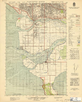
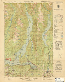
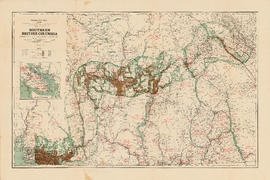
Information concerning the City and District of New Westminster and the Province of British Columbia

Part is the text side of a pamphlet. This part contains information concerning the city and district of New Westminster, with individual panels on the municipalities of Delta, Chilliwhack [sic], Surrey, Langley, and Delta, and the City of New Westminster, the town of Harrison Hot Springs and the province.

New Westminster

Item is a map showing topography, roads, trails, railways, bridges, boundaries, reserves, power lines, telephone lines, triangulation stations, camera stations, bench marks, houses, barns, mills, factories, schools, churches, post offices, telephone exchanges, mines and geographic features in the area of South Burnaby and New Westminster, extending south through Surrey and White Rock to the United States border. A small index map shows the area covered by the primary map in relation to other maps in the series.

New Westminster

Item is a map showing topography, roads, trails, railways, bridges, boundaries, reserves, power lines, telephone lines, triangulation stations, camera stations, bench marks, houses, barns, mills, factories, schools, churches, post offices, telephone exchanges, mines and geographic features in the Pitt Meadows area and extending south through Cloverdale and Langley to the United States border. A small index map shows the area covered by the primary map in relation to other maps in the series.

Vancouver South

Item is a map showing topography, roads, trails, railways, bridges, boundaries, reserves, power lines, telephone lines, triangulation stations, camera stations, bench marks, houses, barns, mills, factories, schools, churches, post offices, telephone exchanges, mines and geographic features in the area of southern Vancouver and Richmond, extending south to the United States border. A small index map shows the area covered by the primary map in relation to other maps in the series.

Vancouver North

Item is a map showing topography, roads, trails, railways, bridges, boundaries, reserves, power lines, telephone lines, triangulation stations, camera stations, bench marks, houses, barns, mills, factories, schools, churches, post offices, telephone exchanges, mines and geographic features in the area of southern Gambier Island, Bowen Island, Whytecliff, and Caulfeild. A small index map shows the area covered by the primary map in relation to other maps in the series.

Vancouver North

Item is a map showing topography, roads, trails, railways, bridges, boundaries, reserves, power lines, telephone lines, triangulation stations, camera stations, bench marks, houses, barns, mills, factories, schools, churches, post offices, telephone exchanges, mines and geographic features in the area from Mount Hanover in the north through West Vancouver and North Vancouver, extending south to the northern part of Vancouver. A small index map shows the area covered by the primary map in relation to other maps in the series.

Coquitlam

Item is a map showing topography, roads, trails, railways, bridges, boundaries, reserves, power lines, telephone lines, triangulation stations, camera stations, bench marks, houses, barns, mills, factories, schools, churches, post offices, telephone exchanges, mines and geographic features in the area of Indian Arm and Coquitlam Lake, extending south to Port Moody, Port Coquitlam, and the northeast part of Burnaby. A small index map shows the area covered by the primary map in relation to other maps in the series.

Coquitlam

Item is a map showing topography, roads, trails, railways, bridges, boundaries, reserves, power lines, telephone lines, triangulation stations, camera stations, bench marks, houses, barns, mills, factories, schools, churches, post offices, telephone exchanges, mines and geographic features in the Pitt Lake area, including Coquitlam Mountain, Mount Blanshard, and Siwash Island. A small index map shows the area covered by the primary map in relation to other maps in the series.

Southern British Columbia showing disposition of lands within the Railway Belt

Item is a map of the area from Howe Sound to Kootenay National Park showing homesteads, sales, special grants, mining land sales and provincial grants, Indian Reserves, forest reserves, timber berths, grazing leases and parks. Also indicated are locations of minerals, types of farming, fish and water power. An inset map shows southern Vancouver Island.

Dial map of Greater Vancouver and suburbs

Part contains a street map of Vancouver, Burnaby, New Westminster, West Vancouver and North Vancouver showing block numbers, street car, bus, and railway lines, parks and hospitals. Map includes two dials (a numbered circle, a paper indicator, a grid of block numbers and a street index used to find locations). A small inset map shows the Capitol Hill/Scenic Park area of Burnaby in greater detail.

Map of Lulu Island and Sea Island ; Municipality of Delta ; Municipality of Surrey ; Municipality of Langley ; Map of Maillardville

Part contains street maps of Lulu Island and Sea Island, Delta, Surrey, Langley, and Maillardville, tourist information about Vancouver, and text advertising the products and services of the Dominion Map and Blueprint Company.

Plan of proposed dam, locks and wharves. Second Narrows, Burrard Inlet

Item consists of a design for a proposed dam and locks system to be located near the Second Narrows of Burrard Inlet. One side of the dammed area is marked "reclaimed tideflats available for industrial purposes," the other "land available for industrial or other purposes." Sites for warehouses are indicated on the dam.

Kilmer and Holland, Engineers and Surveyors

Visitors map of Vancouver

Part is the front sheet of an unfolded tourism brochure showing Vancouver tourist attractions, The sheet includes a map of downtown Vancouver, with transportation information, a map of the roads in Stanley Park, photographs and information on various sites and attractions in the city, as well as general promotional information.

Portions of New Westminster District and Vancouver Island

Item is an economic map which depicts the area of central Vancouver Island made up of the Comox, Nelson, and Newcastle land divisions, as well as portions of the Alberni, Cameron and Nanoose land district. The map includes the inside passage islands between Lasqueti and Sonora Islands, and the coastal portion of the New Westminster land district from Bute Inlet south to the mouth of the north arm of the Fraser River.

Information included on the map includes timber licenses, Indian reservations, other government reserves, District Lots, physical features (not including topography), and municipal boundaries.

Southerly portion. Vancouver Island

Item is an economic map which depicts Vancouver Island south of Buttle Lake, as well as coastal areas of the mainland from the approximate location of Britannia Beach, south and the northern coast of the Olympic Peninsula. Information included in the map include Timber Licenses, Indian reserves, other land reserves, municipal boundaries, District Lots outside municipalities, geographic features (not including topography), transportation routes, and parks.

Map of New Westminster District

Item is a commercially printed map depicting the New Westminster Land District, bounded by the Gulf of Georgia in the west, the international border in the south, range 26 of townships 1 to 4 of the Yale District in the east, and the southern half of township 6 in the north.

The map depicts townships and ranges, and district lots in incorporated areas. The map also depict Dominion Timber Berths and various types of land reserves.

Canadian Pacific Railway. Plan of part of branch line from Port Moody. A point on main line C.P.R. to English Bay, B.C.

Map shows a survey conducted by the Canadian Pacific Railway of English Bay, Burrard Inlet and Coal Harbour, including a rough outline of area and lots. Note on map reads "Certified as a correct plan showing the land required for right of way Burrard Inlet B.C., February 22, 1886. H.J. Cambie, Engineer in Charge." Map is certified as correct and signed by various C.P.R. officials, including W.C. Van Horne.

Results 151 to 200 of 1440