Hastings Townsite : Nanaimo Street to Renfrew Street and Burrard Inlet to Cambridge Street
Hastings Townsite : Rupert Street to Boundary Road and Pender Street to Charles Street
Hastings Townsite : Renfrew Street to Rupert Street and 5th Avenue to 13th Avenue
Hastings Townsite : Rupert Street to Boundary Road and 5th Avenue to 13th Avenue
Hastings Townsite : Nanaimo Street to Renfrew Street and 13th Avenue to Strathcona Road (22nd Avenue)
Hastings Townsite : Nanaimo Street to Renfrew Street and Strathcona Road (22nd Avenue) to Government Road (29th Avenue)
Hastings Townsite : Renfrew Street to Rupert Street and Strathcona Road (22nd Avenue) to Government Road (29th Avenue)
Hastings Townsite : Rupert Street to Boundary Road and Strathcona Road (22nd Avenue) to Government Road (29th Avenue)
Map of Granville Street, downtown Vancouver
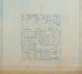
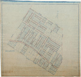
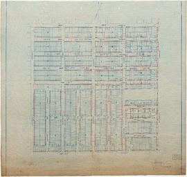
Part of D.L. [District Lot] 185
Water service map of South Vancouver : Ash Street to Ontario Street and 61st Avenue (59th Avenue) to River Avenue (Marine Drive)
Water service map of South Vancouver : Bridge Street (Cambie Street) to Main Street and 16th Avenue to 26th Avenue
Water service map of South Vancouver : Ontario Street to Fraser Street and King Edward Avenue to 34th Avenue (33rd Avenue)
Water service map of South Vancouver : Fraser Street to Knight Street and 25th Avenue to 34th Avenue (33rd Avenue)
Water service map of South Vancouver : Knight Street to Commercial Street and 15th Avenue (16th Avenue) to 22nd Avenue
Water service map of South Vancouver : Commercial Street to Nanaimo Street and Trout Lake to 27th Avenue
Water service map of South Vancouver : Knight Street to Victoria Drive and 22nd Avenue to 34th Ave (33rd Avenue)
Water service map of South Vancouver : Victoria Drive to Slocan Street and 27th Avenue to 35th Avenue (34th Avenue)
Water service map of South Vancouver : Slocan Street to Rupert Street and Vanness Avenue to School Road (School Avenue)
Water service map of South Vancouver : Rupert Street to Tyne Street and Vanness Avenue to School Road (School Avenue)
Water service map of South Vancouver : Wales Street to Churchill Street (Rupert Street) and New Westminster Road (Kingsway) to 46th Avenue (45th Avenue)
Water service map of South Vancouver : Churchill Street (Rupert Street) to Tyne Street and School Road (School Avenue) to 46th Avenue (45th Avenue)
Water service map of South Vancouver : Tyne Street to Park Street (Boundary Road) and Vanness Avenue to 46th Avenue (45th Avenue)
Water service map of South Vancouver : area bounded by Vanness Avenue, Government Street (29th Avenue), and McHardy Street
Water service map of South Vancouver : McHardy Street to Park Street (Boundary Road) and Government Street (29th Avenue) to Vanness Avenue
Water service map of South Vancouver : Victoria Drive to Wales Street and 35th Avenue (34th Avenue) to 46th Avenue (45th Avenue)
Water service map of South Vancouver : Knight Street to Victoria Drive and 34th Avenue (33rd Avenue) to 43rd Avenue (41st Avenue)
Water service map of South Vancouver : Fraser Street to Knight Street and 34th Avenue (33rd Avenue) to 43rd Avenue (41st Avenue)
Water service map of South Vancouver : Ontario Street to Fraser Street and 33rd Avenue to 41st Avenue
Water service map of South Vancouver : Ontario Street to Fraser Street and 43rd Avenue (41st Avenue) to 51st Avenue (49th Avenue)
Water service map of South Vancouver : Fraser Street to Sherbrooke Street and 43rd Avenue (41st Avenue) to 51st Avenue (49th Avenue)
Water service map of South Vancouver : Knight Street to Victoria Drive and 43rd Avenue (41st Avenue) to 51st Avenue (49th Avenue)
Water service map of South Vancouver : Victoria Drive to Vivian Street and 46th Avenue (45th Avenue) to 56th Avenue (54th Avenue)
Water service map of South Vancouver : Vivian Street to Kerr Street and 46th Avenue (45th Avenue) to 56th Avenue (54th Avenue)
Water service map of South Vancouver : Kerr Street to Tyne Street and 46th Avenue (45th Avenue) to 56th Avenue (54th Avenue)
Water service map of South Vancouver : Tyne Street to Park Street (Boundary Road) and 46th Avenue (45th Avenue) to 56th Avenue (54th Avenue)
Water service map of South Vancouver : Ontario Street to Fraser Street and 51st Avenue (49th Avenue) to 61st Avenue (59th Avenue)
Water service map of South Vancouver : Fraser Street to Knight Street and 51st Avenue (49th Avenue) to 61st Avenue (59th Avenue)
Water service map of South Vancouver : Knight Street to Victoria Drive and 51st Avenue (49th Avenue) to 61st Avenue (59th Avenue)
Water service map of South Vancouver : Doman Street to Park Street (Boundary Road) and 67th Avenue (65th Avenue) to North Arm of Fraser River
Water service map of South Vancouver : Fraser Street to Knight Street and 61st Avenue (59th Avenue) to North Arm of Fraser River
Water service map of South Vancouver : Kerr Street to Tyne Street and 56th Avenue (54th Avenue) to 67th Avenue (65th Avenue)
Water service map of South Vancouver : Knight Street to Victoria Drive and 61st Avenue (59th Avenue) to North Arm of Fraser River
Water service map of South Vancouver : Ontario Street to Fraser Street and 61st Avenue (59th Avenue) to River Street (Marine Drive S.E.)
Water service map of South Vancouver : Ontario Street to Fraser Street and River Avenue (Marine Drive) to North Arm of Fraser River
Water service map of South Vancouver : Point Grey boundary to Ontario Street and River Avenue (Marine Drive S.W.) to North Arm of Fraser River


![D.L. [District Lot] 526](/uploads/r/null/c/b/4/cb45fc2541156cf0f1c89b637733e961198017ddd4aa199ba866f1150856a8ba/dfb19024-a115-4097-9258-559e228c275d-MAP332_142.jpg)


![Part of D.L. [District Lot] 185](/uploads/r/null/d/0/2/d020a729408b2c6caa3fc78d706b687230bf429554ef426ba4dc104ce23d48d6/dbf9611e-8fed-4827-b82a-7e29f4922fc3-MAP904_142.jpg)