![[Robert Scott family assembled outside residence at southwest corner of Nicola and Davie Streets]](/uploads/r/null/1/8/189aaad4946182b7eeec06400f0d76172d477f9c26946b50a84987e0140e75bb/e6310d2f-866d-43c2-bdc6-14cb613a22d3-A04267_142.jpg)
[Robert Scott family assembled outside residence at southwest corner of Nicola and Davie Streets]
- AM54-S4-: SGN 361
- Item
- [189-?]
Part of Major Matthews collection
J.S. Matthews' notes with print or negative in Archives.
901 results with digital objects Show results with digital objects
[Robert Scott family assembled outside residence at southwest corner of Nicola and Davie Streets]
Part of Major Matthews collection
J.S. Matthews' notes with print or negative in Archives.
![[Robert Scott family assembled outside residence at southwest corner of Nicola and Davie Streets]](/uploads/r/null/0/5/057f36452a42e127bab2179338e7c6469a469c54113a016496a583bf53e26e67/720e61c2-507c-4cfb-b888-2e47d39e3f13-A04266_142.jpg)
[Robert Scott family assembled outside residence at southwest corner of Nicola and Davie Streets]
Part of Major Matthews collection
J.S. Matthews' notes with print or negative in Archives.
![[Group assembled on front porch of John Linn's cottage, Lynn Creek]](/uploads/r/null/7/9/79c583ab349dd02d284835ea791b850b6452713c5c86d2d62aeea290f47f2109/44b9ea1c-b001-405e-b0e0-098ae164a80b-A04263_142.jpg)
[Group assembled on front porch of John Linn's cottage, Lynn Creek]
Part of Major Matthews collection
J.S. Matthews' notes with print or negative in Archives.
![[Young women with bicycles at southwest corner of Mayor Fred Cope residence, 1100 Haro Street]](/uploads/r/null/7/a/7abc16c99cfd2e3a160d780d8eb99e826fbeb863717bd6e729ecccf3c0d26da8/185fce70-6c00-46c3-858d-bb7b60f4d572-A04257_142.jpg)
[Young women with bicycles at southwest corner of Mayor Fred Cope residence, 1100 Haro Street]
Part of Major Matthews collection
J.S. Matthews' notes with print or negative in Archives.
![[Young women with bicycles at front steps of Mayor Fred Cope residence, 1100 Haro Street]](/uploads/r/null/1/b/1b45fe5d475fde43cced7612bbea5c0356b150a66b1e701d18ff0c5013b16bd6/014121c8-6ab1-4634-a958-24dbfe43f507-A04256_142.jpg)
[Young women with bicycles at front steps of Mayor Fred Cope residence, 1100 Haro Street]
Part of Major Matthews collection
J.S. Matthews' notes with print or negative in Archives.
![[Mayor Fred Cope residence, 1100 Haro Street]](/uploads/r/null/4/c/4c698d4faedd1a2b90d8fb2374e782453bd35d31f379705f633b3f213235cea6/87551e4c-ddb1-4b65-8b88-3a042428b8b8-A04255_142.jpg)
[Mayor Fred Cope residence, 1100 Haro Street]
Part of Major Matthews collection
Photograph shows boy with dog, and young women with bicycles at fence in front of house. J.S. Matthews' notes with print or negative in Archives.
![[Cottages and tents on Tom Turner's orchard, Moodyville (North Vancouver)]](/uploads/r/null/6/8/683da6a67284b30c0d1254a5823def9cea25b87fd83c42cf9c59e7dfdf950c9e/750d8631-e02b-4cde-95bf-ba9a7583e578-A04254_142.jpg)
[Cottages and tents on Tom Turner's orchard, Moodyville (North Vancouver)]
Part of Major Matthews collection
J.S. Matthews' notes with print or negative in Archives.
![[C.W. Campbell residence at 2114 Westminster Avenue (Main Street), between 6th and 7th Avenues]](/uploads/r/null/e/7/e71717d17127568a2a036f52781e2f8c596073cb42d346581cbaf55d3d78caf1/c038d6d2-156e-4d95-b5b7-35c9d08daacb-A04204_142.jpg)
[C.W. Campbell residence at 2114 Westminster Avenue (Main Street), between 6th and 7th Avenues]
Part of Major Matthews collection
J.S. Matthews' notes with print or negative in Archives.
![[Group of men and women assembled on porch of Capilano Canyon Cottage]](/uploads/r/null/5/1/51775b9932ca777c2f33b55c935b3a27cd60e929e2f6712dddd4d3b714043537/3042ed53-bcfc-4c48-87e3-b52535e9c763-A04034_142.jpg)
[Group of men and women assembled on porch of Capilano Canyon Cottage]
Part of Major Matthews collection
J.S. Matthews' notes with print or negative in Archives.
![[Mr. and Mrs. Dagliesh and guests outside Dagliesh residence at Jericho]](/uploads/r/null/2/b/2bb7058769b06ca8d35774d11aee5f67fe776af9b7dbe5ae4e5e1c64cc91ce43/9fc5b3cc-4995-4519-9cff-06ac360c4302-A04064_142.jpg)
[Mr. and Mrs. Dagliesh and guests outside Dagliesh residence at Jericho]
Part of Major Matthews collection
J.S. Matthews' notes with print and negative in Archives.

Part of Major Matthews collection
![[View of 2100 block of 48th Avenue, looking east towards Maple Street]](/uploads/r/null/7/6/7601ca1c463ba34136368f381728eb60e4b1654aab784cb1b14057b9c887f9ef/79d2a9c7-d06a-46f6-a405-3975b0e281d5-A08577_142.jpg)
[View of 2100 block of 48th Avenue, looking east towards Maple Street]
Part of Major Matthews collection
Photograph shows houses, a pile of split logs at the side of the road, and King George V High School (Magee High School) in the distance. J.S. Matthews' notes with print or negative in Archives.
![[Power lines and supporting structure in lane west of Main Street at Pender Street]](/uploads/r/null/1/c/1c402846680276f8837a24aa94a8689864e33938fe4fff21e84db6f711131eb2/cc8097b0-7bcc-4321-9ea5-70b1f3dcb346-A08574_142.jpg)
[Power lines and supporting structure in lane west of Main Street at Pender Street]
Part of Major Matthews collection
Photograph shows power lines, houses with businesses operating on ground floors, and a portion of the City Hall building.
![[Newly installed power poles at the southeast corner of Hastings and Burrard Streets]](/uploads/r/null/2/1/21a14b92f356d106984357441958c60b9e3f5f02390531dc44ea911a99911d7a/576ada4a-2119-4094-820f-7973a7f08be4-A08571_142.jpg)
[Newly installed power poles at the southeast corner of Hastings and Burrard Streets]
Part of Major Matthews collection
Photograph shows power poles, planks over muddy road, and the Townley residence on the corner.
![[Power poles and pruned trees on Burrard Street near Pender Street]](/uploads/r/null/f/e/feb1326600fa4a48804a78083dbcc8fd8f6323a2548084c970e2b2da9bba3652/a9d92e6d-cea0-4288-88ed-a672f8e0d82b-A08568_142.jpg)
[Power poles and pruned trees on Burrard Street near Pender Street]
Part of Major Matthews collection
![[Newly installed power poles at Burrard and Haro Streets]](/uploads/r/null/6/2/625b21683a14eeaf7ff8491abb8d63453009dde335fb0ef368a892e0d3396d07/a8fcfc25-fd17-4061-9f0a-3a4c89451bc4-A08567_142.jpg)
[Newly installed power poles at Burrard and Haro Streets]
Part of Major Matthews collection
![[View of Burrard Street, looking southwest from near Davie Street]](/uploads/r/null/3/3/336c7adb20b44fa804f4bcafa3cf5aa3921043699382306456b7f780465ea510/c820f628-9898-42b9-84ed-cee1179bdcaf-A08563_142.jpg)
[View of Burrard Street, looking southwest from near Davie Street]
Part of Major Matthews collection
Photograph shows power lines, houses, and the Burrard Court apartment building at 1237 Burrard Street.
![[Partially constructed Timms residence at Langley Prairie]](/uploads/r/null/b/9/b9619d433f5518331527ac1485ea93af42fe05ac5614cce695bd5be84835ca7c/e221b38f-247a-405b-ada5-a53f0f470fb6-A08502_142.jpg)
[Partially constructed Timms residence at Langley Prairie]
Part of Major Matthews collection

Hope farm, Grenfell. O.P. Skrine, prop.
Part of Major Matthews collection
Photograph shows piles of hay, and cows in pen.

Part of Major Matthews collection

Part of Major Matthews collection
Photograph shows Mrs.Hutson, Victor, Constance (Mrs. Watret) and Eva Hutson.

Part of Vancouver, B.C. from Hotel Vancouver
Part of Major Matthews collection
Photograph shows the east side of the 600 Block of Granville Street including the New York Block and a liquor store and beyond to the Homer Street Methodist Church, the tower of Holy Rosary Cathedral and houses
![[Exterior of the Swain Sherdahl residence at 2928 Westminster Road (Kingsway)]](/uploads/r/null/7/e/7ead5fa92276ff04cdc318db0ab0263ab927e9fef04a00b3b02c2c8636d8e3e3/01b2efcd-8fe4-43ab-b0a9-94e3bbf75e34-A25203_142.jpg)
[Exterior of the Swain Sherdahl residence at 2928 Westminster Road (Kingsway)]
Part of Major Matthews collection

Vancouver, B.C. From Secord House Powell Street
Part of Major Matthews collection
Photograph shows a view of Powell Street looking west from Dunlevy Avenue
![[Looking north from 7th Avenue just east of Westminster Avenue (Main Street)]](/uploads/r/null/a/2/a254d0b13dafd1500646484021aec162d8fcf41bb6e460aa891e47fd448eed5d/81240ffe-d184-44b8-99ef-2212ad8ad1f1-A63058_142.jpg)
[Looking north from 7th Avenue just east of Westminster Avenue (Main Street)]
Part of Major Matthews collection
Photograph shows part of Mount Pleasant and False Creek, the Westminster Avenue Trestle Bridge and the East End in the background
![[Looking north from 7th Avenue just east of Westminster Avenue (Main Street)]](/uploads/r/null/5/b/5b54f0714ca18d5fa482e133d5dcd9961611386d95b970a21042a150d968714c/ccca5eed-76c4-4397-b2f4-2bf9fa9ace1d-A63057_142.jpg)
[Looking north from 7th Avenue just east of Westminster Avenue (Main Street)]
Part of Major Matthews collection
Photograph shows part of Mount Pleasant and False Creek, a streetcar in motion, a woman pushing a pram and Downtown in the background
Vancouver, B.C. From Secord House Powell Street
Part of Major Matthews collection
Photograph shows a view of Powell Street looking west from Dunlevy Avenue
![[Looking northwest from the Hotel Vancouver on the corner of Granville Street and Georgia Street]](/uploads/r/null/9/8/9864289b1cd445066eff4d7163af7b918370b915696b6164203d8de52e84de2b/cb327b8f-bb17-4a4b-9382-1b2aeb38e8ea-A37111_142.jpg)
[Looking northwest from the Hotel Vancouver on the corner of Granville Street and Georgia Street]
Part of Major Matthews collection
Photograph shows a view of the west side of the 600 Block Howe Street including the East India Tea Company building and Manor House
![[A portion of No. 10, New Conduit Street - Vancouver House]](/uploads/r/null/f/5/f5229faf7bed8f314f22319a71fbb3a460f82bf5f42bb4e7ccf8eabf412bfba6/dd686944-b484-449b-9dac-17a9f636c39b-A62198_142.jpg)
[A portion of No. 10, New Conduit Street - Vancouver House]
Part of Major Matthews collection
![[View across the Fraser River of] New Westminster, B.C.](/uploads/r/null/9/1/919edbe4dff632d0de4fe88561b797aa61a7a10916eae3e65af0fbe91c280dc5/b46b183a-dd0f-45da-81cf-81dd99e5447c-A31733_142.jpg)
[View across the Fraser River of] New Westminster, B.C.
Part of Major Matthews collection
![[View of Powell Street looking west from Dunlevy Avenue]](/uploads/r/null/0/2/025a191743e9f026aa21c885b1db04f179b334d371085718a88f547145e2178d/e5acc4f5-8a78-4e33-b7c6-70d4b8091d3a-A37037_142.jpg)
[View of Powell Street looking west from Dunlevy Avenue]
Part of Major Matthews collection

Vancouver, B.C. From Secord House Powell Street
Part of Major Matthews collection
Photograph shows a view of Powell Street looking west from Dunlevy Avenue. It is a composite photograph that includes the images from Str P74.1 and Str P74.2
![Vancouver, B.C. from Mt. Pleasant (Panorama view) [from Scotia Street and Sixth Avenue]](/uploads/r/null/7/2/72b78a8eafd51df2fbf51d5827543e2e56d582516dc35b844563392b9d5f2ca4/605b2909-96fb-483b-b5b7-d3665dd80ae3-A26630_142.jpg)
Vancouver, B.C. from Mt. Pleasant (Panorama view) [from Scotia Street and Sixth Avenue]
Part of Major Matthews collection
Photograph shows a view of Strathcona and Strathcona School across False Creek from Mount Pleasant.
![[Stanley Park Ranger's House]](/uploads/r/null/c/a/7/ca76e43baf02f87af3eb7686eead45fed45744f91c04897ddce711c7551864b9/d46f4fe1-bcca-4ae0-90be-8fed8dd2cc5b-VLP160_142.jpg)
Part of Major Matthews collection
Photograph shows the Beach Avenue entrance to the Park Ranger's house
![[View of the Burrard Bridge from Pacific Street near Thurlow Street]](/uploads/r/null/f/5/c/f5c4b5cd8e6d6316ba4112ac05f874e1c6c6a334f3f82a2921d6cfc8fea51fc8/d87a2798-5154-4d31-8aa8-2b0bb12df837-CVA371-2979_142.jpg)
[View of the Burrard Bridge from Pacific Street near Thurlow Street]
Part of Major Matthews collection
Photograph shows a view looking southeast including industrial buildings in Yaletown and squatters shacks on the water at the southwest end of the bridge
![[A group in front of the McCleery farmhouse]](/uploads/r/null/1/b/1b7671b0834408e07b06ffab7bf2fd3190277542e278134650f02e0d1eaef232/1e838876-3935-450d-987a-31b25f0db896-A70992_142.jpg)
[A group in front of the McCleery farmhouse]
Part of Major Matthews collection
![[Water Street looking east]](/uploads/r/null/a/a/aa7471c1bf02200206eb9a72517253836fa47fffd41bcf9eb126a2731d55e47a/70d184f9-4365-4cfd-b035-e7b650b8a3f4-A57251_142.jpg)
Part of Major Matthews collection
Photograph shows the residences of Isaac John and Ainsley Moaut and other buildings prior to the Great Fire
![[View of West Georgia Street, looking east from Westcoast Building - 1333 West Georgia Street]](/uploads/r/null/2/f/2f051029a06f3da804e0ee4562608ff99e4d008b93d9361ba340d330287ad41d/fcbc17ae-9098-4521-a93d-60b9a3383ce8-A25259_142.jpg)
[View of West Georgia Street, looking east from Westcoast Building - 1333 West Georgia Street]
Part of Major Matthews collection
Photograph shows the Elbow Room Cafe/ Restaurant on Jervis Street
![[Exterior of 240 East 5th Avenue (formerly Pete Ryder's residence)]](/uploads/r/null/a/6/a6ed615974b00ec80459af6e90f09637296f0b2fc93277cfd5b494ff04bd9045/5c5fb971-d137-40cd-914a-e17678c50bf8-A62549_142.jpg)
[Exterior of 240 East 5th Avenue (formerly Pete Ryder's residence)]
Part of Major Matthews collection
![[Broadway Falls on Ninth Avenue (Broadway) and Heather Street]](/uploads/r/null/3/b/3bd12cc7393a9e63a80f8bffec1460b89537a74c4382fa69e0152a7bbe619a2c/06a74528-9121-451c-a01d-c1c636a85878-A63051_142.jpg)
[Broadway Falls on Ninth Avenue (Broadway) and Heather Street]
Part of Major Matthews collection
Photograph shows flood water from the Heather Street Creek

Part of Major Matthews collection
Photograph shows a view looking northeast from Kingsway and Joyce Road (Street) including the firehall on the grounds of Carton School
![[Exterior of house (formerly a school) at 325 East Broadway]](/uploads/r/null/a/a/aa09fd3013970d19de8470c2d0906fd872c0fa47935c2b4178eeafb72da27be5/a61e72a9-548a-4f4a-9723-f92078cc7967-A62534_142.jpg)
[Exterior of house (formerly a school) at 325 East Broadway]
Part of Major Matthews collection
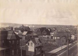
![[Birdseye view of Vancouver looking west from tower of Holy Rosary Church]](/uploads/r/null/8/b/8ba30bd143bea50a4cba9840441cbd8ea6df9c0808c16573db4e24f546a0df2a/2bed08d5-bb8c-4280-abfb-c3d97b2eaf5a-A26604_142.jpg)
[Birdseye view of Vancouver looking west from tower of Holy Rosary Church]
Part of Major Matthews collection
Photograph shows the 600 block of Semour and the 600 block of Georgia Street. Photograph shows the Waverly Hotel (600 Georgia) [701 Seymour] Stanley Park Livery Stables (600 Georgia), Strathcona Block (618 Georgia), Vancouver Opera House (759 Granville), first Hotel Vancouver, Hudson's Bay Co. Building and Christ Church.
![[Vancouver, B.C. from Market [Hall]](/uploads/r/null/8/4/846e786f278efbf24b5ab19dae2e631155ff2cb08300c6f1124eaf55a43862a3/10d78288-46b3-4beb-8d15-480ecf831e96-A61733_142.jpg)
[Vancouver, B.C. from Market [Hall]
Part of Major Matthews collection
Photograph shows Hastings Street looking west from Westminster Avenue (Main Street)
![[Northern view of Fairview from the tower of King Edward High School on 12th Avenue and Oak Street]](/uploads/r/null/b/c/bc4f34ad9aa5a5bc18dec6ca7832786f8b77217c3729cf25944c96705a9e416a/32c6ae21-a7bc-452c-89be-9f78d8c1067f-A43282_142.jpg)
[Northern view of Fairview from the tower of King Edward High School on 12th Avenue and Oak Street]
Part of Major Matthews collection
Photograph shows False Creek and Yaletown, with the first Granville Street Bridge and Burrard railway trestle in the background.
![[Eastern view from the tower of King Edward High School on 12th Avenue and Oak Street]](/uploads/r/null/6/4/64f31f7061366669863378ac44af64ca28593268ca45c2a6b55a3de95c9e9598/a20f13db-f76e-40b2-b4a2-4ebf751752c7-A47182_142.jpg)
[Eastern view from the tower of King Edward High School on 12th Avenue and Oak Street]
Part of Major Matthews collection
Photograph shows the eastern part of Fairview, with the first Cambie Street bridge in the foreground and the Main Street trestle in the background.

New Highway - Clark Drive to Nanaimo Street - route looking east from Commercial Drive
Part of Major Matthews collection

Diagonal connection of 6th Avenue to McLean Drive - view looking east from 6th Avenue
Part of Major Matthews collection
![[A group of unidentified women on the steps of Phillip Wadsworth's house]](/uploads/r/null/4/0/40769531471077a2fe7964703d047f7830df25781445fe1dbc77e055f5154c07/f9b3f37a-4183-48e0-9c7d-5bcf93434234-A61604_142.jpg)
[A group of unidentified women on the steps of Phillip Wadsworth's house]
Part of Major Matthews collection
Photograph shows A.B. Forrest in a horse-drawn buggy
![[A.B. Forrest and his wife in front of their house on the corner of Renfrew Street and 1st Avenue]](/uploads/r/null/d/4/d4a160902c78dfaa06c0edde1b9337d28b1c27251fb8fbb98d3e706e4d74ad8c/46098405-4fe0-45f1-9ad7-74776aaa6ce9-A61601_142.jpg)
[A.B. Forrest and his wife in front of their house on the corner of Renfrew Street and 1st Avenue]
Part of Major Matthews collection