![[North tower of the Lions gate Bridge under construction]](/uploads/r/null/8/7/87fd6a4a0b9740d310bba6a7128b806ff0b78916ab1e048103b5133560556e4f/f68fb15d-d405-43ca-94cb-ac1c44d8c457-A71772_142.jpg)
[North tower of the Lions gate Bridge under construction]
- AM1376-: CVA 1376-683
- Item
- 1938
447 results with digital objects Show results with digital objects
[North tower of the Lions gate Bridge under construction]
![[Unidentified group at] British Properties](/uploads/r/null/6/4/649c09b7874a8802db7c9700c43158e85fe1fe930daacbccdca318ac46733fba/c9fae0f9-7428-4fca-a002-a4dfc66cf2b7-A71800_142.jpg)
[Unidentified group at] British Properties
Dial map of the city of Vancouver including the adjacent municipalities
Part of City of Vancouver Archives technical and cartographic drawing collection
Item is a street map showing Vancouver, Burnaby, New Westminster, West Vancouver and North Vancouver on one side and the University Endowment Lands, Surrey, Maillardville, Lulu Island and Sea Island on the other.
![[View from British Pacific Properties during visit of King George VI and Queen Elizabeth]](/uploads/r/null/e/a/ea62ab5283cf3a0693fa30300b8ea481c8086b0183da0e7d8b9fe8a43a33c370/3a240a9a-b031-432e-b52c-b4825e304b0a-CVA6-245_142.jpg)
[View from British Pacific Properties during visit of King George VI and Queen Elizabeth]
Part of Vancouver Committee for the Reception of their Majesties fonds

Part of Vancouver Committee for the Reception of their Majesties fonds
![[Queen Elizabeth, King George VI and Mayor Lyle J. Telford]](/uploads/r/null/2/b/2b63dbe36bb3b6440ec4f54a35d16820ecf2dd500123f3d06aed09d745a80607/a70ac8d2-00bb-46a1-97e6-0f2e47b7372d-A19871_142.jpg)
[Queen Elizabeth, King George VI and Mayor Lyle J. Telford]
Part of Vancouver Committee for the Reception of their Majesties fonds
![[Queen Elizabeth taking walk with R.C.M.P. escort]](/uploads/r/null/6/e/6e5de748daa526d27292c81df95c3f0202b75dd381cddbe59407d1ce9c0d33ca/4b057c47-eede-4c08-bfd4-4a26234110c8-A19870_142.jpg)
[Queen Elizabeth taking walk with R.C.M.P. escort]
Part of Vancouver Committee for the Reception of their Majesties fonds
![[View from British Pacific Properties during visit of King George VI and Queen Elizabeth]](/uploads/r/null/f/3/f3a033a56ba9e02a1c22a51c06b91ac363996ca4f23e112c0edfdf38cba4f1bf/fd855502-b55f-4861-8a58-42c93f7ed1c7-A19872_142.jpg)
[View from British Pacific Properties during visit of King George VI and Queen Elizabeth]
Part of Vancouver Committee for the Reception of their Majesties fonds
![[View from British Pacific Properties during visit of King George VI and Queen Elizabeth]](/uploads/r/null/7/e/7ed5f0c07fd377994b9c6c0b0333a8542f60bdbec965ca86617e71f09004961c/54ee6dcb-5dba-4172-9556-41f535c3f696-A19874_142.jpg)
[View from British Pacific Properties during visit of King George VI and Queen Elizabeth]
Part of Vancouver Committee for the Reception of their Majesties fonds
![[View from British Pacific Properties during visit of King George VI and Queen Elizabeth]](/uploads/r/null/b/d/bd3d993fae0d90862d7652125cbf60bfa3bd98630abee29651242db56224a044/9c8ab72f-79e2-4dad-b66c-ce098c3804bf-A19875_142.jpg)
[View from British Pacific Properties during visit of King George VI and Queen Elizabeth]
Part of Vancouver Committee for the Reception of their Majesties fonds
![[View from British Pacific Properties during visit of King George VI and Queen Elizabeth]](/uploads/r/null/3/2/3288b9abdc4e3b37ad98c5d82e312d9e8ca22538f405765abd6358273c21ce18/148b0946-a6d7-4343-b989-b10b7c260115-A19876_142.jpg)
[View from British Pacific Properties during visit of King George VI and Queen Elizabeth]
Part of Vancouver Committee for the Reception of their Majesties fonds
![[View from British Pacific Properties during visit of King George VI and Queen Elizabeth]](/uploads/r/null/4/6/4611b15e29741504a5b0cc5bb09a274b0c3fca7866e494568dc0a054615ac648/0c467146-8eaf-4659-8a98-3b72fb9236b9-A19877_142.jpg)
[View from British Pacific Properties during visit of King George VI and Queen Elizabeth]
Part of Vancouver Committee for the Reception of their Majesties fonds
Photograph shows the Lions Gate Bridge and Stanley Park in the background
![[View from British Pacific Properties during visit of King George VI and Queen Elizabeth]](/uploads/r/null/a/6/a63e4ae87cfefb0038eef431016b942045fb5c0d5981d094f722318eb5cd877b/cd14e755-5205-4cec-aca8-b74a27509ff6-A19878_142.jpg)
[View from British Pacific Properties during visit of King George VI and Queen Elizabeth]
Part of Vancouver Committee for the Reception of their Majesties fonds
Photograph shows the Lions Gate Bridge and Stanley Park in the background
![[View from British Pacific Properties during visit of King George VI and Queen Elizabeth]](/uploads/r/null/5/1/51a879171f50816dbf39a3c531a1a39c20d08507a04d59da0543678e7e015fd5/5b488add-29c0-4115-93e9-fa3bbbb903f2-A19879_142.jpg)
[View from British Pacific Properties during visit of King George VI and Queen Elizabeth]
Part of Vancouver Committee for the Reception of their Majesties fonds
Photograph shows the Lions Gate Bridge and Stanley Park in the background
![[View from British Pacific Properties during visit of King George VI and Queen Elizabeth]](/uploads/r/null/3/1/31672d1fde01e4a3ff52cd1efe318d3e2f951f4ee0a51c4dad8b7c3acf9650d8/ef74c6f3-0dda-43e5-87b8-11220bb1a373-A19880_142.jpg)
[View from British Pacific Properties during visit of King George VI and Queen Elizabeth]
Part of Vancouver Committee for the Reception of their Majesties fonds
![[View of Howe Sound from West Vancouver]](/uploads/r/null/6/4/649341c49f83c72c9ccc5752e4c240ed18f92e388317fd2b92d6ea158284ac0e/b8fa4789-0f52-40e6-9c28-3e7d116bf973-A36138_142.jpg)
[View of Howe Sound from West Vancouver]
Part of James Luke Quiney fonds

Aerial photograph showing unidentified cannery in West Vancouver

Municipal Hall, West Vancouver, B.C.
Part of Stuart Thomson fonds
Map of West Vancouver and vicinity : verso
Part of City of Vancouver Archives technical and cartographic drawing collection
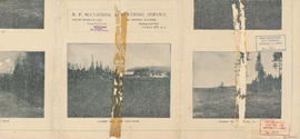
Part contains promotional images of West Vancouver and an advertisement for R.P. Matheson Advertising Service.
![[Looking east towards Prospect Point]](/uploads/r/null/3/5/353b1aa08c35d1d8b5089e30dbf1e7cbd7be47afb7288ca95f34e01df15f3530/0799ffa0-869e-459b-8fdc-d783d59aef7c-A49523_142.jpg)
[Looking east towards Prospect Point]
Part of Major Matthews collection
Part of Stuart Thomson fonds

Part of Stuart Thomson fonds

Dial map of Greater Vancouver and suburbs
Part of City of Vancouver Archives technical and cartographic drawing collection
Part contains a street map of Vancouver, Burnaby, New Westminster, West Vancouver, and North Vancouver showing railways, hospitals, parks and block numbers. The map includes two dials (numbered circles, paper indicators, a grid of block numbers and a street index used to find locations).

Dial map of Greater Vancouver and suburbs
Part of City of Vancouver Archives technical and cartographic drawing collection
Part contains a street map of Vancouver, Burnaby, New Westminster, West Vancouver and North Vancouver showing block numbers, street car, bus, and railway lines, parks and hospitals. Map includes two dials (a numbered circle, a paper indicator, a grid of block numbers and a street index used to find locations). A small inset map shows the Capitol Hill/Scenic Park area of Burnaby in greater detail.

Map of West Vancouver and vicinity
Part of City of Vancouver Archives technical and cartographic drawing collection
Part contains a map of West Vancouver, North Vancouver, and the northern parts of Vancouver and Burnaby. Map shows district lot and block numbers, streets, and distances from City Hall.
Part of City of Vancouver Archives technical and cartographic drawing collection
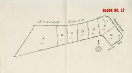
Item is a map depicting the area of the British Properties development bordered by Stevens Drive and Hadden Drive near Eastcot Road.

Plan of West Vancouver Municipality
Part of City of Vancouver Archives technical and cartographic drawing collection
Item is a map showing land subdivisions in West Vancouver, and annotated by J. S. Matthews with historic names and locations. A small key map shows the location covered by the primary map in relation to the rest of the Lower Mainland.

Plan of part of West Vancouver District
Part of City of Vancouver Archives technical and cartographic drawing collection
Item is a map of part of West Vancouver District that covers Altamont Station, Marine Drive, 9th Street and Queens Street. Map shows district lot, block, and some lot numbers.
![[View of Bowen Island from Cliffhouse at Whytecliff Park]](/uploads/r/null/0/6/06b4ec54ef6abcc4c2c05e0970a98acaa62decad87061759fa275e28fbed49e8/8321e48c-0853-43d3-b2f4-4a50bf02bafb-A47136_142.jpg)
[View of Bowen Island from Cliffhouse at Whytecliff Park]
![[Verandah restaurant at Cliffhouse]](/uploads/r/null/2/2/22f8ec8243b49396d301a42224fb2f68f321872ada350ca314bd3256fea35870/207df82d-811a-497c-a979-d3a8b970c6cd-A69402_142.jpg)
[Verandah restaurant at Cliffhouse]
![[Ferry launch "Bowen" leaving Whytecliff dock]](/uploads/r/null/d/f/df382b078cfe01c8216f474845d75dcbf77fe8cb6ed45ebdcc0feb094476c99a/319f266b-0fd3-49dd-9c05-20c6d32fb3ec-A49845_142.jpg)
[Ferry launch "Bowen" leaving Whytecliff dock]
Photograph shows Standard Oil filling station on a R.C.A.F. raft
![[Dock at Whytecliff Park]](/uploads/r/null/9/0/90a5c7170cd4d24785e328b5888e4b943e290205ee4f6bbfe41f0421686d55aa/81e6b9d0-cad0-400e-b5e4-bdcbd0df35ec-A47238_142.jpg)
![[View of] Great Northern Cannery [from Marine Drive]](/uploads/r/null/d/b/db609d6daff2c0c92d795bec6133f0a2ca6a1afd6f8b1d044d7da52d411072fa/da3c5096-acc2-43b1-9346-c9f2bd8c7ce4-A76303_142.jpg)
[View of] Great Northern Cannery [from Marine Drive]
Part of James Crookall fonds
Part of Hubert William Lovell fonds
Photograph was taken in the summer.

Point Atkinson lighthouse, foghorn
Part of Hubert William Lovell fonds
Photograph was taken in the summer.

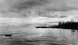
West Vancouver coast from Point Atkinson
Part of Hubert William Lovell fonds
Photograph was taken in the summer.
![Station stop at Caulfeild, West Vancouver on the P[acific].G[reat].E[astern]. [Railway] to Horses...](/uploads/r/null/5/0/50feab3a582e4e8d5c131bbc00895f73a3dd2439b90ff90553b89c0ab11136a3/c1c92217-6dc9-4091-8fb0-d73e31f09ebc-CVA258-35_142.jpg)
Part of Hubert William Lovell fonds
Photograph was taken in the summer.

Part of Hubert William Lovell fonds
Photograph was taken in the summer.

Eagle Harbour, old logging buildings
Part of Hubert William Lovell fonds
Photograph was taken in the summer.
Wild grouse, Point Atkinson trail
Part of Hubert William Lovell fonds
Photograph was taken in the summer.
![[View of a sailboat in the choppy waters of Burrard Inlet near the delta of the Capilano River]](/uploads/r/null/9/6/9673c050d4c95de7e6aa9d1e1951acf0e8be226d2bcf8f5628a5edcad0b88390/0a8ea4e5-2c9b-4d27-91d6-c2eb7f8c3d30-A75990_142.jpg)
[View of a sailboat in the choppy waters of Burrard Inlet near the delta of the Capilano River]
Part of James Crookall fonds
![[The "Empress of Asia" in Burrard Inlet near the mouth of the Capilano River]](/uploads/r/null/5/d/5d85404b45ef37512782d47088c91221702a514c596a36b3cbb189e5e1102ece/e8bbf500-02fb-47fa-b3e7-871038b715fb-A75993_142.jpg)
[The "Empress of Asia" in Burrard Inlet near the mouth of the Capilano River]
Part of James Crookall fonds
![[View from the Lions Gate Bridge of the mouth and delta of the Capilano River]](/uploads/r/null/3/6/36d7a3cda899110ea242541303521e6934274b2876797c95611f8709c01e0dc0/4a8ddffe-948b-48b5-9223-b8555f122e9f-A76099_142.jpg)
[View from the Lions Gate Bridge of the mouth and delta of the Capilano River]
Part of James Crookall fonds
Part of City of Vancouver Archives technical and cartographic drawing collection
Item is a street map showing Vancouver, Burnaby, New Westminster, West Vancouver, and North Vancouver on one side and the Lower Mainland from Vancouver to Chilliwack on the other. Item includes lists of businesses, schools, public buildings, hospitals, bathing beaches, fire halls, and golf and country clubs, as well as text advertising the products and services of the Dominion Map and Blueprint Company.
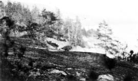
Looking north from east bank above Horseshoe Bay
Part of Samuel H. Logan fonds

Part of Samuel H. Logan fonds
Item is a photograph depicting a view of the Point Atkinson lighthouse taken from the rocks at rear, with Point Grey in the distance.
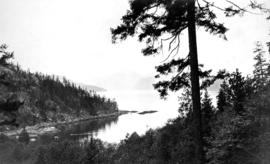
Looking west from North Vancouver towards Cypress Point Cannery
Part of Samuel H. Logan fonds
![G.N. [Great Northern] Cannery](/uploads/r/null/6/c/3/6c31502e8007cfa40e06d0d3460c9aebbb95be9f3684f1eb21b8c81616255466/f326f7a0-fbed-4573-b932-0fe4a715b4f0-CVA260-1194_142.jpg)
Part of James Crookall fonds

Aerial photo, oblique, Fisherman's cove with marinas, West Vancouver
Let's go see! Inside Vancouver
Part of City of Vancouver Archives technical and cartographic drawing collection
Item is a tourist brochure featuring information on attractions on the North Shore (North Vancouver and West Vancouver) and maps showing routes to the area.