Print preview Close

Showing 783 results

Archival description
City of Vancouver Archives technical and cartographic drawing collection Vancouver (B.C.)
Print preview View:

662 results with digital objects Show results with digital objects

City of Vancouver, British Columbia

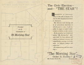
File contains 24 copies of line map 30 (and 10 ancillary maps) showing changes in wards via by-laws from 1886-1972. Base map shows streets, railways and parks. The ward or polling district boundaries established by each by-law are noted on the respective maps, with notes on the verso concerning the changes. A list of the maps showing the date and by-law number is included. The first 10 maps are stapled with ancillary 1972 comparison maps.

Stuart's pocket map of Vancouver, B.C.

Item is an illustrated map of the "old" City of Vancouver. The map shows streets, transportation, and significant businesses (such as C.P.R. wharves, smelter, Hastings Mill, Morse's Mill, C.P.R. Shops, City Hospital, sawmill, slaughter houses, and smallpox hospital). The map includes "Index of Streets, Government Offices, Churches, [etc.], including "Civic and other Principal Buildings", "Places of Amusement or Recreation", "Public Schools", "Principal Mills, Foundries and Manufactories", "Principle Bankers", Principal Hotels", and "Miscellaneous".

The map was designed to be folded into a cover, which is included.

Vancouver, British Columbia

Item is a map showing New Westminster Land District, including lands alienated or covered by application under the Land Act; surveyed timber leases, licences, or berths; Indian reserves; Government reserves; provincial forest boundaries; tree farm licences; municipality boundaries; and park boundaries. Includes a key plan of maps published in the same publisher's series and a reliability diagram noting data sources.

City of Vancouver : Canadian Pacific town site

Part contains four maps. The main map shows district lots and block numbers in Vancouver from Vine Street in the west to Boundary Avenue (Glen Drive) in the east and Stanley Park in the north to 9th Avenue (Broadway) in the south. Three smaller maps include an index plan to district lots in Vancouver, South Vancouver, New Westminster, and Burnaby; a world map showing Canadian Pacific mail steamship lines; and an index plan of Vancouver city limits. Part has been annotated with text describing a June 1888 land clearance plan and hand colouring indicating clearance status.

Vancouver, British Columbia : northerly portion, former City of Vancouver : major street plan

Item is a map which has been removed from a copy of the report "A plan for the City of Vancouver, British Columbia, including Point Grey and South Vancouver and a general plan of the region", commissioned by the Vancouver Town Planning Commission from the planning consultants Harland Bartholomew & Associates.

The map shows the existing and proposed revisions to the major street plan in the northern portion of Vancouver. The map also shows present street widths, lines of vehicles and roadway widths versus proposed street widths, lines of vehicles and roadway widths.

Harland Bartholomew and Associates

Plan of provincial government property being a portion of townsite of Vancouver and sub-division of lot 540, group 1, New Westminster District, B.C., to be sold by public auction at Vancouver, B.C.

Item is a map showing lot numbers, lot boundaries, major streets and property sold or reserved in the area bounded by Campbell Street (Alma Street), present-day Trafalgar Street (unnamed on map), English Bay, and 16th Avenue.

[Sheet 82 : Main Street to Tipping Road and Crompton Street and Twigg Island to Southeast Marine Drive]

Item is a sectional map of a portion of Vancouver showing the area from Main Street to Tipping Road and Crompton Street and Twigg Island to Southeast Marine Drive. Includes streets, blocks, lots and legal descriptions, and the location of the Canadian Pacific Railway.

[Sheet 84 : Laurel Street to Main Street and North Arm of Fraser River to Southwest Marine Drive]

Item is a sectional map of a portion of Vancouver showing the area from Laurel Street to Main Street and North Arm of the Fraser River to Southwest Marine Drive. Includes streets, blocks, lots and legal descriptions, and the location of the Canadian Pacific Railway line and yard.

Vancouver

Item is a map showing land subdivision in the New Westminster District. The map shows lands alienated or covered by applications under the "Land Act"; surveyed timber leases, licences, and births; and Indian reserves; shows land district boundaries; park boundaries; provincial forest boundaries; forest management licences; and municipal boundaries.

The map appears to be based on the National Topographic Series 1:250,000 map 92G, with other data added.

Vancouver : spectacular by nature : official courtesy map

Primary map on recto shows major roads, hotels, travel apartments, parks, golf courses, gardens, recreational facilities, historical and cultural attractions, shopping centres and other places of interest in the downtown, Stanley Park, Kitsilano and Fairview areas. The map on verso shows similar details for Greater Vancouver (including West Vancouver, North Vancouver, Vancouver, Burnaby, Port Moody, Port Coquitlam, Coquitlam, Pitt Meadows, Maple Ridge, New Westminster, Langley, Surrey, Delta, Richmond and White Rock.

Selected park programs for additional park sites 1959-1976

Item is a map showing park programs for 1959-1976. Map was most likely created by the parks department and includes a legend depicting the following information: program A (7,200,000), program B (18,000,000), program C (28,800,000), potential major park sites from which additional acreage is to be selected for each program and existing park sites. The map shows locations selected for alternative programs and locations omitted from alternative programs. Map shows street names and extends from Boundary Road to Stanley Park to University Endowment Lands to Lulu Island.

Bus routes, city of Vancouver, November 26th, 1937

Item is a hand-drawn map showing additions to bus routes, proposed additions to bus routes, dates of bus route additions and miles of bus route additions in Vancouver. A November 26, 1937 edition of "The Buzzer" containing information on bus routes and a reproduction of the hand-drawn map has been affixed to the verso.

Visitors map of Vancouver

Part is the front sheet of an unfolded tourism brochure showing Vancouver tourist attractions, The sheet includes a map of downtown Vancouver, with transportation information, a map of the roads in Stanley Park, photographs and information on various sites and attractions in the city, as well as general promotional information.

Results 151 to 200 of 783