Guide to Vancouver
Guide to Vancouver

Plan showing polling divisions, City of Vancouver, B.C.

Schedule "A" : polling districts, City of Vancouver
Guide map. Vancouver-New Westminster. Burnaby and North Shore municipalities
Guide map. Vancouver-New Westminster. Burnaby and North Shore municipalities

Map cover
Vancouver, British Columbia, Canada
Vancouver, British Columbia, Canada

Warehouse and store sites : very centrally located

An Indian map. Vancouver

Map showing location of single women receiving assistance by mail

Map showing location of single men receiving assistance by mail
Map of Vancouver and Lower Mainland : avenue guide
Map of Vancouver and Lower Mainland : avenue guide
![[Vancouver, B.C. : district lots]](/uploads/r/null/4/a/4a5c15633319c3754d3aa0cc525470bfebcf5a98ad8caeedf44b777194f300bd/2f055d65-47f7-4679-bb91-66b8f1843d2f-MAP531_142.jpg)
[Vancouver, B.C. : district lots]

Second Narrows crossing

Panoramic view of the City of Vancouver, British Columbia, 1898
Map of Vancouver, B.C., and vicinity
Map of Vancouver, B.C., and vicinity

City of Vancouver : east half

City of Vancouver : west half

City of Vancouver
A souvenir and correct map of the location of all the fair buildings of the Vancouver Exhibition
A souvenir and correct map of the location of all the fair buildings of the Vancouver Exhibition

Plan of the Vancouver Exhibition grounds

A souvenir and correct map of the location of all the fair buildings of the Vancouver Exhibition
![Municipality of North Vancouver [Burrard Inlet]](/uploads/r/null/6/d/6d0d9a4b75b38672c56aa89a5984fe2d0e6d66be85f6f375cbe8e2fd7ac94a98/577914e1-3de2-478b-a629-5f391731387a-MAP588_142.jpg)
Municipality of North Vancouver [Burrard Inlet]
Vest pocket map of Vancouver
Vest pocket map of Vancouver

Vest pocket map of Vancouver : map B

Vest pocket map of Vancouver : map C

Vest pocket map of Vancouver : map D

Location of ferry pedestrian subway, Vancouver, B.C.

Vancouver : urban growth, 1865-1970
City of Vancouver, British Columbia
City of Vancouver, British Columbia
Property map: Hastings and Pender streets
Property map: Hastings and Pender streets
Property map : Granville Street
Property map : Granville Street
Vancouver, B.C., Pacific terminus of the C.P.R.
Vancouver, B.C., Pacific terminus of the C.P.R.

Vancouver, B.C. 1890 : built-on area
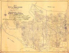
Vancouver civil defense subdivisions
University Endowment Lands, District Lot 140, group 1, New Westminster District
University Endowment Lands, District Lot 140, group 1, New Westminster District

Vancouver and Northern Railway, 1908

Chinatown existing

Chinatown existing

City of Vancouver

Map showing route Vancouver to Mission
Greater Vancouver target area. Civil defence survival instructions
Greater Vancouver target area. Civil defence survival instructions
City of Vancouver, B.C., Canada, 1908
City of Vancouver, B.C., Canada, 1908
Map of Vancouver, B.C. including Hastings Townsite and D.L. 301
Map of Vancouver, B.C. including Hastings Townsite and D.L. 301

Port of the City of Vancouver. Isometric view from the south-west
Indexed guide map of the City of Vancouver and suburbs
Indexed guide map of the City of Vancouver and suburbs

Hotels

District lot index and street index (1st Avenue to Campbell Avenue)

Street index (Campbell Street to Rosser Avenue)

Street index (Royal Oak Avenue, Vancouver to Frederick Road, North Vancouver)
Canadian National Railways mountain region : Vancouver, B.C.
Canadian National Railways mountain region : Vancouver, B.C.