
- AM1594-MAP 342a-: MAP 342a.28
- Item
- July 1912
Part of City of Vancouver Archives technical and cartographic drawing collection
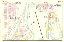
Item is a map depicting an area bounded by the following streets: Oak Street to Thirteenth Avenue West (south side only) to Cypress Street (and 1/2 block immediately west) to Matthews Avenue and Laurier Avenue (north side only).
![Plate 26: Fairview [Ontario Street - False Creek - Oak Street - Broadway/Ninth Avenue]](/uploads/r/null/9/c/f/9cf0028638ea04ddd006a3c088b61627f8c0e4d4b5e18682e311f1d6def04d28/f9c5d29c-3cc9-4177-b843-0d5b612020da-MAP342a_142.jpg)
![Plate 25: Fairview [Oak Street - False Creek - Fourth Avenue - Cypress Street]](/uploads/r/null/2/7/2/2726be0d8aa2ac0291e1b47b1349d50e381b1f9dec983a5584305f99303e4b0b/dba924f1-ac60-4a66-ba3e-98b7efd7357d-MAP342a_142.jpg)
![Plate 24: Kitsilano [Maple Street - Eighth Avenue - Carnarvon Street - Nineteenth Avenue]](/uploads/r/null/b/a/0/ba0d68b19000d99c14b892626e97bedc7f45445a348eb8777d39028478ac4859/2cc1981f-874e-400e-9af5-afe630d81ebd-MAP342a_142.jpg)
![Plate 23: Kitsilano [Carnarvon Street - Tenth Avenue - Crown Street - Twenty-first Avenue]](/uploads/r/null/c/b/9/cb9d797daebe3c23cc3ba0e3ab52ab602fa9dc4a36711e52ea66b2f98545e1ba/5287ebc9-ddb6-4554-a8ca-501a8cdcfd50-MAP342a_142.jpg)
![Plate 22: Kitsilano [Maple Street - English Bay - Bayswater Street - Eighth Avenue]](/uploads/r/null/9/d/9/9d9051a341addd66a3787edec21c3f030078f93d6880678e9cdafe7df84f7ef3/e6465a0a-12da-48fb-b10f-425350c425b0-MAP342a_142.jpg)
![Plate 21: Kitsilano Carnarvon Street - English Bay - Crown Street - Tenth Avenue]](/uploads/r/null/4/2/8/428f96578655c794d997e5a6ff5007ddbcabb876cb06f8aec6efe8db1ca589dc/d66a7b24-0eaa-47f3-bfa5-0a39a8ee9943-MAP342a_142.jpg)
![Plate 20: Point Grey [Crown Street - Sixth Avenue - Blanca Drive - Sixteenth Avenue]](/uploads/r/null/e/7/1/e7131a5080595ea160953fc209124d18fa23d64a87bff5a9e09a0f0548c21440/2ad33d97-773a-48a1-935e-20d3599a75b0-MAP342a_142.jpg)
![Plate 19: Point Grey [DL 176 - English Bay - Blanca Drive - Sixth Avenue]](/uploads/r/null/9/0/9/909403abc0abc4ea9b01b1fe9828873551fc26e82dc2e7e8f84af526c1a137b6/34b7af86-7d81-4ed5-9c84-a350059fc9b2-MAP342a_142.jpg)
![Plate 18: Kitsilano [Granville Street/False Creek - English Bay - Vine Street - Fourth Avenue]](/uploads/r/null/8/4/7/84793377156dc5b2cee4d0a61c1a42ba7d06bf59277c2ade519654c642d016df/c1ac7e98-80d1-43fc-a70e-7e6dc4fef11a-MAP342a_142.jpg)
![Plate 17: West End [False Creek/CPR yards - Drake Street - Burrard Street - False Creek]](/uploads/r/null/6/7/3/673cc6c2e73aac364d594828685a373c4c21e3472090c2f42f66c52e1f4017b7/3e200741-7cad-4e20-852a-40b7b2cbef17-MAP342a_142.jpg)
![Plate 16: West End [Burrard Street - Burnaby Street - Broughton Street - False Creek]](/uploads/r/null/a/e/4/ae4a56ddc4cdf97482012768325293cc1d68ad0a5f115f88f04f5275ddf4c692/6df39ba5-4b67-4a21-9d2c-64e0f75b8726-MAP342a_142.jpg)
![Plate 15: West End [Broughton Street - Burnaby Street/Davie Street - Denman Street - False Creek]](/uploads/r/null/1/3/0/13083b6fde232491e843c0bb62a3e683ea30651590e365309e8d1f17429acfa1/edde3573-9350-4c2b-8fee-5ac5e153d498-MAP342a_142.jpg)
![Plate 13: West End [False Creek - Georgia Street - Homer Street - Nelson Street]](/uploads/r/null/9/d/4/9d42140eaeed380dcafc9d9f2ec4c75ff8838b865768cfc3a3265748ec5e28c6/c274bed5-3f86-4ff0-9a71-2e86ff6884c3-MAP342a_142.jpg)
![Plate 12: Downtown [Homer Street - Nelson Street - Thurlow Street - Burnaby/Drake Street]](/uploads/r/null/c/4/7/c479046ad281d3e8c73d530cdea1a11c67c9851532d39090f74a7aeb902254c9/b6eac841-0ece-4d40-abef-04b5187d1ed7-MAP342a_142.jpg)
![Plate 10: West End [Thurlow Street - Nelson Street - Cardero Street - Burnaby Street]](/uploads/r/null/e/b/2/eb281da970ebd644483c0c62bac6df4efa77211537470a4acc06ddf0dfdfca64/aee7ff8d-629b-4876-aa73-91222025ab9b-MAP342a_142.jpg)
![Plate 9: West End [Thurlow Street - Georgia Street - Cardero Street - Nelson Street]](/uploads/r/null/1/9/b/19b3fe0eae79817485533a75436377555fcbfd19e4603d5072d4b4f96c5c3a32/fd60c8fe-f7b1-4e31-805a-515a9c9bccb9-MAP342a_142.jpg)
![Plate 8: West End [Cardero Street - Barclay Street - Park Road - Beach Avenue - Davie Street]](/uploads/r/null/6/d/6/6d680461017be540974f2eb8ba9641e6ea703be5860e413e63fdfe34f65ceead/e073c970-9088-45fe-8202-64066fbe2941-MAP342a_142.jpg)
![Plate 7: West End [Cardero Street - Burrard Inlet - Coal Harbour/Park Road - Barclay Street]](/uploads/r/null/7/c/9/7c9620050dee0e734bfff1e37ce6e2e0affd0b3c0b799447714657aae517ae79/4b20302f-dc29-4512-858d-5524b7a4467f-MAP342a_142.jpg)
![Plate 6: Downtown [False Creek - Hastings Street - Richards Street - Georgia Street]](/uploads/r/null/d/d/b/ddbaf20b087e86cf7d4207d5d35455b0b7bf77324a6df070a9adb2a0bc587ecf/fa347988-8e1f-4026-b6f3-3901fc6f102b-MAP342a_142.jpg)
![Plate 4: Waterfront Bute Street - Burrard Inlet - Bidwell Street - Georgia Street]](/uploads/r/null/5/6/e/56e493b1b8b9ebd5e77bae9be83741618c7d3b1c1b6a2992e4b6ef5edac7e16b/6eed9ed2-73a1-44f2-9e37-165d726d7fcb-MAP342a_142.jpg)
![Plate 3: Waterfront [Carrall Street - Burrard Inlet - Granville Street - Hastings Street]](/uploads/r/null/c/c/7/cc70d1a765eb2a68965a4c4b627827d53b432cd88d1d50e51081c4b205e112a8/1a6b5b79-2499-48c3-a96f-26eb2ca6444c-MAP342a_142.jpg)
![Plate 2: Waterfront [Granville Street - Burrard Inlet - Bute Street - Seaton/Hastings Street]](/uploads/r/null/e/e/6/ee607ca30e67c8c4896ae282b486b3f964d1df0e69215deb0cd511d30ed9192a/b8527682-9fa1-4aaa-8021-5885b6e2d810-MAP342a_142.jpg)
![Plate 163 [Key Plan of North Vancouver]](/uploads/r/null/e/1/d/e1d59c4aba0a20f0522dd57d1ecfbcc6fa0e15d2cb581616d819932b7b4485b7/be98b40c-82d0-4d47-97d2-e5bc54e3e904-1974-100_142.jpg)
![Plate 164 [Lonsdale Avenue to Second Street to Chesterfield Avenue to Burrard Inlet]](/uploads/r/null/b/c/5/bc5801cb1cab9f718c08d5e85247acf3c6c6d41621bd633be9636327b722a9cd/db55d2fa-bc36-4407-a98b-9c062774aa12-1974-100_142.jpg)
![Plate 165 [St. Georges Road to Second Street to Lonsdale Avenue to Burrard Inlet]](/uploads/r/null/7/4/b/74bf056c6f380a72cc2df80556ee1fab18f65d4b16d8d010c950578becb6ee53/d1a63bcb-2baa-4bed-9444-00a74944242c-1974-100_142.jpg)
![Plate 161 [Vancouver Lumber Co. site]](/uploads/r/null/8/5/2/852127f39051bf85e540ef01942067e3bc3fcf3dd7a1eb053622d2bd87407c8e/d10bf21c-a276-437b-9032-81dea28defdd-1974-100_142.jpg)
![Plate 160 [Alberta Lumber Co. site and Canadian Pacific siding in Fairview]](/uploads/r/null/5/b/1/5b163141ecec46455912dfb30d20790e28bf16aa914158a79baef3f3ae61914e/dbf5b5d5-d8e6-4ced-8f16-af72e7e15c85-1974-100_142.jpg)
![Plate 162 [Bridge Street to Fourteenth Avenue to Heather Street to Seventeenth Avenue]](/uploads/r/null/5/2/5/5256cff8242defeed25de4521f059690bd7ac034661f9e0b1d3a1d3531ed3d68/6f5bb597-8fce-40e1-bc4f-2ec474b293f1-1974-100_142.jpg)
![Plate 157 [Willow Street to Sixth Avenue to block west of Laurel Street to Ninth Avenue]](/uploads/r/null/9/5/9/95917226a7f84bd48d88028f6821d6cb5ccdb9dc3b332600d85491dafd7539e6/e2de822d-869f-4fe6-b52b-84c3f4c8baac-1974-100_142.jpg)
![Plate 158 [Block east of Heather Street to Sixth Avenue to Willow Street to Ninth Avenue]](/uploads/r/null/0/7/3/0738405a50a60a5b916cf7ad08248de8a02426fff80a1d99e58e7c61e6622531/1a1e7d9a-385f-4b13-a466-c0575de337a4-1974-100_142.jpg)
![Plate 159 [Bridge Street to Sixth Avenue to block west of Ash Street to Ninth Avenue]](/uploads/r/null/e/4/4/e44f57cba6b38fa8da6ef44cbb61be076fcf20c0156c0ae088cd88ac1c2d7de9/41ef2962-f94b-4a03-853d-b6e743b5c09f-1974-100_142.jpg)
![Plate 155 [Spruce Street to Sixth Avenue to block west of Alder Street to Ninth Avenue]](/uploads/r/null/6/1/d/61d627b8bf8255c91caa4dae5c1414b7dea029c2d65ae523e8184113877d5762/9e7d5e21-01bf-448f-8037-73dd4abc4549-1974-100_142.jpg)
![Plate 156 [Block east of Oak Street to Sixth Avenue to Spruce Street to Ninth Avenue]](/uploads/r/null/f/8/1/f81307f079a5ed18bb6e49affd7a5f3d3100e9ba3238d592691d04ffeda95499/cad8edde-d5d0-4c5c-b0f8-93ec688a9cb6-1974-100_142.jpg)
![Plate 154 [Block east of Birch Street to Sixth Avenue to Hemlock Street to Ninth Avenue]](/uploads/r/null/6/5/2/652ad579c1fe271158b63c84620eb45e6450996406e4ce1091d1ac6397bc6472/eeb6a7b2-820c-4fc4-a3c6-5ab4f86f5aac-1974-100_142.jpg)
![Plate 153 [Hemlock Street to Sixth Avenue to block west of Granville Street to Ninth Avenue]](/uploads/r/null/0/a/b/0abee4f6ab9261fdd6d4c93bc35e4a02bc8fdc3f6b17439c7a8d92cd560ff491/09319ade-296b-4282-bb2c-e7963da06d6d-1974-100_142.jpg)
![Plate 152 [Block east of Fir Street to Sixth Avenue to Pine Street to Ninth Avenue]](/uploads/r/null/9/3/6/93607ace79536cc9ba73482f1f25a28f8b7cd33c40d6117463d7190a5cd58cab/33eb584e-3f39-41a1-adb0-c3d2f0a2ef0b-1974-100_142.jpg)
![Plate 151 [Pine Street to Sixth Avenue to block west of Cedar Street to Ninth Avenue]](/uploads/r/null/e/4/9/e49218d46361f18de15f4b73198cc7b1fda01b9493e8cf55080a219b228f21dd/90857757-8cb5-40e3-89a3-1b9cb3f4107c-1974-100_142.jpg)
![Plate 149 [Maple Street to Sixth Avenue to block west of Arbutus Street to Ninth Avenue]](/uploads/r/null/1/f/f/1ff5adea07e72b47fb8589cf72b5837f3f0cb33659dab5cf8869d5a88d99bde1/af236417-5448-45f0-93a1-6e86f77ec05e-1974-100_142.jpg)
![Plate 150 [Block east of Cypress Street to Sixth Avenue to Maple Street to Ninth Avenue]](/uploads/r/null/c/6/1/c6127f20b43f5bfe2e7961bb2fce768eef1ea0e23d13f5aa6737d8174cc753cb/41a8abf7-3a8c-4877-b054-6bb5613613ae-1974-100_142.jpg)
![Plate 148 [Yew Street to Sixth Avenue to Vine Street to Ninth Avenue]](/uploads/r/null/1/6/d/16d2ce9f2af7c7c7d0e0d3b10d0236d78460c38de3f1503704b5af9f8b1c1577/b8c5b1ec-4d07-415e-b3c6-fb3fda7febbc-1974-100_142.jpg)
![Plate 147 [Hemlock Street to False Creek to block west of Granville Street to Sixth Avenue]](/uploads/r/null/a/b/d/abd13a3749032aa33979a67cba7062ed3cf112839e13bafb0eee601ec40fc955/30faa6e3-9576-4383-9326-89c314adf9cd-1974-100_142.jpg)
![Plate 145 [Pine Street to Third Avenue to block west of Cedar Street to Sixth Avenue]](/uploads/r/null/6/e/d/6edf28481ccf2f8c292cafc7d295d8dc5f0f8a4df775363d1a834454503f7457/054c1f34-de8e-4f3c-95c6-cd44be0a9257-1974-100_142.jpg)
![Plate 146 [Block east of Fir Street to Third Avenue to Pine Street to Sixth Avenue]](/uploads/r/null/f/5/f/f5f0590ecf8724bfa6c9f2bcff56c118991a327bd55de2e5ce81b9a5dd964194/a512e8de-7c29-40ef-8a86-92ec8f6717bb-1974-100_142.jpg)
![Plate 144 [Block east of Cypress Street to Third Avenue to Maple Street to Sixth Avenue]](/uploads/r/null/b/b/3/bb3486354df3c881ac3bac9a26d9f29e9e8cce53558b1eb170f2803889115167/843d4c60-64fa-4d05-a86f-1f6626b619aa-1974-100_142.jpg)
![Plate 140 [Block east of Pine Street to Kitsilano Indian Reserve to Cedar Street to Third Avenue]](/uploads/r/null/7/e/8/7e8970e4b38be59229b38f8b6eb9833bfce0ac4b6b5ab287ecc09ff682cebecc/42fb5df2-2281-4cc9-a83f-44f82f9e47c3-1974-100_142.jpg)
![Plate 141 [Granville Street to False Creek to block west of Fir Street to Third Avenue]](/uploads/r/null/b/2/5/b255e765c266c20bfe0a9abc3dde1bf65002ca267675bad2dadafa4474df0196/b7dbabfa-7bf6-4bd3-b4e0-15d4a69b2877-1974-100_142.jpg)
![Plate 142 [Block east of Yew Street to Third Avenue to Vine Street to Sixth Avenue]](/uploads/r/null/4/1/b/41bfdfad990b2c36b8c65458c9a335d7188fa3e2385c910acd6f933a1f61eea9/b93009cb-1ffe-4031-a009-d2f37f20b9c1-1974-100_142.jpg)