Showing 268 results
Archival description
Sectional map of Vancouver showing streets, block and lot outlines, and building perimeters : Map 4 : Chilco Street to Burrard Street and Coal Harbour to Robson Street

Sectional map of Vancouver showing streets, block and lot outlines, and building perimeters : Map 12 : Nanaimo Street to Cassiar Street and McGill Street/Wall Street to Pender Street
Sectional map of Vancouver showing streets, block and lot outlines, and building perimeters : Map 15 : Rupert Street to Boundary Road and Pender Street to Kitchener Street
Sectional map of Vancouver showing streets, block and lot outlines, and building perimeters : Map 17 : Nanaimo Street to Rupert Street and Pender Street to Charles Street
Sectional map of Vancouver showing streets, block and lot outlines, and building perimeters : Map 18 : Nanaimo Street to Rupert Street and Charles Street to 5th Avenue
Sectional map of Vancouver showing streets, block and lot outlines, and building perimeters : Map 23 : Balaclava Street to Maple Street and English Bay to 3rd Avenue
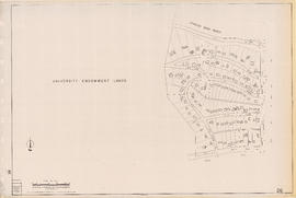
Sectional map of Vancouver showing streets, block and lot outlines, and building perimeters : Map 26 : University Endowment Lands to Blanca Street and N.W. Marine Drive to 4th Avenue
Sectional map of Vancouver showing streets, block and lot outlines, and building perimeters : Map 34 : Nanaimo Street to Rupert Street and 5th Avenue to Grandview Highway North

Sectional map of Vancouver showing streets, block and lot outlines, and building perimeters : Map 36 : Rupert Street to Boundary Road and Grandview Highway to 22nd Avenue
Sectional map of Vancouver showing streets, block and lot outlines, and building perimeters : Map 39 : Nanaimo Street to Rupert Street and 22nd Avenue to Kingsway/Vanness Avenue

Sectional map of Vancouver showing streets, block and lot outlines, and building perimeters : Map 47 : 29th Avenue at King Edward Avenue to Blenheim Street and King Edward Avenue to 33rd Avenue

Sectional map of Vancouver showing streets, block and lot outlines, and building perimeters : Map 56 : Joyce Street/Doman Street to Boundary Road and Kingsway to 49th Avenue

Sectional map of Vancouver showing streets, block and lot outlines, and building perimeters : Map 61 : Cypress Street to Oak Street and 33rd Avenue to 41st Avenue

Sectional map of Vancouver showing streets, block and lot outlines, and building perimeters : Map 63 : Carnarvon Street to Cypress Street and 33rd Avenue to 41st Avenue

Sectional map of Vancouver showing streets, block and lot outlines, and building perimeters : Map 72 : Oak Street to Quebec Street and 46th Avenue to 57th Avenue

Sectional map of Vancouver showing streets, block and lot outlines, and building perimeters : Map 74 : Inverness Street to Nanaimo Street and 49th Avenue to 61st Avenue

Sectional map of Vancouver showing streets, block and lot outlines, and building perimeters : Map 76 : Kerr Street to Boundary Road and 49th Avenue/48th Avenue to Rosemont Drive

Sectional map of Vancouver showing streets, block and lot outlines, and building perimeters : Map 85 : Laburnum Street to Fremlin Street and 57th Avenue to 68th Avenue/67th Avenue

Sectional map of Vancouver showing streets, block and lot outlines, and building perimeters : Map 87 : Barnard Street to Heather Street and 75th Avenue/Kent Avenue South to the North Arm of the Fraser River

Sectional map of Vancouver showing streets, block and lot outlines, and building perimeters : Map 88 : MacDonald Street to Laburnum Street/Angus Drive and 57th Avenue to the North Arm of the Fraser River
![Sheet 2A [Windermere Street to Pender Street to Slocan Street to Charles Street]](/uploads/r/null/e/f/0/ef0145166907c36b80690dbaafd084071b8c82a23a84f931050a22101462f091/f7da3c3b-6025-445b-a5a6-5eb1608264e9-LEG1153_142.jpg)
Sheet 2A [Windermere Street to Pender Street to Slocan Street to Charles Street]
![Sheet 2D [Boundary Road to Chalres Stret to Windermere Street to 5th Avenue]](/uploads/r/null/9/7/0/9702a82a6010cf52eb7cf7e486466e91e67bc732d2586158ff4cf07d8f71fb7e/f364eebb-c9c0-4aba-8970-b9128de74769-LEG1153_142.jpg)
Sheet 2D [Boundary Road to Chalres Stret to Windermere Street to 5th Avenue]
![Sheet 4D [Bundary Road to 29th Avenue to Manor Street to Euclid Avenue]](/uploads/r/null/c/0/2/c02fc1e98486bf47bb5179c1d6b399831444222c7a54db8f5a58dda1cce6d070/eb4d8a12-929b-4b83-9998-97fd0b274ae9-LEG1153_142.jpg)
Sheet 4D [Bundary Road to 29th Avenue to Manor Street to Euclid Avenue]
![Sheet 5B [Boundary Road to Euclid Avenue to Joyce Street to 45th Avenue]](/uploads/r/null/b/d/a/bdaaca7a1a5c9f9359248cc9d383c63ffcf8800e719c0cf177f45dd4bac3cb61/e97627da-8e6c-4ebc-87bd-d46130b9261d-LEG1153_142.jpg)
Sheet 5B [Boundary Road to Euclid Avenue to Joyce Street to 45th Avenue]
![Sheet 9B [Slocan Street to 6th Avenue to Semlin Drive to 14th Avenue]](/uploads/r/null/b/7/5/b75c61b603e8ab998f68941a380457aeae4de4affd845d40405472b07f3738a2/140ef05a-e687-4959-a97a-2765c7610a3c-LEG1153_142.jpg)
Sheet 9B [Slocan Street to 6th Avenue to Semlin Drive to 14th Avenue]
![Sheet 10B [Slocan Street to 23rd Avenue to Sidney Street to 29th Avenue]](/uploads/r/null/7/a/6/7a643182fb12f452f594aa241aacdb21982fb1e70249d145f3f8edff509857db/bec9da93-10c1-43a2-98ad-4a46771fceb9-LEG1153_142.jpg)
Sheet 10B [Slocan Street to 23rd Avenue to Sidney Street to 29th Avenue]
![Sheet 10D [Chambers Street to 29th Avenue to Gladstone Street to 37th Avenue]](/uploads/r/null/d/d/7/dd7db9c8c09a85f2d91d18832f6ed2cfe09f88d6850111e170876ccfaec70043/9668563c-4058-4346-ae11-a99c8a48a605-LEG1153_142.jpg)
Sheet 10D [Chambers Street to 29th Avenue to Gladstone Street to 37th Avenue]
![Sheet 11A [Victoria Drive to 37th Avenue to Knight Street to 45th Avenue]](/uploads/r/null/6/e/a/6ead9db0025ca23bfc2bcb8dcd095d7cd06a2e60497eb4f6de3c4729d163bf79/b80628c0-b5ff-4789-80b8-4077ef9b593b-LEG1153_142.jpg)
Sheet 11A [Victoria Drive to 37th Avenue to Knight Street to 45th Avenue]
![Sheet 11D [Vivian Street to 45th Avenue to Gladstone Street to 53rd Avenue]](/uploads/r/null/9/6/9/96934c830e4481712138cb8f3cd33681a83ae902562312b7cbd5cd275b1b0da6/bff15411-9432-4e56-b26c-0df02be250e3-LEG1153_142.jpg)
Sheet 11D [Vivian Street to 45th Avenue to Gladstone Street to 53rd Avenue]
![Sheet 13A [Foot of Victoria Drive to Fraser River]](/uploads/r/null/e/0/7/e076af466f7ca711ddf57dd662031efc3cc4c28e6408b4e31ea3fe7270ab18c7/d6f87673-7469-46e1-a7df-652efb652390-LEG1153_142.jpg)
Sheet 13A [Foot of Victoria Drive to Fraser River]
![Sheet 13B [SW Marine Drive to Duff Street to Fraser River]](/uploads/r/null/0/3/4/03421275306943b3d9eb9b3aaaa73979580d2e415b3a634dee138ceee5ac2b65/e60534ef-16bb-4a15-9951-7bbb070a9b45-LEG1153_142.jpg)
Sheet 13B [SW Marine Drive to Duff Street to Fraser River]
![Sheet 13D [Boundary Road to Ellis Avenue to Kinross Street to Fraser River]](/uploads/r/null/b/2/7/b27058cc4ac42327fbb3aab78b65df9c8b942cbe642a9f79ec83473c1e7ac265/de84ac8c-0385-4ab1-bf1a-3f06a1d433f3-LEG1153_142.jpg)
Sheet 13D [Boundary Road to Ellis Avenue to Kinross Street to Fraser River]
![Sheet 16C [Fraser Street to 16th Avenue to Main Street to 25th Avenue]](/uploads/r/null/1/1/6/1163864e8162291b537da118276007a2b3de69380e8b078eb0d088d795995f87/afb49aec-b5bb-4c60-9401-d4ef89479635-LEG1153_142.jpg)
Sheet 16C [Fraser Street to 16th Avenue to Main Street to 25th Avenue]
![Sheet 17A [Fraser Street to 25th Avenue to Main Street to 33rd Avenue]](/uploads/r/null/3/5/e/35efa02285fe97cbbc78720917aa8f41cad1a29600cbbaae19da1739512c2cf6/201df1a8-a4c7-4b71-8d0f-44e0e32ed2a6-LEG1153_142.jpg)
Sheet 17A [Fraser Street to 25th Avenue to Main Street to 33rd Avenue]
![Sheet 18C [Fraser Street to 49th Avenue to Quebec Street to 57th Avenue]](/uploads/r/null/e/2/f/e2f9c3ea4472dbe48bd8516342b20420864c4606305256d7d105ef9c13f8b92d/3f4cc050-5c81-48c0-839f-764a5d3fbc12-LEG1153_142.jpg)
Sheet 18C [Fraser Street to 49th Avenue to Quebec Street to 57th Avenue]
![Sheet 18D [Knight Street to 49th Avenue to Fraser Street to 57th Avenue]](/uploads/r/null/0/8/9/089e18c6a22f42c15094baceb413af7c5bca7847727d97ad9532267883c0b578/858c4aa4-ab11-4eca-8f21-030e40945604-LEG1153_142.jpg)
Sheet 18D [Knight Street to 49th Avenue to Fraser Street to 57th Avenue]
![Sheet 20A [Cardero Street to Coal Harbour to Lagoon Drive to Nelson Street]](/uploads/r/null/c/1/5/c15fe5fc7308fea52c7b2dad6a58192b47ebdca216af4850ad394b2e8312a84d/443a9c44-bc78-4001-b61e-78b45cf8eae3-LEG1153_142.jpg)
Sheet 20A [Cardero Street to Coal Harbour to Lagoon Drive to Nelson Street]
![Sheet 20D [Burrard Street to Georgia Street to Cardero Street to Davie Street]](/uploads/r/null/b/2/2/b227c2a1c3fbdebd7ed96887165f5b8c40c17b524a7310c00344090027aeadf6/217c15e3-8ba2-44de-8318-fa45f58fa634-LEG1153_142.jpg)
Sheet 20D [Burrard Street to Georgia Street to Cardero Street to Davie Street]
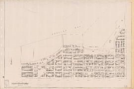
![Sheet 21A [Beatty Street to Burrard Inlet to Burrard Street to Robson Street]](/uploads/r/null/0/5/8/058e79353d3f348364f7fa7d7713159c08ff9e9197abfefa7b788ed54697214a/0226588b-2824-4d8d-8e1e-0480b5e6a0f3-LEG1153_142.jpg)
Sheet 21A [Beatty Street to Burrard Inlet to Burrard Street to Robson Street]
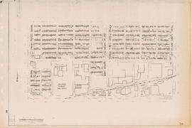
![Sheet 21B [Main Street to Burrard Inlet to Cambie Street to Georgia Viaduct]](/uploads/r/null/1/9/c/19c01f9d7a7acf130ac0065f15d22aa87c5495ab4d7f6b953f80f5cd409753d1/4608aa7c-9db4-49fa-8364-2d8efbac9ba8-LEG1153_142.jpg)
Sheet 21B [Main Street to Burrard Inlet to Cambie Street to Georgia Viaduct]
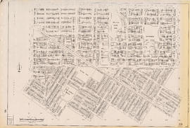
![Sheet 21C [False Creek to Robson Street to Burrard Street to Davie Street]](/uploads/r/null/8/2/9/829e20337c4231ce8897bc6a0161604243983aa30bb5d2016e7d85ae7e9d3a5e/5ee6e204-dcfb-4a3c-9e96-92608ad3b3bf-LEG1153_142.jpg)
Sheet 21C [False Creek to Robson Street to Burrard Street to Davie Street]
![Sheet 23C [Cambie Street to 16th Avenue to Oak Street to King Edward Avenue]](/uploads/r/null/6/4/b/64b4a79d7ba12c4b938d3254c2f1fa01bd43e086021e68c4fd7b8ec8d5fbd756/0cf4e8a0-7070-44ba-828e-e4f3b9607d50-LEG1153_142.jpg)
Sheet 23C [Cambie Street to 16th Avenue to Oak Street to King Edward Avenue]
![Sheet 25D [Quebec Street to 49th Avenue to Cambie Street to 57th Avenue]](/uploads/r/null/a/a/7/aa7f8e384a73e9ea29b08e9a195450b62421fa254c1e764071eac679a0fee825/7707c2e5-94dd-466a-a23c-742938e4dacf-LEG1153_142.jpg)
Sheet 25D [Quebec Street to 49th Avenue to Cambie Street to 57th Avenue]
![Sheet 26A [Yukon Street to 57th Avenue to Fremlin Street to 64th Avenue]](/uploads/r/null/0/5/f/05fe950bc7a8260055adeb735a9e9de5a66de6cd6d8d867866a4f26d8e0b3955/fc1ca8e3-1753-4d95-814c-f919f021a743-LEG1153_142.jpg)
Sheet 26A [Yukon Street to 57th Avenue to Fremlin Street to 64th Avenue]

Sheet 28C [Granville Street to 16th Avenue to East Boulevard to King Edward Avenue
![Sheet 28D [Oak Street to 16th Avenue to Granville Street to King Edward Avenue]](/uploads/r/null/a/5/1/a514fb5929f963961a28eb8c8e9a69bb9f116d11e1e000fa2eddcfd6db203aa5/b285ef7c-aa9f-4438-9f64-ab6097f790e7-LEG1153_142.jpg)
Sheet 28D [Oak Street to 16th Avenue to Granville Street to King Edward Avenue]
![Sheet 30C [Granville Street to 49th Avenue to Laburnum Street to 57th Avenue]](/uploads/r/null/4/a/b/4ab83ed389898a1ff0b3828a03fce28518842f15c117f17009ae007f168e581e/18eeba1d-cff1-468b-807e-0dd45275afde-LEG1153_142.jpg)
Sheet 30C [Granville Street to 49th Avenue to Laburnum Street to 57th Avenue]
![Sheet 30D [Oak Street to 49th Avenue to Granville Street to 57th Avenue]](/uploads/r/null/0/5/9/0599d384c71c73fa06c612cd5dd6e2aa873f963dffca49f2e0c69b8ef4f8a6e5/59418dcb-5719-431e-80c9-77827269def0-LEG1153_142.jpg)
Sheet 30D [Oak Street to 49th Avenue to Granville Street to 57th Avenue]
![Sheet 34B [Arbutus Street to Broadway to Stephens Street to 16th Avenue]](/uploads/r/null/b/b/5/bb507511bc6166d08572a65680bb2dfce5a74bd7d57acad869a729acafeb3c27/ad8133d2-9fc8-4702-9a69-1757c539a657-LEG1153_142.jpg)
Sheet 34B [Arbutus Street to Broadway to Stephens Street to 16th Avenue]
![Sheet 35C [Trafalgar Street to 33rd Avenue to Blenheim Street to 41st Avenue]](/uploads/r/null/2/f/d/2fd752d3f48aa7cecdf56eb40b0a5bde82183a3957844ce8de8abe3f927394b5/6571bf0a-fe92-44d6-8d05-61611fba1aa2-LEG1153_142.jpg)
Sheet 35C [Trafalgar Street to 33rd Avenue to Blenheim Street to 41st Avenue]
Results 151 to 200 of 268