
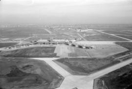
Aerial view of airport terminal, runways and approaches to Sea Island
- AM1376-F12-: CVA 290-16.06
- Item
- [ca. 1968]
Aerial view of airport terminal, runways and approaches to Sea Island
Aerial view of airport terminal, runways and approaches to Sea Island

Aerial view of airport terminal, runways and approaches to Sea Island

Aerial view of airport terminal, runways and approaches to Sea Island
Aerial view of airport terminal, runways and approaches to Sea Island

Aerial view of airport terminal, runways and approaches to Sea Island
Aerial view of airport terminal, runways and approaches to Sea Island

Aerial view of Alberta Wheat Pool elevator under construction and original Second Narrows Bridge

Aerial view of Alberta Wheat Pool elevator under construction and the East Vancouver Port Lands

Aerial view of an unidentified estate-house and large garden on lower mainland of Vancouver

Aerial view of an unidentified estate-house and large garden on lower mainland of Vancouver
![[Aerial view of biplane over The Lions]](/uploads/r/null/2/0/2072f7cce07a632f3ed3e2f7ebad407f424ac73da89d95c5fe835c233ab20ae7/b74a8663-848f-4e8f-a407-1de5125f4f06-A71798_142.jpg)
[Aerial view of biplane over The Lions]
Oblique view showing a biplane over the bridge and the Prospect Point Signal Station

Aerial view of Brockton Point in Stanley Park looking south
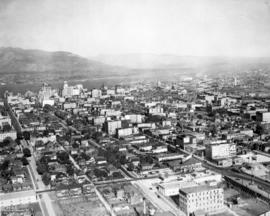
Aerial view of downtown Vancouver looking north along Granville Street
![[Aerial view of Downtown Vancouver looking south from Burrard Inlet]](/uploads/r/null/3/2/32bc12be65a895f144d669768ee019e6abc83bc4018b11b3ecf96930fbd98786/024e645a-ce5d-4e73-a4e1-efb2ad9b7995-A71518_142.jpg)
[Aerial view of Downtown Vancouver looking south from Burrard Inlet]
Photograph shows Canada Place under construction, the SeaBus terminal, Waterfront Station (formerly the C.P.R. Station), the Marine Building, Harbour Centre and False Creek and Granville Island in the background

Aerial view of eastern portion of Vancouver Harbour showing Vancouver Terminal
![[Aerial view of fire at Vancouver sawmill]](/uploads/r/null/2/6/261c182ef20aa4aa00d0b46917096bf17c339730ec5975e81a6c1fbc2b63158f/05be5137-bdbf-42ad-a142-3e73d5538015-A71287_142.jpg)


Aerial view of Hastings Park and P.N.E. "Playland"

Aerial view of Hastings Park, looking north east, with squatters shacks on shore of Burrard Inlet
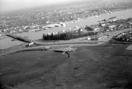
![[Aerial view of industrial area]](/uploads/r/null/5/d/5dd69372e15c5f349b4b4b8cdb7a12063cbbf02d158ab97d57ba863214b5c209/5f3baa69-a2f9-4adb-a590-4b420086d51d-A71604_142.jpg)

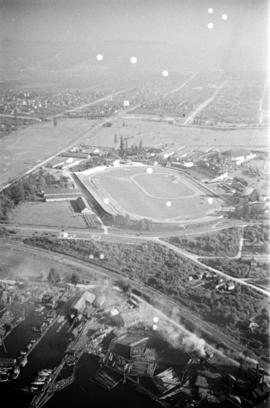
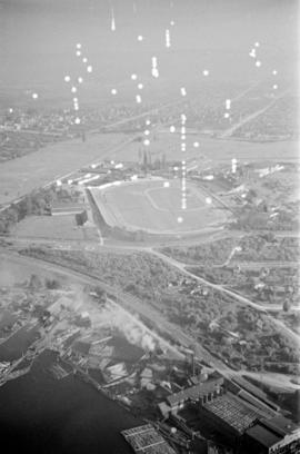
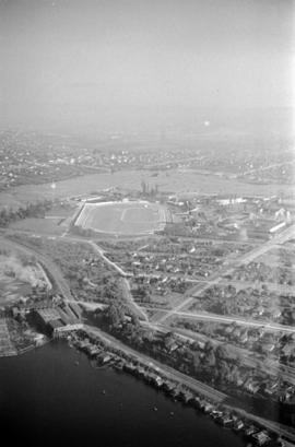
Aerial view of Little Mountain area
Item is an aerial photograph showing an oblique view of the Little Mountain area.
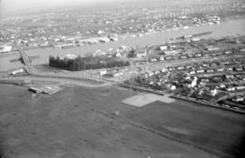
![[Aerial view of rail yard and industrial area]](/uploads/r/null/9/f/9f92989deb2b54597c6743bd67717653fc644c23b6fc48e55d2e1b9dbf6e8489/763b5a38-9eae-4b16-bedc-45ca5c32d888-A71602_142.jpg)
![[Aerial view of Richmond Centre mall]](/uploads/r/null/2/e/2ee69f17353dd5eafd9d3c5d8d0ae7f95f74b5669c564c68a4c72ffafb9cda20/e0752fe7-4588-4c42-a25c-ef561bf4ed68-A71603_142.jpg)
[Aerial view of Richmond Centre mall]
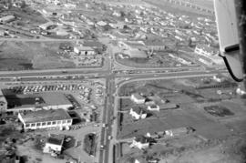
Item is a photograph showing the Richmond Centre shopping mall as well as Samuel Brighouse Elementary School and Minoru Park.
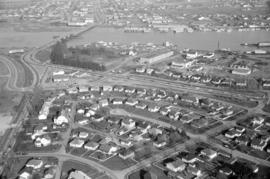
![[Aerial view of shopping centres]](/uploads/r/null/d/2/d21dcc14ced0356484b5666789f851fac68a175214b4718fae1444fec7417944/1f264270-6b68-43e6-be2e-f5b59df5d035-A71605_142.jpg)
![[Aerial view of shopping centres]](/uploads/r/null/1/0/10ff59da2ba368988732f96fd1cd6e8fa091b0be501fa556439f7a93e5f7da6e/ac882c6d-a7cb-45e1-94f7-e89b0f645a16-A71607_142.jpg)

Aerial view of Stanley Park, Brockton Oval, Coal Harbour and city centre of Vancouver

Aerial view of the Convent of the Sacred Heart
Item is a photograph showing an aerial view of Sacred Heart Convent, looking north, bounded by Dunbar Street and U.B.C. Endowment Lands.

Aerial view of the Crescent in Shaughnessy
![[Aerial view of the] R.C.A.F. Station - Jericho Base](/uploads/r/null/8/e/4/8e42b1405ef2582c0bf2f0d9b3cded040b3653149e99127143b2c22e3db208d4/3a100420-1303-4063-a836-fe84101cc54d-CVA308-3_142.jpg)
[Aerial view of the] R.C.A.F. Station - Jericho Base
![[Aerial view of Vancouver]](/uploads/r/null/9/b/9b3acec26123edc53f11bf2f41f3286d09254ffea9918cd31b6715395ebe18d0/26473909-fe49-4474-8c3f-05eb1e8ab059-CVA1376-252_142.jpg)
Oblique view showing Fairview, Vancouver General Hospital, False Creek and the Expo 86 and other sites under development on the north side, Granville Island, Granville Bridge, Burrard Bridge, Yaletown, Downtown, the West End, Stanley Park and the Lions Gate Bridge, North Vancouver and The Lions in the background

Aerial view of Vancouver airport, aircrafts at terminal

Aerial view of Vancouver airport, Sea Island


Aerial view of Whytecliff Park
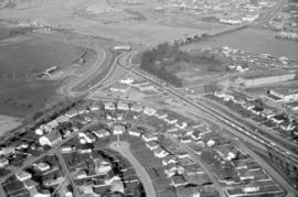
![[Aerial view over Burnaby]](/uploads/r/null/3/3/331b6e68239af4202f445b5284f51f9a4cb22c20b12ed83ca8ea7f7333df1d07/025da952-0a47-40b0-8988-6a3f80af1576-A71612_142.jpg)
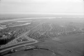
Oblique view showing the area between Canada Way, Sumner Avenue, Willingdon Avenue and the Trans Canada Highway including the Villa Inn and a hotel under construction
![[Aerial view over Burnaby]](/uploads/r/null/0/0/000c0196f6c810d76eb723bd8a3264ee3e43b53d6e32e7ad08a8e01e6712e7d7/75a245f8-8a3d-404d-bc50-219fadd7d908-A71611_142.jpg)
Oblique view showing the area between Canada Way, Sumner Avenue, Willingdon Avenue and the Trans Canada Highway including the Villa Inn and a hotel under construction
![[Aerial view over Burnaby]](/uploads/r/null/0/3/037ecb1cc7577fad52b33cbaec0eaf096ffaba433660c44f741e17d03dfdfabd/2b0ca722-06fa-4545-9dc1-41843e30b8ec-A71610_142.jpg)
Oblique view showing the area between Canada Way, Sumner Avenue, Willingdon Avenue and the Trans Canada Highway including the Villa Inn and a hotel under construction

Aerial view over reservoir in Stanley Park, Beaver Lake to the left