
British Columbia - Vancouver skyline
- AM1435-: CVA 1435-4
- Item
- [197-?]
Item is aerial photograph showing part of downtown Vancouver, Stanley Park and Coal Harbour.
1537 results with digital objects Show results with digital objects
British Columbia - Vancouver skyline
Item is aerial photograph showing part of downtown Vancouver, Stanley Park and Coal Harbour.

British Columbia - Vancouver skyline
Item is aerial photograph showing Stanley Park and Coal Harbour.
![Gardens - Canada : Kingswood [Kings]mere, Ontario, Mackenzie King House](/uploads/r/null/4/5/450453f4e197515dab94a29e60b8f3ffc7de6dc5a6d93ffd6a5d5267981fcacb/5f99d43c-35b0-4b9a-9ee7-331e5d16127c-A53363_142.jpg)
Gardens - Canada : Kingswood [Kings]mere, Ontario, Mackenzie King House
Image shows view in Mackenzie King Estate in Gatineau Park
![Marion Armstrong [standing at the foot of the steps at 3500 Willow Street, Vancouver, B.C.]](/uploads/r/null/8/3/832c3d5f1545c1150be3b5f1c677ef089807a38b42412683c1c593fd6c6322e3/2265a349-ac9c-4f77-a9f5-9df86211a44d-A71400_142.jpg)
Marion Armstrong [standing at the foot of the steps at 3500 Willow Street, Vancouver, B.C.]
Photograph shows a portion of Heather Park and houses bordering the park.
![Doris Armstrong (right) and Florrie Wilson in [front of Heather] park by 3500 Willow Street[, Van...](/uploads/r/null/b/6/b661535a23da9af886769e540d2081f83175a012de95179bbc929289e6d97d74/c1102e31-4e57-4cb4-b7e9-c4219156efeb-A71403_142.jpg)
Photograph shows portion of Heather Park and houses bordering the park.
![[View of the ranger's cottage directly behind the entrance arch to Stanley Park]](/uploads/r/null/c/7/c78ecc2347c66879c28e7f3153f6458a0c359cce591299b2f7e2afc96ea37563/85a92948-753e-42aa-9c72-de1854bbc5b9-A37912_142.jpg)
[View of the ranger's cottage directly behind the entrance arch to Stanley Park]
![[Float in the P.N.E. parade]](/uploads/r/null/5/c/5c6540cddd95d60a82ee393400dca5e99130c8100893d210d1fcca834e9a7a4c/bb65858e-700a-48a4-b937-76085fc2ffda-A37892_142.jpg)
Photograph shows a float celebrating the 59th anniversary of the opening of Stanley Park in the Pacific National Exhibition parade along Hastings Street.

![[Aerial view of the West End showing the increase of apartment buildings west of Cardero Street]](/uploads/r/null/9/4/9410444a29ad3e6e13228ba5ad44b40986af7ad70945337641000d03b991a529/ee9fb9e8-21b9-4ca5-a5b6-d28e6d51046e-A25977_142.jpg)
[Aerial view of the West End showing the increase of apartment buildings west of Cardero Street]
Part of Major Matthews collection
Photograph shows oblique view of Lost Lagoon, Stanley Park and Lord Roberts School
![[Walking path Stanley Park, two women]](/uploads/r/null/5/9/59fc83028be528c01bd917d0e6d17004b72bdf84f98d061d7cd93de3d14539ef/46a0a5d3-99aa-4bf4-b7d5-b0624ad49b4f-2008-022_142.jpg)
[Walking path Stanley Park, two women]
Part of Leslie F. Sheraton fonds
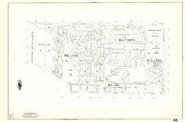
![[Sheet 88 : Macdonald Street to Angus Drive and Edgington Avenue to Fifty-seventh Avenue]](/uploads/r/null/5/9/595b991e091f624b5f74507db063dddb150624fbef03fe1d577f8d7a32bb9088/8afa1350-f31b-43bd-a14f-0ea9082c21fe-MAP339_142.jpg)
[Sheet 88 : Macdonald Street to Angus Drive and Edgington Avenue to Fifty-seventh Avenue]
Part of City of Vancouver Archives technical and cartographic drawing collection
Item is a sectional map of a portion of Vancouver showing the area from Macdonald Street to Angus Drive and Edgington Avenue to Fifty-seventh Avenue. Includes streets, blocks, lots and legal descriptions, and the locations of schools, parks and golf courses.
![[Sheet 87 : Barnard Street to Heather Street and Beckwith Road to Seventy-fifth Avenue]](/uploads/r/null/5/b/5b41d7f129096861b243317317db68bc0b54890dd82076ae972b78c504318686/01e0f65c-cd9d-4050-8861-1cafa29a58cc-MAP339_142.jpg)
[Sheet 87 : Barnard Street to Heather Street and Beckwith Road to Seventy-fifth Avenue]
Part of City of Vancouver Archives technical and cartographic drawing collection
Item is a sectional map of a portion of Vancouver showing the area from Barnard Street to Heather Street and the North Arm of the Fraser River to Seventy-fifth Avenue. Includes streets, blocks, lots and legal descriptions, and the locations of schools and parks. Also Includes streets and blocks in Richmond from Beckwith Road to River Drive.
![[Sheet 83 : Fremlin Street to Main Street and Southwest Marine Drive to Fifty-seventh Avenue]](/uploads/r/null/3/e/3efc869894db6ec7c88cf96b10cd2cb7f93db04cae7e1f6f35be1ac51c2bdc14/6323fdeb-3ce2-4794-bc7f-691ce81ee431-MAP339_142.jpg)
[Sheet 83 : Fremlin Street to Main Street and Southwest Marine Drive to Fifty-seventh Avenue]
Part of City of Vancouver Archives technical and cartographic drawing collection
Item is a sectional map of a portion of Vancouver showing the area from Fremlin Street to Main Street and Southwest Marine Drive to Fifty-seventh Avenue. Includes streets, blocks, lots and legal descriptions, and the locations of schools, parks and hospitals.
![[Sheet 86 : Angus Drive to Laurel Street and Seventy-fifth Avenue to Sixty-seventh Avenue]](/uploads/r/null/6/e/6efd95dacdad7f8976575767597855d90ccaa34e423b1ba76885d33d2dffb725/8167b0a2-0792-4e60-9755-7a4706830df0-MAP339_142.jpg)
[Sheet 86 : Angus Drive to Laurel Street and Seventy-fifth Avenue to Sixty-seventh Avenue]
Part of City of Vancouver Archives technical and cartographic drawing collection
Item is a sectional map of a portion of Vancouver showing the area from Angus Drive to Laurel Street and Seventy-fifth Avenue to Sixty-seventh Avenue. Includes streets, blocks, lots and legal descriptions, and the locations of schools and parks.
![[Sheet 85 : Laburnum Street to Fremlin Street and Sixty-eighth Avenue to Fifty-seventh Avenue]](/uploads/r/null/a/b/ab9f29b0e940cdcc4947062af96fb062d03e6ee1a34cac14d94b05edec4e2463/b9e1d243-5b38-4c67-ad11-2beba81bb35b-MAP339_142.jpg)
[Sheet 85 : Laburnum Street to Fremlin Street and Sixty-eighth Avenue to Fifty-seventh Avenue]
Part of City of Vancouver Archives technical and cartographic drawing collection
Item is a sectional map of a portion of Vancouver showing the area from Laburnum Street to Fremlin Street and Sixty-eighth Avenue to Fifty-seventh Avenue. Includes streets, blocks, lots and legal descriptions, and the locations of schools and parks.
![[Sheet 81 : Main Street to Inverness Street and Southeast Marine Drive to Fifty-seventh Avenue]](/uploads/r/null/9/5/9518e71d1e1780cdb281e3519ba78f0606992747daac9a2701b7f7ff38a67a92/65136071-c971-4835-877a-159bf293b14d-MAP339_142.jpg)
[Sheet 81 : Main Street to Inverness Street and Southeast Marine Drive to Fifty-seventh Avenue]
Part of City of Vancouver Archives technical and cartographic drawing collection
Item is a sectional map of a portion of Vancouver showing the area from Main Street to Inverness Street and Southeast Marine Drive to Fifty-seventh Avenue. Includes streets, blocks, lots and legal descriptions, and the locations of schools and parks.
![[Sheet 72 : Oak Street to Quebec Street and Fifty-eighth Avenue to Forty-sixth Avenue]](/uploads/r/null/d/9/d95b8e85252fc5bb5a704534795819328aaac0251d8659e64190e79cd61b3037/43d93b13-ddc2-4f78-9ba2-07fbbcf3baa9-MAP339_142.jpg)
[Sheet 72 : Oak Street to Quebec Street and Fifty-eighth Avenue to Forty-sixth Avenue]
Part of City of Vancouver Archives technical and cartographic drawing collection
Item is a sectional map of a portion of Vancouver showing the area from Oak Street to Quebec Street and Fifty-eighth Avenue to Forty-sixth Avenue. Includes streets, blocks, lots and legal descriptions, and the locations of schools and parks.
![[Sheet 75 : Nanaimo Street to Kerr Street and Bobolink Avenue to Forty-ninth Avenue]](/uploads/r/null/d/1/d14981939464fabe5e1b9488ecd26d62b3e16b1f4d1b8e00ece1bac6fa0dbdfa/a8e1d890-9726-473c-8f49-69d918d62d56-MAP339_142.jpg)
[Sheet 75 : Nanaimo Street to Kerr Street and Bobolink Avenue to Forty-ninth Avenue]
Part of City of Vancouver Archives technical and cartographic drawing collection
Item is a sectional map of a portion of Vancouver showing the area from Nanaimo Street to Kerr Street and Bobolink Avenue to Forty-ninth Avenue. Includes streets, blocks, lots and legal descriptions, and the locations of schools, parks and golf courses.
Part of City of Vancouver Archives technical and cartographic drawing collection
Item is a sectional map of a portion of Vancouver showing the area from Musqueam Indian Reserve to Balaclava Street and Forty-ninth Avenue to Forty-first Avenue. Includes streets, blocks, lots and legal descriptions, and the locations of schools, parks and golf courses.

Part of City of Vancouver Archives technical and cartographic drawing collection
Item is a sectional map of a portion of Vancouver showing the area from Musqueam Indian Reserve to Musqueam Park and North Arm, Fraser River to Southwest Marine Drive. Includes streets, blocks, lots and legal descriptions, and parks.
![[Sheet 63 : Carnarvon Street to Cypress Street and Forty-first Avenue to Thirty-third Avenue]](/uploads/r/null/4/3/43f21afad72cf7d769c23be0a8b778e288335df1801a3b9d42bace4e74c8ea1a/64b6fa50-ede8-4087-81fc-6b7da9b7dfd1-MAP339_142.jpg)
[Sheet 63 : Carnarvon Street to Cypress Street and Forty-first Avenue to Thirty-third Avenue]
Part of City of Vancouver Archives technical and cartographic drawing collection
Item is a sectional map of a portion of Vancouver showing the area from Carnarvon Street to Cypress Street and Forty-first Avenue to Thirty-third Avenue. Includes streets, blocks, lots and legal descriptions, and the locations of parks and schools.
![[Sheet 64 : Balaclava Street to Cypress Street and Forty-ninth Avenue to Forty-first Avenue]](/uploads/r/null/6/d/6d41bb5db0383d13fdc92e51638fb1e2c9ac8e11a664fd9070ee16be3212d8f5/07989ba9-42ff-4d9a-ac56-a25405a93120-MAP339_142.jpg)
[Sheet 64 : Balaclava Street to Cypress Street and Forty-ninth Avenue to Forty-first Avenue]
Part of City of Vancouver Archives technical and cartographic drawing collection
Item is a sectional map of a portion of Vancouver showing the area from Balaclava Street to Cypress Street and Forty-ninth Avenue to Forty-first Avenue. Includes streets, blocks, lots and legal descriptions, and the locations of parks and schools.
![[Sheet 62 : Cypress Street to Oak Street and Forty-ninth Avenue to Forty-first Avenue]](/uploads/r/null/7/c/7c5b951f94dee2cfd6a1b82979539f15bd77424ef36377f8e2db0e7bfb4aae10/78c561eb-987a-4aef-9574-18f261df2111-MAP339_142.jpg)
[Sheet 62 : Cypress Street to Oak Street and Forty-ninth Avenue to Forty-first Avenue]
Part of City of Vancouver Archives technical and cartographic drawing collection
Item is a sectional map of a portion of Vancouver showing the area from Cypress Street to Oak Street and Forty-ninth Avenue to Forty-first Avenue. Includes streets, blocks, lots and legal descriptions, and the locations of parks and schools.
![[Sheet 60 : Oak Street to Quebec Street and Forty-sixth Avenue to Thirty-seventh Avenue]](/uploads/r/null/b/5/b5e1b3fe1dda55eb9d0029fcbe47cb6048a48720c1ad1f7b1897640d35203319/e097b4d6-7a5c-41bc-9ca5-1b9e7b57eccc-MAP339_142.jpg)
[Sheet 60 : Oak Street to Quebec Street and Forty-sixth Avenue to Thirty-seventh Avenue]
Part of City of Vancouver Archives technical and cartographic drawing collection
Item is a sectional map of a portion of Vancouver showing the area from Oak Street to Quebec Street and Forty-sixth Avenue to Thirty-seventh Avenue. Includes streets, blocks, lots and legal descriptions, and the locations of parks and schools.
![[Sheet 58 : Inverness Street to Nanaimo Street and Forty-ninth Avenue to Forty-first Avenue]](/uploads/r/null/5/5/55825f5529a2ab4a1b9c04e6d086f342c86830cc9828262a5f7b22eab255b346/4ce8baf7-a89b-4c24-bec2-d1a45477ca67-MAP339_142.jpg)
[Sheet 58 : Inverness Street to Nanaimo Street and Forty-ninth Avenue to Forty-first Avenue]
Part of City of Vancouver Archives technical and cartographic drawing collection
Item is a sectional map of a portion of Vancouver showing the area from Inverness Street to Nanaimo Street and Forty-ninth Avenue to Forty-first Avenue. Includes streets, blocks, lots and legal descriptions, and the locations of parks and schools.
![[Sheet 59 : Quebec Street to Inverness Street and Forty-seventh Avenue to Thirty-seventh Avenue]](/uploads/r/null/0/1/015bc0f349dc1228105d4cdd774354b22820bad860e0a822b707d62c3eb343f5/b9fe9076-66e5-4167-b081-e65e8b625778-MAP339_142.jpg)
[Sheet 59 : Quebec Street to Inverness Street and Forty-seventh Avenue to Thirty-seventh Avenue]
Part of City of Vancouver Archives technical and cartographic drawing collection
Item is a sectional map of a portion of Vancouver showing the area from Quebec Street to Inverness Street and Forty-seventh Avenue to Thirty-seventh Avenue. Includes streets, blocks, lots and legal descriptions, and the locations of parks, schools and Mountainview Cemetery.

Part of City of Vancouver Archives technical and cartographic drawing collection
Item is a sectional map of a portion of Vancouver showing the area from Nanaimo Street to Doman Street and Joyce Street and Forty-ninth Avenue to Forty-first Avenue. Includes streets, blocks, lots and legal descriptions, and the locations of parks and schools.
![[Sheet 53 : Inverness Street to Nanaimo Street and Forty-first Avenue to Thirty-second Avenue]](/uploads/r/null/a/9/a9fdfc1181cd3a36ad078c24a5892d8bfc60c5456733839fa59914d5700e6509/5f8f4fc4-26e4-49f3-b5d4-acced16d8490-MAP339_142.jpg)
[Sheet 53 : Inverness Street to Nanaimo Street and Forty-first Avenue to Thirty-second Avenue]
Part of City of Vancouver Archives technical and cartographic drawing collection
Item is a sectional map of a portion of Vancouver showing the area from Inverness Street to Nanaimo Street and Forty-first Avenue to Thirty-second Avenue. Includes streets, blocks, lots and legal descriptions, and the location of parks.

Part of City of Vancouver Archives technical and cartographic drawing collection
Item is a sectional map of a portion of Vancouver showing the area from Nanaimo Street to Joyce Street, Cecil Street and McHardy Street and Forty-first Avenue to Ward Street and Vanness Avenue. Includes streets, blocks, lots and legal descriptions, and the locations of parks and schools.
![[Sheet 47 : Camosun Street to Blenheim Street and Thirty-third Avenue to King Edward Avenue]](/uploads/r/null/5/9/59c6b01a85dc6051f7cfecf1f33eb7e7017beb24d0dd57b512fcddc2063e3e8f/eabe5a9f-362b-46a4-9efc-275f9b96459b-MAP339_142.jpg)
[Sheet 47 : Camosun Street to Blenheim Street and Thirty-third Avenue to King Edward Avenue]
Part of City of Vancouver Archives technical and cartographic drawing collection
Item is a sectional map of a portion of Vancouver showing the area from Camosun Street to Blenheim Street and Thirty-third Avenue to King Edward Avenue. Includes streets, blocks, lots and legal descriptions, and the locations of parks and schools.
![[Sheet 50 : Oak Street to Ontario Street and Thirty-seventh Avenue to Twenty-eighth Avenue]](/uploads/r/null/a/3/a3b7d0414ced2d15d401c5747a576809010cc56bb00c564251adecdb35091358/01957154-6807-4889-bc0f-a1f2455ab066-MAP339_142.jpg)
[Sheet 50 : Oak Street to Ontario Street and Thirty-seventh Avenue to Twenty-eighth Avenue]
Part of City of Vancouver Archives technical and cartographic drawing collection
Item is a sectional map of a portion of Vancouver showing the area from Oak Street to Ontario Street and Thirty-seventh Avenue to Twenty-eighth Avenue. Includes streets, blocks, lots and legal descriptions, and the locations of parks, schools, hospitals, reservoirs, stadiums and RCMP barracks.
![[Sheet 45 : Discovery Street to Blenheim Street and King Edward Avenue to Fourteenth Avenue]](/uploads/r/null/7/b/7b9edfc2a053f0ba6c95af404ad3bf4f22a5e63ff6ddcd9acea2fd6dc469d916/ef5279fc-e406-412e-9886-eddb46d44c27-MAP339_142.jpg)
[Sheet 45 : Discovery Street to Blenheim Street and King Edward Avenue to Fourteenth Avenue]
Part of City of Vancouver Archives technical and cartographic drawing collection
Item is a sectional map of a portion of Vancouver showing the area from Discovery Street to Blenheim Street and King Edward Avenue to Fourteenth Avenue. Includes streets, blocks, lots and legal descriptions, and the locations of parks and schools.
![[Sheet 43 : East Boulevard to Oak Street and Laurier Avenue to Fourteenth Avenue]](/uploads/r/null/8/8/8846e3e6c19438103b656786c264d5dcccc37b59de3cf8fa85bb05f01b65d8f9/9fb3d6cb-93e9-48d0-be52-05cc55ad4ec4-MAP339_142.jpg)
[Sheet 43 : East Boulevard to Oak Street and Laurier Avenue to Fourteenth Avenue]
Part of City of Vancouver Archives technical and cartographic drawing collection
Item is a sectional map of a portion of Vancouver showing the area from East Boulevard to Oak Street and Laurier Avenue to Fourteenth Avenue. Includes streets, blocks, lots and legal descriptions, and the locations of parks and schools.
![[Sheet 44 : Blenheim Street to Arbutus Street and King Edward Avenue to Fourteenth Avenue]](/uploads/r/null/2/f/2fdf5060ec6fdc47756dc75416312dd42047abea2beed2d99f086c73bd0c8726/2fe0f45d-ad6c-46e6-9a9f-50c795523f5f-MAP339_142.jpg)
[Sheet 44 : Blenheim Street to Arbutus Street and King Edward Avenue to Fourteenth Avenue]
Part of City of Vancouver Archives technical and cartographic drawing collection
Item is a sectional map of a portion of Vancouver showing the area from Blenheim Street to Arbutus Street and King Edward Avenue to Fourteenth Avenue. Includes streets, blocks, lots and legal descriptions, and the locations of parks, schools and railways.
![[Sheet 40 : Inverness Street to Nanaimo Street and Twenty-second Avenue to Thirteenth Avenue]](/uploads/r/null/9/3/9367a0c50f6fa513d717a1972b1bac72acde6d41b002fefcf48ddbd8c8122e8a/c7bfac0b-bf44-441b-b059-fd7bbc0bd4a0-MAP339_142.jpg)
[Sheet 40 : Inverness Street to Nanaimo Street and Twenty-second Avenue to Thirteenth Avenue]
Part of City of Vancouver Archives technical and cartographic drawing collection
Item is a sectional map of a portion of Vancouver showing the area from Inverness Street to Nanaimo Street and Twenty-second Avenue to Thirteenth Avenue. Includes streets, blocks, lots and legal descriptions, and the locations of parks, schools and railways.
![[Sheet 41 : Ontario Street to Inverness Street and Twenty-eighth Avenue to Sixteenth Avenue]](/uploads/r/null/c/2/c22ca2538905633f64373261ce970df6216075ce4de9e22d491c2e212ce17c1f/616ab944-e39a-4c66-abb4-918b17cc3252-MAP339_142.jpg)
[Sheet 41 : Ontario Street to Inverness Street and Twenty-eighth Avenue to Sixteenth Avenue]
Part of City of Vancouver Archives technical and cartographic drawing collection
Item is a sectional map of a portion of Vancouver showing the area from Ontario Street to Inverness Street and Twenty-eighth Avenue to Sixteenth Avenue. Includes streets, blocks, lots and legal descriptions, and the locations of parks and schools.
![[Sheet 39 : Kingsway and Nanaimo Street to Rupert Street and Ward Street to Twenty-second Avenue]](/uploads/r/null/0/4/0409c276b1c046750a9680e1310ce46ec18fce0f1dfc928aab80fbe273730918/665972e9-723b-462b-b30f-95f1484b2c51-MAP339_142.jpg)
[Sheet 39 : Kingsway and Nanaimo Street to Rupert Street and Ward Street to Twenty-second Avenue]
Part of City of Vancouver Archives technical and cartographic drawing collection
Item is a sectional map of a portion of Vancouver showing the area from Kingsway and Nanaimo Street to Rupert Street and Ward Street to Twenty-second Avenue. Includes streets, blocks, lots and legal descriptions, and the locations of parks, schools and railways.
![[Sheet 42 : Oak Street to Ontario Street and Twenty-eighth Avenue to Sixteenth Avenue]](/uploads/r/null/c/7/c7489c984c3ec99abcbb22a87a294856654f9c25046416db253386367e8f4001/9f397dcd-244e-47bf-8acc-e4ae1dcd8a0d-MAP339_142.jpg)
[Sheet 42 : Oak Street to Ontario Street and Twenty-eighth Avenue to Sixteenth Avenue]
Part of City of Vancouver Archives technical and cartographic drawing collection
Item is a sectional map of a portion of Vancouver showing the area from Oak Street to Ontario Street and wenty-eighth Avenue to Sixteenth Avenue. Includes streets, blocks, lots and legal descriptions, and the locations of parks and schools.

Part of City of Vancouver Archives technical and cartographic drawing collection
Item is a sectional map of a portion of Vancouver showing the area from Rupert Street to Boundary Road and Wellington Avenue to Twenty-second Avenue. Includes streets, blocks, lots and legal descriptions, and the locations of parks and schools. Also included are streets and blocks in the area from Boundary Road to Carleton Avenue in Burnaby.
![[Sheet 38 : Nanaimo Street to Rupert Street and Twenty-second Avenue to Grandview Highway]](/uploads/r/null/c/a/cad90f0f77fa879900b59b4a35c25c5e44009065121168e70a62d613ae189442/cb54334e-9bba-4633-aa5c-0d322a73ef41-MAP339_142.jpg)
[Sheet 38 : Nanaimo Street to Rupert Street and Twenty-second Avenue to Grandview Highway]
Part of City of Vancouver Archives technical and cartographic drawing collection
Item is a sectional map of a portion of Vancouver showing the area from Nanaimo Street to Rupert Street and Twenty-second Avenue to Grandview Highway. Includes streets, blocks, lots and legal descriptions, and the locations of parks, schools and a preventorium (TB hospital).
![[Sheet 36 : Rupert Street to Carlton Avenue and Twenty-second Avenue to Grandview Highway]](/uploads/r/null/2/a/2a5d48ee373aa9984afbf5119a86658558d79c8c5df27b60fdf83e4bb2673a3d/2b3f592c-cadf-4bac-a188-0a08249104da-MAP339_142.jpg)
[Sheet 36 : Rupert Street to Carlton Avenue and Twenty-second Avenue to Grandview Highway]
Part of City of Vancouver Archives technical and cartographic drawing collection
Item is a sectional map of a portion of Vancouver showing the area from Rupert Street to Boundary Road and Twenty-second Avenue to Grandview Highway. Includes streets, blocks, lots and legal descriptions, and the locations of parks and schools. Also included are streets and blocks in the area from Boundary Road to Carleton Avenue in Burnaby.
![[Sheet 33 : Clark Drive to Nanaimo Street and Thirteenth Avenue to Second Avenue]](/uploads/r/null/5/e/5ef811f96e8c284708c2b73dafde35219a65ddca967ebd7473adfc3e76a171d6/a1b4e29f-54ea-431a-8eff-df608d7e60ff-MAP339_142.jpg)
[Sheet 33 : Clark Drive to Nanaimo Street and Thirteenth Avenue to Second Avenue]
Part of City of Vancouver Archives technical and cartographic drawing collection
Item is a sectional map of a portion of Vancouver showing the area from Clark Drive to Nanaimo Street and Thirteenth Avenue to Second Avenue. Includes streets, blocks, lots and legal descriptions, and the locations of parks, schools and railways.
![[Sheet 30 : Maple Street to Oak Street and Fourteenth Avenue to Third Avenue and False Creek]](/uploads/r/null/2/f/2f9cbcb3930282909d8a62f01384c5c21cf803594c41529ced8de9bed70e9575/e94bfa39-bc0b-46aa-9bdd-b2c0b97f5eba-MAP339_142.jpg)
[Sheet 30 : Maple Street to Oak Street and Fourteenth Avenue to Third Avenue and False Creek]
Part of City of Vancouver Archives technical and cartographic drawing collection
Item is a sectional map of a portion of Vancouver showing the area from Maple Street to Oak Street and Fourteenth Avenue to Third Avenue and False Creek. Includes streets, blocks, lots and legal descriptions, and the locations of parks, schools and railways.
![[Sheet 32 : Main Street to Clark Drive and Sixteenth Avenue to Great Northern Way]](/uploads/r/null/1/2/1275197193b0488ed8a599413ce061f9bd30140e8bcc64728b9f05c994d8909a/718a0877-7ea9-4090-a67c-7e61c28e238e-MAP339_142.jpg)
[Sheet 32 : Main Street to Clark Drive and Sixteenth Avenue to Great Northern Way]
Part of City of Vancouver Archives technical and cartographic drawing collection
Item is a sectional map of a portion of Vancouver showing the area from Main Street to Clark Drive and Sixteenth Avenue to Great Northern Way. Includes streets, blocks, lots and legal descriptions, and the locations of parks, schools and railways.

Part of City of Vancouver Archives technical and cartographic drawing collection
Item is a sectional map of a portion of Vancouver showing the area from the University Endowment Lands and Drummond Drive to Camosun Street and Fourteenth Avenue to Fourth Avenue. Includes streets, blocks, lots and legal descriptions, and the locations of parks and schools.
![[Sheet 24 : Jericho Beach to Balaclava Street and Fourth Avenue to Cameron Avenue]](/uploads/r/null/e/7/e737857a87702a8fbd029d7bdb109697279cac537d45931818415e380dd2867c/67258081-9a3b-44c0-9191-8a3719f6c999-MAP339_142.jpg)
[Sheet 24 : Jericho Beach to Balaclava Street and Fourth Avenue to Cameron Avenue]
Part of City of Vancouver Archives technical and cartographic drawing collection
Item is a sectional map of a portion of Vancouver showing the area from Jericho Beach to Balaclava Street and Fourth Avenue to Cameron Avenue. Includes streets, blocks, lots and legal descriptions, and the locations of parks and beaches.
![[Sheet 25 : Blanca Street to Jericho Beach and Fourth Avenue to Locarno Beach]](/uploads/r/null/a/a/aa0a0c46231b6c2f088187b2268cd829388fc6dd96aa8123f7a8f43d92c642cb/395c09b4-af3a-4986-8987-c83c92a27d94-MAP339_142.jpg)
[Sheet 25 : Blanca Street to Jericho Beach and Fourth Avenue to Locarno Beach]
Part of City of Vancouver Archives technical and cartographic drawing collection
Item is a sectional map of a portion of Vancouver showing the area from Blanca Street to Jericho Beach and Fourth Avenue to Locarno Beach. Includes streets, blocks, lots and legal descriptions, and the locations of parks and beaches.
![[Sheet 23 : Balaclava Street to Maple Street and Third Avenue to English Bay]](/uploads/r/null/3/a/3a54a965065dcf8e280a31b4062305fcb93608d40098e982820d383458c84410/0437e9bd-e467-4a81-83ee-f6e9e7ec43b2-MAP339_142.jpg)
[Sheet 23 : Balaclava Street to Maple Street and Third Avenue to English Bay]
Part of City of Vancouver Archives technical and cartographic drawing collection
Item is a sectional map of a portion of Vancouver showing the area from Balaclava Street to Maple Street and Third Avenue to English Bay. Includes streets, blocks, lots and legal descriptions, and the locations of parks and beaches.
![[Sheet 22 : Maple Street to Drake Street and Fourth Avenue to Thurlow Street]](/uploads/r/null/4/2/42281b3ab55033f1c62b4ea532ffecc218f82690d1735cd3bb58cfbb1c9a5424/cb682ac6-121a-4bac-99a4-5470e73d38f4-MAP339_142.jpg)
[Sheet 22 : Maple Street to Drake Street and Fourth Avenue to Thurlow Street]
Part of City of Vancouver Archives technical and cartographic drawing collection
Item is a sectional map of a portion of Vancouver showing the area from Maple Street to Drake Street and Fourth Avenue to Thurlow Street. Includes streets, blocks, lots and legal descriptions, and the locations of First Nations reserves, parks, railways and railway yards.
![[Sheet 14 : Cassiar Street to Carleton Avenue and Pender Street to Eton Street]](/uploads/r/null/a/4/a404347152c9328da5ec443862d19bc937a2199f1ce3cde01729819bfd1272d2/5ec2b15f-3c41-4c16-8567-f00ced74929f-MAP339_142.jpg)
[Sheet 14 : Cassiar Street to Carleton Avenue and Pender Street to Eton Street]
Part of City of Vancouver Archives technical and cartographic drawing collection
Item is a sectional map of a portion of Vancouver showing the area from Cassiar Street to Boundary Road and Pender Street to Kitchener Street. Includes streets, blocks, lots and legal descriptions, and the locations of parks and retirement homes. Also shown are streets and blocks in the area from Boundary Road to Carleton Avenue in Burnaby.