
Sheet 4 : Slocan Street to Boundary Road and Seventh Avenue to Seventeenth Avenue

Sheet 3 : Slocan Street to Boundary Road and Seventh Avenue to Charles Street

Sheet 2: Slocan Street to Boundary Road and Charles Street to Triumph Street

Sheet 1: Slocan Street to Boundary Road and Triumph Street to Burrard Inlet
Sectional map and street directory of Vancouver : Dial map of the city of Vancouver including adjacent municipalities
Sectional map and street directory of Vancouver : Dial map of the city of Vancouver including adjacent municipalities
City of Vancouver, Vancouver, British Columbia : sectional maps
City of Vancouver, Vancouver, British Columbia : sectional maps

Sheet S.V. 17 : Jellicoe Street to Boundary Road and Sixty-third Avenue to Fraser River

Sheet S.V. 16 : Dawson Street to Boundary Road and Fiftieth Avenue to Sixty-third Avenue

Sheet S.V. 14 : Duchess Street to Boundary Road and Twenty-ninth Avenue to Fortieth Avenue

Sheet S.V. 13 : Borden Street to Jellicoe Street and Sixtieth Avenue to Fraser River

Sheet S.V. 12 : Fleming Street to Raleigh Street and Forty-eighth Avenue to Newport Avenue

Sheet S.V. 11 : Fleming Street to Killarney Street and Thirty-seventh Avenue to Forty-eighth Avenue

Sheet S.V. 10 : Dumfries Street to Fairmont Street and Twenty-seventh Avenue to Thirty-seventh Avenue

Plan of Point Grey Municipality

Map of the city of Vancouver, British Columbia

Map and guide of Greater Vancouver

Vancouver, B.C. street map

Vancouver, B.C. city map : street index to Vancouver map, detail map of Downtown Vancouver, and tourist attractions

Map of down-town retail business section

Wrigley's 1930 map of Vancouver and Lower Mainland

Map of West Vancouver and vicinity

B.C. Electric guide to Greater Vancouver : Richmond transit system, downtown Vancouver transit system, street index, and general information

Street map of Greater Victoria, B.C., map cover, and street index of Greater Vancouver

Street map of Greater Vancouver, B.C.

Street map of Greater Vancouver showing distances from Bekins building

Maps of downtown Vancouver and the Fraser Valley, detail maps of traffic interchanges, and general information

Street map of Greater Vancouver, B.C.

B.C. Electric guide to Greater Vancouver : Richmond transit system, downtown Vancouver transit system, street index, and general information

Street map of Vancouver

Indexed map of Greater Vancouver showing distances from Bekins building
![City of Vancouver surrounding [sic] and municipalities including City of New Westminster](/uploads/r/null/8/9/1/8919931915a624a5abd2e5d2953118fdd853654343ce31193f00d341d482bf39/fd6eb299-3e6a-498e-bfd9-62a3279a8861-LEG1329_142.jpg)
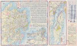
City of Vancouver surrounding [sic] and municipalities including City of New Westminster

Street map of Vancouver
Maps of Victoria and Vancouver Island, mileage chart and traffic routes

Guide map : Vancouver, New Westminster, Burnaby and North Shore municipalities

Map of Vancouver, Burnaby, New Westminster, British Columbia : street index and advertisements

Map of Vancouver, Burnaby, New Westminster, British Columbia ; Points of interest in Vancouver, British Columbia

Visitors map of Vancouver ; world famous Stanley Park ; downtown Vancouver

Visitors map of Vancouver

Wrigley's new map of Vancouver and Lower Mainland

Map of downtown section of Vancouver ; Diagram of New Westminster, B.C., downtown section

Map of Lulu Island and Sea Island ; Municipality of Surrey ; Map of Maillardville ; University Endowment Lands

Dial map of Greater Vancouver and suburbs

Map of Burnaby and New Westminster, British Columbia

Dial map of Greater Vancouver

Map of Fraser Valley

Dial map of Greater Vancouver and suburbs

Vest pocket map of Vancouver : map C

Vest pocket map of Vancouver : map D

Map of Greater Vancouver

Vest pocket map of Vancouver : map B