![[Electric circuit box]](/uploads/r/null/2/a/2aedef419fbf6eeac69e8a37df37d6bcaa7944773af356c93449a733b5a00487/8b59ff71-c39f-4aea-b21b-ce626773069d-A13345_142.jpg)
- AM1184-S1-: CVA 1184-2984
- Item
- [195-?]
![[Electrical circuits in an industrial building]](/uploads/r/null/9/4/9443b79e112597531f629641f52df3f0d8cfdfd7f9f8574b7024a6f99fc425ab/9a8ab64f-0cf9-4cb3-af2d-bb783c89bcec-A12423_142.jpg)
[Electrical circuits in an industrial building]
![[Electrical switch inside an industrial building]](/uploads/r/null/0/9/0932d2a434809bb2b553d263e584519e568520d79fa9d3546971f029a01dea6d/f3270b25-cf84-417b-b925-a11727fe2ea1-A12420_142.jpg)
[Electrical switch inside an industrial building]

Part of Hubert William Lovell fonds
Photograph was taken in the summer.

B.C. Electric Ltd. public information : control room at Carrall St. plant

B.C. Electric publications : Ralph Grom : farm scene, plowing and milk room


Electrical Industries : switch boxes
Electrical Industries : switch boxes

Cheakamus power survey : copy of portion of plan no. 11 accompanying report by E.A. Cleveland
Part of City of Vancouver fonds
Map is a topographical plan showing elevations and the location of power houses, dams, pipelines, tunnels and railways as well as mountains, glaciers, creeks and lakes in the Garibaldi Lake area. The map shows the area approximately between the Cheakamus River in the west and Pitt River in the east, and between Green Lake in the north and Rampart Lake in the south.
The map is a tracing of a portion of one of the maps created by E.A. Cleveland in 1931 and was included in the appendix to his report to the City of Vancouver on the hydro-electric capacity of the Cheakamus River system (the atlas of maps accompanying the Cleveland report is MAP 939). Sheet 11 of that atlas was a copy of the map Topographical map of Garibaldi Park, published by the British Columbia Department of Lands in 1928, a copy of which had been used as a base map to note elements of the Cheakamus River hydro-electric survey.

Part of City of Vancouver fonds
Item is a photograph showing uniformed fire fighters riding in horse-drawn fire wagons; Parnell McCarville (right center) came on duty July 29, 1907, others unidentified.
![[View of fire at G.H. Cottrell Warehouse, 139 Water Street]](/uploads/r/null/d/4/2/d42e9cc6d0ed113b820738761abee8e002b3343ece277b2d2aa63d56af341039/38d982ad-3791-47df-aa20-a24e3dff0244-CVA354-018_142.jpg)
[View of fire at G.H. Cottrell Warehouse, 139 Water Street]
Part of City of Vancouver fonds
Item is a photograph showing fire fighters climbing a ladder at building with hoses and engines below and spectators watching from below and from across the street at a rooming house.
![[Looking east along the 600 block of] Hastings Street](/uploads/r/null/e/2/e2a3cdf3015ee6e23d01ef3caa461446879ff4a5a101e0005a6b4d73f2b7fd8c/ac9b4faa-4954-4eeb-bf85-504578ea1dae-A37895_142.jpg)
[Looking east along the 600 block of] Hastings Street
Photograph shows S. Blackson, tobacconist at the corner of Granville and Hastings Streets and other buildings on Hastings Street.
![[Palace Livery Stables, Burrard Street]](/uploads/r/null/d/4/d4c6988c2fd428dffe548a8494fc953d02df66fe2b74f5ccbee1e37a12520a5a/83952f62-7137-47be-ba15-7ae7143eea1b-A37896_142.jpg)
[Palace Livery Stables, Burrard Street]
Photograph shows the stables, snow-covered street and north shore mountains in the background..
![[Electric generator building on dam]](/uploads/r/null/7/4/74929ff55856ffaffea66029b7a79ba26ed4aab35c265ab81b5f164988af3569/253ced17-e004-4168-8fb7-f701445488f6-A33212_142.jpg)
[Electric generator building on dam]
Part of Major Matthews collection
![[Electric meter installation near ceiling in hallway of office building]](/uploads/r/null/f/f/ff083eaf6fdd88529c4c4790cf0478ac2c77e515b9350fd57e60ac0e4c714e78/326b9e5b-f818-492c-b198-084cb96acdb4-A08520_142.jpg)
[Electric meter installation near ceiling in hallway of office building]
Part of Major Matthews collection
![[Electric power lines running above lane east of Granville Street]](/uploads/r/null/3/3/3324f373f9cba7df3b8f570a1813fb5b056fc9304c04a7ee87978ff8874b3d2f/53a93d20-1465-45e3-829f-e1034e13d850-A08386_142.jpg)
[Electric power lines running above lane east of Granville Street]
Part of Major Matthews collection

Part of Major Matthews collection
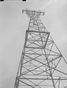
![[Electrical towers and other structures in cleared area]](/uploads/r/null/7/0/70b0e7978c57df7c1dbfc09f697336faf3dd7a10a78e1f33beb2b11861038967/d1e50e5a-5311-406b-a46b-fa0e883f50db-A04838_142.jpg)
[Electrical towers and other structures in cleared area]
Part of Major Matthews collection

Part of Major Matthews collection
Photograph shows the remains of a building, a burned street car and a man standing on an electrical transformer
![[Cable structure used to clear site for Buntzen Lake Power Plant number one]](/uploads/r/null/9/d/9d2b822519327170e06e8b9635e1c91891ab9bd5643bac780ced7720625e53fe/8bc71161-42de-4cb3-9ff7-cbc3327e3d60-A04698_142.jpg)
[Cable structure used to clear site for Buntzen Lake Power Plant number one]
Part of Major Matthews collection

Part of Major Matthews collection
Photograph shoes truck, as well as lamps, stove and washing machine.
![[B.C. Electric Railway Company right-of-way and power lines through hop fields near Sardis]](/uploads/r/null/d/e/de73c7a0f6d4cab6fdb96ec7bb521002a773292621e0f468502693cc1cda4e61/0c4436a5-3110-411d-ac8b-f100d9ecbbeb-A08425_142.jpg)
[B.C. Electric Railway Company right-of-way and power lines through hop fields near Sardis]
Part of Major Matthews collection
![[Boards and other debris in excavation area for Buntzen Lake Power Plant number one]](/uploads/r/null/6/0/601c04d46153f9d458961b3f100f423f06af9f82009c2bb27793d40c8d2e12b0/1da93105-0995-4d59-a4c3-da9565349a69-A04793_142.jpg)
[Boards and other debris in excavation area for Buntzen Lake Power Plant number one]
Part of Major Matthews collection
![[Buntzen Lake Power Plant number one construction site]](/uploads/r/null/1/0/107275f95b20365196e9b3794ac90dc96467055edf1afce0d2fa7d4c9c7db03b/9e950024-7564-4ac0-8912-1855bceba105-A04709_142.jpg)
[Buntzen Lake Power Plant number one construction site]
Part of Major Matthews collection
![[Collapsed structure and equipment, from construction of Buntzen Lake Power Plant number two]](/uploads/r/null/a/6/a6be0ec52269f94339e9cdad7f2a4a3f92fe990b1f946e395750235e5949d4a2/85ae8744-f59c-4ab9-84e7-4bd81e4dc9b7-A08134_142.jpg)
[Collapsed structure and equipment, from construction of Buntzen Lake Power Plant number two]
Part of Major Matthews collection
![[Concrete stacks of the Vancouver Steam Plant]](/uploads/r/null/7/a/7aec3bd9d506a3eec4deba9e5d1109f27acafc781b71ffab5c9b524af155fb03/93bf40a4-f44a-4c3b-a7eb-5b6771b2fa16-A08481_142.jpg)
[Concrete stacks of the Vancouver Steam Plant]
Part of Major Matthews collection
Photograph shows stacks and surrounding buildings, as well as a construction elevator used to pour concrete for the construction of the Georgia Viaduct. Photograph also shows False Creek and Mount Pleasant in the distance.
![[Concrete stacks of the Vancouver Steam Plant]](/uploads/r/null/6/9/69523427bdc722341e4e6daa1f6a67640bb6b0922b9ac1b9b04abae0b1d6a447/53c23422-10dd-44e9-8eea-4298c91ac434-A08486_142.jpg)
[Concrete stacks of the Vancouver Steam Plant]
Part of Major Matthews collection
![[Construction of Buntzen Lake Power Plant number one]](/uploads/r/null/a/e/aeb9df2b8b1c737f7a4f29c1542de987029bfa42519c9e624725d9a09f6e0a42/33070dc2-356b-4812-b160-e4b3c439ea0c-A08123_142.jpg)
[Construction of Buntzen Lake Power Plant number one]
Part of Major Matthews collection
![[Construction of east portal of hydraulic tunnel for Buntzen Lake Power Plant number two]](/uploads/r/null/1/3/13e9936885bfb15ac77c822bb2ad54a1263de00172f5b64fb20498b7993f8eae/2e17874a-a84b-487a-9371-2f601107c848-A08164_142.jpg)
[Construction of east portal of hydraulic tunnel for Buntzen Lake Power Plant number two]
Part of Major Matthews collection
![[Construction of penstock number one for Buntzen Lake Power Plant number two]](/uploads/r/null/5/e/5e16c21204a0d46b8654eb57e371e689df461683b95343ac4d3be48d3216ec05/2eb9f0bb-9b41-49b5-a3af-57e0505d716a-A08150_142.jpg)
[Construction of penstock number one for Buntzen Lake Power Plant number two]
Part of Major Matthews collection
Photograph shows railway track and sections of pipe.
![[Diagram showing electrical connections of rectifier for New Westminster High School]](/uploads/r/null/c/0/c06b1206c6cdeab2221b4e87ad1fdb305700ae0840ee1b73d29aba132376f8c0/aa4b63b5-2165-435e-9a62-a0129d046ab2-A08613_142.jpg)
[Diagram showing electrical connections of rectifier for New Westminster High School]
Part of Major Matthews collection
Photograph negative is a copy of technical drawing produced by the Standard Electric Time Co.

Annual Pacific Coast Convention
Part of Major Matthews collection
Photograph shows a visit of the American Institute of Electrical Engineers to plant No. 2 where lunch was served in the high tension switch room
![[Partially constructed hydraulic tunnel for Buntzen Lake Power Plant number two]](/uploads/r/null/2/0/204c7d03fefbf753b6bd3f09c896b0ded6a3a40dca9a04134787f95f0ebde98f/def5a950-49c5-4392-9930-e6e0893bb8d4-A08170_142.jpg)
[Partially constructed hydraulic tunnel for Buntzen Lake Power Plant number two]
Part of Major Matthews collection
![[Partially laid cable ducts in the sidewalk of the Georgia Viaduct]](/uploads/r/null/1/b/1bb85355316dfa848d64725820c33dec3898fe29f4ff418b568ce89750f996c8/1fdc2ce0-6ffb-4a7e-902b-009c30e73521-A08499_142.jpg)
[Partially laid cable ducts in the sidewalk of the Georgia Viaduct]
Part of Major Matthews collection
![[Pelton-Doble hydraulic valves used for power plant penstocks]](/uploads/r/null/7/2/72be573d4399b643f7b8b391b7aaba20212d8513e5e84ee92b7f6daf80648b07/c7e73229-be0e-4611-96f9-2ee68533b3b2-A08270_142.jpg)
[Pelton-Doble hydraulic valves used for power plant penstocks]
Part of Major Matthews collection
![[Pieces of lead covered cable, showing corrosion as part of an electrolysis survey]](/uploads/r/null/1/9/19780e9e5c42eda7d1628053e23ffeb93eef1b004a2907f701c385345ad7a27d/a9e73b6f-7b31-4d5d-8e47-bd31f5afdb4c-A08492_142.jpg)
[Pieces of lead covered cable, showing corrosion as part of an electrolysis survey]
Part of Major Matthews collection
Photograph shows specimens, and labels indicating type of specimen and the location from which it was taken.
![[Pieces of water pipe and lead covered cable, showing corrosion as part of an electrolysis survey]](/uploads/r/null/a/7/a76821c125cd337722a6b60bdc050032d5202f94769abfdb541c5714b0b31fe7/a6c2c8fb-9d92-411f-8221-f5827a9a1ab2-A08455_142.jpg)
[Pieces of water pipe and lead covered cable, showing corrosion as part of an electrolysis survey]
Part of Major Matthews collection
Photograph shows specimens, and labels indicating type of specimen and the location from which it was taken.
![[Pieces of water pipe, showing corrosion as part of an electrolysis survey]](/uploads/r/null/6/f/6f28d4c27df95c2eefecdd965ce4d68f3baa700fc2c570dd71f0a8eff69a7a9b/bed4c9f2-9bf7-4c94-919a-915caa99def1-A08495_142.jpg)
[Pieces of water pipe, showing corrosion as part of an electrolysis survey]
Part of Major Matthews collection
Photograph shows specimens, and labels indicating type of specimen and the location from which it was taken.
![[Power lines and supporting structure in lane west of Main Street at Pender Street]](/uploads/r/null/1/c/1c402846680276f8837a24aa94a8689864e33938fe4fff21e84db6f711131eb2/cc8097b0-7bcc-4321-9ea5-70b1f3dcb346-A08574_142.jpg)
[Power lines and supporting structure in lane west of Main Street at Pender Street]
Part of Major Matthews collection
Photograph shows power lines, houses with businesses operating on ground floors, and a portion of the City Hall building.
![[Power lines over intersection of Cambie and Pender Streets]](/uploads/r/null/5/6/567541cd1d6b32e46f96fe47ea2ea6f11a047a332ba8dfa7097f0d7126b1bb63/f0b55b3c-8dee-4642-bf4f-0be7267e5a57-A08573_142.jpg)
[Power lines over intersection of Cambie and Pender Streets]
Part of Major Matthews collection
Photograph shows intersection, looking northwest towards Victory Square.
![[Power lines over lane near Pender and Main Streets]](/uploads/r/null/1/d/1d8fe4102b6c917d2a94cf6b540db7009a25d49bc03015f3ffb4e00308d23a45/0e575a68-e823-41d6-8a79-f8389a11ad8a-A08564_142.jpg)
[Power lines over lane near Pender and Main Streets]
Part of Major Matthews collection
Photograph shows electric power lines and support structure, and part of the Sherman Hotel.
![[Power poles along dirt road]](/uploads/r/null/3/f/3f4448f4f1664c7a45a9f772a26e8dd98c31a7deb74b6d0baf2e4d6b5b74efce/0fd5cf5d-f7dd-4097-a8cf-e3e025a10241-A04748_142.jpg)
Part of Major Matthews collection
![[Underground cable manholes for Haro Street substation]](/uploads/r/null/4/c/4c8ff38c4cf3c563bd9d648e7e30eee12f514df06665bcbbedaa28879011c7f1/44fb0a9b-33a4-4e2c-862b-0cf924893b5f-A08412_142.jpg)
[Underground cable manholes for Haro Street substation]
Part of Major Matthews collection
![[Various scenes regarding the activities of the B.C. Electric Railway Company]](/uploads/r/null/0/4/0467efa94464a02c16e7e38b6205a4b0778adf1514ce8924e4ac79c3a7001f04/1ad6b443-1dee-4db8-9265-74dc574fcf64-A08284_142.jpg)
[Various scenes regarding the activities of the B.C. Electric Railway Company]
Part of Major Matthews collection
Photograph negative is a copy of four photograph prints, showing: people assembled on porch for Director's visit to construction site; partially constructed Coquitlam Dam; water flowing through temporary gates of dam; and construction site for Coquitlam Dam. Negative was created to produce lantern slides of the four images.
![[Various scenes regarding the activities of the B.C. Electric Railway Company]](/uploads/r/null/1/e/1ee190fc72fadd51237e24e63ebb67bd94c2352f32456af3578b86cdb6837205/c1ba3b40-e82c-444f-964a-467a3c398cd3-A08286_142.jpg)
[Various scenes regarding the activities of the B.C. Electric Railway Company]
Part of Major Matthews collection
Photograph negative is a copy of four photograph prints, showing: man standing on partially built structure; group of men assembled on porch of house; and two views of construction site of dam or power plant. Negative was created to produce lantern slides of the four images.
![[View of Columbia Street]](/uploads/r/null/e/f/ef93d73651c288cd13bec183ae441b073bef56fd8e1478d1e8606db139c05f97/fffbb383-9d42-4db1-944b-a41bd8bd0042-A33175_142.jpg)
Part of Major Matthews collection
![[Three men on float in False Creek conducting an electrolysis survey]](/uploads/r/null/c/4/c4be4a4e981144167414053feaf177d8d72bde6b5a85fe60d1ae5b9bfb6c9b8e/5df883f0-ed94-42e4-a906-b4f43bbc6639-A08610_142.jpg)
[Three men on float in False Creek conducting an electrolysis survey]
Part of Major Matthews collection
Photograph shows three men with equipment on a small float, and two men in canoes nearby.