
Landscape - historical : aerial (VanDusen)
- AM1502-S1-2-: CVA 1502-1701
- Item
- [Apr. 5, 1990]
462 results with digital objects Show results with digital objects
Landscape - historical : aerial (VanDusen)

Landscape - historical : aerial (VanDusen)
![Landscape - graphics (plans, etc.) : aerial V[an]D[usen]](/uploads/r/null/2/e/2ee9a58a6336be3999a26af233122153bd043971a2536067687463b1ce2bcb64/f915c383-9d2b-4aee-9ed0-f5bcf55059a4-A54248_142.jpg)
Landscape - graphics (plans, etc.) : aerial V[an]D[usen]
![Landscape - graphics (plans, etc.) : aerial V[an]D[usen]](/uploads/r/null/3/6/3621b9ce5739e1bd86ce0cda8d3e80e7602cb2d64dc9fd47e1cdc935bc34ba1a/404f8cf3-5320-4afd-bd71-5592fdbb1e03-A54249_142.jpg)
Landscape - graphics (plans, etc.) : aerial V[an]D[usen]
![Landscape - graphics (plans, etc.) : [untitled]](/uploads/r/null/a/d/ad347baa27f1b868d25d1650c73b399d89d4945170c84d64ac3f7a37951d7e8c/58aef767-bb3e-4534-ab55-67a5a0fda7d3-A54250_142.jpg)
Landscape - graphics (plans, etc.) : [untitled]
Slide shows an aerial view of VanDusen Garden.
![Landscape - graphics (plans, etc.) : [untitled]](/uploads/r/null/a/d/ad18f1f5066bff4d2596cc32e8a7647f62fdf639dc56be32e36821c632b4e838/f0dbe26a-550d-4888-b96d-c1672406c0dd-A54251_142.jpg)
Landscape - graphics (plans, etc.) : [untitled]
Slide shows an aerial view of VanDusen Garden.
![Landscape - graphics (plans, etc.) : [untitled]](/uploads/r/null/9/0/909643c898f5e86663c57c80624adad9c680be74cd01f57274ef9916cc045483/8d47c74a-1004-4bb6-bd31-7ad94eca52ac-A54252_142.jpg)
Landscape - graphics (plans, etc.) : [untitled]

Landscape - graphics (plans, etc.) : aerial

Landscape - graphics (plans, etc.) : stone garden
![[Aerial view of J.F. Malkin's residence at 1950 Southwest Marine Drive]](/uploads/r/null/e/8/e8b684b06c9e0631c4a425d2b9bcd1376874c91eef26e2a789fe69d080c32f4c/ed047908-3466-488c-9dc3-536dcb876908-A62676_142.jpg)
[Aerial view of J.F. Malkin's residence at 1950 Southwest Marine Drive]
Part of Major Matthews collection
Oblique view from an "autogiro" aircraft looking north over Kerrisdale
![[Aerial view looking east over the West End and Vancouver Harbour]](/uploads/r/null/7/2/72a6a15fa5e8b8bb00446ded690554cbc6e31a707a1b358bde2c463fbd514287/86590540-e15a-410c-8083-495eb213a7ca-A63256_142.jpg)
[Aerial view looking east over the West End and Vancouver Harbour]
Part of Major Matthews collection
Oblique view showing Lost Lagoon, Brockton Point and Deadman's Island
![[Aerial view of] Pacific National Exhibition [at Hastings Park]](/uploads/r/null/a/c/acd5dd5e58cdbe8cd9c6468f795b4a633b0c3ea659353323eba7ec40221ad776/aa746b47-2f03-4577-94ef-977cab2a0066-A23456_142.jpg)
[Aerial view of] Pacific National Exhibition [at Hastings Park]
Part of Major Matthews collection
Photograph shows houses on Renfrew Street and Second Narrows Highway Bridge.
![[Aerial photograph of the Alberta Wheat Pool elevators and shipping gallery]](/uploads/r/null/3/2/32dabc19b9a47ef8b896d54d0659490566097669fc4b47d2f53556b539abddda/989f5b86-0587-4af2-9362-01b4eea2b5d7-A25116_142.jpg)
[Aerial photograph of the Alberta Wheat Pool elevators and shipping gallery]
Part of Major Matthews collection
Oblique view shows the New Brighton Pool
![[Aerial view of Vancouver Harbour from Stanley Park looking east to Indian Arm]](/uploads/r/null/c/b/cb066fdc626d69001bfb4c896937f586737298cc09ee0de3cc7fdd0bca8df09e/93414b9d-edd5-4e76-a79d-fb7a26360472-A31831_142.jpg)
[Aerial view of Vancouver Harbour from Stanley Park looking east to Indian Arm]
Part of Major Matthews collection
Oblique view

Part of Gordon Brown fonds
![Landscape - graphics (plans, etc.) : [untitled]](/uploads/r/null/4/f/4fbed26539ccf55c230e9edaefc592803c5fde23cd609f0dfd1061594196421b/a0243e9a-ee8a-48a1-8668-91cd52dad7b0-A54243_142.jpg)
Landscape - graphics (plans, etc.) : [untitled]
Slide shows a black-and-white aerial photograph of VanDusen Garden.

Aerial view of P.N.E. Playland
Item is a photograph depicting an oblique view showing the roller coaster and rest of the amusement park.

British Columbia - Vancouver skyline
Item is aerial photograph showing downtown Vancouver and Burrard Inlet.

British Columbia - Vancouver skyline
Item is aerial photograph showing downtown Vancouver and Burrard Inlet.

British Columbia - Vancouver skyline
Item is aerial photograph showing downtown Vancouver.

British Columbia - Vancouver skyline
Item is aerial photograph showing downtown Vancouver.

Part of City of Vancouver fonds
Address: Vancouver - Hastings Street West, 200. Comment in slide list for this image is "Site is designed in two parts as a park and as a memorial contrast between natural landscape and a more formal man-made area. Upper area strongly enclosed by trees while northern part is open to street." Photograph shows an aerial view of Victory Square.

Aerial view looking northeast over Hastings Park
Item is a photograph depicting an oblique view showing Renfrew Street, the Hastings Park race track, the amusement park including the roller coaster, exhibition buildings, Callister Park and the houses between Oxford Street, Triumph Street, Kaslo Street and Renfrew Street.
![[Aerial view of the West End showing the increase of apartment buildings west of Cardero Street]](/uploads/r/null/9/4/9410444a29ad3e6e13228ba5ad44b40986af7ad70945337641000d03b991a529/ee9fb9e8-21b9-4ca5-a5b6-d28e6d51046e-A25977_142.jpg)
[Aerial view of the West End showing the increase of apartment buildings west of Cardero Street]
Part of Major Matthews collection
Photograph shows oblique view of Lost Lagoon, Stanley Park and Lord Roberts School
![[Aerial view of fire at Vancouver sawmill]](/uploads/r/null/2/6/261c182ef20aa4aa00d0b46917096bf17c339730ec5975e81a6c1fbc2b63158f/05be5137-bdbf-42ad-a142-3e73d5538015-A71287_142.jpg)
![[Aerial photograph of downtown Vancouver looking north]](/uploads/r/null/2/4/24032a0f19bc217e5bb533d7218824f932301e972f1020a352118b50afcf8a93/8e2450db-6794-4283-95a6-7641bc80437d-A69847_142.jpg)
[Aerial photograph of downtown Vancouver looking north]
Photograph shows an oblique view of the north shore of False Creek including the C.P.R. Roundhouse, Yaletown, Cambie Bridge (old), Sweeney Cooperage, Georgia Viaduct, Post Office building under construction, Pier "B/C", Coal Harbour, Stanley Park, Lions Gate Bridge and a view of North and West Vancouver.
![[Aerial view of Downtown Vancouver looking south from Burrard Inlet]](/uploads/r/null/3/2/32bc12be65a895f144d669768ee019e6abc83bc4018b11b3ecf96930fbd98786/024e645a-ce5d-4e73-a4e1-efb2ad9b7995-A71518_142.jpg)
[Aerial view of Downtown Vancouver looking south from Burrard Inlet]
Photograph shows Canada Place under construction, the SeaBus terminal, Waterfront Station (formerly the C.P.R. Station), the Marine Building, Harbour Centre and False Creek and Granville Island in the background
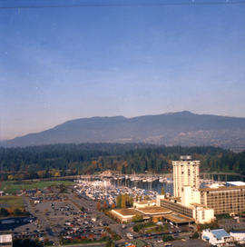
![[Aerial view of rail yard and industrial area]](/uploads/r/null/9/f/9f92989deb2b54597c6743bd67717653fc644c23b6fc48e55d2e1b9dbf6e8489/763b5a38-9eae-4b16-bedc-45ca5c32d888-A71602_142.jpg)
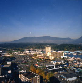
![[Aerial view of industrial area]](/uploads/r/null/5/d/5dd69372e15c5f349b4b4b8cdb7a12063cbbf02d158ab97d57ba863214b5c209/5f3baa69-a2f9-4adb-a590-4b420086d51d-A71604_142.jpg)

British Columbia - Vancouver skyline
Item is aerial photograph showing Stanley Park and Coal Harbour.

British Columbia - Vancouver skyline
Item is photograph showing an aerial view of Burrard Inlet showing the southern shoreline and parts of Stanley Park.

British Columbia - Vancouver skyline
Item is photograph showing an aerial view of Burrard Inlet showing the southern shoreline and parts of Stanley Park.

British Columbia - Vancouver skyline
Item is photograph showing an aerial view of Burrard Inlet showing the southern shoreline and parts of Stanley Park.

British Columbia - Vancouver skyline
Item is aerial photograph showing Coal Harbour from the south shore.
British Columbia - Vancouver skyline
Item is aerial photograph showing downtown Vancouver looking north west towards Stanley Park.

British Columbia - Vancouver skyline
Item is aerial photograph showing downtown Vancouver looking north west towards Stanley Park.

British Columbia - Vancouver skyline
Item is aerial photograph showing part of downtown Vancouver, Stanley Park and Coal Harbour.

British Columbia - Vancouver skyline
Item is aerial photograph showing Coal Harbour and Stanley Park from the south shore.

British Columbia - Vancouver skyline
Item is aerial photograph showing construction of downtown Vancouver.

British Columbia - Vancouver skyline
Item is aerial photograph showing downtown Vancouver looking north west towards Stanley Park.

British Columbia - Vancouver skyline
Item is aerial photograph showing part of downtown Vancouver looking north west towards Stanley Park.
British Columbia - Vancouver skyline
Item is aerial photograph showing part of downtown Vancouver looking north towards Stanley Park and Coal Harbour.

British Columbia - Vancouver skyline
Item is aerial photograph showing downtown Vancouver looking north west towards Stanley Park.

British Columbia - Vancouver skyline
Item is aerial photograph showing Coal Harbour from the south shore.

British Columbia - Vancouver skyline
Item is aerial photograph showing construction of downtown Vancouver.

British Columbia - Vancouver skyline
Item is aerial photograph showing downtown Vancouver looking north west towards Stanley Park.

British Columbia - Vancouver skyline
Item is aerial photograph showing downtown Vancouver looking north west towards Stanley Park.

British Columbia - Vancouver skyline
Item is aerial photograph showing downtown Vancouver and Burrard Inlet.

British Columbia - Vancouver skyline
Item is aerial photograph showing downtown Vancouver looking north west towards Stanley Park.

British Columbia - Vancouver skyline
Item is aerial photograph showing Coal Harbour and Burrard Inlet