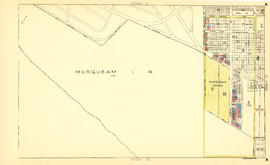
Sheet 8 : McLean Drive to Slocan Street and William Street to Seventh Avenue
- AM1594-MAP 779-: MAP 779.10
- Item
- [ca. 1935], revised to Oct. 7, 1938
Part of City of Vancouver Archives technical and cartographic drawing collection
Item is a section showing the area from McLean Drive to Slocan Street and William Street to Seventh Avenue. Includes streets and roads, blocks, lots, legal descriptions, railways, parks, schools and some businesses.
Vancouver (B.C.). Office of the City Engineer