
- AM1594-: MAP 1199-: LEG1377.06
- Part
- [ca. 1940]
Part of City of Vancouver Archives technical and cartographic drawing collection
Part contains a street map of Greater Vancouver showing highways, municipal boundaries, parks and golf courses.
190 results with digital objects Show results with digital objects
Part of City of Vancouver Archives technical and cartographic drawing collection
Part contains a street map of Greater Vancouver showing highways, municipal boundaries, parks and golf courses.

Plan of Point Grey Municipality
Part of City of Vancouver Archives technical and cartographic drawing collection
Item is a map showing streets, district lot, and block numbers and has been annotated to show locations of American elm trees along streets. Further annotations identify locations of trees that have been sprayed or are to be sprayed.

Part of City of Vancouver Archives technical and cartographic drawing collection
Item is a copy of sections of a November 1889 fire insurance map that have been pieced together. Includes the area between Seymour and Dunlevy Streets, from the south shore of the Burrard Inlet to Keefer Street. Map shows Chinatown, part of False Creek, and buildings and their uses (commercial, residential, industrial). The name of the business, business owner, or type of business is noted for most commercial and industrial buildings.

Sheet 1: Slocan Street to Boundary Road and Triumph Street to Burrard Inlet
Part of City of Vancouver Archives technical and cartographic drawing collection
Item is a section showing the area bound by Slocan Street, Boundary Road, Triumph Street and the waterfront. Includes streets, roads, railways, blocks, lots, legal descriptions, quit claims, leases, parks and businesses along the waterfront.
Vancouver (B.C.). Office of the City Engineer

Sheet 2: Slocan Street to Boundary Road and Charles Street to Triumph Street
Part of City of Vancouver Archives technical and cartographic drawing collection
Sheet is a section showing the area from Slocan Street to Boundary Road and Charles Street to Triumph Street. Includes streets, roads, blocks, lots, legal descriptions, parks, schools, and retirement homes.
Vancouver (B.C.). Office of the City Engineer

Sheet 3 : Slocan Street to Boundary Road and Seventh Avenue to Charles Street
Part of City of Vancouver Archives technical and cartographic drawing collection
Item is a section showing the area from Slocan Street to Boundary Road and Seventh Avenue to Charles Street. Includes streets and roads, blocks, lots, legal descriptions, parks and schools.
Vancouver (B.C.). Office of the City Engineer

Sheet 10 : Clark Drive to Slocan Street and waterfront to Triumph Street
Part of City of Vancouver Archives technical and cartographic drawing collection
Item is a section showing the area from Clark Drive to Slocan Street and waterfront to Triumph Street. Includes streets and roads, blocks, lots, legal descriptions, railways, parks, boys' detention home and businesses along the waterfront. The Town of Hastings is indicated on the map.
Vancouver (B.C.). Office of the City Engineer

Sheet 19 : Maple Street to Richards Street and Drake Street to Third Avenue
Part of City of Vancouver Archives technical and cartographic drawing collection
Item is a section showing Maple Street to Richards Street and Drake Street to Third Avenue. Includes streets, roads, blocks, lots, legal descriptions, parks, schools, the Burrard and Granville Street Bridges, C.P.R. right-of-ways, the Squamish Band reserve, C.P.R. leases and property, and government reserve. Map includes Granville Island.
Vancouver (B.C.). Office of the City Engineer

Sheet 16 : St. George Street to Argyle Street and Fifty-eighth Avenue to Fraser River
Part of City of Vancouver Archives technical and cartographic drawing collection
Item is a section showing the area from St. George Street to Argyle Street and Fifty-eighth Avenue to the Fraser River. Includes streets, roads, blocks, lots, legal descriptions, railway lines, parks and schools.
Vancouver (B.C.). Office of the City Engineer

Sheet A : University Endowment Lands to Imperial Street and waterfront to Fifth Avenue
Part of City of Vancouver Archives technical and cartographic drawing collection
Item is a section showing the area from the University Endowment Lands to Imperial Street and waterfront to Fifth Avenue. Includes streets, roads and sewers; blocks, lots and legal descriptions; and parks.
Vancouver (B.C.). Office of the City Engineer

Sheet G : Trafalgar Street to Granville Street and Sixteenth Avenue to Nanton Avenue
Part of City of Vancouver Archives technical and cartographic drawing collection
Item is a section showing the area from Trafalgar Street to Granville Street and Sixteenth Avenue to Nanton Avenue. Includes streets, roads and sewers; blocks, lots and legal descriptions; and parks, railway lines and schools.
Vancouver (B.C.). Office of the City Engineer

Sheet H : Alexandra Street to Cambie Street and Fifteenth Avenue to Twenty-seventh Avenue
Part of City of Vancouver Archives technical and cartographic drawing collection
Item is a section showing the area from Alexandra Street to Cambie Street and Fifteenth Avenue to Twenty-seventh Avenue. Includes streets, roads, blocks, lots, legal descriptions, parks, hospitals and schools.
Vancouver (B.C.). Office of the City Engineer

Sheet L : Trafalgar Street to Granville Street and Nanton Avenue to Thirty-eighth Avenue
Part of City of Vancouver Archives technical and cartographic drawing collection
Item is a section showing the area from Trafalgar Street to Granville Street and Nanton Avenue to Thirty-eighth Avenue. Includes streets, roads and sewers; blocks, lots and legal descriptions; and parks, golf courses and schools.
Vancouver (B.C.). Office of the City Engineer

Sheet O : Holland Street to Elm Street and Thirty-eighth Avenue to Forty-ninth Avenue
Part of City of Vancouver Archives technical and cartographic drawing collection
Item is a section showing the area from Holland Street to Elm Street and Thirty-eighth Avenue to Forty-ninth Avenue. Includes streets, roads and sewers; blocks, lots and legal descriptions; and golf courses, parks and schools.
Vancouver (B.C.). Office of the City Engineer

Sheet P : Trafalgar Street to Granville Street and Thirty-ninth Avenue to Thirty-seventh Street
Part of City of Vancouver Archives technical and cartographic drawing collection
Item is a section showing the area from Trafalgar Street to Granville Street and Thirty-ninth Avenue to Thirty-seventh Street. Includes streets and roads; blocks, lots and legal descriptions; and parks and schools.
Vancouver (B.C.). Office of the City Engineer

Sheet X : Marine Drive to Ash Street and Fifty-ninth Avenue to Seventy-first Avenue
Part of City of Vancouver Archives technical and cartographic drawing collection
Item is a section showing the area from Marine Drive to Ash Street and Fifty-ninth Avenue to Seventy-first Avenue. Includes streets and roads; blocks, lots and legal descriptions; and parks and schools.
Vancouver (B.C.). Office of the City Engineer

Sheet S.V. 3 : Cambie Street to St. George Street and Twenty-seventh Avenue to Thirty-eighth Avenue
Part of City of Vancouver Archives technical and cartographic drawing collection
Item is a section showing the area from Cambie Street to St. George Street and Twenty-seventh Avenue to Thirty-eighth Avenue. Map shows streets, roads, blocks, lots and legal descriptions and the locations of parks, schools, reservoirs and Mountainview Cemetery.
Vancouver (B.C.). Office of the City Engineer

Sheet 5 : Dumfries Street to Fairmont Street and Twenty-seventh Avenue to Thirty-seventh Avenue
Part of City of Vancouver Archives technical and cartographic drawing collection
Item is a section showing the area from Dumfries Street to Fairmont Street and Twenty-seventh Avenue to Thirty-seventh Avenue. Includes streets, roads, blocks, lots, legal descriptions, parks, railway lines and schools.
Vancouver (B.C.). Office of the City Engineer

Sheet 8 : Prince Edward Street to Bruce Street and Thirty-fifth Avenue to Forty-seventh Avenue
Part of City of Vancouver Archives technical and cartographic drawing collection
Item is a section showing the area from Prince Edward Street to Bruce Street and Thirty-fifth Avenue to Forty-seventh Avenue. Includes streets, roads, blocks, lots, legal descriptions, and cemeteries, parks and schools.
Vancouver (B.C.). Office of the City Engineer

Sheet 10 : Carlton Street to Boundary Road and Fortieth Avenue to Fiftieth Avenue
Part of City of Vancouver Archives technical and cartographic drawing collection
Item is a section showing the area from Carlton Street to Boundary Road and Fortieth Avenue to Fiftieth Avenue. Includes streets, roads, blocks, lots, legal descriptions, parks and schools.
Vancouver (B.C.). Office of the City Engineer

Sheet 6 : Knight Street to Slocan Street and Eighteenth Avenue to Twenty-ninth Avenue
Part of City of Vancouver Archives technical and cartographic drawing collection
Item is a section showing the area from Knight Street to Slocan Street and Eighteenth Avenue to Twenty-ninth Avenue. Includes streets and roads, blocks, lots, legal descriptions, railways, parks and schools. Some annotations have been made in pencil.
Vancouver (B.C.). Office of the City Engineer

Sheet 9 : Clark Drive to Slocan Street and Triumph Street to Charles Street
Part of City of Vancouver Archives technical and cartographic drawing collection
Item is a section showing the area from Clark Drive to Slocan Street and Triumph Street to Charles Street. Includes streets and roads, blocks, lots, legal descriptions, railways, parks, schools and drill hall. The Town of Hastings is indicated on the map.
Vancouver (B.C.). Office of the City Engineer

Sheet S.V. 16 : Dawson Street to Boundary Road and Fiftieth Avenue to Sixty-third Avenue
Part of City of Vancouver Archives technical and cartographic drawing collection
Item is a section showing the area from Dawson Street to Boundary Road and Fiftieth Avenue to Sixty-third Avenue. Includes streets, roads, blocks, lots, legal descriptions, parks and golf courses.
Vancouver (B.C.). Office of the City Engineer

Sheet 2 : Slocan Street to Boundary Road and Charles Street to Triumph Street
Part of City of Vancouver Archives technical and cartographic drawing collection
Item is a section showing the area from Slocan Street to Boundary Road and Charles Street to Triumph Street. Includes streets, roads, blocks, lots, legal descriptions, parks, schools, and retirement homes.
Vancouver (B.C.). Office of the City Engineer

Sheet 4 : Slocan Street to Boundary Road and Broadway to Seventeenth Avenue
Part of City of Vancouver Archives technical and cartographic drawing collection
Item is a section showing the area from Slocan Street to Boundary Road and Broadway to Seventeenth Avenue. Includes streets and roads, blocks, lots, legal descriptions, railways, parks and schools.
Vancouver (B.C.). Office of the City Engineer

Sheet 14 : Main Street to Knight Street and Fifteenth Avenue to King Edward Street
Part of City of Vancouver Archives technical and cartographic drawing collection
Item is a section showing the area from Main Street to Knight Street and Fifteenth Avenue to King Edward Street. Includes streets and roads, blocks, lots, legal descriptions, parks, schools and businesses.
Vancouver (B.C.). Office of the City Engineer

Sheet 22 : Stanley Park to Burrard Street and waterfront to Robson Street
Part of City of Vancouver Archives technical and cartographic drawing collection
Item is a section showing Stanley Park to Burrard Street and waterfront to Robson Street. Includes streets and roads; blocks, lots and legal descriptions. Map shows the locations of Stanley Park, Deadmans Island, marine filling stations, the dredged channel, harbour headline, C.P.R .yards and Pier A, businesses along the waterfront, government buildings, land leases and quit claims.
Vancouver (B.C.). Office of the City Engineer

Sheet B : Discovery Street to Trutch Street and waterfront to Fourth Avenue
Part of City of Vancouver Archives technical and cartographic drawing collection
Item is a section showing the area from Discovery Street to Trutch Street and waterfront to Fourth Avenue. Includes streets, roads and sewers; blocks, lots and legal descriptions; and parks and schools. Map shows Jericho Air Station and crown leases.
Vancouver (B.C.). Office of the City Engineer

Sheet K : Wallace Street to Trafalgar Street and Twenty-seventh Street to Thirty-eighth Avenue
Part of City of Vancouver Archives technical and cartographic drawing collection
Item is a section showing the area from Wallace Street to Trafalgar Street and Twenty-seventh Street to Thirty-eighth Avenue. Includes streets, roads and sewers; blocks, lots and legal descriptions; and parks and schools.
Vancouver (B.C.). Office of the City Engineer

Sheet P : Trafalgar Street to Granville Street and Thirty-ninth Avenue to Forty-ninth Street
Part of City of Vancouver Archives technical and cartographic drawing collection
Item is a section showing the area from Trafalgar Street to Granville Street and Thirty-ninth Avenue to Forty-ninth Street. Includes streets, roads, blocks, lots, legal descriptions, parks, golf courses, schools and community centres. Annotations in red pencil.
Vancouver (B.C.). Office of the City Engineer

Sheet S : Musqueam Reserve to Macdonald Street and Forty-ninth Avenue to Fraser River
Part of City of Vancouver Archives technical and cartographic drawing collection
Item is a section showing the area from the Musqueam Reserve to Macdonald Street and Forty-ninth Avenue to Fraser River. Includes streets, roads, blocks, lots, and legal descriptions. Map indicates the locations of the Point Grey Golf and Country Club and the Celtic Cannery. Annotations in red ink.
Vancouver (B.C.). Office of the City Engineer

Part of City of Vancouver Archives technical and cartographic drawing collection
Item is a sheet with two sections. The first section shows the area from Milton Street to Heather Street and Seventy-second Avenue to Fraser River; the second section shows the area from Angus Drive to Granville Street and South West Marine Drive to Fraser River. Sections show streets, roads, blocks, lots and legal descriptions, as well as the location of railway lines, the Eburne Sawmill, and a proposed bridge to Richmond.
Vancouver (B.C.). Office of the City Engineer

Sheet S.V. 9 : St. George Street to Argyle Street and Fifty-eighth Avenue to Fraser River
Part of City of Vancouver Archives technical and cartographic drawing collection
Item is a section showing the area from St. George Street to Argyle Street and Fifty-eighth Avenue to Fraser River. Includes streets, roads, blocks, lots, legal descriptions, railway lines, parks and schools.
Vancouver (B.C.). Office of the City Engineer

Part of City of Vancouver Archives technical and cartographic drawing collection
Item is a section showing the area from Dumfries Street to Fairmont Street and Twenty-seventh Avenue to Thirty-seventh Avenue. Includes streets, roads, blocks, lots, legal descriptions, railway lines, parks and schools. Annotations in green pencil.
Vancouver (B.C.). Office of the City Engineer

Vest pocket map of Vancouver : map D
Part of City of Vancouver Archives technical and cartographic drawing collection
Part shows Vancouver from Heather Street to Garden Drive and Grant Street to Sixteenth Avenue. Shows district lot and block numbers, public schools, and hospitals.

District lot index and street index (1st Avenue to Campbell Avenue)
Part of City of Vancouver Archives technical and cartographic drawing collection
Part contains two pages from the booklet accompanying a guide map of Greater Vancouver.

Guide map : Vancouver, New Westminster, Burnaby and North Shore municipalities : street index
Part of City of Vancouver Archives technical and cartographic drawing collection

Visitors map of Vancouver ; world famous Stanley Park ; downtown Vancouver
Part of City of Vancouver Archives technical and cartographic drawing collection
Part contains detail maps of Stanley Park and downtown Vancouver, tourist information including traffic rules, locations of churches, golf courses, and amenities, and a list of member businesses of the Vancouver Tourist Association.

Part of City of Vancouver Archives technical and cartographic drawing collection
Part contains a map of Greater Vancouver showing the locations of Bekins Moving and Storage, distances from the Burrard Street and York Street location and city streets. Part includes four photographic images of points of interest in Vancouver.

Map of West Vancouver and vicinity
Part of City of Vancouver Archives technical and cartographic drawing collection
Part contains a map of West Vancouver, North Vancouver, and the northern parts of Vancouver and Burnaby. Map shows district lot and block numbers, streets, and distances from City Hall.

Map of down-town retail business section
Part of City of Vancouver Archives technical and cartographic drawing collection
Part contains a map of downtown Vancouver showing streets and businesses, and information on industry in Vancouver and British Columbia.

Part of City of Vancouver Archives technical and cartographic drawing collection
Map shows Vancouver from the University Endowment Lands to South Granville Street and from English Bay to the Fraser River. Streets, parks, schools and golf courses are identified. Map joins with MAP 574 to create a map of the entire City of Vancouver.
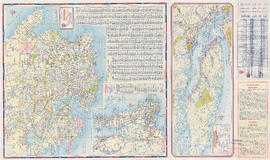
Maps of Victoria and Vancouver Island, mileage chart and traffic routes
Part of City of Vancouver Archives technical and cartographic drawing collection
Part contains a street map of Victoria with street index, a map of Victoria and vicinity showing major roads, a map of Vancouver Island showing highways, a mileage chart, and traffic rules for Vancouver and Victoria.
Part of City of Vancouver Archives technical and cartographic drawing collection
Item is a pamphlet containing street maps of Greater Vancouver and the Fraser Valley, detail maps of traffic interchanges, and general tourist information.

Street map of Greater Vancouver, B.C.
Part of City of Vancouver Archives technical and cartographic drawing collection
Part contains a street map of Greater Vancouver showing block numbers, parks, golf courses, cemeteries, and hospitals; inset maps showing streets in Coquitlam and the Horseshoe Bay area; and a map showing Highway 99 from Horseshoe Bay to Squamish.
Metropolitan areas of Vancouver and Victoria, B.C. road map
Part of City of Vancouver Archives technical and cartographic drawing collection
Item is road map designed to be folded into a pamphlet and containing three maps showing streets in Greater Vancouver, major roads from the North Shore to Bellingham, Washington, and major roads in and around Victoria. Item also includes information about traffic rules in Vancouver and the use of the imperial gallon in British Columbia.

Part of City of Vancouver Archives technical and cartographic drawing collection
Part contains a street map of Greater Vancouver.
Indexed map of Greater Vancouver
Part of City of Vancouver Archives technical and cartographic drawing collection
Item is a promotional brochure for Bekins Moving and Storage, with a map of Greater Vancouver showing distances from the Bekins building on one side, and text advertising the company's services and facilities on the other.
Street map of Greater Vancouver
Part of City of Vancouver Archives technical and cartographic drawing collection
Item is a published road map, created for and distributed by Home Oil Distributors, with a map of Greater Vancouver on one side and maps of the Fraser Valley, Surrey and Richmond (iwth street indexes) on the other. The maps show roads, block numbers, boundaries, highway markers and Home Oil gas stations.
Part of City of Vancouver Archives technical and cartographic drawing collection
Item is a pamphlet containing a street map of Greater Vancouver, an illustrated map of West Vancouver and North Vancouver, and real estate information including the benefits of owning versus renting real property.