Sectional map of Vancouver showing streets, block and lot outlines, and building perimeters : Map 60 : Oak Street to Quebec Street and 37th Avenue to 46th Avenue
Sectional map of Vancouver showing streets, block and lot outlines, and building perimeters : Map 61 : Cypress Street to Oak Street and 33rd Avenue to 41st Avenue
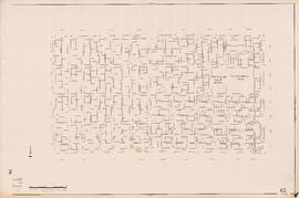
Sectional map of Vancouver showing streets, block and lot outlines, and building perimeters : Map 62 : Cypress Street to Oak Street and 41st Avenue to 49th Avenue
Sectional map of Vancouver showing streets, block and lot outlines, and building perimeters : Map 63 : Carnarvon Street to Cypress Street and 33rd Avenue to 41st Avenue
Sectional map of Vancouver showing streets, block and lot outlines, and building perimeters : Map 64 : Balaclava Street to Cypress Street and 41st Avenue to 49th Avenue
Sectional map of Vancouver showing streets, block and lot outlines, and building perimeters : Map 65 : Camosun Street to Carnarvon Street and 33rd Avenue to 41st Avenue
Sectional map of Vancouver showing streets, block and lot outlines, and building perimeters : Map 66 : Crown Street to Balaclava Street and 41st Avenue to 49th Avenue
Sectional map of Vancouver showing streets, block and lot outlines, and building perimeters : Map 67 : Musqueam Indian Reserve and Shaughnessy Golf Course
Sectional map of Vancouver showing streets, block and lot outlines, and building perimeters : Map 69 : Wallace Street to MacDonald Street and 49th Avenue to the North Arm of the Fraser River
Sectional map of Vancouver showing streets, block and lot outlines, and building perimeters : Map 70 : Macdonald Street to Cypress Street and 49th Avenue to 57th Avenue
Sectional map of Vancouver showing streets, block and lot outlines, and building perimeters : Map 71 : Cypress Street to Oak Street and 49th Avenue to 57th Avenue
Sectional map of Vancouver showing streets, block and lot outlines, and building perimeters : Map 72 : Oak Street to Quebec Street and 46th Avenue to 57th Avenue
Sectional map of Vancouver showing streets, block and lot outlines, and building perimeters : Map 73 : Quebec Street to Inverness Street and 47th Avenue to 57th Avenue
Sectional map of Vancouver showing streets, block and lot outlines, and building perimeters : Map 74 : Inverness Street to Nanaimo Street and 49th Avenue to 61st Avenue
Sectional map of Vancouver showing streets, block and lot outlines, and building perimeters : Map 75 : Nanaimo Street to Kerr Street and 49th Avenue to Bobolink Avenue
Sectional map of Vancouver showing streets, block and lot outlines, and building perimeters : Map 76 : Kerr Street to Boundary Road and 49th Avenue/48th Avenue to Rosemont Drive
Sectional map of Vancouver showing streets, block and lot outlines, and building perimeters : Map 78 : Kerr Street to Boundary Road and S.E. Marine Drive to the North Arm of the Fraser River
Sectional map of Vancouver showing streets, block and lot outlines, and building perimeters : Map 79 : Gladstone Street/Nanaimo Street to Kerr Street and Bobolink Avenue to the North Arm of the Fraser River
Sectional map of Vancouver showing streets, block and lot outlines, and building perimeters : Map 80 : Inverness Street to Gladstone Street/Nanaimo Street and 61st Avenue to the North Fork of the North Arm of the Fraser River
Sectional map of Vancouver showing streets, block and lot outlines, and building perimeters : Map 81 : Main Street to Inverness Street and 57th Avenue to S.E. Marine Drive
Sectional map of Vancouver showing streets, block and lot outlines, and building perimeters : Map 82 : Main Street to Crompton Street and S.E. Marine Drive to the North Fork of the North Arm of the Fraser River
Sectional map of Vancouver showing streets, block and lot outlines, and building perimeters : Map 83 : Fremlin Street to Main Street and 57th Avenue to 67th Avenue/S.W. Marine Drive
Sectional map of Vancouver showing streets, block and lot outlines, and building perimeters : Map 84 : Laurel Street to Main Street and 67th Avenue/S.W. Marine Drive to the North Fork of the North Arm of the Fraser River
Sectional map of Vancouver showing streets, block and lot outlines, and building perimeters : Map 85 : Laburnum Street to Fremlin Street and 57th Avenue to 68th Avenue/67th Avenue
Sectional map of Vancouver showing streets, block and lot outlines, and building perimeters : Map 86 : Angus Drive to Laurel Street and 68th Avenue/67th Avenue to the North Arm of the Fraser River
Sectional map of Vancouver showing streets, block and lot outlines, and building perimeters : Map 87 : Barnard Street to Heather Street and 75th Avenue/Kent Avenue South to the North Arm of the Fraser River
Sectional map of Vancouver showing streets, block and lot outlines, and building perimeters : Map 88 : MacDonald Street to Laburnum Street/Angus Drive and 57th Avenue to the North Arm of the Fraser River
Sectional map of Vancouver showing streets, block and lot outlines, and building perimeters : Map 89 : Area west of Angus Drive to Barnard Street and S.W. Marine Drive to the North Arm of the Fraser River
Sectional map of Vancouver showing streets, block and lot outlines, and building perimeters : Map 90 : Iona Island to Wood Island and Celtic Avenue to Sea Island
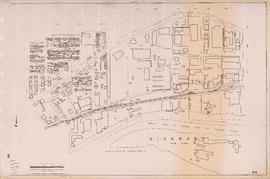
Sheet 1A [Northwest corner of Exhibition Park to Burrard Inlet to Slocan Street to Cambridge Street]
Sheet 1B [Boundary Road to Burrard Inlet to Rupert Street to Cambridge Street]
Sheet 1C [South portion of Exhibition Park to Cambridge Street to Slocan Street]
Sheet 1D [Boundary Road to Cambridge Street to Windermere Street to Pender Street]
Sheet 2A [Windermere Street to Pender Street to Slocan Street to Charles Street]
Sheet 2B [Boundary Road to Pender Street to Windermere Street to Charles Street]
Sheet 2C [Windermere Street to Charles Street to Slocan Street to 5th Avenue]
Sheet 2D [Boundary Road to Chalres Stret to Windermere Street to 5th Avenue]
Sheet 3A [Windermere Street to 5th Avenue to Slocan Street to Grandview Highway]
Sheet 3B [Boundary Road to 5th Avenue to Windermere Street to Grandview Highway]
Sheet 3C [Windermere Street to Grandview Highway to Slocan Street to 22nd Avenue]
Sheet 3D [Boundary Road to Grandview Highway to Windermere Street to 22nd Avenue]
Sheet 4A [Windermere Street to 22nd Avenue to Slocan Street to 29th Avenue]
Sheet 4B [Boundary Road to 22nd Avenue to Windermere Street to 29th Avenue]
Sheet 4C [Spencer Street to 29th Avenue to Slocan Street to Kingsway Avenue]
Sheet 4D [Bundary Road to 29th Avenue to Manor Street to Euclid Avenue]
Sheet 5A [McKinnon Street to Kingsway Avenue to Wales Street to 45th Avenue]
Sheet 5B [Boundary Road to Euclid Avenue to Joyce Street to 45th Avenue]
Sheet 5C [Doman Street to 45th Avenue to Vivian Street to 52nd Avenue]
Sheet 5D [Boundary Road to 45th Avenue to Doman Street to 52nd Avenue]
Sheet 6A [Doman Street to 52nd Avenue to Vivian Street to 61st Avenue]


![Sheet 1A [Northwest corner of Exhibition Park to Burrard Inlet to Slocan Street to Cambridge Street]](/uploads/r/null/4/a/9/4a95f2d331599fc1ed353ee49268f50fbc2f377d28b98788199ef496d1657e19/54d2e041-40b4-4c97-89e1-d44e9d73ba03-LEG1153_142.jpg)
![Sheet 1B [Boundary Road to Burrard Inlet to Rupert Street to Cambridge Street]](/uploads/r/null/2/d/e/2de8a9356c43bdf5c2000524f0160e69ebb4155a087c48253380abd411347e98/c0871cff-d576-48da-93e7-50334a7f3bfe-LEG1153_142.jpg)
![Sheet 1C [South portion of Exhibition Park to Cambridge Street to Slocan Street]](/uploads/r/null/0/9/8/098483f307187795ecf4e61450d06083a061d3907b0222ef0f03256008e2e58e/d7a0fcd1-8028-4946-a99a-8ba6da1b2e4a-LEG1153_142.jpg)
![Sheet 1D [Boundary Road to Cambridge Street to Windermere Street to Pender Street]](/uploads/r/null/1/d/4/1d47034f04f443cd5d3bba2f8d2d21c3a21a2e6b801a5af04c074e2c3b6dd02e/7ad1a0c8-97c9-4e10-98c2-5017d74f4033-LEG1153_142.jpg)
![Sheet 2A [Windermere Street to Pender Street to Slocan Street to Charles Street]](/uploads/r/null/e/f/0/ef0145166907c36b80690dbaafd084071b8c82a23a84f931050a22101462f091/f7da3c3b-6025-445b-a5a6-5eb1608264e9-LEG1153_142.jpg)
![Sheet 2B [Boundary Road to Pender Street to Windermere Street to Charles Street]](/uploads/r/null/6/d/d/6dd321f1933530c0449917d5fdeb9ddeadff6b12ddc423a9f60d2633579ba2f1/e16c6545-d33e-4bf8-93d8-24f9847c06ac-LEG1153_142.jpg)
![Sheet 2C [Windermere Street to Charles Street to Slocan Street to 5th Avenue]](/uploads/r/null/5/c/3/5c31b68277d535d0bf8c13023079d05dfe1fb535497b50e8f264465db169ce22/3a1ef444-0d14-4f3d-aaa7-27bc65dc7224-LEG1153_142.jpg)
![Sheet 2D [Boundary Road to Chalres Stret to Windermere Street to 5th Avenue]](/uploads/r/null/9/7/0/9702a82a6010cf52eb7cf7e486466e91e67bc732d2586158ff4cf07d8f71fb7e/f364eebb-c9c0-4aba-8970-b9128de74769-LEG1153_142.jpg)
![Sheet 3A [Windermere Street to 5th Avenue to Slocan Street to Grandview Highway]](/uploads/r/null/c/0/8/c081ba1194af0da71e1f88ca1a7c4efd637e7ae3d846b4e9fd5d153faa656b0e/ce3a288b-01f7-491a-b5ee-59b744d23996-LEG1153_142.jpg)
![Sheet 3B [Boundary Road to 5th Avenue to Windermere Street to Grandview Highway]](/uploads/r/null/c/9/c/c9c099174510121f7347c0ed2dc3f4db8a646b3846d9fcf65747209bb83b81d2/51551449-0417-479e-8467-bddbe7b574b3-LEG1153_142.jpg)
![Sheet 3C [Windermere Street to Grandview Highway to Slocan Street to 22nd Avenue]](/uploads/r/null/1/9/6/19695a354a40b66650d4a6b96b8fdd67ad76a3e8091ea936c2671a1e22e520da/e571973c-a7de-4828-9846-136aabb0b4e5-LEG1153_142.jpg)
![Sheet 3D [Boundary Road to Grandview Highway to Windermere Street to 22nd Avenue]](/uploads/r/null/e/3/8/e38ad95268d472e5b09a59157e2655363d00d976611f9b5ce0783a0b268c9102/92a3bbb3-76f5-4077-ae8c-e541a3b6a3ae-LEG1153_142.jpg)
![Sheet 4A [Windermere Street to 22nd Avenue to Slocan Street to 29th Avenue]](/uploads/r/null/a/d/f/adf64a2e43a5bbd7b7b6359d2dfbb3ff89b5ac7e2947a14033383119422d0069/643362ca-2df8-48bd-9f04-c5af1d6505f1-LEG1153_142.jpg)
![Sheet 4B [Boundary Road to 22nd Avenue to Windermere Street to 29th Avenue]](/uploads/r/null/f/3/b/f3b17dcb0ca74267e166e0229fcb9ab99281c9b35b609d67f1110241073d6bd8/486b3ba1-dce8-4aaa-85fb-b164dc027e6a-LEG1153_142.jpg)
![Sheet 4C [Spencer Street to 29th Avenue to Slocan Street to Kingsway Avenue]](/uploads/r/null/0/c/1/0c1c1eea769ffe690bcd89398f43463c8f8019dacc5ed2883d8a0f82728d4559/dc190b53-9756-4e8e-ac6f-ec929e1e7f01-LEG1153_142.jpg)
![Sheet 4D [Bundary Road to 29th Avenue to Manor Street to Euclid Avenue]](/uploads/r/null/c/0/2/c02fc1e98486bf47bb5179c1d6b399831444222c7a54db8f5a58dda1cce6d070/eb4d8a12-929b-4b83-9998-97fd0b274ae9-LEG1153_142.jpg)
![Sheet 5A [McKinnon Street to Kingsway Avenue to Wales Street to 45th Avenue]](/uploads/r/null/e/8/a/e8a898c0e8b3b2f26130948113540327f8be8bf9b6cc9f24dcf2a87dd8475188/e2ed686c-e99a-4a73-a462-257126de47b2-LEG1153_142.jpg)
![Sheet 5B [Boundary Road to Euclid Avenue to Joyce Street to 45th Avenue]](/uploads/r/null/b/d/a/bdaaca7a1a5c9f9359248cc9d383c63ffcf8800e719c0cf177f45dd4bac3cb61/e97627da-8e6c-4ebc-87bd-d46130b9261d-LEG1153_142.jpg)
![Sheet 5C [Doman Street to 45th Avenue to Vivian Street to 52nd Avenue]](/uploads/r/null/0/f/4/0f44f7b43fd58c096ccc443d651cbc43d9aadeac3e13e7b6863a8914a79bd80d/1486eb87-cda0-4a49-b822-95368cce1f7a-LEG1153_142.jpg)
![Sheet 5D [Boundary Road to 45th Avenue to Doman Street to 52nd Avenue]](/uploads/r/null/9/a/5/9a56c23cc8d5ad437bb7063cd9cf0f954bc1d67724ef20861270160771809b4c/d7777803-4376-423c-a5d5-8a44ed84aee7-LEG1153_142.jpg)
![Sheet 6A [Doman Street to 52nd Avenue to Vivian Street to 61st Avenue]](/uploads/r/null/6/8/b/68b456da543f104f4daefa87e7c0ddbd6dbb5db25e3239ded4652d327398b023/092d539d-4c5c-4406-b26f-1fa7e217b791-LEG1153_142.jpg)