![[Sheet 19 : Clark Drive to Nanaimo Street and Second Avenue to Frances Street]](/uploads/r/null/6/e/6ead2ad53e7927dc776c7c6e209eaf9f3e6dc61a60b191a0180e7c1e60ef8ace/46817199-aca3-4b79-afda-f95b0d9f2f0b-MAP339_142.jpg)
[Sheet 19 : Clark Drive to Nanaimo Street and Second Avenue to Frances Street]
- AM1594-MAP 339-: MAP 339.18
- Item
- 1970
Part of City of Vancouver Archives technical and cartographic drawing collection
Item is a sectional map of a portion of Vancouver showing the area from Clark Drive to Nanaimo Street and Second Avenue to Frances Street. Includes streets, blocks, lots and legal descriptions, and the locations of parks and schools..


![[Sheet 21 : Homer Street to Main Street and Fourth Avenue to Georgia Viaduct]](/uploads/r/null/8/c/8c7ce2ae32274b3000b670b2a47c1114fd3c3faf20caeaef1a64c8137aab4f37/d256dda0-fa87-4985-97d6-ed6431e5a608-MAP339_142.jpg)


![[Sheet 22 : Maple Street to Drake Street and Fourth Avenue to Thurlow Street]](/uploads/r/null/4/2/42281b3ab55033f1c62b4ea532ffecc218f82690d1735cd3bb58cfbb1c9a5424/cb682ac6-121a-4bac-99a4-5470e73d38f4-MAP339_142.jpg)


![[Sheet 23 : Balaclava Street to Maple Street and Third Avenue to English Bay]](/uploads/r/null/3/a/3a54a965065dcf8e280a31b4062305fcb93608d40098e982820d383458c84410/0437e9bd-e467-4a81-83ee-f6e9e7ec43b2-MAP339_142.jpg)


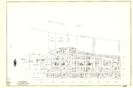
![[Sheet 24 : Jericho Beach to Balaclava Street and Fourth Avenue to Cameron Avenue]](/uploads/r/null/e/7/e737857a87702a8fbd029d7bdb109697279cac537d45931818415e380dd2867c/67258081-9a3b-44c0-9191-8a3719f6c999-MAP339_142.jpg)

![[Sheet 25 : Blanca Street to Jericho Beach and Fourth Avenue to Locarno Beach]](/uploads/r/null/a/a/aa0a0c46231b6c2f088187b2268cd829388fc6dd96aa8123f7a8f43d92c642cb/395c09b4-af3a-4986-8987-c83c92a27d94-MAP339_142.jpg)


![[Sheet 29 : Balaclava Street to Maple Street and Fourteenth Avenue to Third Avenue]](/uploads/r/null/d/6/d672783fbbcdf46b6e25dc13c2f50caa22e19935f01490a9053af4afffc83c80/9a39458e-9f4b-43a8-a595-082419eecd5b-MAP339_142.jpg)


![[Sheet 30 : Maple Street to Oak Street and Fourteenth Avenue to Third Avenue and False Creek]](/uploads/r/null/2/f/2f9cbcb3930282909d8a62f01384c5c21cf803594c41529ced8de9bed70e9575/e94bfa39-bc0b-46aa-9bdd-b2c0b97f5eba-MAP339_142.jpg)


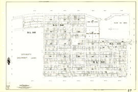
![[Sheet 32 : Main Street to Clark Drive and Sixteenth Avenue to Great Northern Way]](/uploads/r/null/1/2/1275197193b0488ed8a599413ce061f9bd30140e8bcc64728b9f05c994d8909a/718a0877-7ea9-4090-a67c-7e61c28e238e-MAP339_142.jpg)
