![[James L. Quiney with delphiniums at 4916 Union Street, Burnaby]](/uploads/r/null/c/3/c3fdd23b8f7784cd83aeecbb66e1c0b2ab7a63f22d66ab67645ddbac1e2d7201/c906c0d8-906f-4591-b10e-68a2bc1832de-A20481_142.jpg)
[James L. Quiney with delphiniums at 4916 Union Street, Burnaby]
- AM1584-: CVA 7-174
- Item
- 1930
Part of James Luke Quiney fonds
Delphiniums are about eleven feet high with blooms at six feet.
343 results with digital objects Show results with digital objects
[James L. Quiney with delphiniums at 4916 Union Street, Burnaby]
Part of James Luke Quiney fonds
Delphiniums are about eleven feet high with blooms at six feet.
![[James L. Quiney with delphiniums at 4916 Union Street, Burnaby]](/uploads/r/null/5/b/5b3346e9ffd324197f5e2037c1d5f58ce0da785dcae8dfa34e26e31868ca2f84/84fa78f5-2ca8-4dab-a308-00295fbd421a-A20482_142.jpg)
[James L. Quiney with delphiniums at 4916 Union Street, Burnaby]
Part of James Luke Quiney fonds
![Mr. and Mrs. James L. Quiney [in the garden at] 4916 Union Street, Burnaby](/uploads/r/null/2/b/2b14a4475f159c8724c464066521fd10b5ce8a560e131d8b8821d829aae11195/39a6debe-8246-4dd2-8e70-677b9209933d-A20483_142.jpg)
Mr. and Mrs. James L. Quiney [in the garden at] 4916 Union Street, Burnaby
Part of James Luke Quiney fonds
![Mr. and Mrs. James L. Quiney [in the garden at] 4916 Union Street, Burnaby](/uploads/r/null/d/7/d7da9e4f03d77c85bd288a34fce2a360eb89f9658ac52e7262db8a5c3b15aca8/f55deca0-b872-42f7-8f94-e1691ae8ab3d-A20484_142.jpg)
Mr. and Mrs. James L. Quiney [in the garden at] 4916 Union Street, Burnaby
Part of James Luke Quiney fonds
![[Aerial photograph of north Burnaby near intersection of Lougheed and Sperling]](/uploads/r/null/0/4/0402a7c6f7e8a28c8ca96ea5b930f8be591de0a42bfa4e4d588b57d8242e3df2/89b183bb-b4c9-4610-bd3d-233b78ca3218-A38735_142.jpg)
[Aerial photograph of north Burnaby near intersection of Lougheed and Sperling]
![[Aerial photograph of north Burnaby near intersection of Lougheed and Sperling]](/uploads/r/null/f/6/f6d5ee2897afb7fca08a02c5516b73fa64f9dffc0b96e41335272f5049bff318/5e860ead-2105-466e-9535-74449508fa1c-A38734_142.jpg)
[Aerial photograph of north Burnaby near intersection of Lougheed and Sperling]
![[Aerial photograph of north Burnaby near intersection of Lougheed and Sperling]](/uploads/r/null/a/c/acb6598698ac88b27910cc65b590d05b02972403e78fecc5ae1a368cd0c4886b/32a0806e-9249-4407-8edf-f969bf2582fb-A38736_142.jpg)
[Aerial photograph of north Burnaby near intersection of Lougheed and Sperling]
![[The wreck of Great Northern Railway train and engine No. 202 near Burnaby Lake]](/uploads/r/null/8/c/8c120a4630e58ec6d8ede7b74872a099c2d81d36816091c5d03a7f59f92b5a8d/05948ab1-0906-4e2d-adcd-79b1683f14b6-A62610_142.jpg)
[The wreck of Great Northern Railway train and engine No. 202 near Burnaby Lake]
Part of Major Matthews collection
![[Kingsway at Boundary Road]](/uploads/r/null/0/9/092e433ed069d0ecb5f976ae7ab9930590d2abef0adbcf8e8ae2041c60e2f24b/4ef6a8b6-f153-4441-910f-bc7c3b47eb88-A20219_142.jpg)
Part of Major Matthews collection
Photograph shows a billboard in the distance
![Kingsway and Patterson [Avenue]](/uploads/r/null/f/2/f2482c3a28fb03b5dd4931ccb7b2cfb3022990487fc3eac2951094a54da18e47/d5869bda-5313-4cd4-ab2a-68e9b5c55d86-A20220_142.jpg)
Kingsway and Patterson [Avenue]
Part of Major Matthews collection
Photograph shows a Ruddy-Duker Company billboard advertising The Camrin and Vance Hotel in Seattle
![Kingsway and Edmonds [Street on] north side city incoming](/uploads/r/null/b/a/ba05eda748307a0827332472c9e29aefd0c0dcb584ad376dbb0cf23bf857d13f/55eb2571-bf7e-4654-9630-fe4ce969b767-A20214_142.jpg)
Kingsway and Edmonds [Street on] north side city incoming
Part of Major Matthews collection
Photograph shows a billboard advertising Ingledew's and the Richfield Garage
![C.J. Piper's cottage [at] Piper [Avenue] North Burnaby [south of G.N. tracks]](/uploads/r/null/9/a/9a3383533a82a10784f197733a8bbe77d594580610fe4d659cc365be4f3bd7ee/a443bbf3-a683-4860-81b7-20db56c2cfcf-A46620_142.jpg)
C.J. Piper's cottage [at] Piper [Avenue] North Burnaby [south of G.N. tracks]
Part of Major Matthews collection
![C.J. Piper's cottage [on] Piper [Avenue] North Burnaby south of G.N. tracks](/uploads/r/null/7/4/74c4ace93d1630f4d7e6731aa8a13ebff0f61bb1aedb18c09022c4149782ef62/6b4d01af-231f-4c66-9be0-fe8c5a706956-A46621_142.jpg)
C.J. Piper's cottage [on] Piper [Avenue] North Burnaby south of G.N. tracks
Part of Major Matthews collection
![C.J. Piper's cottage [on] Piper [Avenue near] Burnaby Lake](/uploads/r/null/5/a/5afaa36920167f8ea5bae3dbea35cb9278c732e2acb87068462fe7f2c7b36866/47ff0806-eaa5-4cc5-bbf2-f1de5a74120c-A46622_142.jpg)
C.J. Piper's cottage [on] Piper [Avenue near] Burnaby Lake
Part of Major Matthews collection
![[Creek near] C.J. Piper's cottage [on] Piper [Avenue] south of G.N.R. track North Burnaby](/uploads/r/null/b/0/b07a3a285c36eeb39d1a022d09cfd4079ebdb5c56421cae66bda8e85b95e3c9f/f1ccade7-c066-4825-84be-c0de420f1c9e-A46623_142.jpg)
[Creek near] C.J. Piper's cottage [on] Piper [Avenue] south of G.N.R. track North Burnaby
Part of Major Matthews collection

Piper floating wharf at foot of Piper Avenue south of G.N. track North Burnaby
Part of Major Matthews collection

Piper Avenue looking south to Burnaby Lake
Part of Major Matthews collection
![Piper Mill, Piper Siding [near] Great Northern Railway](/uploads/r/null/1/d/1d9a0aba9c7f1ffd1a3f41724bc058318e250a59b4b2f4d41d42f9149bb900be/c48c5164-6f25-491b-99a1-51422353e29c-A46626_142.jpg)
Piper Mill, Piper Siding [near] Great Northern Railway
Part of Major Matthews collection
![Piper Mill, Piper Siding [near] Great Northern Railway](/uploads/r/null/c/9/c90e447850ff00fc2c98215222bc129f027332096635eb40c3fc528ed17fb5ae/270dc2c7-b4a4-43b7-b16f-931ca52bcf05-A46627_142.jpg)
Piper Mill, Piper Siding [near] Great Northern Railway
Part of Major Matthews collection

Great Northern Railway track (from New Westminster to Vancouver) at Piper Mill, Piper Siding
Part of Major Matthews collection
![[Meal served at Oakalla prison]](/uploads/r/null/2/7/27752c0f754fd773ae2cc6e29935cf6f346781c443b852eae0cf9413d33fdfaf/d174a04e-d9a2-496c-a89d-a4f906db6355-A12625_142.jpg)
[Meal served at Oakalla prison]
![[Interior view of the library at Oakalla prison]](/uploads/r/null/6/6/66182ea62b4ac548526033cf052ad91bdc4fc5a1837d2d2a7a84cbabd612b3f7/03ce81e2-d420-4753-83a5-5650481e64af-A12624_142.jpg)
[Interior view of the library at Oakalla prison]
![[Interior view of a jail cell at Oakalla prison]](/uploads/r/null/8/0/8015d880e11144ebc60c774a5c9a535fc6959b7a48483e481a397514c87a69f6/dea1a9c7-0b76-4407-8da5-c65421d27330-A12623_142.jpg)
[Interior view of a jail cell at Oakalla prison]
![[Oakalla prison uniform laid out on a table]](/uploads/r/null/2/5/25891445b38bcad05cbedf036916b9037ffdd80be8735bcf46befbaacb6f52c9/a9167112-3815-41d8-9a6b-aabc85f83c3f-A12622_142.jpg)
[Oakalla prison uniform laid out on a table]

Dial map of Greater Vancouver and suburbs
Part of City of Vancouver Archives technical and cartographic drawing collection
Part contains a street map of Vancouver, Burnaby, New Westminster, West Vancouver, and North Vancouver showing railways, hospitals, parks and block numbers. The map includes two dials (numbered circles, paper indicators, a grid of block numbers and a street index used to find locations).

Dial map of Greater Vancouver and suburbs
Part of City of Vancouver Archives technical and cartographic drawing collection
Part contains a street map of Vancouver, Burnaby, New Westminster, West Vancouver and North Vancouver showing block numbers, street car, bus, and railway lines, parks and hospitals. Map includes two dials (a numbered circle, a paper indicator, a grid of block numbers and a street index used to find locations). A small inset map shows the Capitol Hill/Scenic Park area of Burnaby in greater detail.

Map of Burnaby and New Westminster, British Columbia
Part of City of Vancouver Archives technical and cartographic drawing collection
Part consists of a street map of Burnaby and New Westminster, information on bus and street car routes, and text advertising the products and services of the Dominion Map and Blueprint Company.

City of Vancouver : Canadian Pacific town site
Part of City of Vancouver Archives technical and cartographic drawing collection
Part contains four maps. The main map shows district lots and block numbers in Vancouver from Vine Street in the west to Boundary Avenue (Glen Drive) in the east and Stanley Park in the north to 9th Avenue (Broadway) in the south. Three smaller maps include an index plan to district lots in Vancouver, South Vancouver, New Westminster, and Burnaby; a world map showing Canadian Pacific mail steamship lines; and an index plan of Vancouver city limits.

Part of James Crookall fonds

Part of James Crookall fonds
Photograph shows a view at night from Burnaby Heights looking west to the harbour
![[Cars in lane near James Crookall's home in Burnaby Heights]](/uploads/r/null/8/d/8dfa35a086ab107c4743b1a887929b56fa47a5d3ab3c53a59de8f49565d95852/7da10e5f-57c6-4794-9231-d076b941e730-A74426_142.jpg)
[Cars in lane near James Crookall's home in Burnaby Heights]
Part of James Crookall fonds
![[Looking west from Burnaby Heights showing the sun streaming through the clouds]](/uploads/r/null/6/9/69d1909058c0ea90a95343eba4b8826ecf60cb2453a11f2450f18228e01c4b96/52e79cb1-e8f7-404f-aa64-a46f3934b223-A74446_142.jpg)
[Looking west from Burnaby Heights showing the sun streaming through the clouds]
Part of James Crookall fonds
![[Rear of houses from James Crookall's house in Burnaby Heights]](/uploads/r/null/0/f/0f7e9c4ff37c2aaef194e3042e6dba7ea1283933df91b16dc9401780e2d2a184/cc9aac3d-ef77-4a6b-b0d0-ec8ea9a1732a-A75563_142.jpg)
[Rear of houses from James Crookall's house in Burnaby Heights]
Part of James Crookall fonds
![[House at 3743 Eton Street]](/uploads/r/null/2/7/27337974ac25bcc2d888966b6e3f08a5b6814955f7e01ab4ad5b43aeb0884aed/271ce821-58e1-4754-a4d9-0bf1c56268be-A75564_142.jpg)
Part of James Crookall fonds
![[James Crookall's mother at the gate to 3746 Eton Street]](/uploads/r/null/a/a/aaa1db4416f8e4521f3d6437361e7e35324ee998dfbbef869c0fcba260a5416a/bb433989-7448-4c37-8ec6-15b9e2bce99c-A75729_142.jpg)
[James Crookall's mother at the gate to 3746 Eton Street]
Part of James Crookall fonds
![[James Crookall's mother in the garden of 3746 Eton Street]](/uploads/r/null/3/e/3ed71864810b4d85b18555a1fc922ed1bf01aa47985080e67370c9de857d92f0/0106a6d3-7cea-4bdd-82ce-32f2d376d04f-A75728_142.jpg)
[James Crookall's mother in the garden of 3746 Eton Street]
Part of James Crookall fonds
![[Members of James Crookall's family]](/uploads/r/null/e/5/e58875ea70e7cefbd7a6cb096eb528d10142436021cd677fb0c683c0b79457e6/516f33c7-a393-424f-bc25-9fe0dceb07d6-A76082_142.jpg)
[Members of James Crookall's family]
Part of James Crookall fonds
Group portrait
![[Members of James Crookall's family]](/uploads/r/null/f/3/f30a8b871d7d27342016ba91a41730f03a329a9e180d8f5ba94bd99664149ec4/43f65c8f-37bc-47cf-9c4f-38e3f7404cc0-A76083_142.jpg)
[Members of James Crookall's family]
Part of James Crookall fonds
Group portrait
![Flashlight - Mock Trial Vancouver Heights Presbyterian Church [150 MacDonald, Burnaby]](/uploads/r/null/c/3/c3f226a4f78f6ad698826a62802b8cfc00ef0a9fbadf8543bc0f46feb3f8c2ac/e72e7c60-5d1b-45c1-95b2-59e53f00fba5-A16717_142.jpg)
Flashlight - Mock Trial Vancouver Heights Presbyterian Church [150 MacDonald, Burnaby]
Part of Stuart Thomson fonds

Choir performing on Chevron stage

Cats musical performance on Chevron stage

Cats musical performance on Chevron stage

Cats musical performance on Chevron stage

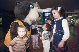
Tillicum interacting with children at Lougheed Mall

Tillicum interacting with children at Lougheed Mall
Tillicum interacting with children at Lougheed Mall


