Showing 197 results

Archival description
Greater Vancouver (B.C.)
Print preview View:

74 results with digital objects Show results with digital objects

Metropolitan Vancouver

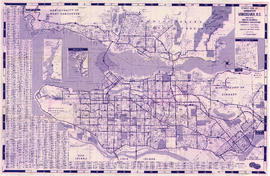
Item is a map showing the locations and names of major businesses and corporations in the Greater Vancouver area. The map also shows major roads, highways, railways and proposed highway routes. 5 mile and 10 mile radius circles are depicted around the "geographical centre of metropolitan Vancouver." Map background is a mosaic of aerial photographs.

New Westminster

Item is a map showing topography, roads, trails, railways, bridges, boundaries, reserves, power lines, telephone lines, triangulation stations, camera stations, bench marks, houses, barns, mills, factories, schools, churches, post offices, telephone exchanges, mines and geographic features in the Pitt Meadows area and extending south through Cloverdale and Langley to the United States border. A small index map shows the area covered by the primary map in relation to other maps in the series.

New Westminster

Item is a map showing topography, roads, trails, railways, bridges, boundaries, reserves, power lines, telephone lines, triangulation stations, camera stations, bench marks, houses, barns, mills, factories, schools, churches, post offices, telephone exchanges, mines and geographic features in the area of South Burnaby and New Westminster, extending south through Surrey and White Rock to the United States border. A small index map shows the area covered by the primary map in relation to other maps in the series.

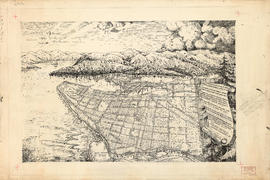
Perspective of Greater Vancouver from Grouse Mountain (elevation 4000 ft.)

item is an illustrated, map-like pictorial view of Greater Vancouver. Locations of districts, waterways, beaches, golf courses, principal parks and significant buildings are identified by matching an index list to corresponding letters and numbers on the vertical and horizontal axes along the border of the map.

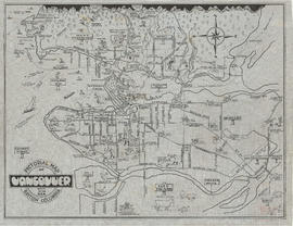
Pictorial map of Greater Vancouver showing dates of settlement in specific areas and opening dates of regional landmarks

Item consists of an illustrated map of the Vancouver area and an overlay showing dates of settlement in various areas and the opening dates of regional landmarks. A poem about the growth of Vancouver has been included on the right-hand side of the map. Verso contains a seemingly unrelated drawing dated 1911 and showing front and side elevations for a church building.

Plan of Greater Vancouver, British Columbia

Item is a map of Greater Vancouver from Alma Road (Alma Street) to Boundary Road and Burrard Inlet to King Edward Avenue. Map shows district lot, block, and lot numbers, waterfront businesses, rail lines, schools, parks, beaches, and concentric circles indicating distances from a point located approximately at the intersection of Cambie and Hastings Streets.

Railroad map of Greater Vancouver, British Columbia

Item is a map which shows the routes of the Great Northern Railway, the Burlington Northern Railway, the Canadian Northern Pacific Railway, the British Columbia Electric Railway, the Canadian Pacific Railway, the Canadian National Railway, and the Pacific Great Eastern Railway. The map notes years of railway completion, years of abandonment, existing trackage, abandoned trackage, proposed trackage, tunnel trackage, and important dates.

Railroads of the Lower Mainland of British Columbia

Primary map shows railroads, railroad names, subdivisions, spurs or yards, timetable station names, station buildings, absolute signals, signal identities, hot boxes and/or dragging equipment detectors, mileboards, bridges and interchanges in the Greater Vancouver area from West Vancouver in the north to the United States border in the south and from Haney in the east to Horseshoe Bay in the west. Ancillary maps show the B.C. Rail Squamish subdivision, the Vancouver B.N., C.N. and C.P. railroad yards, New Westminster C.N., C.P. and S.R.Y. railroad details, Burlington Northern Brunette details, the Canadian National Thornton Yard and Coquitlam C.P. details.

Railroads of the Lower Mainland of British Columbia, 1882-1992

Primary map shows existing track, abandoned track, station buildings and bridges in the Greater Vancouver area from West Vancouver in the north to the United States border in the south and from Haney in the east to Horseshoe Bay in the west. Ancillary maps show details of Vancouver B.C.E., C.No.P., C.P. and G.N. railroad yards and New Westminster B.C.E., C.No.P., C.P. details. The item also includes a chronology of railroad subsidiaries, takeovers and mergers.

Rights of way Vancouver and vicinity

Item is a portion of a topographical map of the Lower Mainland which has been extensively annotated to show the routes and rights-of-way of the various railways running through the region.

The lines shown are: Canadian Pacific Railway, Canadian National Railway, Great Northern Railway, B.C. Electric Railway, Canadian Pacific Railway operated by B.C. Electric Railway, Canadian Pacific Railway joint operation with National Harbours Board Terminal Railway, Great Northern Railway joint operation with National Harbours Board Terminal Railway, Great Northern Railway joint operation with Canadian National Railway, National Harbours Board Terminal Railway and Canadian Pacific Railway tunnel and Pacific Great Eastern Railway lease to National Harbours Board.

Sectional map and street directory of Vancouver : Dial map of the city of Vancouver including adjacent municipalities

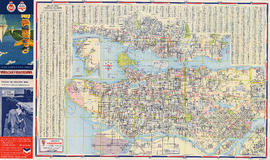
Item is a street map showing Vancouver, West Vancouver, North Vancouver and Burnaby on one side and the Lower Mainland from Vancouver to Chilliwack on the other. Item also includes information about bus services in Greater Vancouver and text advertising the products and services of the Dominion Map and Blueprint Company.

Sectional map and street directory of Vancouver : Dial map of the city of Vancouver including adjacent municipalities

Item is a street map showing Vancouver, West Vancouver, North Vancouver, and Burnaby on one side and the Fraser Valley, New Westminster, and Greater Vancouver transit lines on the other. Item also includes text advertising the products and services of the Dominion Map and Blueprint Company.

Sectional map and street directory of Vancouver : Dial map of the city of Vancouver including adjacent municipalities

Item is a street map showing Vancouver, West Vancouver, North Vancouver, and Burnaby on one side and the Lower Mainland from Vancouver to Chilliwack, Richmond, and New Westminster on the other. Item also includes text advertising the products and services of Dominion Map and Blueprint Ltd.

Sectional map and street directory of Vancouver : Dial map of the city of Vancouver including adjacent municipalities

Item is a street map showing Vancouver, West Vancouver, North Vancouver and Burnaby on one side and the Lower Mainland from Vancouver to Chilliwack on the other. Item also includes information about bus services in Greater Vancouver and text advertising the products and services of the Dominion Map and Blueprint Company.

Results 101 to 150 of 197