![Pacific Highway 1/4 mile west of bridge [on] north side incoming](/uploads/r/null/7/7/77cef5933a207fc8fa97f8f449ce69e5e2cfaba97444080837a18d1e7ccf6e78/cd3b0660-360d-429c-9d16-cbef4f1c592d-A20212_142.jpg)
Pacific Highway 1/4 mile west of bridge [on] north side incoming
- AM54-S4-1---: CVA 20-20
- Item
- 1932
Part of Major Matthews collection
Photograph shows a billboard advertising the Trocadero Cafe and National Lunch
Pacific Highway 1/4 mile west of bridge [on] north side incoming
Part of Major Matthews collection
Photograph shows a billboard advertising the Trocadero Cafe and National Lunch
![Pacific Highway 100 feet from customs [on] south side [of] highway incoming](/uploads/r/null/a/f/af88bd268467cecf5481dcfad3022a009fb6db54d9397bb13afa112719ecf0d6/add49f39-7ef3-43d1-9fac-39c9c6df7102-A20194_142.jpg)
Pacific Highway 100 feet from customs [on] south side [of] highway incoming
Part of Major Matthews collection
Photograph shows a Harry Duker Company billboard advertising B.C. Rye and Old Colonel Bourbon and a Welcome sign for the Auto Club of B.C. showing the speed limits for highways and cities
![Pacific Highway 300 feet west [of] Old Yale Road](/uploads/r/null/c/5/c5d2a69a5eacd4dff218b51a943a6e13d12ff2d2925de6b8b2353bbc1f275bf7/04cb108c-f7b2-4f71-9a92-3bcc8622a8d8-A20203_142.jpg)
Pacific Highway 300 feet west [of] Old Yale Road
Part of Major Matthews collection

Pacific Highway and gravel pit
Part of Major Matthews collection
Photograph shows two billboards advertising Church's Shoes and Ingledew's, and Hotel Russell (partly obscured)

Pacific Highway and Meridian Road
Part of Major Matthews collection
Photograph shows a Ruddy-Duker Company billboard advertising oil filters and signs for: Quaker State Motor Oil, the Trocadero Cafe and the New Your Fur Company

Pacific Highway and Old Yale Road
Part of Major Matthews collection
Photograph shows a Ruddy-Duker Company billboard advertising Cross's Ginger Ale

Pacific Highway and Old Yale Road incoming
Part of Major Matthews collection
Photograph shows a Ruddy-Duker Company billboard advertising David Spencer Ltd.

Pacific Highway at Serpentine River incoming
Part of Major Matthews collection
Photograph shows two Ruddy-Duker Company billboarda advertising spark plugs and oil filters, and David Spencers and a sign on a barn advertising Vancouver Motors Ltd.
![Pacific Highway [near] Kiwanis Arch incoming](/uploads/r/null/7/4/740f967d044d90fc31e2655a25833263cd9fde65ce403301ec4765502272f3c8/4bc1b63a-0aaf-472a-b560-3fd7c025abd3-A20196_142.jpg)
Pacific Highway [near] Kiwanis Arch incoming
Part of Major Matthews collection
Photograph shows a Ruddy-Duker Company billboard advertising David Spencer Ltd.
![[Pacific Highway near Yale]](/uploads/r/null/1/4/14c07ef9988f937ab9921d2df28a9104185144f09895b6499672b5ccb06a7335/52c8fabc-b05d-46ac-a453-052cd05f128c-A09310_142.jpg)
Part of Major Matthews collection

Pacific Highway north side east of Grosvenor Road incoming
Part of Major Matthews collection
Photograph shows a billboard advertising The York Hotel
![Pacific Highway one mile west of Fry's Corner [on] south side incoming](/uploads/r/null/2/7/275fdfd1b79050d3fd150ffa3b42128cac4a4c29625d96ef9da71cd1c993cdea/5e6f3190-b803-48c0-a837-b34d710aae8c-A20199_142.jpg)
Pacific Highway one mile west of Fry's Corner [on] south side incoming
Part of Major Matthews collection
Photograph shows a billboard for the Devonshire Apartment Hotel

Part of Major Matthews collection
Photograph shows School Road
Part of Major Matthews collection
Photograph shows a sign "Cyclists Dangerous Road"
![[Park Road]](/uploads/r/null/3/3/33aa2cba58e412fea0dcc16030c76a94bd52a4a1ea54ced9845f836584ff20ad/a6559c6a-bcb9-4b96-8622-53976cb91f8c-A36881_142.jpg)
Part of Major Matthews collection
![[Park Road]](/uploads/r/null/b/c/bca00f713e33c0bbf869169d8978b3809a5d9df93731524d225a7d5e96948a0e/4dc5f0fa-5a5f-4149-b9cf-75bc642007e7-A36711_142.jpg)
Part of Major Matthews collection
![[Park Road]](/uploads/r/null/6/c/6c75a5441a95123b136766e11126fcb8a8171203a25ba24b8611023775f6213d/ab9e6147-de0a-40ce-8b4a-d95f56e6feb4-A36867_142.jpg)
Part of Major Matthews collection
![[Park Road]](/uploads/r/null/d/e/de8dc433a134563e952779fcdfd114c9d075637cfa54e0a80fe12fd088926515/7fcb483a-b296-4021-bab7-ad27b1fe5454-A36860_142.jpg)
Part of Major Matthews collection
![[Park Road]](/uploads/r/null/4/d/4dd0a2566ca828ad2e6b47a74cdedb9be3de2220687785e7209eb1cfbe37fbc8/e4a4c60b-3f33-4d81-90e4-ffca054c2116-A36754_142.jpg)
Part of Major Matthews collection
![[Park Road at Brockton Point]](/uploads/r/null/6/b/6b84dbc5060429de687dc8bb223b8c12e46e3c299e6de45101fb7079d2fa502a/493a8a06-f139-41a2-9362-2f1db4f16e8e-A36701_142.jpg)
Part of Major Matthews collection
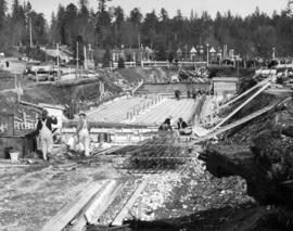
![[Park Road at Brockton Point under construction]](/uploads/r/null/3/0/303fb80d7dc376a51bfc34a222fa8d1715c9c8539dae04caae702b9affc039a2/141be698-5c82-413c-a4ff-e32a6e5b7a99-A36824_142.jpg)
[Park Road at Brockton Point under construction]
Part of Major Matthews collection
Photograph shows the barque "Robert Kerr" in the distance
!["Park Road" from [the] Narrows up to Prospect Point](/uploads/r/null/1/8/18490d062707794418e672b858a93648180f759da5bf924d24e8257e4299eea3/9ee05716-b486-45e1-a064-b5b02bee4b11-A46634_142.jpg)
"Park Road" from [the] Narrows up to Prospect Point
Part of Major Matthews collection
![[Park Road near Brockton Point]](/uploads/r/null/9/d/9df74beb3ead1a0ec437bd73765d15589e8c7774e0c9128cafab9d5c1c692bb5/635bf0c4-65a0-4848-b492-b62864ccf79e-A62631_142.jpg)
[Park Road near Brockton Point]
Part of Major Matthews collection

Part of Stanley Park Road on Brockton Point Vancouver, B.C.
Part of Major Matthews collection
![[Paved road through forest between New Westminster and Cloverdale]](/uploads/r/null/c/6/c683031c46c56a50decb6b3079672392fbe380cbe6cc247076b1cf3aa529b494/afb92b36-ead0-44d9-9288-0e16a82ecb6d-A04351_142.jpg)
[Paved road through forest between New Westminster and Cloverdale]
Part of Major Matthews collection
J.S. Matthews' notes with print or negative in Archives.

Piper Avenue looking south to Burnaby Lake
Part of Major Matthews collection
![[Plank road to Canadian Northern Railway freight shed]](/uploads/r/null/f/5/f5f67d6d3ef0fd4d1d1ad4f76f3200eae8708a53d4168e9ae646d94942055668/6fa0e1d6-7b07-4106-9166-296407183c05-A09093_142.jpg)
[Plank road to Canadian Northern Railway freight shed]
Part of Major Matthews collection
![Plank road [to Canadian Northern Railway] Vancouver freight shed](/uploads/r/null/0/2/02f4c264bbf89ac8d6e2039d74ad3132b07a6a9aecb1a6d67e0d1da0669b3187/a5204c8c-618c-41f8-8fc9-ba1ebfd22686-A09086_142.jpg)
Plank road [to Canadian Northern Railway] Vancouver freight shed
Part of Major Matthews collection
Photograph shows two men walking on plank road by freight shed.

Part of Major Matthews collection
Photograph shows a gravel road and a bridge over Bon Accord Creek

Part of Major Matthews collection
![[Power poles along dirt road]](/uploads/r/null/3/f/3f4448f4f1664c7a45a9f772a26e8dd98c31a7deb74b6d0baf2e4d6b5b74efce/0fd5cf5d-f7dd-4097-a8cf-e3e025a10241-A04748_142.jpg)
Part of Major Matthews collection
![[Power poles along dirt road]](/uploads/r/null/5/e/5e668bbe5e21a9965ca8dae0484194cae7548e6a284e14ca8a28ac29d8f6155c/88dff179-da71-4b23-9862-2d5cd9495a40-A04751_142.jpg)
Part of Major Matthews collection
Part of Major Matthews collection
Photograph shows the Royal Vancouver Yacht Club in the background

Prospect Point, Stanley Park, Vancouver, B.C.
Part of Major Matthews collection
Photograph shows a woman standing near a flagpole next to a dirt road, looking out towards Burrard Inlet. J.S. Matthews' notes with print or negative in Archives.
![[Repairing the road after the Seymour Creek washout]](/uploads/r/null/8/2/8233c5b9dc175116957eb424fa00a10f30aaf44bc9042bb1c636671f77e279fd/e9498fdf-4d04-45cc-b311-334d84b07a57-A33584_142.jpg)
[Repairing the road after the Seymour Creek washout]
Part of Major Matthews collection
![[River Road (Marine Drive) looking east from Shaughnessy Street]](/uploads/r/null/1/2/122fc6e851d1ffed042982cc7e853a2265c7d1ccf0e4697faf06f4322ce3a02e/6a26912b-93d5-46ac-aade-1f39f3700a60-A37141_142.jpg)
[River Road (Marine Drive) looking east from Shaughnessy Street]
Part of Major Matthews collection
![[River Road (Marine Drive) near McCleery's farm]](/uploads/r/null/8/b/8b3a8aaf0ff18b9da5738fbf3fe10b9c3577cc80079f52d76d583fde6a574200/934e6cc5-a29b-48bb-ab45-36c88e40e9ec-A37101_142.jpg)
[River Road (Marine Drive) near McCleery's farm]
Part of Major Matthews collection
![[River Road (Marine Drive) near McCleery's farm]](/uploads/r/null/f/e/fe71cd33c573d0d5c54086ee4dea5f848be7817ef7759410586d7afcc76838c9/fd07b1a3-6056-4a32-9039-1e71b1e1dbd0-A37100_142.jpg)
[River Road (Marine Drive) near McCleery's farm]
Part of Major Matthews collection
![[Road around mountain to Coquitlam Dam]](/uploads/r/null/0/9/09fe6eac46ebe49a22a0117d512c5bed232d0b2365dbbbc0dcf45759713f7413/2683899b-906e-41ae-acaa-9b2ad2e45ad5-A08413_142.jpg)
[Road around mountain to Coquitlam Dam]
Part of Major Matthews collection
![[Road around tree in Stanley Park]](/uploads/r/null/e/9/e911742df94cea352931ab210f9140a4c286aa8243edd44307207e41b9d86cc5/73898296-4d34-4f7b-b8e3-1608a8cb832b-A04420_142.jpg)
[Road around tree in Stanley Park]
Part of Major Matthews collection
J.S. Matthews' notes with print or negative in Archives.
![[Road in Stanley Park near Brockton Point]](/uploads/r/null/b/8/b8aa1a0c165756c09f317fff3916a8de1c5a7036f11387056b17247f83a4983b/d7d67379-3251-4974-9daa-e9ffde35d2b7-A04022_142.jpg)
[Road in Stanley Park near Brockton Point]
Part of Major Matthews collection
Road Leading to Dockyard - Esquimalt
Part of Major Matthews collection
Photograph shows the telegraph office, church and other buildings.
![[Road through forest on Bowen Island]](/uploads/r/null/4/4/446ddb4687d3b2ee1aa96f8eb795ca22c3c8a8c828d3749240ee0801c4e27474/09b4dc2c-1c2e-4900-a4a2-2c9befcd36e0-A04618_142.jpg)
[Road through forest on Bowen Island]
Part of Major Matthews collection
J.S. Matthews' notes with print or negative in Archives.
![[Road through forest on Bowen Island]](/uploads/r/null/b/6/b6b5c5af20de889886d3d0db0e835de8ba345a4b2511318377d82742026fe3ec/ee6094be-bb1b-4319-aaf1-45a65f41d7f8-A04617_142.jpg)
[Road through forest on Bowen Island]
Part of Major Matthews collection
J.S. Matthews' notes with print or negative in Archives.
![[Road through forest on Bowen Island]](/uploads/r/null/7/0/70def0c98cc2e1d1ab537b1410505e807b5318ad0679a79b85842b2ca5eebbfe/4a43a587-8575-4ada-9fbf-e4f6749e6696-A04620_142.jpg)
[Road through forest on Bowen Island]
Part of Major Matthews collection
J.S. Matthews' notes with print or negative in Archives.
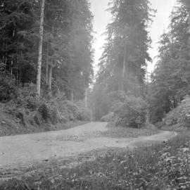
![[Road through Stanley Park]](/uploads/r/null/4/e/4ed20a4b9aa83332c66373b7b26e260f348323996cc651a552e8a75612d67c6b/3d6cc97a-f594-4d67-b48f-12c4fc3cfbf3-A09653_142.jpg)
Part of Major Matthews collection
![[Road through Stanley Park]](/uploads/r/null/c/5/c5cc5cce0beff22843029245c3bbb357474727607f60a34536ee878388b6b578/109ab64c-8b9b-4218-8ff9-d08ec6f7feb8-A09675_142.jpg)
Part of Major Matthews collection
Photograph shows a split in the road around a large tree. A sign on the tree directs traffic to "Keep to the left".
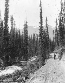
Part of Major Matthews collection
Photograph shows two men on a dirt road beside a roiling stream
![Rogers Pass [Highway]](/uploads/r/null/7/a/7a8bab558d799cc829194f8468b37b41b1561d92c702daf18635f2c151b1a09e/cd827869-375f-4da9-8848-f70fb9435790-A25532_142.jpg)
Part of Major Matthews collection

Part of Major Matthews collection