
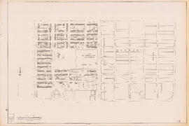
Map of Vancouver Sun's city circulation
- AM1594-: MAP 955-: LEG1336.42
- Part
- 1948
Part of City of Vancouver Archives technical and cartographic drawing collection
504 results with digital objects Show results with digital objects
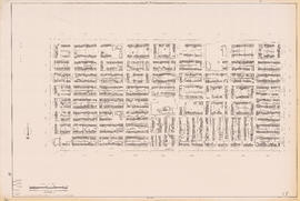
Map of Vancouver Sun's city circulation
Part of City of Vancouver Archives technical and cartographic drawing collection

Wrigley's 1930 map of Vancouver and Lower Mainland
Part of City of Vancouver Archives technical and cartographic drawing collection
Part contains a map of Greater Vancouver showing streets, paved streets, trails, street car lines, bus lines, railways, auto camps, hospitals, schools and block numbers. Concentric circles spaced one mile apart emanate from a point in downtown Vancouver.

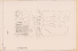
Circulation map of Greater Vancouver : today's market data on Vancouver
Part of City of Vancouver Archives technical and cartographic drawing collection
Part contains maps and population and circulation data for three areas: Retail City Area, Retail Suburban Area, and All Other Country Area.

City of Vancouver : Canadian Pacific town site
Part of City of Vancouver Archives technical and cartographic drawing collection
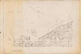
Part contains four maps. The main map shows district lots and block numbers in Vancouver from Vine Street in the west to Boundary Avenue (Glen Drive) in the east and Stanley Park in the north to 9th Avenue (Broadway) in the south. Three smaller maps include an index plan to district lots in Vancouver, South Vancouver, New Westminster, and Burnaby; a world map showing Canadian Pacific mail steamship lines; and an index plan of Vancouver city limits. Part has been annotated with text describing a June 1888 land clearance plan and hand colouring indicating clearance status.

Plan of the Vancouver Exhibition grounds
Part of City of Vancouver Archives technical and cartographic drawing collection
Part contains a map showing the layout and location of the Vancouver Exhibition grounds, and an index to locations on the map.

Part of City publications collection

City of Vancouver, B.C. area map : Maple Street to Heatley Avenue and Burrard Inlet to 6th Avenue
Part of City publications collection

Part of City publications collection

Part of City publications collection

Part of City publications collection

City of Vancouver, B.C. area map : Inverness Street to Boundary Road and 32nd Avenue to 54th Avenue
Part of City publications collection

Part of City publications collection

Part of City publications collection

Part of City publications collection

Part of City publications collection


Part of City publications collection

Part of City publications collection

Part of City publications collection
Part of City publications collection
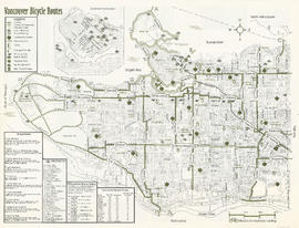
Part contains a map of Vancouver bicycle routes with a key to attractions, bridges and ferries, and downtown bicycle parking locations. An inset map shows Downtown Vancouver in more detail.

Part of City publications collection
Part contains safety and security information for cyclists and a small map of major bikeways in Vancouver.

Part of City publications collection
Part contains a map of Vancouver bicycle routes with a key to attractions, bridges and ferries, and downtown bicycle parking locations. An inset map shows Downtown Vancouver in more detail.

Part of City publications collection
Part contains safety and security information for cyclists and a small map of major bikeways in Vancouver.

Vancouver Parks and Recreation : map and guide
Part of City publications collection
Part contains a map of Vancouver showing major roadways and locations of attractions advertised in the pamphlet, a map of Stanley Park in more detail, and textual information on Stanley Park and Vancouver beaches.

One way streets : illustrations of special intersections
Part of City publications collection
Part contains pamphlet cover and illustrations showing traffic flow at the intersections of Robson Street and Cambie Street, Richards Street, Water Street, and Cordova Street, and Beatty Street and Pender Street

One way streets : Illustrated map of Downtown Vancouver
Part of City publications collection
Part contains an illustrated map of Downtown Vancouver showing traffic flow along new one-way streets. Illustration has been annotated with address block numbers and continuations of streets directly east of Main Street.

Part of City publications collection
Part contains a map of the north half of Vancouver (Burrard Inlet to 22nd Avenue) showing bicycle routes, parks, and SkyTrain stations, and textual information on downtown bicycle parking and combining cycling with public transit.

Part of City publications collection
Part contains a map of the south half of Vancouver (22nd Avenue to the Fraser River) showing bicycle routes, parks, and SkyTrain stations, a list of useful contacts for cyclists, and information on bridges and connections.

Map of Vancouver, British Columbia
Part of City of Vancouver fonds
Part contains a map of Vancouver showing railways, bus lines, fire halls, hospitals, libraries, schools, districts, postal block numbers, and distances from City Hall. Map has been annotated with colour over some areas, and the total number of lots and City lots within those areas is noted.

Bus routes, city of Vancouver, November 26th 1937
Part of City of Vancouver Archives technical and cartographic drawing collection

Page from "The Buzzer," November 26, 1937, showing map of bus routes
Part of City of Vancouver Archives technical and cartographic drawing collection
Part is the verso of a hand-drawn map showing bus routes in Vancouver, and contains a page from the November 26, 1937 edition of "The Buzzer." The page contains information on bus routes in Vancouver and a reproduction of the hand-drawn map.
Part of City publications collection

Part of City publications collection
Part of City publications collection
Part of City publications collection

Part of City publications collection

Part of City publications collection


Part of City publications collection


Part of City publications collection

Part of City publications collection
Part of City publications collection
Part of City publications collection
Part of City publications collection


Part of City publications collection
Part of City publications collection
Part of City publications collection