
Sheet 21 : Burrard Street to False Creek and waterfront to Robson Street
- AM1594-MAP 779-: MAP 779.23
- Item
- [July 1945?]
Part of City of Vancouver Archives technical and cartographic drawing collection
Item is a section showing Burrard Street to False Creek and waterfront to Robson Street. Includes streets and roads; blocks, lots and legal descriptions; the locations of hotels, court house, businesses, parks, and schools; crown leases; C.P.R. land and the company's Piers B and C, yards, sheds and depot; the B.C. Electric Railway Carrall Street Yard; and the Union Steamship Company.
Vancouver (B.C.). Office of the City Engineer
![[Sheet 21 : Homer Street to Main Street and Fourth Avenue to Georgia Viaduct]](/uploads/r/null/8/c/8c7ce2ae32274b3000b670b2a47c1114fd3c3faf20caeaef1a64c8137aab4f37/d256dda0-fa87-4985-97d6-ed6431e5a608-MAP339_142.jpg)


![[Sheet 22 : Maple Street to Drake Street and Fourth Avenue to Thurlow Street]](/uploads/r/null/4/2/42281b3ab55033f1c62b4ea532ffecc218f82690d1735cd3bb58cfbb1c9a5424/cb682ac6-121a-4bac-99a4-5470e73d38f4-MAP339_142.jpg)


![[Sheet 23 : Balaclava Street to Maple Street and Third Avenue to English Bay]](/uploads/r/null/3/a/3a54a965065dcf8e280a31b4062305fcb93608d40098e982820d383458c84410/0437e9bd-e467-4a81-83ee-f6e9e7ec43b2-MAP339_142.jpg)


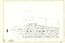
![[Sheet 24 : Jericho Beach to Balaclava Street and Fourth Avenue to Cameron Avenue]](/uploads/r/null/e/7/e737857a87702a8fbd029d7bdb109697279cac537d45931818415e380dd2867c/67258081-9a3b-44c0-9191-8a3719f6c999-MAP339_142.jpg)

![[Sheet 25 : Blanca Street to Jericho Beach and Fourth Avenue to Locarno Beach]](/uploads/r/null/a/a/aa0a0c46231b6c2f088187b2268cd829388fc6dd96aa8123f7a8f43d92c642cb/395c09b4-af3a-4986-8987-c83c92a27d94-MAP339_142.jpg)


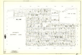


![[Sheet 29 : Balaclava Street to Maple Street and Fourteenth Avenue to Third Avenue]](/uploads/r/null/d/6/d672783fbbcdf46b6e25dc13c2f50caa22e19935f01490a9053af4afffc83c80/9a39458e-9f4b-43a8-a595-082419eecd5b-MAP339_142.jpg)


![[Sheet 30 : Maple Street to Oak Street and Fourteenth Avenue to Third Avenue and False Creek]](/uploads/r/null/2/f/2f9cbcb3930282909d8a62f01384c5c21cf803594c41529ced8de9bed70e9575/e94bfa39-bc0b-46aa-9bdd-b2c0b97f5eba-MAP339_142.jpg)


![[Sheet 32 : Main Street to Clark Drive and Sixteenth Avenue to Great Northern Way]](/uploads/r/null/1/2/1275197193b0488ed8a599413ce061f9bd30140e8bcc64728b9f05c994d8909a/718a0877-7ea9-4090-a67c-7e61c28e238e-MAP339_142.jpg)

![[Sheet 33 : Clark Drive to Nanaimo Street and Thirteenth Avenue to Second Avenue]](/uploads/r/null/5/e/5ef811f96e8c284708c2b73dafde35219a65ddca967ebd7473adfc3e76a171d6/a1b4e29f-54ea-431a-8eff-df608d7e60ff-MAP339_142.jpg)
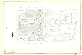
![[Sheet 34 : Nanaimo Street to Rupert Street and Fifth Avenue to Grandview Highway]](/uploads/r/null/4/d/4dec0865cb529d2b3586764b85cb4fe3474714725cb43f9b355eec779ad8162d/6493e9ac-b956-4a83-88fc-b8d6c13efcdf-MAP339_142.jpg)


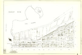
![[Sheet 35 : Rupert Street to Ardley Avenue and Grandview Highway to Fifth Avenue]](/uploads/r/null/b/9/b99ee96b798b34d2651dd213f0a858725b96bd6d586dd8d3701744c75c085139/a2e07931-8625-4adb-a51a-547f78416127-MAP339_142.jpg)
![[Sheet 36 : Rupert Street to Carlton Avenue and Twenty-second Avenue to Grandview Highway]](/uploads/r/null/2/a/2a5d48ee373aa9984afbf5119a86658558d79c8c5df27b60fdf83e4bb2673a3d/2b3f592c-cadf-4bac-a188-0a08249104da-MAP339_142.jpg)


![[Sheet 38 : Nanaimo Street to Rupert Street and Twenty-second Avenue to Grandview Highway]](/uploads/r/null/c/a/cad90f0f77fa879900b59b4a35c25c5e44009065121168e70a62d613ae189442/cb54334e-9bba-4633-aa5c-0d322a73ef41-MAP339_142.jpg)

![[Sheet 39 : Kingsway and Nanaimo Street to Rupert Street and Ward Street to Twenty-second Avenue]](/uploads/r/null/0/4/0409c276b1c046750a9680e1310ce46ec18fce0f1dfc928aab80fbe273730918/665972e9-723b-462b-b30f-95f1484b2c51-MAP339_142.jpg)
![[Sheet 4 : Chilco Street to Burrard Street and Robson Street to Deadmans Island]](/uploads/r/null/9/4/9482209e02b8dc04c79ef404276e1d40bcbb4fab0330b4aa744e352ae9440921/5597738a-70b2-4cfc-a802-6a076987c33d-MAP339_142.jpg)

