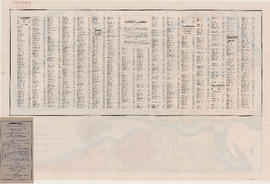
Plate 48 [Denman Street to Georgia Street to Chilco Street to Haro Street]
Plate 49 [Cardero Street to Georgia Street to Denman Street to Haro Street]
Plate 50 [Broughton Street to Georgia Street to Cardero Street to Haro Street]
Plate 51 [Bute Street to Georgia Street to Broughton Street to Haro Street]
Plate 52 [Thurlow Street to Georgia Street to Bute Street to Haro Street]
Plate 53 [Hornby Street to Georgia Street to Thurlow Street to Haro & Smithe Streets]
Plate 54 [Denman Street to Haro Street to Chilco Street to Comox Street]
Plate 55 [Cardero Street to Haro Street to Denman Street to Comox Street]
Plate 56 [Broughton Street to Haro Street to Cardero Street to Comox Street]
Plate 57 [Bute Street to Haro Streeto to Broughton Street to Comox Street]
Plate 58 [Thurlow Street to Haro Street to Bute Street to Comox Street]
Plate 59 [Hornby Street to Haro Street to Thurlow Street to Comox Street]
Plate 60 [Seymour Street to Smithe Street to Honby Street to Helmcken Street]
Plate 61 [Hamilton Street to Smithe Street to Seymour Street to Helmcken Street]
Plate 62 [Chilco Street to Burrard Inlet to Stanley Park boundary to Pendrell Street]
Plate 63 Denman Street to Comox Street to Stanley Park boundary to English Bay]
Plate 64 [Cardero Street to Comox Street to Denman Street to Beach Avenue/Burnaby Street]
Plate 65 [Broughton Street to Comox Street to Cardero Street to Burnaby Street]
Plate 66 [Bute Street to Comox Street to Broughton Street to Burnaby Street]
Plate 67 [Thurlow Street to Comox Street to Bute Street to Burnaby Street]
Plate 68 [Hornby Street to Comox Street to Thurlow Street to Burnaby/Drake Streets]
Plate 69 [Seymour Street to Helmcken Street to Hornby Street to Drake Street]
Plate 70 [Hamilton Street to Helmcken Street to Seymour Street to Drake Street]
Plate 71 [Canadian Pacific yards between False Creek and Mainland]
Plate 72 [western portion of Beach Avenue]
Plate 73 [Broughton Street to Burnaby Street to Cardero Street to English Bay]
Plate 74 [Bute Street to Burnaby Street to Broughton Street to English Bay]
Plate 75 [Thurlow Street to Burnaby Street to Bute Street to False Creek]
Plate 76 [Hornby Street to Burnaby/Drake Streets to Thurlow Street to Beach Avenue]
Plate 77 [Seymour Street to Drake Street to Hornby Street to Beach Avenue]
Plate 78 Canadian Pacific yards to Drake Street to Seymour Street to False Creek]
Plate 79 [Canadian Pacific yards to Beach Avenue to Burrard Street to False Creek]
Plate 80 [Beatty Street to Georgia Street to Hamilton Street to Smithe Street]
Plate 81 [False Creek to south of Georgia Viaduct to Canadian Pacific tracks to north of Connaught Bridge]
City of Vancouver. Fifth Sale. Lots and blocks in Lot 540
192 : plan of Provincial Government property being a portion of Townsite of Vancouver and subdivision of Lot 540 Group 1, New Westminster District, B.C., to be sold by public auction
Vancouver, B.C. zoning diagram
Map of the City of Vancouver
Guide map. Vancouver-New Westminster. Burnaby and North Shore municipalities
Street index
Map cover
Vancouver, B.C., Pacific terminus of the C.P.R.
City of Vancouver. Canadian Pacific town site
Index to streets and block numbers
Plate A [Index map of Vancouver - western portion]
Plate B [Index map of Vancouver - central portion]
Plate C [Index map of Vancouver - eastern portion]
Plate 101 [Alberta Street to False Creek to Bridge Street to Fifth Avenue]
Plate 102 [Front Street to False Creek to Cambie Street Bridge]
Plate 103 [Manitoba Street to False Creek to Dufferin Street]
![Plate 48 [Denman Street to Georgia Street to Chilco Street to Haro Street]](/uploads/r/null/3/1/f/31fb02a8c5fe87fb75e5649e7258d40f099d74790b6b817c055a23c47062f367/8c3c6be0-14fe-4dd0-a122-b7dcf4a5f252-1972-582_142.jpg)
![Plate 49 [Cardero Street to Georgia Street to Denman Street to Haro Street]](/uploads/r/null/f/8/3/f83f60f0cf6179467b2cfb55df4e15974428f00ca270b347eba70def07c87b4a/e9c44223-a505-4e2f-ba8a-0802db370187-1972-582_142.jpg)
![Plate 50 [Broughton Street to Georgia Street to Cardero Street to Haro Street]](/uploads/r/null/3/c/e/3ce897611318249b82b6bfe65c193580dceecc9b6c7dc7dc4df4dda52f95d62d/a2a18677-a4cb-48c6-9c91-b4cfe4e24892-1972-582_142.jpg)
![Plate 51 [Bute Street to Georgia Street to Broughton Street to Haro Street]](/uploads/r/null/e/3/e/e3ebb38703c1b41aae789b9939c2d46455fc5ac1a2238fd09cb52f82b04fd6d6/ca94d983-b0f4-4f4c-aa98-8d607820e6e8-1972-582_142.jpg)
![Plate 52 [Thurlow Street to Georgia Street to Bute Street to Haro Street]](/uploads/r/null/9/9/7/9974cf0b077af327236f4ff0ad07f5b79faf390b6a8994170a88dfaf1cab4766/1c777dfe-5e21-4efa-bed4-b54417dd63ba-1972-582_142.jpg)
![Plate 53 [Hornby Street to Georgia Street to Thurlow Street to Haro & Smithe Streets]](/uploads/r/null/0/a/f/0afa83e6e2a0e374d477b05d9edc30b35b43a7add6b571e75db93e97a72f63d3/31a50727-0e6a-4fd1-9f6c-d1c782784696-1972-582_142.jpg)
![Plate 54 [Denman Street to Haro Street to Chilco Street to Comox Street]](/uploads/r/null/5/3/f/53f5d570e3ae51049ccc47b91eeb7d1442288ccba31b0501af86eff8c999c4e7/cf81018f-6b85-4882-a14a-68c8283d46da-1972-582_142.jpg)
![Plate 55 [Cardero Street to Haro Street to Denman Street to Comox Street]](/uploads/r/null/2/8/b/28b7e0c47cf2df6194f0d312839c21114394a6a01179b83b34ecbc50a47f5dd4/0f01449f-3c3a-4f35-81ac-baf26798e875-1972-582_142.jpg)
![Plate 56 [Broughton Street to Haro Street to Cardero Street to Comox Street]](/uploads/r/null/d/0/b/d0bc7d49c946b9217909d32bb9a0c5efc6d7168aec6f2a940de91cf6536a2b2a/b81f0dc7-40e8-4330-a868-a73b45d7be64-1972-582_142.jpg)
![Plate 57 [Bute Street to Haro Streeto to Broughton Street to Comox Street]](/uploads/r/null/b/8/0/b80af6c275a4f50383e980393c5bbb71ffac579306faacdd2f19e94537aef5d8/2b5f8d9c-f87a-46c4-a5bd-c747c3670b2b-1972-582_142.jpg)
![Plate 58 [Thurlow Street to Haro Street to Bute Street to Comox Street]](/uploads/r/null/f/f/3/ff3fef4648e4af29a0b7351c72851a94e5082ca72fdc5b896f0ac5e23df4bfa4/85569fe2-8ee1-4af6-8376-bb46aedc6d0a-1972-582_142.jpg)
![Plate 59 [Hornby Street to Haro Street to Thurlow Street to Comox Street]](/uploads/r/null/1/f/e/1feab4419dbe682163b953bafb4e0f5200a26f80997e9c7c07ff5791a3b2b6c6/5316deec-b472-4bc6-88d7-7105c845dff9-1972-582_142.jpg)
![Plate 60 [Seymour Street to Smithe Street to Honby Street to Helmcken Street]](/uploads/r/null/7/8/a/78a3a8d6e7c29b8aec40ccaf7b114f0aa224e1e4a4499d4f189e1be81d78f87b/81df315a-bd3c-4c53-9dae-b5ec7ed40456-1972-582_142.jpg)
![Plate 61 [Hamilton Street to Smithe Street to Seymour Street to Helmcken Street]](/uploads/r/null/b/0/0/b009bace3394a162e6619dfa0970b61b03b6bf0b3992515ead5e5462fd22e200/188309c6-5b24-41f1-8468-04a807ba727e-1972-582_142.jpg)
![Plate 62 [Chilco Street to Burrard Inlet to Stanley Park boundary to Pendrell Street]](/uploads/r/null/f/c/b/fcb0376d9738d8c5ff62defc8484a52d81612329c2e61b2dd330894781a78564/4c60c9a5-b17b-43a3-9b79-d0a11f3b0b8c-1972-582_142.jpg)
![Plate 63 Denman Street to Comox Street to Stanley Park boundary to English Bay]](/uploads/r/null/6/9/c/69ce168db30e2419169b908adf2ebfb703b175281a691522e95f33f912e430a5/75ee95dc-33b3-4146-b0cd-144375a9b593-1972-582_142.jpg)
![Plate 64 [Cardero Street to Comox Street to Denman Street to Beach Avenue/Burnaby Street]](/uploads/r/null/a/c/d/acd75a8ee3db22c5eee70aac61d1b822c24e81e49c6ad60fb83edcb5bb790c11/b149dea3-0380-4dce-94e3-dfe7dd777d51-1972-582_142.jpg)
![Plate 65 [Broughton Street to Comox Street to Cardero Street to Burnaby Street]](/uploads/r/null/e/2/0/e209dc577cce482ca7200491d48c2e215064c62f666afcd968fb767affacec39/860381c6-4d46-4fab-a34c-dc44bb7d05da-1972-582_142.jpg)
![Plate 66 [Bute Street to Comox Street to Broughton Street to Burnaby Street]](/uploads/r/null/2/2/3/223e29903c3144f4d83ac824acd2128ed2b15c2c045998f0342a6fc8058dd769/2c880230-1bc4-4138-a167-213a23ffff12-1972-582_142.jpg)
![Plate 67 [Thurlow Street to Comox Street to Bute Street to Burnaby Street]](/uploads/r/null/9/e/6/9e61fbe5d4986742d82a6ce8b0046071a3cf90de1f96596cff7a9016bb5d0f61/54d9f7af-07dd-440f-bf88-47b7f80ea6dc-1972-582_142.jpg)
![Plate 68 [Hornby Street to Comox Street to Thurlow Street to Burnaby/Drake Streets]](/uploads/r/null/f/7/d/f7d9cd7561677ed01fa8e61e44f639546cb77d34d3ac06a4c35321f5bf60b671/00b69160-8d7f-4ca0-9ff7-438c2bb63517-1972-582_142.jpg)
![Plate 69 [Seymour Street to Helmcken Street to Hornby Street to Drake Street]](/uploads/r/null/3/7/3/37330eff1ce4aa559e86f0d5f0748a4c7ffcf627fc680de72302ebf9a5cb9df4/e0f35d9e-e540-40fb-a87d-026debb71dec-1972-582_142.jpg)
![Plate 70 [Hamilton Street to Helmcken Street to Seymour Street to Drake Street]](/uploads/r/null/1/8/d/18df5d1b1fa19f409d693219d2bbd713341ea2bfee9af2ec0129894f2bb937d4/0b5f965f-2534-4e51-808c-bf10c982b1f7-1972-582_142.jpg)
![Plate 71 [Canadian Pacific yards between False Creek and Mainland]](/uploads/r/null/e/a/5/ea54b234ef8ac9aac5e3c4b1fb1e4faabeda6dffb6f25fbfc5e7c1e7c4f8216f/1823de1f-abb5-4c9d-8453-fa6979933294-1972-582_142.jpg)
![Plate 72 [western portion of Beach Avenue]](/uploads/r/null/f/8/7/f87b18d10c1e70a78c4233b6cd2f014445fa13625e7854b728543a93ad9d0ce4/df6e3687-c48e-46ce-9407-344203d4b928-1972-582_142.jpg)
![Plate 73 [Broughton Street to Burnaby Street to Cardero Street to English Bay]](/uploads/r/null/d/4/d/d4d8344fb9fe03f24afb63b7902e1dc6b26c8aee04e7f37f3fa54e97373668ca/09d385e8-fefb-4816-8f4b-9b7cd544a65d-1972-582_142.jpg)
![Plate 74 [Bute Street to Burnaby Street to Broughton Street to English Bay]](/uploads/r/null/f/5/a/f5a676b2dbb5bd50aea3d8da4a8b6063dd0432ae34eab9bac9b63e229bc1c6c1/3a4811f6-9929-4b7e-8c1a-00b514e14dd0-1972-582_142.jpg)
![Plate 75 [Thurlow Street to Burnaby Street to Bute Street to False Creek]](/uploads/r/null/4/b/3/4b384cf689e0b4df8b172cc49ab4e4ece27aa86ac06485fa0a1a2561a10904cd/15596025-5e83-4f1c-9d78-cc0f7a05832f-1972-582_142.jpg)
![Plate 76 [Hornby Street to Burnaby/Drake Streets to Thurlow Street to Beach Avenue]](/uploads/r/null/7/8/2/78299212149d18634009b8f3c6d52450dceb47a2edec212c0f3d07f0e65dd5ad/17a1b420-b0c5-47fe-b4b8-27fe165e9ebf-1972-582_142.jpg)
![Plate 77 [Seymour Street to Drake Street to Hornby Street to Beach Avenue]](/uploads/r/null/1/e/2/1e2f280818ba9c268a0c3eb37f6c26a3d4e98c44809eaf72f0aa04233923a609/998d7dea-3511-482f-a646-6f87ea4550cd-1972-582_142.jpg)
![Plate 78 Canadian Pacific yards to Drake Street to Seymour Street to False Creek]](/uploads/r/null/8/1/c/81c7bdb672f0865def3028cba44861754379b4aa98b7dccf45208a5c0e846567/647f56a7-45c0-47e2-b351-acff47aac926-1972-582_142.jpg)
![Plate 79 [Canadian Pacific yards to Beach Avenue to Burrard Street to False Creek]](/uploads/r/null/0/d/b/0db6cb152921eb1a151cba66857c8735fd0fedc15a817296747c66d82f27c657/a98e998d-c944-4c90-866d-fd5d59533397-1972-582_142.jpg)
![Plate 80 [Beatty Street to Georgia Street to Hamilton Street to Smithe Street]](/uploads/r/null/d/a/e/daee4ac4066a4e662fb048df52afe5dfc7adc6341a7c055973e46ba1453f8330/505c63b5-b54a-4d4f-bfa1-bce3b08a1f61-1972-582_142.jpg)


![Plate A [Index map of Vancouver - western portion]](/uploads/r/null/0/d/0/0d022ba039f0508a397a4d35450b667671f0ef36fd388f800f51681434d2a2a9/795dc4f4-e794-4288-880d-6bd4de616417-1974-100_142.jpg)
![Plate B [Index map of Vancouver - central portion]](/uploads/r/null/3/3/6/336c664924c5e585334207b2fe0914ca7325cbf0099b84ef15ac10c18e7792d9/5b4fc691-1bcd-4a8e-864a-16ebbe062389-1974-100_142.jpg)
![Plate C [Index map of Vancouver - eastern portion]](/uploads/r/null/8/b/6/8b6eb59bc4a531f865d7df228919b13fa3b1b60a5776762d5d955cc44c5b8db5/83254bae-fa92-4283-82e4-0a09c85c0b9e-1974-100_142.jpg)
![Plate 101 [Alberta Street to False Creek to Bridge Street to Fifth Avenue]](/uploads/r/null/3/a/c/3ac4671c467690486217deca7d5b3609b605b6fc542b79fb134372abed97a952/1e879c50-27f7-4e55-8d48-ae8d72b27441-1974-100_142.jpg)
![Plate 102 [Front Street to False Creek to Cambie Street Bridge]](/uploads/r/null/2/3/4/23495fedf0cfd0840f946ff51151c2d620ac4381afedbd39cc496162211c108a/798a5687-2c56-4add-bf27-5adb8e27ebeb-1974-100_142.jpg)
![Plate 103 [Manitoba Street to False Creek to Dufferin Street]](/uploads/r/null/0/8/7/0878dcb1525256aa0f6a2ddfe63ea87046dd130caf68b3d7632593fb9d0e805f/b9950050-5631-4c4c-ac19-d2f7d1e8440a-1974-100_142.jpg)