![Plate 67 [Thurlow Street to Comox Street to Bute Street to Burnaby Street]](/uploads/r/null/9/e/6/9e61fbe5d4986742d82a6ce8b0046071a3cf90de1f96596cff7a9016bb5d0f61/54d9f7af-07dd-440f-bf88-47b7f80ea6dc-1972-582_142.jpg)
Plate 67 [Thurlow Street to Comox Street to Bute Street to Burnaby Street]
- AM1594-MAP 383-: 1972-582.42
- Item
- 1913-1920
Part of City of Vancouver Archives technical and cartographic drawing collection
Plate 67 [Thurlow Street to Comox Street to Bute Street to Burnaby Street]
Part of City of Vancouver Archives technical and cartographic drawing collection
![Plate 68 [Hornby Street to Comox Street to Thurlow Street to Burnaby/Drake Streets]](/uploads/r/null/f/7/d/f7d9cd7561677ed01fa8e61e44f639546cb77d34d3ac06a4c35321f5bf60b671/00b69160-8d7f-4ca0-9ff7-438c2bb63517-1972-582_142.jpg)
Plate 68 [Hornby Street to Comox Street to Thurlow Street to Burnaby/Drake Streets]
Part of City of Vancouver Archives technical and cartographic drawing collection
![Plate 69 [Seymour Street to Helmcken Street to Hornby Street to Drake Street]](/uploads/r/null/3/7/3/37330eff1ce4aa559e86f0d5f0748a4c7ffcf627fc680de72302ebf9a5cb9df4/e0f35d9e-e540-40fb-a87d-026debb71dec-1972-582_142.jpg)
Plate 69 [Seymour Street to Helmcken Street to Hornby Street to Drake Street]
Part of City of Vancouver Archives technical and cartographic drawing collection
![Plate 70 [Hamilton Street to Helmcken Street to Seymour Street to Drake Street]](/uploads/r/null/1/8/d/18df5d1b1fa19f409d693219d2bbd713341ea2bfee9af2ec0129894f2bb937d4/0b5f965f-2534-4e51-808c-bf10c982b1f7-1972-582_142.jpg)
Plate 70 [Hamilton Street to Helmcken Street to Seymour Street to Drake Street]
Part of City of Vancouver Archives technical and cartographic drawing collection
![Plate 71 [Canadian Pacific yards between False Creek and Mainland]](/uploads/r/null/e/a/5/ea54b234ef8ac9aac5e3c4b1fb1e4faabeda6dffb6f25fbfc5e7c1e7c4f8216f/1823de1f-abb5-4c9d-8453-fa6979933294-1972-582_142.jpg)
Plate 71 [Canadian Pacific yards between False Creek and Mainland]
Part of City of Vancouver Archives technical and cartographic drawing collection
![Plate 72 [western portion of Beach Avenue]](/uploads/r/null/f/8/7/f87b18d10c1e70a78c4233b6cd2f014445fa13625e7854b728543a93ad9d0ce4/df6e3687-c48e-46ce-9407-344203d4b928-1972-582_142.jpg)
Plate 72 [western portion of Beach Avenue]
Part of City of Vancouver Archives technical and cartographic drawing collection
Part is a map sheet that contains two portions of the map: the first shows the area bounded by Cardero Street, Burnaby Street, and Beach Avenue. The second shows the structures south of Beach Avenue between Thurlow and Burrard Streets.
![Plate 73 [Broughton Street to Burnaby Street to Cardero Street to English Bay]](/uploads/r/null/d/4/d/d4d8344fb9fe03f24afb63b7902e1dc6b26c8aee04e7f37f3fa54e97373668ca/09d385e8-fefb-4816-8f4b-9b7cd544a65d-1972-582_142.jpg)
Plate 73 [Broughton Street to Burnaby Street to Cardero Street to English Bay]
Part of City of Vancouver Archives technical and cartographic drawing collection
![Plate 74 [Bute Street to Burnaby Street to Broughton Street to English Bay]](/uploads/r/null/f/5/a/f5a676b2dbb5bd50aea3d8da4a8b6063dd0432ae34eab9bac9b63e229bc1c6c1/3a4811f6-9929-4b7e-8c1a-00b514e14dd0-1972-582_142.jpg)
Plate 74 [Bute Street to Burnaby Street to Broughton Street to English Bay]
Part of City of Vancouver Archives technical and cartographic drawing collection
![Plate 75 [Thurlow Street to Burnaby Street to Bute Street to False Creek]](/uploads/r/null/4/b/3/4b384cf689e0b4df8b172cc49ab4e4ece27aa86ac06485fa0a1a2561a10904cd/15596025-5e83-4f1c-9d78-cc0f7a05832f-1972-582_142.jpg)
Plate 75 [Thurlow Street to Burnaby Street to Bute Street to False Creek]
Part of City of Vancouver Archives technical and cartographic drawing collection
![Plate 76 [Hornby Street to Burnaby/Drake Streets to Thurlow Street to Beach Avenue]](/uploads/r/null/7/8/2/78299212149d18634009b8f3c6d52450dceb47a2edec212c0f3d07f0e65dd5ad/17a1b420-b0c5-47fe-b4b8-27fe165e9ebf-1972-582_142.jpg)
Plate 76 [Hornby Street to Burnaby/Drake Streets to Thurlow Street to Beach Avenue]
Part of City of Vancouver Archives technical and cartographic drawing collection
![Plate 77 [Seymour Street to Drake Street to Hornby Street to Beach Avenue]](/uploads/r/null/1/e/2/1e2f280818ba9c268a0c3eb37f6c26a3d4e98c44809eaf72f0aa04233923a609/998d7dea-3511-482f-a646-6f87ea4550cd-1972-582_142.jpg)
Plate 77 [Seymour Street to Drake Street to Hornby Street to Beach Avenue]
Part of City of Vancouver Archives technical and cartographic drawing collection
![Plate 78 Canadian Pacific yards to Drake Street to Seymour Street to False Creek]](/uploads/r/null/8/1/c/81c7bdb672f0865def3028cba44861754379b4aa98b7dccf45208a5c0e846567/647f56a7-45c0-47e2-b351-acff47aac926-1972-582_142.jpg)
Plate 78 Canadian Pacific yards to Drake Street to Seymour Street to False Creek]
Part of City of Vancouver Archives technical and cartographic drawing collection
![Plate 79 [Canadian Pacific yards to Beach Avenue to Burrard Street to False Creek]](/uploads/r/null/0/d/b/0db6cb152921eb1a151cba66857c8735fd0fedc15a817296747c66d82f27c657/a98e998d-c944-4c90-866d-fd5d59533397-1972-582_142.jpg)
Plate 79 [Canadian Pacific yards to Beach Avenue to Burrard Street to False Creek]
Part of City of Vancouver Archives technical and cartographic drawing collection
![Plate 80 [Beatty Street to Georgia Street to Hamilton Street to Smithe Street]](/uploads/r/null/d/a/e/daee4ac4066a4e662fb048df52afe5dfc7adc6341a7c055973e46ba1453f8330/505c63b5-b54a-4d4f-bfa1-bce3b08a1f61-1972-582_142.jpg)
Plate 80 [Beatty Street to Georgia Street to Hamilton Street to Smithe Street]
Part of City of Vancouver Archives technical and cartographic drawing collection

Part of City of Vancouver Archives technical and cartographic drawing collection

City of Vancouver. Fifth Sale. Lots and blocks in Lot 540
Part of City of Vancouver Archives technical and cartographic drawing collection
Part is the outer sheet of an unfolded brochure advertising the sale of lots owned by the provincial government. The map included in the sheet is an index map of greater Vancouver, showing the location of District Lot 540.

Part of City of Vancouver Archives technical and cartographic drawing collection
Part is the inner sheet of an unfolded brochure, showing lots offered for sale in the northern portion of District Lot 540.

Vancouver, B.C. zoning diagram
Part of City of Vancouver Archives technical and cartographic drawing collection
Part is the front side of an unfolded pamphlet. The sheet contains general information on historical events, why planning is conducted, zoning, general facts about the city and the province, a statement of purpose for town planning, and a list of applicable statutes.

Part of City of Vancouver Archives technical and cartographic drawing collection
Item is a zoning map of the City of Vancouver, with zoning indicated by colour coding and the types of construction characteristic of each zoning type.

Guide map. Vancouver-New Westminster. Burnaby and North Shore municipalities
Part of City of Vancouver Archives technical and cartographic drawing collection
Part is a map which shows city streets, local areas, schools, hospitals, firehalls, parks and golf courses as well as railways, street railways and interurbans and bus routes.
Part of City of Vancouver Archives technical and cartographic drawing collection

Part of City of Vancouver Archives technical and cartographic drawing collection
Part is the original attached cover for the map, which would have been stored folded in the cover.

Vancouver, B.C., Pacific terminus of the C.P.R.
Part of City of Vancouver Archives technical and cartographic drawing collection
Part is the front page of an unfoldedd brochure. The text describes Vancouver's growth and prospects for the future. Illustrations of different buildings in Vancouver and some parks are also shown.
Ross and Ceperley (Vancouver, B.C.)

City of Vancouver. Canadian Pacific town site
Part of City of Vancouver Archives technical and cartographic drawing collection
Part is a map sheet with one principal map, three inset maps and one illustration. The main map is a copy of a L.A. Hamilton map of downtown Vancouver and the land surrounding False Creek. Textual information is provided about the history and layout of Stanley Park. Inset maps show the Canadian Pacific mail steamships lines around the world and an index plan of Vancouver, B.C. An illustration is incuded of the north shore mountains as seen from Vancouver.

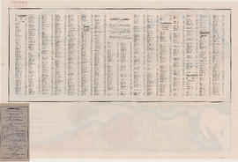
Index to streets and block numbers
Part of City of Vancouver Archives technical and cartographic drawing collection
![Plate A [Index map of Vancouver - western portion]](/uploads/r/null/0/d/0/0d022ba039f0508a397a4d35450b667671f0ef36fd388f800f51681434d2a2a9/795dc4f4-e794-4288-880d-6bd4de616417-1974-100_142.jpg)
Plate A [Index map of Vancouver - western portion]
Part of City of Vancouver Archives technical and cartographic drawing collection
![Plate B [Index map of Vancouver - central portion]](/uploads/r/null/3/3/6/336c664924c5e585334207b2fe0914ca7325cbf0099b84ef15ac10c18e7792d9/5b4fc691-1bcd-4a8e-864a-16ebbe062389-1974-100_142.jpg)
Plate B [Index map of Vancouver - central portion]
Part of City of Vancouver Archives technical and cartographic drawing collection
![Plate C [Index map of Vancouver - eastern portion]](/uploads/r/null/8/b/6/8b6eb59bc4a531f865d7df228919b13fa3b1b60a5776762d5d955cc44c5b8db5/83254bae-fa92-4283-82e4-0a09c85c0b9e-1974-100_142.jpg)
Plate C [Index map of Vancouver - eastern portion]
Part of City of Vancouver Archives technical and cartographic drawing collection
![Plate 101 [Alberta Street to False Creek to Bridge Street to Fifth Avenue]](/uploads/r/null/3/a/c/3ac4671c467690486217deca7d5b3609b605b6fc542b79fb134372abed97a952/1e879c50-27f7-4e55-8d48-ae8d72b27441-1974-100_142.jpg)
Plate 101 [Alberta Street to False Creek to Bridge Street to Fifth Avenue]
Part of City of Vancouver Archives technical and cartographic drawing collection
![Plate 102 [Front Street to False Creek to Cambie Street Bridge]](/uploads/r/null/2/3/4/23495fedf0cfd0840f946ff51151c2d620ac4381afedbd39cc496162211c108a/798a5687-2c56-4add-bf27-5adb8e27ebeb-1974-100_142.jpg)
Plate 102 [Front Street to False Creek to Cambie Street Bridge]
Part of City of Vancouver Archives technical and cartographic drawing collection
![Plate 103 [Manitoba Street to False Creek to Dufferin Street]](/uploads/r/null/0/8/7/0878dcb1525256aa0f6a2ddfe63ea87046dd130caf68b3d7632593fb9d0e805f/b9950050-5631-4c4c-ac19-d2f7d1e8440a-1974-100_142.jpg)
Plate 103 [Manitoba Street to False Creek to Dufferin Street]
Part of City of Vancouver Archives technical and cartographic drawing collection
![Plate 104 [Quebec Street to False Creek to Manitoba Street to Dufferin Street]](/uploads/r/null/b/3/b/b3b42c0352bed859e94ea30004ddb12475eea99c16a153542be22e644023b5ac/98b44bb6-b7b2-4f4c-aa2e-1d090030146e-1974-100_142.jpg)
Plate 104 [Quebec Street to False Creek to Manitoba Street to Dufferin Street]
Part of City of Vancouver Archives technical and cartographic drawing collection
![Plate 105 [Front Street to False Creek to Quebec Street to Dufferin Street]](/uploads/r/null/a/f/b/afbb9be25514350d408eefa5865173e3a489ecdb6752d6b3096564052b234ca4/8c126ea6-16bb-4f0b-8131-a16f2a686d95-1974-100_142.jpg)
Plate 105 [Front Street to False Creek to Quebec Street to Dufferin Street]
Part of City of Vancouver Archives technical and cartographic drawing collection
![Plate 106 [Manitoba Street to Dufferin Street to Alberta Street to Fifth Avenue]](/uploads/r/null/a/2/8/a288bcdc881a84d269c058cb38c117c43ef34c68d4a36dd1ffa72bfc2a46ba60/2d5baff6-456c-4406-9faf-fdd562e492b0-1974-100_142.jpg)
Plate 106 [Manitoba Street to Dufferin Street to Alberta Street to Fifth Avenue]
Part of City of Vancouver Archives technical and cartographic drawing collection
![Plate 107 [Quebec Street to Dufferin Street to Manitoba Street to Fifth Avenue]](/uploads/r/null/0/d/7/0d79d0f2e59b2acf6f0b094b86112948aced989bd8c13eb8f8ac17f5cb05a1fd/b74906fe-c1a9-49b1-8bc5-37b4141108f6-1974-100_142.jpg)
Plate 107 [Quebec Street to Dufferin Street to Manitoba Street to Fifth Avenue]
Part of City of Vancouver Archives technical and cartographic drawing collection
![Plate 108 [Scotia Street to Front/Dufferin Streets to Quebec Street to Fifth Avenue]](/uploads/r/null/5/4/6/54625ed1d1a99824d0a91f9897950dc4d1691ce8f7fae7be8086e768e671ef0e/5da48b46-8a62-40b9-9992-0fcbe4e8b491-1974-100_142.jpg)
Plate 108 [Scotia Street to Front/Dufferin Streets to Quebec Street to Fifth Avenue]
Part of City of Vancouver Archives technical and cartographic drawing collection
![Plate 109 [Victoria Drive to False Creek to Scotia Street to Fifth Avenue]](/uploads/r/null/c/f/7/cf796986affb1d4761889c3b98c83be508ab7b762a16dcde3f48354e496a910f/3e0ce046-091f-45fb-b3ec-8ef8d907b4c2-1974-100_142.jpg)
Plate 109 [Victoria Drive to False Creek to Scotia Street to Fifth Avenue]
Part of City of Vancouver Archives technical and cartographic drawing collection
![Plate 110 [Carolina Street to False Creek to Victoria Drive to Seventh Avenue]](/uploads/r/null/9/c/d/9cde1416ae9e7694bef6c49f29ddb6e0e736b4639ac4c5dfd11bc2ba91e0e05e/c91e3418-bc09-4b26-a8c5-2adaccfe4aa1-1974-100_142.jpg)
Plate 110 [Carolina Street to False Creek to Victoria Drive to Seventh Avenue]
Part of City of Vancouver Archives technical and cartographic drawing collection
![Plate 111 [Burns Street to False Creek to Carolina Street to Seventh Avenue]](/uploads/r/null/2/d/2/2d251d7248e7bf038122c9c38701419ecb65debefb060aa248148844edbc39a1/2e6a05ed-365c-42ec-b3ff-64338fcca4d0-1974-100_142.jpg)
Plate 111 [Burns Street to False Creek to Carolina Street to Seventh Avenue]
Part of City of Vancouver Archives technical and cartographic drawing collection
![Plate 112 [Alberta Street to Fifth Avenue to Bridge Street to Eighth Avenue]](/uploads/r/null/7/f/9/7f975ee4ccb3f0a5d9e1476fa7387fafeece721794c61445a846aff9bf0a1bce/4c08bf91-8091-4758-a4c4-2dbb0cc6ca4e-1974-100_142.jpg)
Plate 112 [Alberta Street to Fifth Avenue to Bridge Street to Eighth Avenue]
Part of City of Vancouver Archives technical and cartographic drawing collection
![Plate 113 [Manitoba Street to Fifth Avenue to Alberta Street to Eighth Avenue]](/uploads/r/null/6/7/c/67cdb1d1eab4b07c2b015fc0f90710fa8ae4450274ff5bd6f2998b216902384e/44c3fa3c-b383-463b-9d54-278f6ba758a1-1974-100_142.jpg)
Plate 113 [Manitoba Street to Fifth Avenue to Alberta Street to Eighth Avenue]
Part of City of Vancouver Archives technical and cartographic drawing collection
![Plate 114 [Quebec Street to Fifth Avenue to Manitoba Street to Eighth Avenue]](/uploads/r/null/1/d/a/1da8c667b11d0f463073015a74cdc6f409f2f18733a36abda9afe0b996d9abe6/02c6dfe0-25c2-4696-8ff5-429480c2de74-1974-100_142.jpg)
Plate 114 [Quebec Street to Fifth Avenue to Manitoba Street to Eighth Avenue]
Part of City of Vancouver Archives technical and cartographic drawing collection
![Plate 115 [Scotia Street to Fifth Avenue to Quebec Street to Eighth Avenue]](/uploads/r/null/b/8/6/b86c99928da0cefb46e6dc6e7d9b2f9feb0c5d75b13cbfacf0da89c0e212870c/10e20065-c9ef-41ad-a820-8e3c418d2043-1974-100_142.jpg)
Plate 115 [Scotia Street to Fifth Avenue to Quebec Street to Eighth Avenue]
Part of City of Vancouver Archives technical and cartographic drawing collection
![Plate 116 [Victoria Drive to Dufferin Street/Fifth Avenue to Scotia Street to Eighth Avenue]](/uploads/r/null/a/4/8/a48d7c5927867042c40b8415d5b33492b6ba8385e375aec78a675f2d3859417a/0dac58ba-008b-4d37-8ea2-aabfd1cb96d8-1974-100_142.jpg)
Plate 116 [Victoria Drive to Dufferin Street/Fifth Avenue to Scotia Street to Eighth Avenue]
Part of City of Vancouver Archives technical and cartographic drawing collection
![Plate 117 [Carolina Street to Seventh Avenue to Victoria Drive to Tenth Avenue]](/uploads/r/null/f/0/1/f01e37963864f5231283cc4e6bc7df6cd6d6df44667846c5e69dc6787c623881/1797e915-b1a7-4980-acf1-b42faefa128c-1974-100_142.jpg)
Plate 117 [Carolina Street to Seventh Avenue to Victoria Drive to Tenth Avenue]
Part of City of Vancouver Archives technical and cartographic drawing collection
![Plate 118 [Burns Street to Seventh Avenue to Carolina Street to Tenth Avenue]](/uploads/r/null/1/3/d/13d0f752a2256754eef1871ceaee111678790dfc9ac08ab3515e1d24051659bc/b001c220-4630-4f03-bbd4-e73eaafe8133-1974-100_142.jpg)
Plate 118 [Burns Street to Seventh Avenue to Carolina Street to Tenth Avenue]
Part of City of Vancouver Archives technical and cartographic drawing collection
![Plate 119 [Dock Street to Seventh Avenue to Burns Street to Tenth Avenue]](/uploads/r/null/d/7/c/d7cf9a44b79c3474cf22e547b284ddfb851d469419b4c16364c5bd62aacd6b8a/6ff5b121-a238-4b51-8586-2e9962088a05-1974-100_142.jpg)
Plate 119 [Dock Street to Seventh Avenue to Burns Street to Tenth Avenue]
Part of City of Vancouver Archives technical and cartographic drawing collection
![Plate 120 [Manitoba Street to Eighth Avenue to Alberta Street to Eleventh Avenue]](/uploads/r/null/f/a/6/fa6302e459598f703ec9a4f6d49de458a312194cf71a4d02ffaeb7416336e184/73a06efd-6ff6-4712-86d3-99cef6e5d4f3-1974-100_142.jpg)
Plate 120 [Manitoba Street to Eighth Avenue to Alberta Street to Eleventh Avenue]
Part of City of Vancouver Archives technical and cartographic drawing collection
![Plate 121 [Quebec Street to Eighth Avenue to Manitoba Street to Eleventh Avenue]](/uploads/r/null/a/f/1/af121e25c31c0cfec1192729732131e8c10fc3b73fef80730f442c4b8851d11e/1a24a04e-7d82-4800-96dd-ef72113c34a3-1974-100_142.jpg)
Plate 121 [Quebec Street to Eighth Avenue to Manitoba Street to Eleventh Avenue]
Part of City of Vancouver Archives technical and cartographic drawing collection
![Plate 122 [Scotia Street to Eighth Avenue to Quebec Street to Eleventh Avenue]](/uploads/r/null/8/8/1/881d5dea72196cae5eaf43f70c73e80c2fb405045a4bdf21ca39865bf3017c2a/f99553c0-92f4-46fe-8932-ac6c8ad65532-1974-100_142.jpg)
Plate 122 [Scotia Street to Eighth Avenue to Quebec Street to Eleventh Avenue]
Part of City of Vancouver Archives technical and cartographic drawing collection