Add to clipboard
City of Vancouver : Canadian Pacific town site
Add to clipboard
Vancouver, B.C., the Pacific coast terminus of the C.P.R. [Canadian Pacific Railway]
Indexed map of Greater Vancouver
Add to clipboard
Indexed map of Greater Vancouver
Add to clipboard
"Know your city" : Buckley's map of Vancouver (un-abridged)
Add to clipboard
City of Vancouver, Canadian Pacific Town Site
Add to clipboard
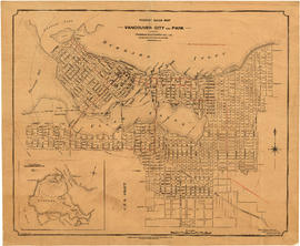
Tourist guide map of Vancouver City and Park
Map of Vancouver Unemployment and Relief [BC]
Add to clipboard
Map of Vancouver Unemployment and Relief [BC]
Vancouver, B.C., Pacific terminus of the C.P.R.
Add to clipboard
Vancouver, B.C., Pacific terminus of the C.P.R.
Add to clipboard
Plan of portions of False Creek (Kitsilano) Indian Reserve, Vancouver, B.C., required for Burrard Street Bridge right-of-way
Bird's eye view of Vancouver, B.C.
Add to clipboard
Bird's eye view of Vancouver, B.C.
Add to clipboard
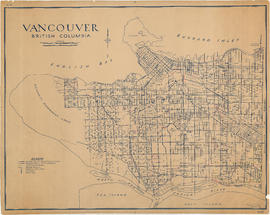
Vancouver, British Columbia
Add to clipboard
City of Vancouver. Fifth Sale. Lots and blocks in Lot 540
Add to clipboard
192 : plan of Provincial Government property being a portion of Townsite of Vancouver and subdivision of Lot 540 Group 1, New Westminster District, B.C., to be sold by public auction
Add to clipboard
Plan of the City of Vancouver, British Columbia
Add to clipboard
Vancouver City : plan of Subdivision of lot 301, Group 1, New Westminster District
Add to clipboard
Plan of the City of Vancouver, B.C.
Waterworks map of City of Vancouver
Add to clipboard
Waterworks map of City of Vancouver
Vancouver, B.C. zoning diagram
Add to clipboard
Vancouver, B.C. zoning diagram
Add to clipboard
Transit routes in downtown area Vancouver, B.C. effective July 18, 1952
Guide to Vancouver
Add to clipboard
Guide to Vancouver
Add to clipboard
Plan showing polling divisions, City of Vancouver, B.C.
Add to clipboard
Schedule "A" : polling districts, City of Vancouver
Guide map. Vancouver-New Westminster. Burnaby and North Shore municipalities
Add to clipboard
Guide map. Vancouver-New Westminster. Burnaby and North Shore municipalities
Add to clipboard
Map cover
Vancouver, British Columbia, Canada
Add to clipboard
Vancouver, British Columbia, Canada
Add to clipboard
Warehouse and store sites : very centrally located
Add to clipboard
An Indian map. Vancouver
Add to clipboard
Map showing location of single women receiving assistance by mail
Add to clipboard
Map showing location of single men receiving assistance by mail
Map of Vancouver and Lower Mainland : avenue guide
Add to clipboard
Map of Vancouver and Lower Mainland : avenue guide
Add to clipboard
[Vancouver, B.C. : district lots]
Add to clipboard
Second Narrows crossing
Add to clipboard
Panoramic view of the City of Vancouver, British Columbia, 1898
Map of Vancouver, B.C., and vicinity
Add to clipboard
Map of Vancouver, B.C., and vicinity
Add to clipboard
City of Vancouver : east half
Add to clipboard
City of Vancouver : west half
Add to clipboard
City of Vancouver
A souvenir and correct map of the location of all the fair buildings of the Vancouver Exhibition
Add to clipboard
A souvenir and correct map of the location of all the fair buildings of the Vancouver Exhibition
Add to clipboard
Plan of the Vancouver Exhibition grounds
Add to clipboard
A souvenir and correct map of the location of all the fair buildings of the Vancouver Exhibition
Add to clipboard
Municipality of North Vancouver [Burrard Inlet]
Vest pocket map of Vancouver
Add to clipboard
Vest pocket map of Vancouver
Add to clipboard
Vest pocket map of Vancouver : map B
Add to clipboard
Vest pocket map of Vancouver : map C
Add to clipboard
Vest pocket map of Vancouver : map D
Add to clipboard
Location of ferry pedestrian subway, Vancouver, B.C.
Add to clipboard
Vancouver : urban growth, 1865-1970
City of Vancouver, British Columbia
Add to clipboard
City of Vancouver, British Columbia
Property map: Hastings and Pender streets
Add to clipboard
Property map: Hastings and Pender streets
Property map : Granville Street
Add to clipboard
Property map : Granville Street


![Vancouver, B.C., the Pacific coast terminus of the C.P.R. [Canadian Pacific Railway]](/uploads/r/null/e/2/c/e2cdc004f3cf462100ed2ef053aa6087887b3f3200917cd5fba6292afb3b2d2d/bfcde3fa-32d7-4d08-86e5-ecf70c6f8388-LEG1340_142.jpg)


![[Vancouver, B.C. : district lots]](/uploads/r/null/4/a/4a5c15633319c3754d3aa0cc525470bfebcf5a98ad8caeedf44b777194f300bd/2f055d65-47f7-4679-bb91-66b8f1843d2f-MAP531_142.jpg)


![Municipality of North Vancouver [Burrard Inlet]](/uploads/r/null/6/d/6d0d9a4b75b38672c56aa89a5984fe2d0e6d66be85f6f375cbe8e2fd7ac94a98/577914e1-3de2-478b-a629-5f391731387a-MAP588_142.jpg)


