Showing 269 results
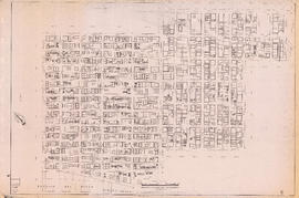
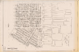
Archival description![Sheet 20B [Burrard Street to Burrard Inlet to Cardero Street to Georgia Street]](/uploads/r/null/2/d/7/2d75e4f8be37129a74a2b029a37894a5c9236512c1cf1e87f396ab643322d50a/6599a0ed-8fbc-49e5-a54c-be3ac20f7ff9-LEG1153_142.jpg)
Sheet 20B [Burrard Street to Burrard Inlet to Cardero Street to Georgia Street]
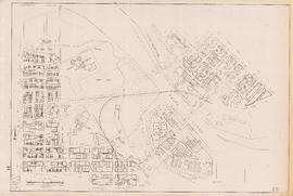
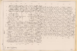
![Sheet 20E [Burrard Street to Davie Street to Cardero Street to False Creek]](/uploads/r/null/2/8/8/28803b69ed37ea5295c834f1dc116b0d3f55d7906623919d9aec8a599b694eeb/617839ac-0ec0-488b-be9f-da51556150ce-LEG1153_142.jpg)
Sheet 20E [Burrard Street to Davie Street to Cardero Street to False Creek]
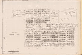
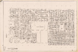
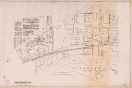
![Sheet 21D [Station Street to Georgia Viaduct to Connaught Bridge to False Creek]](/uploads/r/null/1/c/c/1cce6e5de2ecb3689ce514a49bb625c3d1bacd82e33995a5836567dfbea0527a/e827967d-d48c-4cb2-b0c5-e96d77cc421f-LEG1153_142.jpg)
Sheet 21D [Station Street to Georgia Viaduct to Connaught Bridge to False Creek]
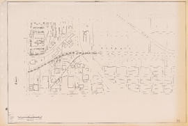
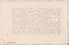
![Sheet 22A [False Creek to Burrard Bridge to Fir Street to Broadway]](/uploads/r/null/2/9/9/299875c18b9ea151bb9a574e273ac6a8ab0828369c0c8d7d5bdf172ac745641f/7dfddd59-1e03-46a4-9ede-f23bbc55e8fb-LEG1153_142.jpg)
Sheet 22A [False Creek to Burrard Bridge to Fir Street to Broadway]
![Sheet 24B [Main Street to King Edward Avenue to Cambie Street to 31st Avenue]](/uploads/r/null/6/b/e/6be171c12870a10680c5d4e5ffc0c28a4e5f2599b7e9cf410853373d275dc79b/5babbd98-8853-4663-915a-6ab0735179dd-LEG1153_142.jpg)
Sheet 24B [Main Street to King Edward Avenue to Cambie Street to 31st Avenue]
![Sheet 25A [Cambie Street to 41st Avenue to Oak Street to 49th Avenue]](/uploads/r/null/2/a/c/2ac3063a0c3c88b108ed5cd490bd016ccd27b83de9c016f7b2095d92a350254f/8ded00ee-e2c6-49d8-979b-28df2df7864c-LEG1153_142.jpg)
Sheet 25A [Cambie Street to 41st Avenue to Oak Street to 49th Avenue]
![Sheet 25C [Cambie Street to 49th Avenue to Oak Street to 57th Avenue]](/uploads/r/null/3/9/c/39cbabc22fef55ee96797487731e97bca5a2ee9b8adbdab28d71d16a55e6459b/497c7d8d-f437-4339-b631-481933ef51c5-LEG1153_142.jpg)
Sheet 25C [Cambie Street to 49th Avenue to Oak Street to 57th Avenue]
![Sheet 26C [Yukon Street to 64th Avenue to Fremlin Street to Kent Avenue]](/uploads/r/null/1/e/3/1e3c0d49d5b6bd49c571c7dddc74fbd87d680726a69d28b8eaa3e23de2bd8956/d4884c98-7d8e-403f-a192-4726d342c5dc-LEG1153_142.jpg)
Sheet 26C [Yukon Street to 64th Avenue to Fremlin Street to Kent Avenue]
![Sheet 26D [Main Street to SW Marine Drive to Yukon Street to Fraser River]](/uploads/r/null/3/1/6/3161bed16af9a222ebc8c176831f06d57cc134e38fc48d0275899ad1007fcdd6/ad857108-61f7-4a73-a1cd-ade56977c6af-LEG1153_142.jpg)
Sheet 26D [Main Street to SW Marine Drive to Yukon Street to Fraser River]
![Sheet 28B [Oak Street to Broadway to Granville Street to 16th Avenue]](/uploads/r/null/e/3/9/e39c7f8c28163119556e70691eaf85fcdf329eadaca535b09b09fdad0f446575/bc31e72d-4dd5-49db-8645-2a92c42285bb-LEG1153_142.jpg)
Sheet 28B [Oak Street to Broadway to Granville Street to 16th Avenue]
![Sheet 29C [Granville Street to 33rd Avenue to maple Street to 41st Avenue]](/uploads/r/null/5/9/6/59630ff85c6803e8299a6bea855daca96289d017d436c4d6c289fe874c13a41a/9d616eed-5783-4388-a5f6-6eea4ecd4ce6-LEG1153_142.jpg)
Sheet 29C [Granville Street to 33rd Avenue to maple Street to 41st Avenue]
![Sheet 30A [Granville Street to 41st Avenue to Maple Street to 49th Avenue]](/uploads/r/null/d/7/2/d72ce36bbecdb5e5a7a132573fa9297e36714fae8be8866729ea7693a072210e/6e00c84e-6810-4d67-9923-fa850decae8f-LEG1153_142.jpg)
Sheet 30A [Granville Street to 41st Avenue to Maple Street to 49th Avenue]
![Sheet 31A [Granville Street to 57th Avenue to Arbutus Street to 64th Avenue]](/uploads/r/null/9/1/8/9184c8698fca3e24151617df2798ae607719079ff33f3a87f663491cd817816d/2abef7f3-0cb9-4ddd-83da-29c5bd925126-LEG1153_142.jpg)
Sheet 31A [Granville Street to 57th Avenue to Arbutus Street to 64th Avenue]
![Sheet 31B [Laurel/Fremlin Streets to 57th Avenue to Granville Street to 64th Avenue]](/uploads/r/null/0/f/b/0fba99a8fde4007d2bdfe0aec799f50b122b42e9026890e8fc2d1c8943e80b52/f3c96070-7b31-49e5-992a-596008dc0f20-LEG1153_142.jpg)
Sheet 31B [Laurel/Fremlin Streets to 57th Avenue to Granville Street to 64th Avenue]
![Sheet 33A [Stephens Street to English Bay to Blenehim Street to 1st Avenue]](/uploads/r/null/a/f/e/afe1579741abced0aad5df778dfd35c9f63988bccee0fa7a3b9da9a15f793635/87232a2f-22b5-44cb-ad35-8c52fc23f5a9-LEG1153_142.jpg)
Sheet 33A [Stephens Street to English Bay to Blenehim Street to 1st Avenue]
![Sheet 33B [Arbutus Street to English Bay to Stephens Street to 1st Avenue]](/uploads/r/null/8/f/c/8fc713dcb77b096222ee8638c5b1e194f635c9af7b1f7f1d17abf1b019cdff75/7058ad67-b7a0-4940-9742-d752033ff385-LEG1153_142.jpg)
Sheet 33B [Arbutus Street to English Bay to Stephens Street to 1st Avenue]
![Sheet 35A [Trafalgar Street to King Edward Avenue to Blenheim Street to 33rd Avenue]](/uploads/r/null/6/4/8/648be52a546b43201063ee32aea015a66237c5ebd207aa6f1c773f9ed5705860/f195e23a-7e01-4b75-9b68-050ee5d330f4-LEG1153_142.jpg)
Sheet 35A [Trafalgar Street to King Edward Avenue to Blenheim Street to 33rd Avenue]
![Sheet 36A [Trafalgar Street to 41st Avenue to Blenheim Street to 49th Avenue]](/uploads/r/null/2/8/4/28460f6a324d3a76d6e4b6164988efd9eae41a90614f984a6108a03436add80d/a5c058b4-8ee2-4bad-b10e-7b990bc2e566-LEG1153_142.jpg)
Sheet 36A [Trafalgar Street to 41st Avenue to Blenheim Street to 49th Avenue]
![Sheet 36B [Maple Street to 41st Avenue to Trafalgar Street to 49th Avenue]](/uploads/r/null/a/4/0/a40c683a4e05e13a0b2788be31d5bd9e052323e28a1c760c2c1370625278ab20/7377513a-5067-46ca-bc51-fb94fc7fdc29-LEG1153_142.jpg)
Sheet 36B [Maple Street to 41st Avenue to Trafalgar Street to 49th Avenue]
![Sheet 39C [Wallace Street to 16th Avenue to Discovery Street to King Edward Avenue]](/uploads/r/null/2/5/c/25c5aa22e403558f96fbd40e3ae0947be0ace24e232e953b87a2fb754b3fb1a3/ff315df3-3abc-48e3-b95c-305139a29e88-LEG1153_142.jpg)
Sheet 39C [Wallace Street to 16th Avenue to Discovery Street to King Edward Avenue]
![Sheet 43B [Discovery Street to English Bay to Blanca Street to 2nd Avenue]](/uploads/r/null/2/1/0/21007a691605ce3411c27c74a7e68e1ecc145d09c86feadc96ecb9b090f3c96e/bff71469-8c56-4157-b106-946d78ab28bd-LEG1153_142.jpg)
Sheet 43B [Discovery Street to English Bay to Blanca Street to 2nd Avenue]

Sectional map of Vancouver showing streets, block and lot outlines, and building perimeters: Map 5 : Lagoon Street to Nicola Street and Robson Street to English Bay
Sectional map of Vancouver showing streets, block and lot outlines, and building perimeters : Map 6 : Nicola Street to Beatty Street and Georgia Street to Beach Avenue/Drake Street

Sectional map of Vancouver showing streets, block and lot outlines, and building perimeters : Map 8 : Piers at Burrard Inlet between Main Street and Clark Drive

Sectional map of Vancouver showing streets, block and lot outlines, and building perimeters : Map 9 : Main Street to Clark Drive and Burrard Inlet to Prior Street

Sectional map of Vancouver showing streets, block and lot outlines, and building perimeters : Map 20 : Main Street to Clark Drive and Prior Street to 2nd Avenue/Great Northern Way
Sectional map of Vancouver showing streets, block and lot outlines, and building perimeters : Map 22 : Maple Street to Drake Street and Vanier Park/Sunset Beach to 4th Avenue

Sectional map of Vancouver showing streets, block and lot outlines, and building perimeters : Map 24 : Jericho Beach Park to Balaclava Street and English Bay to 4th Avenue
Sectional map of Vancouver showing streets, block and lot outlines, and building perimeters : Map 27 : Blanca Street to Camosun Street and 4th Avenue to 14th Avenue
Sectional map of Vancouver showing streets, block and lot outlines, and building perimeters : Map 35 : Rupert Street to Boundary Road and 5th Avenue to Grandview Highway
Sectional map of Vancouver showing streets, block and lot outlines, and building perimeters : Map 37 : Rupert Street to Boundary Road and 22nd Avenue to Wellington Avenue/Monmouth Avenue
Sectional map of Vancouver showing streets, block and lot outlines, and building perimeters : Map 44 : Blenheim Street to Arbutus Street and 14th Avenue to King Edward Avenue/23rd Avenue

Sectional map of Vancouver showing streets, block and lot outlines, and building perimeters : Map 48 : Blenheim Street to Arbutus Street King Edward Avenue/23rd Avenue ro 33rd Avenue
Sectional map of Vancouver showing streets, block and lot outlines, and building perimeters : Map 51 : Ontario Street to Inverness Street and 28th Avenue to 37th Avenue

Sectional map of Vancouver showing streets, block and lot outlines, and building perimeters : Map 52 : Inverness Street to Nanaimo Street and 22nd Avenue/24th Avenue to 32nd Avenue

Sectional map of Vancouver showing streets, block and lot outlines, and building perimeters : Map 55 : McHardy Street/Cecil Street to Boundary Road and Wellington Avenue/Monmouth Avenue to Kingsway

Sectional map of Vancouver showing streets, block and lot outlines, and building perimeters : Map 57 : Berkley Street/Nanaimo Street to Joyce Street/Doman Street and 41st Avenue to 49th Avenue

Sectional map of Vancouver showing streets, block and lot outlines, and building perimeters : Map 60 : Oak Street to Quebec Street and 37th Avenue to 46th Avenue
Sectional map of Vancouver showing streets, block and lot outlines, and building perimeters : Map 62 : Cypress Street to Oak Street and 41st Avenue to 49th Avenue

Sectional map of Vancouver showing streets, block and lot outlines, and building perimeters : Map 66 : Crown Street to Balaclava Street and 41st Avenue to 49th Avenue

Sectional map of Vancouver showing streets, block and lot outlines, and building perimeters : Map 71 : Cypress Street to Oak Street and 49th Avenue to 57th Avenue

Sectional map of Vancouver showing streets, block and lot outlines, and building perimeters : Map 78 : Kerr Street to Boundary Road and S.E. Marine Drive to the North Arm of the Fraser River

Sectional map of Vancouver showing streets, block and lot outlines, and building perimeters : Map 79 : Gladstone Street/Nanaimo Street to Kerr Street and Bobolink Avenue to the North Arm of the Fraser River

Sectional map of Vancouver showing streets, block and lot outlines, and building perimeters : Map 82 : Main Street to Crompton Street and S.E. Marine Drive to the North Fork of the North Arm of the Fraser River
Sectional map of Vancouver showing streets, block and lot outlines, and building perimeters : Map 84 : Laurel Street to Main Street and 67th Avenue/S.W. Marine Drive to the North Fork of the North Arm of the Fraser River

Sectional map of Vancouver showing streets, block and lot outlines, and building perimeters : Map 86 : Angus Drive to Laurel Street and 68th Avenue/67th Avenue to the North Arm of the Fraser River

Sectional map of Vancouver showing streets, block and lot outlines, and building perimeters : Map 89 : Area west of Angus Drive to Barnard Street and S.W. Marine Drive to the North Arm of the Fraser River
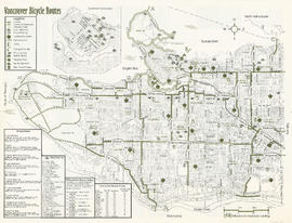
Vancouver bicycle routes

Cycling in Vancouver

Vancouver Parks and Recreation : map and guide
Results 101 to 150 of 269