
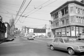
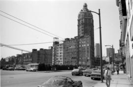
00 West Hastings Street south side
- COV-S510-: CVA 779-E17.13
- Item
- 1981
Part of City of Vancouver fonds
Images show Wosk's Ltd. at 58 West Hastings
221331 results with digital objects Show results with digital objects
00 West Hastings Street south side
Part of City of Vancouver fonds
Images show Wosk's Ltd. at 58 West Hastings

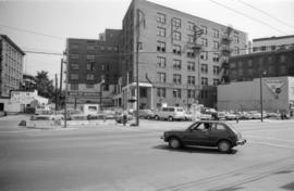
00 West Hastings Street south side
Part of City of Vancouver fonds
Image shows Bank of Montreal.

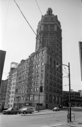
00 West Pender Street north side
Part of City of Vancouver fonds
Image shows Arco Hotel.

00 West Pender Street north side
Part of City of Vancouver fonds
00 West Pender Street north side
Part of City of Vancouver fonds
00 West Pender Street north side
Part of City of Vancouver fonds
00 West Pender Street south side
Part of City of Vancouver fonds
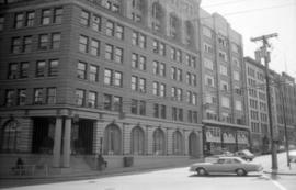
00 West Pender Street south side
Part of City of Vancouver fonds
00 West Pender Street south side
Part of City of Vancouver fonds

00 West Pender Street south side
Part of City of Vancouver fonds
Image shows Chatham Steel Wholesale.

00 West Pender Street south side
Part of City of Vancouver fonds
![[000 block East Pender Street, 1 of 3]](/uploads/r/null/f/c/6/fc6342f0781510b485897f7d121b1fe81058df12cdeb13398cf943a0f3dd6fea/161768a3-63dd-42d2-af82-3064386b12cf-CVA1095-06779_142.jpg)
[000 block East Pender Street, 1 of 3]
Part of City of Vancouver fonds
![[000 block East Pender Street, 2 of 3]](/uploads/r/null/d/1/8/d18d6a25f2c6cc70667449fdca3e0630ee758cc181894c02e7f370005acc0b24/832fd3d3-228b-4ebb-a975-8d717fe931d6-CVA1095-06780_142.jpg)
[000 block East Pender Street, 2 of 3]
Part of City of Vancouver fonds
![[000 block East Pender Street, 3 of 3]](/uploads/r/null/9/1/f/91ff6069571188213682e32a5f679d941cbbaeca77bf16a8fee67b1b4646879c/6bc09737-b5e6-42e7-9640-58472f208b00-CVA1095-06781_142.jpg)
[000 block East Pender Street, 3 of 3]
Part of City of Vancouver fonds
0-2 Central Park correspondence
0-2 outside organizations - Central Park
Item includes census land delineation code for cities, municipalities and villages.
Item includes inset maps of Creston area and Rossland Trail area, as well as census land delineation code for cities, municipalities and villages
09-03 : Okanagan Similkameen and Kettle Valleys
Item includes inset map of the Okanagan Valley, as well as census land delineation code for cities, municipalities and villages
Item includes census land delineation code for cities, municipalities and villages.
Item includes inset map of Nanaimo area and greater Victoria, as well as census land delineation code for cities, municipalities and villages
09-06 : Kamloops-Lillooet Region
Item includes census land delineation code for cities, municipalities and villages.
09-07 : Central Mainland Coast
Item includes census land delineation code for cities, municipalities and villages.
Item includes census land delineation code for cities, municipalities and villages.
Item includes census land delineation code for cities, municipalities and villages.
Item includes inset of Dawson Creek area, as well as census land delineation code for cities, municipalities and villages.
![1 - Hangar #7 - exterior interior [1 of 20]](/uploads/r/null/3/2/a/32a46da871aee4c2c68b5e85538c8bfa32fe00d80ac360b800f09c6d2a95c82b/5b1d0ffd-095c-4bb0-ac3e-43e7b41361ea-CVA395-05213_142.jpg)
#1 - Hangar #7 - exterior interior [1 of 20]
Part of Habitat Forum photographs
![1 - Hangar #7 - exterior interior [10 of 20]](/uploads/r/null/7/6/8/768af21a91b0718a9e86c83f2030ca1d2195c3f94a368317cae011ed7057492e/58e2c479-130d-4c3b-8fd2-15f8bd97cc5f-CVA395-05222_142.jpg)
#1 - Hangar #7 - exterior interior [10 of 20]
Part of Habitat Forum photographs
![1 - Hangar #7 - exterior interior [11 of 20]](/uploads/r/null/b/e/d/bedf532ea12b14373049321d9fc9420ca8c32c10cbafdec8d2fc10cbeb57577f/5891495c-fbf8-42ea-84ad-ad836d2a4bbf-CVA395-05223_142.jpg)
#1 - Hangar #7 - exterior interior [11 of 20]
Part of Habitat Forum photographs
![1 - Hangar #7 - exterior interior [12 of 20]](/uploads/r/null/a/1/b/a1b02f2f152e745cf4910ef0839aad25499127049415ebd7517c7a2de4121e7c/820e52bf-392e-489d-8864-6f29319fedf8-CVA395-05224_142.jpg)
#1 - Hangar #7 - exterior interior [12 of 20]
Part of Habitat Forum photographs
![1 - Hangar #7 - exterior interior [13 of 20]](/uploads/r/null/3/a/d/3ade223f84b213908ca076c72b1b8d4079d7af5fdc7e9965abb6c5eb28ce0c1b/c21c9cea-802e-4532-9c71-2520f58cc779-CVA395-05225_142.jpg)
#1 - Hangar #7 - exterior interior [13 of 20]
Part of Habitat Forum photographs
Item is a photograph showing Hangar 8, the Exhibition Hall.
![1 - Hangar #7 - exterior interior [14 of 20]](/uploads/r/null/3/b/a/3ba26a7c7fae65e7713f23d5f3f667f29a587c3a128add8db0c69026da8d83c7/296340c8-d8ba-448f-bcce-472a9d8cf88f-CVA395-05226_142.jpg)
#1 - Hangar #7 - exterior interior [14 of 20]
Part of Habitat Forum photographs
![1 - Hangar #7 - exterior interior [15 of 20]](/uploads/r/null/4/f/0/4f031f5296bf248e7e8bf3144b7b5f1bd9fb27f8adc62ed66a00bc0a86683926/2dfec654-2807-4564-beff-89ecc1bd77e0-CVA395-05227_142.jpg)
#1 - Hangar #7 - exterior interior [15 of 20]
Part of Habitat Forum photographs
![1 - Hangar #7 - exterior interior [16 of 20]](/uploads/r/null/1/9/c/19cc3976486142d1d8dff018f10c62447495bd590fc1f059bc9366b17a9771d8/6f77533e-574a-4aa0-b5e4-76081d33e3db-CVA395-05228_142.jpg)
#1 - Hangar #7 - exterior interior [16 of 20]
Part of Habitat Forum photographs
![1 - Hangar #7 - exterior interior [17 of 20]](/uploads/r/null/5/4/9/5499fe1cf295a58228936ee2dd9ad6a9f8dc793521e68a262fa93344749ac63e/4a42ddf2-e1e1-4360-876c-a6e55d8ed0ca-CVA395-05229_142.jpg)
#1 - Hangar #7 - exterior interior [17 of 20]
Part of Habitat Forum photographs
![1 - Hangar #7 - exterior interior [18 of 20]](/uploads/r/null/8/5/7/857fcd7df9c420918794a3f834c067fed0e05db6199fb60786e3596455378e16/00813fdc-bc63-413f-9f8b-6203c609a1ed-CVA395-05230_142.jpg)
#1 - Hangar #7 - exterior interior [18 of 20]
Part of Habitat Forum photographs
![1 - Hangar #7 - exterior interior [19 of 20]](/uploads/r/null/1/d/6/1d664189d1bcb5b5eb11d3d39380776eb53ed69dd867748b7b5ef4c3e9afad08/047496e7-a7f9-448f-a315-95239819b4cb-CVA395-05231_142.jpg)
#1 - Hangar #7 - exterior interior [19 of 20]
Part of Habitat Forum photographs
![1 - Hangar #7 - exterior interior [2 of 20]](/uploads/r/null/1/7/8/178c97590880b87c0a62debbdcffdfc51e8859be8d120d0c5834047ed3f9af6f/5d626e20-42d7-421a-8017-976f8115e554-CVA395-05214_142.jpg)
#1 - Hangar #7 - exterior interior [2 of 20]
Part of Habitat Forum photographs
![1 - Hangar #7 - exterior interior [20 of 20]](/uploads/r/null/f/a/4/fa4c96c7a8db7568246f0f5fe4e4134d0e4f9e3f166ea6e8a096a84e4c3c2037/8e40a480-5e2f-4820-8186-7f416a385868-CVA395-05232_142.jpg)
#1 - Hangar #7 - exterior interior [20 of 20]
Part of Habitat Forum photographs
![1 - Hangar #7 - exterior interior [3 of 20]](/uploads/r/null/9/5/a/95ad6669ebb983208a4b86c6c33fd53113e2afc7fef3bc510ddf1f480bdc16af/ce072114-02e9-44c7-bad2-64b305ea81f2-CVA395-05215_142.jpg)
#1 - Hangar #7 - exterior interior [3 of 20]
Part of Habitat Forum photographs
Item is a photograph showing Hangar 7.
![1 - Hangar #7 - exterior interior [4 of 20]](/uploads/r/null/3/0/0/300dc13bbc400b9366e3354e8a190eb3371f8e6269f145e668ebf105bfb58489/8ac88b27-62fc-45fe-be64-ec522080d23f-CVA395-05216_142.jpg)
#1 - Hangar #7 - exterior interior [4 of 20]
Part of Habitat Forum photographs
Item is a photograph showing Hangar 7.
![1 - Hangar #7 - exterior interior [5 of 20]](/uploads/r/null/6/8/b/68b5622d992a14af96ac240ad09f44c2f5c288fc9fb28ad4865d9eacd108681c/6f6787b7-8ca8-4b81-b09c-ff58adcc6731-CVA395-05217_142.jpg)
#1 - Hangar #7 - exterior interior [5 of 20]
Part of Habitat Forum photographs
![1 - Hangar #7 - exterior interior [6 of 20]](/uploads/r/null/4/5/a/45a881b15582e80202b12fae6b9248ffc6b568a293c6f24d4043156764b91fef/6af8113b-994b-406f-947c-cfab61da825c-CVA395-05218_142.jpg)
#1 - Hangar #7 - exterior interior [6 of 20]
Part of Habitat Forum photographs
Item is a photograph showing Hangar 7 from above.