
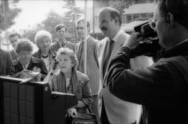
Mike Harcourt and Theresa Galloway at drinking fountain inauguration
- COV-S477-3-F111-: CVA 775-189-: CVA 775-189.18
- Part
- Oct. 1, 1986
Part of City of Vancouver fonds
11112 results with digital objects Show results with digital objects
Mike Harcourt and Theresa Galloway at drinking fountain inauguration
Part of City of Vancouver fonds

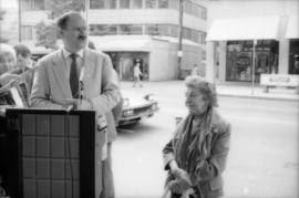
Mike Harcourt and Theresa Galloway at drinking fountain inauguration
Part of City of Vancouver fonds
Theresa Galloway and Mike Harcourt at drinking fountain inauguration
Part of City of Vancouver fonds
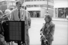
Mike Harcourt and Theresa Galloway at drinking fountain inauguration
Part of City of Vancouver fonds

Mike Harcourt and Theresa Galloway at drinking fountain inauguration
Part of City of Vancouver fonds
Mike Harcourt and Theresa Galloway at drinking fountain inauguration
Part of City of Vancouver fonds
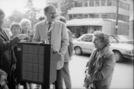
Mike Harcourt and Theresa Galloway at drinking fountain inauguration
Part of City of Vancouver fonds

Theresa Galloway drinking from fountain
Part of City of Vancouver fonds
Theresa Galloway drinking from fountain
Part of City of Vancouver fonds

Theresa Galloway and group of women pose with drinking fountain
Part of City of Vancouver fonds

Theresa Galloway and group of women pose with drinking fountain
Part of City of Vancouver fonds

Part of City of Vancouver fonds

Part of City of Vancouver fonds
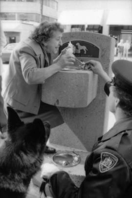
Constable Rob Bosley and police dog Sport at drinking fountain
Part of City of Vancouver fonds

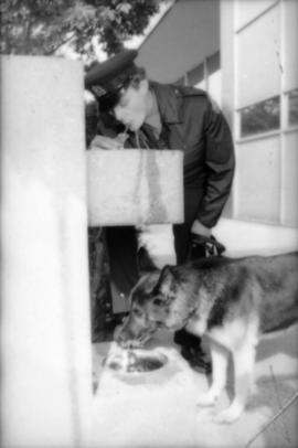
Constable Rob Bosley and police dog Sport at drinking fountain
Part of City of Vancouver fonds

Constable Rob Bosley and police dog Sport at drinking fountain
Part of City of Vancouver fonds
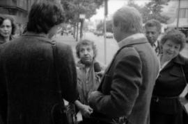
Theresa Galloway speaking to press at drinking fountain inauguration
Part of City of Vancouver fonds
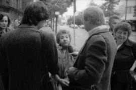
Theresa Galloway speaking to press at drinking fountain inauguration
Part of City of Vancouver fonds

Theresa Galloway and police dog Sport at drinking fountain inauguration
Part of City of Vancouver fonds

Theresa Galloway and police dog Sport at drinking fountain inauguration
Part of City of Vancouver fonds

Pilot chart of the North Pacific Ocean
Part of John Leckie fonds
Part contains nautical charts showing a variety of data including weather conditions, currents, storm tracks, radio stations, icebergs, and fishing banks. Part includes textual explanations of symbols and supplementary data.

Current chart of the eastern North Pacific Ocean - Sept., Oct., and Nov.
Part of John Leckie fonds
Part contains a nautical chart showing currents in the eastern North Pacific Ocean and a table showing maximum drift for each square on the chart.

Part of City of Vancouver Archives technical and cartographic drawing collection
Part depicts the upper left hand quadrant of the map, and includes a diagram of the solar system, a table of dimensions of bodies in the solar system, a chart of constellations viewable in the northern hemisphere, text on geographical definiations and the cause of the tides, and a map of the northern half of the Americas.
Dunn, Samuel
Part of City of Vancouver Archives technical and cartographic drawing collection
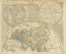
Part depicts a chart of the astronomical latitude & longitude analemma, a table showing values of the place of the sun in the ecliptic & declinatiobn, a chart of the constellations viewable in the southern hemisphere, text on geographical definitions and the cause of the tides, and a map of the northern portion of Africa, Europe and Asia.
Dunn, Samuel

Part of City of Vancouver Archives technical and cartographic drawing collection
Part depicts text and accompanying diagram on "the art of dialing by a common globe", a chart of universal scale, a map of the world using Mercator's projection, a map of the southern half of the Americans, descriptions of the various maps and charts, and the left-hand side of a map of the lunar surface viewable from Earth.
Dunn, Samuel

Part of City of Vancouver Archives technical and cartographic drawing collection
Part depicts the right-hand side of a map of the lunar surface viewable from Earth, a chart of the Analemma, a chart and accompanying text entitled "the vicissitude of seasons explained", a chart and accompanying text on "the art of dialing by a common globe", and a map of the southern portion of Africa and Asia, as well as Australia.
Dunn, Samuel
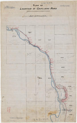
Part of City of Vancouver fonds
Part is the northern half of a map of the Capilano River, depicting the area of the Capilano River valley from District Lots 595 and 602 north to the dam located in District Lot 673.

Part of City of Vancouver fonds
Part is the southern half of a map of the Capilano River, depciting the area of the Capilano River valley from the river's mouth at Burrard Inlet north to District Lot 596.

Map of the municipalities of New Westminster, British Columbia
Part of City of Vancouver Archives technical and cartographic drawing collection
Part consists of the map component of a pamphlet. The map shows the location of churches, school, canaries, sawmills, backyards, tanneries, woolen mills, hatcheries, roads, and railways on a map which depicts the area of Greater Vancouver from the Gulf of Georgia east to Harrison Lake and south to the United States border.

Information concerning the City and District of New Westminster and the Province of British Columbia
Part of City of Vancouver Archives technical and cartographic drawing collection
Part is the text side of a pamphlet. This part contains information concerning the city and district of New Westminster, with individual panels on the municipalities of Delta, Chilliwhack [sic], Surrey, Langley, and Delta, and the City of New Westminster, the town of Harrison Hot Springs and the province.

Map of Vancouver, B.C. including Hastings Townsite and D.L. 301
Part of City of Vancouver Archives technical and cartographic drawing collection

Part of City of Vancouver Archives technical and cartographic drawing collection

Part of City of Vancouver Archives technical and cartographic drawing collection
Part is the front sheet of an unfolded tourism brochure showing Vancouver tourist attractions, The sheet includes a map of downtown Vancouver, with transportation information, a map of the roads in Stanley Park, photographs and information on various sites and attractions in the city, as well as general promotional information.

Part of City of Vancouver Archives technical and cartographic drawing collection
Part is the reverse side of a tourism brochure, containing a tourist map of Greater Vancouver, showing major roads, locations of tourist attractions and recreational sites, and routes into Vancouver.
Part of City of Vancouver Archives technical and cartographic drawing collection
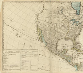
Part is the top left hand quadrant of a map of the Americas, and depicts North America and the north-west portion of South America. The sheet also includes a list of territories and islands in North America and appears to relate to territorial divisions as a result of the Treaty of Paris and the Treaty of Versailles (1783).
Part of City of Vancouver Archives technical and cartographic drawing collection
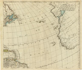
Part is the top right portion of a map of the Americas, and depicts the north-eastern portion of the Canadian coast, the eastern portion of the West Indies, the north-east corner of South America and the coastal areas of south-west Europe and wesern Africa.
![Sheet 1A [Northwest corner of Exhibition Park to Burrard Inlet to Slocan Street to Cambridge Street]](/uploads/r/null/4/a/9/4a95f2d331599fc1ed353ee49268f50fbc2f377d28b98788199ef496d1657e19/54d2e041-40b4-4c97-89e1-d44e9d73ba03-LEG1153_142.jpg)
Sheet 1A [Northwest corner of Exhibition Park to Burrard Inlet to Slocan Street to Cambridge Street]
Part of City publications collection
![Sheet 1B [Boundary Road to Burrard Inlet to Rupert Street to Cambridge Street]](/uploads/r/null/2/d/e/2de8a9356c43bdf5c2000524f0160e69ebb4155a087c48253380abd411347e98/c0871cff-d576-48da-93e7-50334a7f3bfe-LEG1153_142.jpg)
Sheet 1B [Boundary Road to Burrard Inlet to Rupert Street to Cambridge Street]
Part of City publications collection
![Sheet 1C [South portion of Exhibition Park to Cambridge Street to Slocan Street]](/uploads/r/null/0/9/8/098483f307187795ecf4e61450d06083a061d3907b0222ef0f03256008e2e58e/d7a0fcd1-8028-4946-a99a-8ba6da1b2e4a-LEG1153_142.jpg)
Sheet 1C [South portion of Exhibition Park to Cambridge Street to Slocan Street]
Part of City publications collection
![Sheet 1D [Boundary Road to Cambridge Street to Windermere Street to Pender Street]](/uploads/r/null/1/d/4/1d47034f04f443cd5d3bba2f8d2d21c3a21a2e6b801a5af04c074e2c3b6dd02e/7ad1a0c8-97c9-4e10-98c2-5017d74f4033-LEG1153_142.jpg)
Sheet 1D [Boundary Road to Cambridge Street to Windermere Street to Pender Street]
Part of City publications collection
![Sheet 2A [Windermere Street to Pender Street to Slocan Street to Charles Street]](/uploads/r/null/e/f/0/ef0145166907c36b80690dbaafd084071b8c82a23a84f931050a22101462f091/f7da3c3b-6025-445b-a5a6-5eb1608264e9-LEG1153_142.jpg)
Sheet 2A [Windermere Street to Pender Street to Slocan Street to Charles Street]
Part of City publications collection
![Sheet 2B [Boundary Road to Pender Street to Windermere Street to Charles Street]](/uploads/r/null/6/d/d/6dd321f1933530c0449917d5fdeb9ddeadff6b12ddc423a9f60d2633579ba2f1/e16c6545-d33e-4bf8-93d8-24f9847c06ac-LEG1153_142.jpg)
Sheet 2B [Boundary Road to Pender Street to Windermere Street to Charles Street]
Part of City publications collection
![Sheet 2C [Windermere Street to Charles Street to Slocan Street to 5th Avenue]](/uploads/r/null/5/c/3/5c31b68277d535d0bf8c13023079d05dfe1fb535497b50e8f264465db169ce22/3a1ef444-0d14-4f3d-aaa7-27bc65dc7224-LEG1153_142.jpg)
Sheet 2C [Windermere Street to Charles Street to Slocan Street to 5th Avenue]
Part of City publications collection
![Sheet 2D [Boundary Road to Chalres Stret to Windermere Street to 5th Avenue]](/uploads/r/null/9/7/0/9702a82a6010cf52eb7cf7e486466e91e67bc732d2586158ff4cf07d8f71fb7e/f364eebb-c9c0-4aba-8970-b9128de74769-LEG1153_142.jpg)
Sheet 2D [Boundary Road to Chalres Stret to Windermere Street to 5th Avenue]
Part of City publications collection
![Sheet 3A [Windermere Street to 5th Avenue to Slocan Street to Grandview Highway]](/uploads/r/null/c/0/8/c081ba1194af0da71e1f88ca1a7c4efd637e7ae3d846b4e9fd5d153faa656b0e/ce3a288b-01f7-491a-b5ee-59b744d23996-LEG1153_142.jpg)
Sheet 3A [Windermere Street to 5th Avenue to Slocan Street to Grandview Highway]
Part of City publications collection
![Sheet 3B [Boundary Road to 5th Avenue to Windermere Street to Grandview Highway]](/uploads/r/null/c/9/c/c9c099174510121f7347c0ed2dc3f4db8a646b3846d9fcf65747209bb83b81d2/51551449-0417-479e-8467-bddbe7b574b3-LEG1153_142.jpg)
Sheet 3B [Boundary Road to 5th Avenue to Windermere Street to Grandview Highway]
Part of City publications collection
![Sheet 3C [Windermere Street to Grandview Highway to Slocan Street to 22nd Avenue]](/uploads/r/null/1/9/6/19695a354a40b66650d4a6b96b8fdd67ad76a3e8091ea936c2671a1e22e520da/e571973c-a7de-4828-9846-136aabb0b4e5-LEG1153_142.jpg)
Sheet 3C [Windermere Street to Grandview Highway to Slocan Street to 22nd Avenue]
Part of City publications collection
![Sheet 3D [Boundary Road to Grandview Highway to Windermere Street to 22nd Avenue]](/uploads/r/null/e/3/8/e38ad95268d472e5b09a59157e2655363d00d976611f9b5ce0783a0b268c9102/92a3bbb3-76f5-4077-ae8c-e541a3b6a3ae-LEG1153_142.jpg)
Sheet 3D [Boundary Road to Grandview Highway to Windermere Street to 22nd Avenue]
Part of City publications collection
![Sheet 4A [Windermere Street to 22nd Avenue to Slocan Street to 29th Avenue]](/uploads/r/null/a/d/f/adf64a2e43a5bbd7b7b6359d2dfbb3ff89b5ac7e2947a14033383119422d0069/643362ca-2df8-48bd-9f04-c5af1d6505f1-LEG1153_142.jpg)
Sheet 4A [Windermere Street to 22nd Avenue to Slocan Street to 29th Avenue]
Part of City publications collection
![Sheet 4B [Boundary Road to 22nd Avenue to Windermere Street to 29th Avenue]](/uploads/r/null/f/3/b/f3b17dcb0ca74267e166e0229fcb9ab99281c9b35b609d67f1110241073d6bd8/486b3ba1-dce8-4aaa-85fb-b164dc027e6a-LEG1153_142.jpg)
Sheet 4B [Boundary Road to 22nd Avenue to Windermere Street to 29th Avenue]
Part of City publications collection