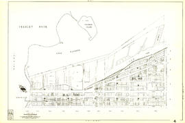
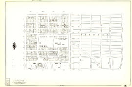
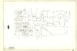
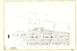
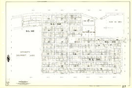
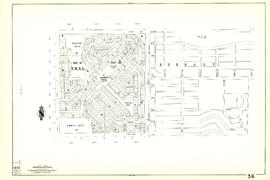
Print preview Close

Showing 1440 results

Archival description
City of Vancouver Archives technical and cartographic drawing collection With digital objects
Print preview View:

Sheet 9 : Main Street to Clark Drive and Prior Street to Burrard Inlet

Item is a section showing the area from Main Street to Clark Drive and Prior Street to Burrard Inlet. Includes streets, blocks, lots and legal descriptions, and the locations of parks, schools, railways and piers along the waterfront.

Vancouver (B.C.). Engineering Services

Sheet 4 : Chilco Street to Burrard Street and Robson Street to Coal Harbour

Item is a section showing the area from Chilco Street to Burrard Street and Robson Street to Deadmans Island. Includes streets, blocks, lots and legal descriptions, as well as parks and the location of some businesses and organizations along the waterfront.

Vancouver (B.C.). Engineering Services

Sheet 5 : Stanley Park to Nicola Street and English Bay Beach to Robson Street

Item is a section showing the area from Stanley Park to Nicola Street and English Bay Beach to Robson Street. Includes streets, blocks, lots and legal descriptions, and the locations of parks, beaches, schools and golf courses.

Vancouver (B.C.). Engineering Services

Sheet 10 : Clark Drive to Nanaimo Street and Frances Street to Burrard Inlet

Item is a section showing the area from Clark Drive to Nanaimo Street and Frances Street to Burrard Inlet. Includes streets, blocks, lots and legal descriptions, and the locations of parks and a juvenile detention home.

Vancouver (B.C.). Engineering Services

Sheet 12 : Nanaimo Street to Cassiar Street and Pender Street to McGill Street

Item is a section showing the area from Nanaimo Street to Cassiar Street and Pender Street to McGill Street. Includes streets, blocks, lots and legal descriptions, and the locations of bridges, reservoirs and railways.

Vancouver (B.C.). Engineering Services

Sheet 14 : Cassiar Street to Boundary Road and Pender Street to Eton Street

Item is a section showing the area from Cassiar Street to Boundary Road and Pender Street to Kitchener Street. Includes streets, blocks, lots and legal descriptions, and the locations of parks and retirement homes. Also shown are streets and blocks in the area from Boundary Road to Carleton Avenue in Burnaby.

Vancouver (B.C.). Engineering Services

Sheet 15 : Rupert Street to Boundary Road and Kitchener Street to Pender Street

Item is a section showing the area from Rupert Street to Boundary Road and Kitchener Street to Pender Street. Includes streets, blocks, lots and legal descriptions. Also shown are streets and blocks in the area from Boundary Road to Carleton Avenue in Burnaby.

Vancouver (B.C.). Engineering Services

Sheet 17 : Nanaimo Street to Rupert Street and Charles Street to Pender Street

Item is a section showing the area from Nanaimo Street to Rupert Street and Charles Street to Pender Street. Includes streets, blocks, lots and legal descriptions. Includes streets, blocks, lots and legal descriptions, and the locations of parks and schools.

Vancouver (B.C.). Engineering Services

Sheet 20 : Main Street to Clark Drive and Great Northern Way to Prior Street

Item is a section showing the area from Main Street to Clark Drive and Great Northern Way to Prior Street. Includes streets, blocks, lots and legal descriptions, and the locations of parks, railways and railway yards.

Vancouver (B.C.). Engineering Services

Sheet 22 : Maple Street to Drake Street and Fourth Avenue to Thurlow Street

Item is a section showing the area from Maple Street to Drake Street and Fourth Avenue to Thurlow Street. Includes streets, blocks, lots and legal descriptions, and the locations of First Nations reserves, parks, railways and railway yards.

Vancouver (B.C.). Engineering Services

Sheet 27 : University Endowment Lands and Drummond Drive to Camosun Street and Fourteenth Avenue to Fourth Avenue

Item is a section showing the area from the University Endowment Lands and Drummond Drive to Camosun Street and Fourteenth Avenue to Fourth Avenue. Includes streets, blocks, lots and legal descriptions, and the locations of parks and schools.

Vancouver (B.C.). Engineering Services

Sheet 28 : Camosun Street to Balaclava Street and Fourteenth Avenue to Fourth Avenue

Item is a section showing the area from Camosun Street to Balaclava Street and Fourteenth Avenue to Fourth Avenue. Includes streets, blocks, lots and legal descriptions, and the locations of parks and schools.

Vancouver (B.C.). Engineering Services

Sheet 30 : Maple Street to Oak Street and Fourteenth Avenue to Third Avenue and False Creek

Item is a section showing the area from Maple Street to Oak Street and Fourteenth Avenue to Third Avenue and False Creek. Includes streets, blocks, lots and legal descriptions, and the locations of parks, schools and railways.

Vancouver (B.C.). Engineering Services

Sheet 35 : Rupert Street to Ardley Avenue and Grandview Highway to Fifth Avenue

Item is a section showing the area from Rupert Street to Boundary Road and Grandview Highway to Fifth Avenue. Includes streets, blocks, lots and legal descriptions, and the locations of schools and railways. Also included are streets, blocks and railways in the area from Boundary Road to Ardley Avenue in Burnaby.

Vancouver (B.C.). Engineering Services

Sheet 36 : Rupert Street to Carlton Avenue and Twenty-second Avenue to Grandview Highway

Item is a section showing the area from Rupert Street to Boundary Road and Twenty-second Avenue to Grandview Highway. Includes streets, blocks, lots and legal descriptions, and the locations of parks and schools. Also included are streets and blocks in the area from Boundary Road to Carleton Avenue in Burnaby.

Vancouver (B.C.). Engineering Services

Sheet 37 : Rupert Street to Carleton Avenue and Wellington Avenue to Twenty-second Avenue and Elmwood Street

Item is a section showing the area from Rupert Street to Boundary Road and Wellington Avenue to Twenty-second Avenue. Includes streets, blocks, lots and legal descriptions, and the locations of parks and schools. Also included are streets and blocks in the area from Boundary Road to Carleton Avenue in Burnaby.

Vancouver (B.C.). Engineering Services

Sheet 38 : Nanaimo Street to Rupert Street and Twenty-second Avenue to Grandview Highway

Item is a section showing the area from Nanaimo Street to Rupert Street and Twenty-second Avenue to Grandview Highway. Includes streets, blocks, lots and legal descriptions, and the locations of parks, schools and a preventorium (TB hospital).

Vancouver (B.C.). Engineering Services

Sheet 39 : Kingsway and Nanaimo Street to Rupert Street and Ward Street to Twenty-second Avenue

Item is a section showing the area from Kingsway and Nanaimo Street to Rupert Street and Ward Street to Twenty-second Avenue. Includes streets, blocks, lots and legal descriptions, and the locations of parks, schools and railways.

Vancouver (B.C.). Engineering Services

Sheet 40 : Inverness Street to Nanaimo Street and Twenty-second Avenue to Thirteenth Avenue

Item is a section showing the area from Inverness Street to Nanaimo Street and Twenty-second Avenue to Thirteenth Avenue. Includes streets, blocks, lots and legal descriptions, and the locations of parks, schools and railways.

Vancouver (B.C.). Engineering Services

Sheet 41 : Ontario Street to Inverness Street and Twenty-eighth Avenue to Sixteenth Avenue

Item is a section showing the area from Ontario Street to Inverness Street and Twenty-eighth Avenue to Sixteenth Avenue. Includes streets, blocks, lots and legal descriptions, and the locations of parks and schools.

Vancouver (B.C.). Engineering Services

Sheet 42 : Oak Street to Ontario Street and Twenty-eighth Avenue to Sixteenth Avenue

Item is a section showing the area from Oak Street to Ontario Street and wenty-eighth Avenue to Sixteenth Avenue. Includes streets, blocks, lots and legal descriptions, and the locations of parks and schools.

Vancouver (B.C.). Engineering Services

Sheet 44 : Blenheim Street to Arbutus Street and King Edward Avenue to Fourteenth Avenue

Item is a section showing the area from Blenheim Street to Arbutus Street and King Edward Avenue to Fourteenth Avenue. Includes streets, blocks, lots and legal descriptions, and the locations of parks, schools and railways.

Vancouver (B.C.). Engineering Services

Sheet 45 : Discovery Street to Blenheim Street and King Edward Avenue to Fourteenth Avenue

Item is a section showing the area from Discovery Street to Blenheim Street and King Edward Avenue to Fourteenth Avenue. Includes streets, blocks, lots and legal descriptions, and the locations of parks and schools.

Vancouver (B.C.). Engineering Services

[Aerial map of Greater Vancouver]

Map is a poster of an aerial photograph showing Vancouver, North Vancouver, West Vancouver, Richmond, Burnaby, Delta, Coquitlam, Port Coquitlam, Port Moody, and Surrey. It also shows location of Sea Island Industrial Park and Lake-City Industrial Park which Webb & Knapp sponsor. "Lake-City Industrial Park and Sea Island Industrial Park, comprising approximately 900 acres of industrial estate property".

Powell Lake

Item is a map of southwestern British Columbia from Bute Inlet to Alta Lake and Chilko Lake to northern Gabriola Island showing Crown granted land, surveyed timber leases and licenses, Indian Reserves, government reserves, land district and park boundaries, nautical distances, municipalities, cities and villages, telegraph and telephone lines, pipelines, railways, government agents' offices, mining and sub-mining recording offices, post offices, lighthouses, roads, and elevations of geographical features.

Canadian Pacific Railway. Plan of part of branch line from Port Moody. A point on main line C.P.R. to English Bay, B.C.

Map shows a survey conducted by the Canadian Pacific Railway of English Bay, Burrard Inlet and Coal Harbour, including a rough outline of area and lots. Note on map reads "Certified as a correct plan showing the land required for right of way Burrard Inlet B.C., February 22, 1886. H.J. Cambie, Engineer in Charge." Map is certified as correct and signed by various C.P.R. officials, including W.C. Van Horne.

Map of New Westminster District

Item is a commercially printed map depicting the New Westminster Land District, bounded by the Gulf of Georgia in the west, the international border in the south, range 26 of townships 1 to 4 of the Yale District in the east, and the southern half of township 6 in the north.

The map depicts townships and ranges, and district lots in incorporated areas. The map also depict Dominion Timber Berths and various types of land reserves.

Panoramic view of the City of Vancouver, British Columbia, 1898

Item is a map showing an oblique aerial eye view of Vancouver, including Burrard Inlet, Upper False Creek Flats and False Creek. Streets, buildings and businesses are identified. Inset shows location of the Vancouver City foundry, Machine Works and Sugar Refinery. The map includes pictorial representations of buildings, industrial activity around Burrard Inlet, watercraft and vegetation. The perspective view of the map is to the south/south-east.

The map was originally included as a supplement to the Daily World newspaper.

Map of New Westminster District, B.C

Item is a map showing District Lots in Vancouver, and township/range designations in other areas. The map also shows False Creek Trail, North Arm Road, False Creek Road, Granville Road from Granville to Hastings, New Westminster and Burrard Inlet Road, North Road, Semiahmoo Road, New Westminster and Yale Wagon Road, and others. Annotated by W. E. Graveley, 1885, to show additional features including Kingsway, Haney, Albion Camp, etc.

Stuart's pocket map of Vancouver, B.C.

Item is an illustrated map of the "old" City of Vancouver. The map shows streets, transportation, and significant businesses (such as C.P.R. wharves, smelter, Hastings Mill, Morse's Mill, C.P.R. Shops, City Hospital, sawmill, slaughter houses, and smallpox hospital). The map includes "Index of Streets, Government Offices, Churches, [etc.], including "Civic and other Principal Buildings", "Places of Amusement or Recreation", "Public Schools", "Principal Mills, Foundries and Manufactories", "Principle Bankers", Principal Hotels", and "Miscellaneous".

The map was designed to be folded into a cover, which is included.

Top left plate

Part is the top left hand quadrant of a map of the Americas, and depicts North America and the north-west portion of South America. The sheet also includes a list of territories and islands in North America and appears to relate to territorial divisions as a result of the Treaty of Paris and the Treaty of Versailles (1783).

Bottom right plate

Part depicts the right-hand side of a map of the lunar surface viewable from Earth, a chart of the Analemma, a chart and accompanying text entitled "the vicissitude of seasons explained", a chart and accompanying text on "the art of dialing by a common globe", and a map of the southern portion of Africa and Asia, as well as Australia.

Dunn, Samuel

Results 51 to 100 of 1440