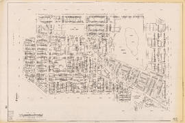
Sheet 38D [Blenheim Street to 1st Avenue to Wallace Street to 10th Avenue]
Sheet 41A [Wallace Street to 41st Avenue to Musqueam Reserve to 49th Avenue]
Sheet 41B [Blenheim Street to 41st Avenue to Wallace Street to 49th Avenue]
Sheet 41D [Blenheim Street to 49th Avenue to Musqueam Reserve to Fraser River]
Sheet 42B [Blenheim Street to Celtic Avenue to Fraser River]
Sectional map of Vancouver showing streets, block and lot outlines, and building perimeters : Map 11 : Nanaimo Street to Rupert Street and Burrard Inlet to McGill Street
Sectional map of Vancouver showing streets, block and lot outlines, and building perimeters : Map 13 : Rupert Street to Boundary Road and Burrard Inlet to Eton Street
Sectional map of Vancouver showing streets, block and lot outlines, and building perimeters : Map 14 : Cassiar Street to Boundary Road and Eton Street to Pender Street
Sectional map of Vancouver showing streets, block and lot outlines, and building perimeters : Map 19 : Clark Drive to Nanaimo Street and Frances Street/Ferndale Street to 2nd Avenue
Sectional map of Vancouver showing streets, block and lot outlines, and building perimeters : Map 33 : Clark Drive to Nanaimo Street and 2nd Avenue to 13th Avenue
Sectional map of Vancouver showing streets, block and lot outlines, and building perimeters : Map 40 : Inverness Street to Nanaimo Street and 13th Avenue to 22nd Avenue/24th Avenue
Sectional map of Vancouver showing streets, block and lot outlines, and building perimeters : Map 42 : Oak Street to Ontario Street and 16th Avenue to 28th Avenue
Sectional map of Vancouver showing streets, block and lot outlines, and building perimeters : Map 43 : East Boulevard to Oak Street and 14th Avenue to Laurier Avenue
Sectional map of Vancouver showing streets, block and lot outlines, and building perimeters : Map 46 : Blanca Street to Discovery Street and 14th Avenue to 16th Avenue
Sectional map of Vancouver showing streets, block and lot outlines, and building perimeters : Map 49 : Arbutus Street to Oak Street and Laurier Avenue to 33rd Avenue
Sectional map of Vancouver showing streets, block and lot outlines, and building perimeters : Map 50 : Oak Street to Ontario Street and 28th Avenue to 37th Avenue
Sectional map of Vancouver showing streets, block and lot outlines, and building perimeters : Map 58 : Inverness Street to Berkley Street/Nanaimo Street and 41st Avenue to 49th Avenue
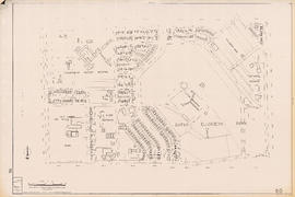
Sectional map of Vancouver showing streets, block and lot outlines, and building perimeters : Map 67 : Musqueam Indian Reserve and Shaughnessy Golf Course
Sectional map of Vancouver showing streets, block and lot outlines, and building perimeters : Map 69 : Wallace Street to MacDonald Street and 49th Avenue to the North Arm of the Fraser River
Sectional map of Vancouver showing streets, block and lot outlines, and building perimeters : Map 73 : Quebec Street to Inverness Street and 47th Avenue to 57th Avenue
Sectional map of Vancouver showing streets, block and lot outlines, and building perimeters : Map 75 : Nanaimo Street to Kerr Street and 49th Avenue to Bobolink Avenue
Sectional map of Vancouver showing streets, block and lot outlines, and building perimeters : Map 80 : Inverness Street to Gladstone Street/Nanaimo Street and 61st Avenue to the North Fork of the North Arm of the Fraser River
Sectional map of Vancouver showing streets, block and lot outlines, and building perimeters : Map 81 : Main Street to Inverness Street and 57th Avenue to S.E. Marine Drive
Sectional map of Vancouver showing streets, block and lot outlines, and building perimeters : Map 83 : Fremlin Street to Main Street and 57th Avenue to 67th Avenue/S.W. Marine Drive
Sectional map of Vancouver showing streets, block and lot outlines, and building perimeters : Map 90 : Iona Island to Wood Island and Celtic Avenue to Sea Island
Historical park development
Peer pressure: giving independence with responsibility and gender differences
Stanley Park map and guide : park map showing trails, amenities, and recreation sites
One way streets : illustrations of special intersections
Present use. Vancouver harbour
Listen to the children
City of Vancouver, B.C. area map : Inverness Street to Boundary Road 54th Avenue to the North Arm of the Fraser River
City of Vancouver, B.C. area map : Granville Street to Inverness Street and 6th Avenue to 37th Avenue
City of Vancouver, B.C. area map : Wallace Street to Cartier Street and 49th Avenue to the North Arm of the Fraser River
City of Vancouver, B.C. area map : western boundary with University Endowment Lands to Camosun Street and English Bay to 16th Avenue; Musqueam Indian Reserve no. 2
City of Vancouver, British Columbia : 1981 census of Canada
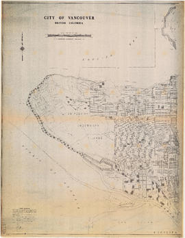
City of Vancouver, British Columbia : Point Grey to Cypress Street
Cycling in Vancouver
Stanley Park map and guide : park history, food services, and general information
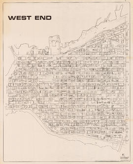
West End
West End
Too close... for comfort
Vancouver Parks and Recreation : a guide to services
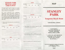
Stanley Park bicycle lane user survey
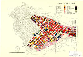
Land use - 1954
Healthy eating for school age children
North-East Burnaby Study, revised Simon Fraser townsite plan : 1967 City of Vancouver alternative proposals
City of Vancouver, B.C. area map : Heatley Avenue to Boundary Road and Burrard Inlet to 2nd Avenue/5th Avenue
City of Vancouver, B.C. area map : Inverness Street to Boundary Road and 2nd Avenue/5th Avenue to 32nd Avenue
City of Vancouver, B.C. area map : Cartier Street to Inverness Street and 57th Avenue to the North Fork of the North Arm of the Fraser River
![Sheet 38D [Blenheim Street to 1st Avenue to Wallace Street to 10th Avenue]](/uploads/r/null/2/4/a/24a75dbb7f7bbe44a899c43d154e4ca6379e01a60c49e440460c0a47aae9d526/e23bc31f-1f4e-4e9c-9170-7bca8fc14020-LEG1153_142.jpg)
![Sheet 41A [Wallace Street to 41st Avenue to Musqueam Reserve to 49th Avenue]](/uploads/r/null/d/7/f/d7f1e8bd92ef76bcd7457d96a14646d040f9cc8a043fa474a88dbf056606dd90/cbe2dfc1-4957-4833-9e0f-6bb7f1d3c6a8-LEG1153_142.jpg)
![Sheet 41B [Blenheim Street to 41st Avenue to Wallace Street to 49th Avenue]](/uploads/r/null/7/b/2/7b2dd608c9e447bf448dcfc09ed76f8691e4c1e216e012b1b2e2776c5196a218/ad8b9cc6-c5a4-4aa4-8286-2fb92afe4f82-LEG1153_142.jpg)
![Sheet 41D [Blenheim Street to 49th Avenue to Musqueam Reserve to Fraser River]](/uploads/r/null/e/9/2/e92fc5827e22fcead9e0370739bc0dfbf09b3591c72f423289effff3fdd52ebe/55542ee4-2c2b-4357-ad50-9c533e59a857-LEG1153_142.jpg)
![Sheet 42B [Blenheim Street to Celtic Avenue to Fraser River]](/uploads/r/null/d/0/f/d0f904ceb3f9e449b3756ccfde3fdf618ac91b559883559e2cc0e567d57d7a15/c8590d75-7fb0-42c1-b582-67f9b91bfed6-LEG1153_142.jpg)